Skip to content Skip to sidebar Skip to footer

A Blow Me Down East Traverse

In the early morning of July 28, IATNL executive members Paul Wylezol, Delano Pittman and Ulrica Murley-Pye set off on a north to south traverse of the Blow Me Down Mountains on the south side of the Bay of Islands. However unlike the well-established IATNL Blow Me Down Traverse through the center of the Blow Me Down Ophiolite Massif, this trek took a more easterly route that included Knights and Red Gulches. Like the other three Bay of Islands Ophiolite Massifs (i.e., Lewis Hills, North Arm Hills/Gregory Mountains and Table Mountain, aka Tablelands), the eastern side of the mountains is composed primarily of rust-colored peridotite from earth's mantle, forced to the surface by plate tectonics during the closing of the Iapetus Ocean approximately 450 million years ago.  The western side of the massifs, by contrast, is composed primarily of light-gray gabbro from the oceanic crust, which is typically found on top of the mantle at the bottom of an ocean. From the Benoit's Cove water supply road south of Route 450, the trek began by crossing Clarks Brook and following a 1km excavator track to the base of the mountains. From there the trio climbed up through the first rocky gully  until they reached the top of a 510m high plateau jutting out from the northeastern end of the mountains.  After walking around the edge of a small tranquil pond they then had to climb another 90m vertical over 1km before descending into Knights Gulch near where the river exits…

IATNL Hosts American Hiking Society Founding President Jim Kern

From July 22 to 27, IATNL executive members Paul Wylezol and Arne Helgeland played host to American Hiking Society Founding President Jim Kern.  Paul, Arne and Jim, who soon turns 88, are friends of Appalachian Trail Museum President Larry Luxenberg, who in 2019 joined Paul and Arne on an IAT 10th anniversary tour of Scotland, followed by an Appalachian Outdoor Economy Forum in Northern Ireland. Jim, who is also founder of the Florida Trail, was in Newfoundland for the first time to do a little hiking and sightseeing, beginning on the Great Northern Peninsula where Paul and his wife Annie own a beachfront inn in Portland Creek. The first adventure included a 45-minute hike into Western Brook Pond and a 2-hour boat tour of the inland fiord followed by another 45-minute walk and seafood dinner. 
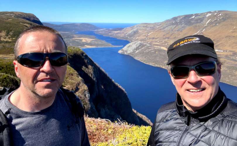
Day 2 also included a tour of Western Brook Pond, but this time from the air, when the trio took a morning floatplane ride over the Long Range Mountains, provided by Portland Creek Outfitters. The 1-hour round trip began at Portland Creek Pond and flew south down the back end of a series of inland fiords to Western Brook Pond, before returning via the coastline. 
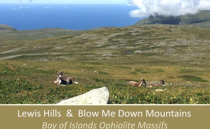
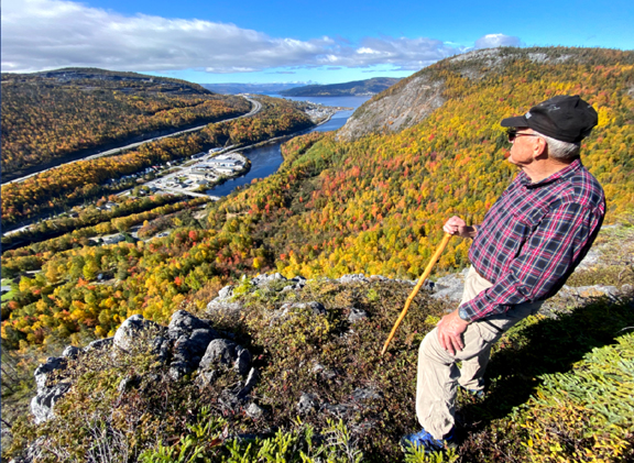
In the afternoon, the tour returned to ground and headed south, first to Gros Morne Mountain  then around Bonne Bay to the Tablelands, where they hiked Tablelands Trail into Winterhouse Gulch 
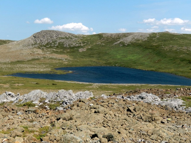
before driving to Trout River, where they got a distant view of Trout River Pond, the south side of…

Explore the great outdoors: IAT Ulster-Ireland

Ireland’s chapter in the International Appalachian Trail runs from the spectacular West Donegal to the stunning North Coast in County Antrim. Get ready to take the next step on one of the world’s largest walking trail networks, the Ulster–Ireland leg of the International Appalachian Trail. The next phase of the Ulster-Ireland chapter of the International Appalachian Trail (IAT) has been launched across Northern Ireland and the Republic of Ireland and is an extension of the world-renowned walking route on the Canada and US border, as well as in countries around the globe. The route starts at Bunglas Viewpoint at the spectacular Slieve League and passes through the BlueStack Mountains in County Donegal before crossing the border into Northern Ireland at Kelly’s Bridge. Here the route picks up the Ulster Way where it takes through the rural landscapes of Tyrone and the Sperrins, as well as taking in the much loved Ulster American Folk Park – itself a shrine to the lasting connection between Ulster and America. Past The Sperrins the IAT Ulster-Ireland runs north onto the world-famous Giant’s Causeway Coast and the stunning north Antrim coastline before traversing the Glens of Antrim and finishing at the port of Larne. Discover historic monuments, dramatic coastlines, rugged mountains, areas of outstanding natural beauty, and a World Heritage Site, all with geological links to the Appalachian Mountains. IAT Ulster-Ireland Points of Interest Points of interest include Slieve League, Bluestack Mountains, Lough Eske, Killeter Forest, Sperrin Mountains, the Causeway Coast, and the Glens of Antrim. County Donegal Slieve League boasts some of the highest…

Lew Coty’s West Tablelands Trek

Unable to travel to Newfoundland during the summers of 2020 and 2021 due to Covid-19, Lew Coty recently reminisced about his many adventures in Western Newfoundland while browsing his e-photo albums, and shared the following story about his West Tablelands Trek with us. Lew hopes to return again this August when he takes a break from his Vermont maple syrup grove. … “Looking northeast across Trout River Pond from the Trout River campground, the western end of the Tablelands looms on the horizon. Centered in this scene is a deeply cut canyon that my topo map shows is cut by a stream that flows into …”

Stowbridges Basecamp Nearing Completion

After significant work over the past two years, the IATNL basecamp at Stowbridges in North Arm is nearing completion and will soon be available for public use. Serving as a basecamp for eco, geo and adventure “seefarers” and hikers interested in exploring the remotest region of the Bay of Islands and Cabox Geopark, the renovated two-storey biscuit box house in a small southeast facing cove once served as seasonal home for a local fisherman from Cox’s Cove.

New Phase of IAT Launches in Ulster Ireland

A new phase of a walking trail which links Northern Ireland and the Republic of Ireland with the Appalachian Mountains has been launched in a bid to attract more international visitors. The International Appalachian Trail (IAT) Ulster–Ireland is part of an international walking trail that follows the Appalachian Mountain terrain, which existed on the super continent Pangaea before the Atlantic Ocean formed that broke up the continent. The Ulster-Ireland section totals 279 miles (449 km) in length, was established in 2011, launched in 2013 and continues the trail after it leaves the North American continent. It starts at the Slieve League cliffs, passes through Glencolmcille, traverses the Bluestack Mountains in Co Donegal before crossing into Co Tyrone. Here it picks up the Ulster Way, taking in the Sperrins, the north coast and the Glens of Antrim. Walkers along the Mid and East Antrim section of the IAT Ulster-Ireland The next phase of the walking trail has now been launched, which includes a number of improvements including newly installed pieces of art, new trail furniture and updated information panels and improved facilities at many locations. A marketing campaign has also been launched to coincide with the trail works, promoting the walk to audiences across America, as well as in Northern Ireland and the Republic of Ireland, incorporating videos, photography and offers from local businesses. This campaign will be carried out by Outdoor Recreation Northern Ireland. The initiative is part of a cross-border project funded by the Rural Development Programme 2014 – 2020 and being…

IATNL In Memoriam for Tom Calon

The IATNL is saddened to announce the passing of Tom Calon, a professor of earth sciences at Memorial University of Newfoundland (MUN) who spent many years exploring the geology and landscapes of Western Newfoundland and often took advantage of IATNL trails to access the backcountry. As a tribute to Tom and his keen desire for our spectacular landscapes be made available to the public, Tom’s family requested that in memoriam donations be made to the IATNL to help develop and maintain trails for all residents and visitors to enjoy.

Arne Attacks Bear Head!

On October 15, octogenarian Arne Helgeland hiked up 335 meters (1100 feet) to Arne’s Lookout at the top of the new IATNL Bear Head Trail. Follow along as he takes in the bright fall colours and fantastic views of the lower Humber Valley.

IATNL Launches Elephant Trail with Group Hike

On Friday, June 25, after 2.5 years of intermittent work, the International Appalachian Trail Newfoundland & Labrador (IATNL) launched the Elephant Trail on the south side of Trout River Pond with a group hike of 14 people. The trail is at the northern end of the 3-day North Arm Traverse, with the southern end located at the IATNL Basecamp at Stowbridges on the north side of North Arm, Bay of Islands.

Across the Blow Me Downs to Knights Brook Falls

With early spring in the lowlands and late winter in the highlands, IATNL/Cabox Chairperson Paul Wylezol set off to cross the eastern end of Blow Me Down Ophiolite Massif to check out a series of waterfalls on Knights Brook, where the crystal-clear stream emerges from the mountains and turns south to follow its course through 7kms of foothills to the eastern end of Serpentine Lake. In 2021 spring arrived a month early in Western Newfoundland, which permitted this April 25 trek. Temperatures ranged from 8 to 10C at the base of the mountains and in the valleys, but hovered between 2 and 4C on top, where a 20-30km breeze across large swaths of snowpack added a ‘still winter’ chill.

Spring Up and Over the Elephant

On April 14 during the mildest spring in many years, IATNL Directors Paul Wylezol and Delano Pittman took advantage of a blue sky day to make the first spring trek of the new IATNL/Cabox Geopark Elephant Trail on the south side of Trout River Pond, which will be completed to the top of the Elephant’s back by early Summer 2021. The 10-hour 23-kilometer trek began approximately 2kms past Trout River Campground on Chimney Cove gravel access road, where an ATV trail makes a right angle intersection and follows the Gros Morne National Park boundary southeast to within 1 kilometer of the foot of the Elephant.

Copyright © 2023 International Appalachian Trail Newfoundland and Labrador (IATNL)