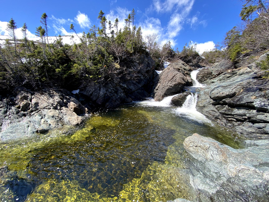
With early spring in the lowlands and late winter in the highlands, IATNL/Cabox Chairperson Paul Wylezol set off to cross the eastern end of Blow Me Down Ophiolite Massif to check out a series of waterfalls on Knights Brook, where the crystal-clear stream emerges from the mountains and turns south to follow its course through 7kms of foothills to the eastern end of Serpentine Lake.
In 2021, spring arrived a month early in Western Newfoundland, which permitted this April 25 trek. Temperatures ranged from 8 to 10C at the base of the mountains and in the valleys, but hovered between 1 and 3C on top, where a 20-30km breeze across large swaths of snowpack added a ‘still winter’ chill.
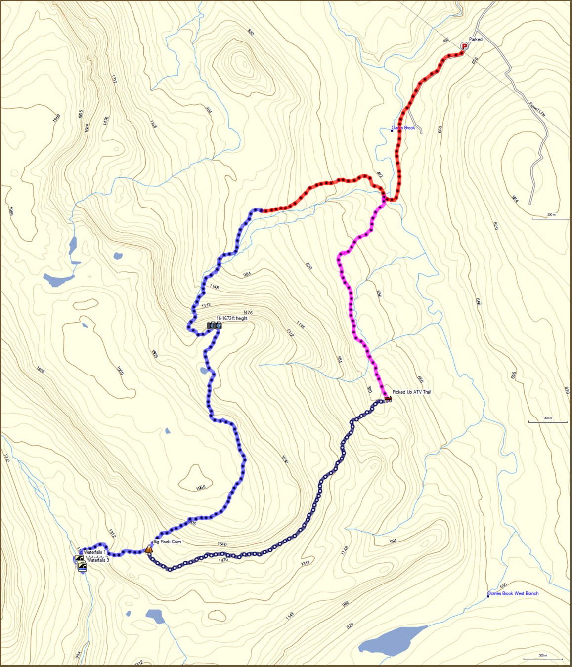
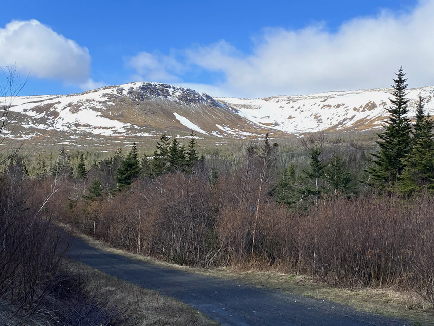
The route Paul took to the top of the Blow Me Downs started at the gate to the Benoit’s Cove water supply off Webcon Road. From there he walked down the 1.5km service road to knee-deep Clarks Brook, which after crossing, he followed a 1km track to a water intake, then turned off to head up the northeast gully.
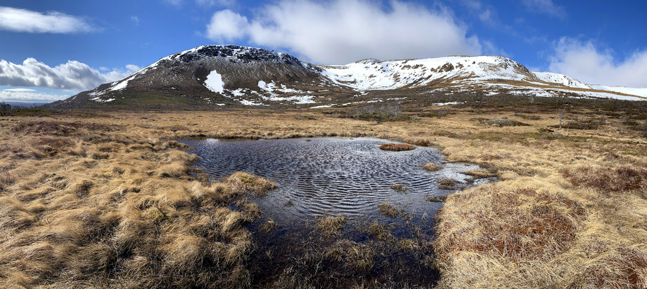
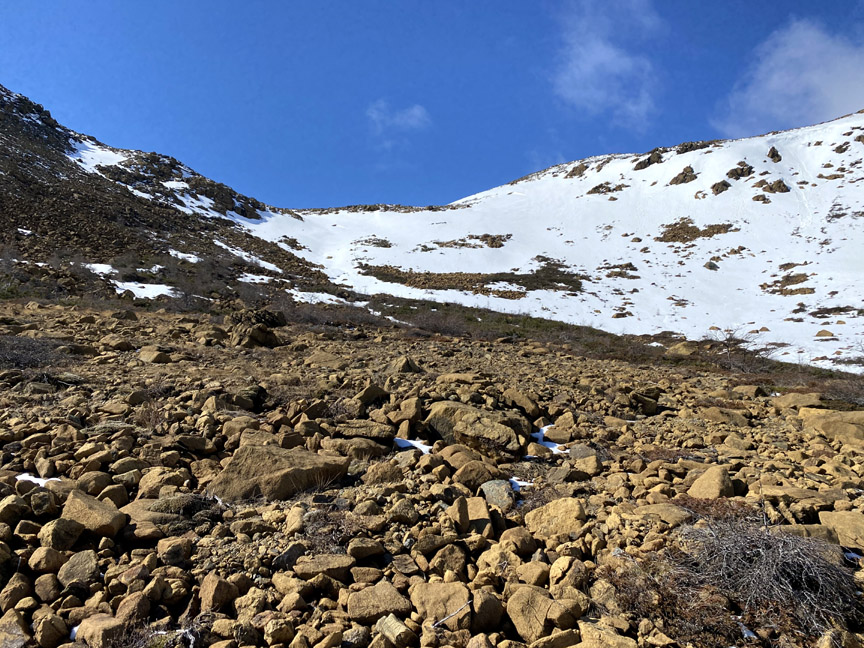
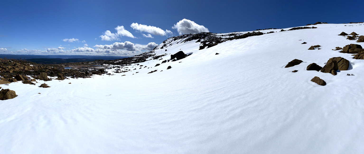
The bottom of the gully is covered mostly with short grasses and shrubs, which transition to small and medium-sized peridotite boulders from the earth’s mantle as the elevation and proximity to the massif increases.
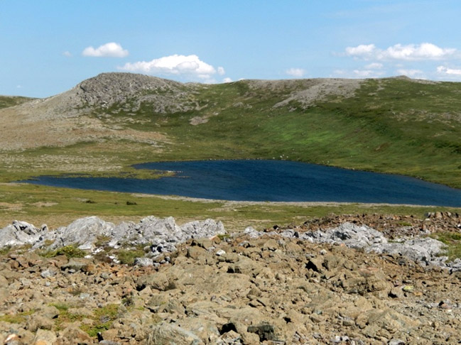
Above the rocks it was necessary to walk across a sizeable patch of snow that filled the hollows on the northeast – leeward – side of the mountains. Looking back the view was expansive, taking in the mountains, lowlands and foothills surrounding the Humber Arm.
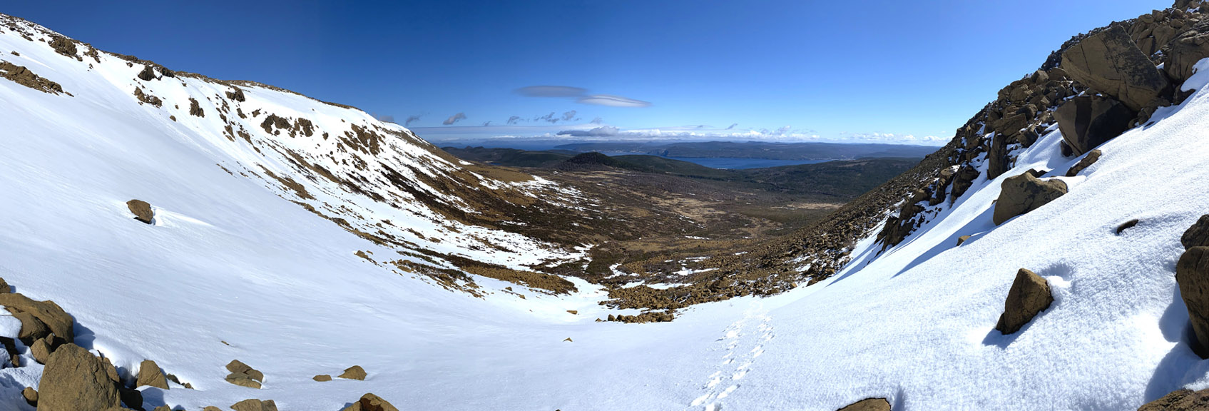
After only a 1.5 hour walk, Paul was on top of the massif, albeit a lower protrusion which provides a great cross-section view of the snow-covered mountains and Bay of Islands beyond.
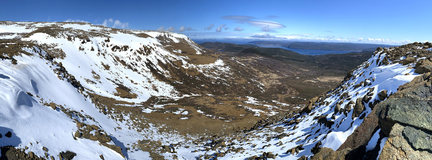
In spite of the snow, it was still possible to see much of the geological composition of the mountains, from rust-colored harzburgite (a form of peridotite) to darker brown pyroxenite to colorful green serpentinite.
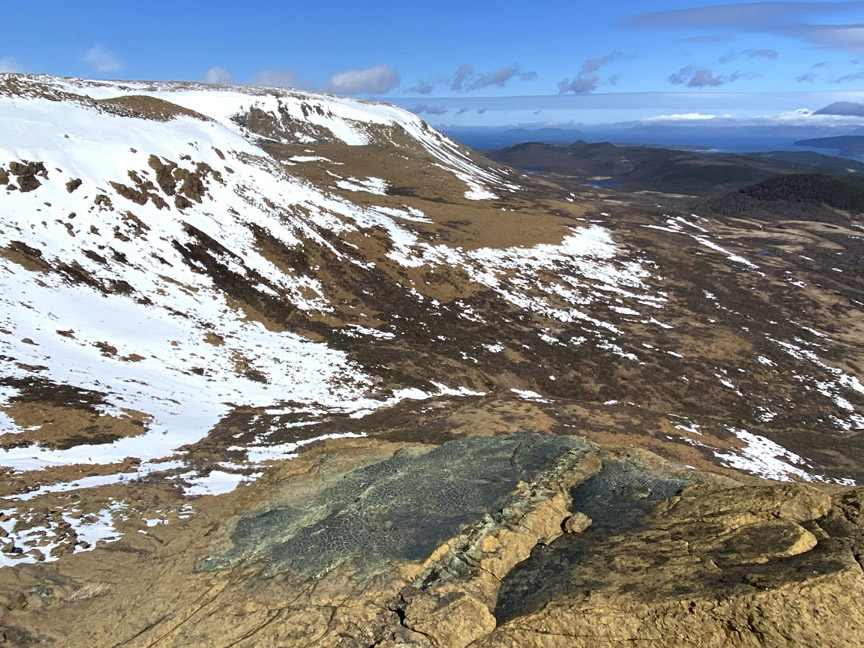
From this mountain ledge, Paul had to climb another 250ft (75 meters) over one kilometer to the top of the plateau, which on the eastern end of the mountains rises to approximately 2,000ft (600 meters).
For more on the story, go to the Cabox Geopark website.