Skip to content Skip to footer

The IATNL Thru-Hiker Route begins near the Marine Atlantic ferry terminal in Port aux Basques at the southwest corner of the island of Newfoundland, then extends north along the west coast to Crow Head at the tip of the Great Northern Peninsula just east of L’Anse aux Meadows UNESCO World Heritage Site, the Vinland of the Greenlander Sagas.

It is composed of the Newfoundland T’Trailway (aka Trans Canada Trail), an assortment of gravel logging roads, and little-traveled secondary highways.  Along the way, experienced wilderness hikers can detour onto one of the IATNL backcountry mountain routes spread throughout Western Newfoundland, from the Grand Codroy Way east of Codroy Valley, Lewis Hills Trail and Blow Me Down Traverse between Stephenville and Corner Brook, Humber Valley Trail near the city of Corner Brook, North Arm Traverse on the North Arm Hills between Bay of Islands and Trout River Pond in Gros Morne National Park, and Indian Lookout Trail southeast of Portland Creek on the Great Northern Peninsula.

Click the appropriate box below for more information.

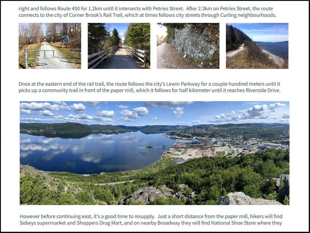
Trail Route Description

Click here for IATNL Thru-Hike description

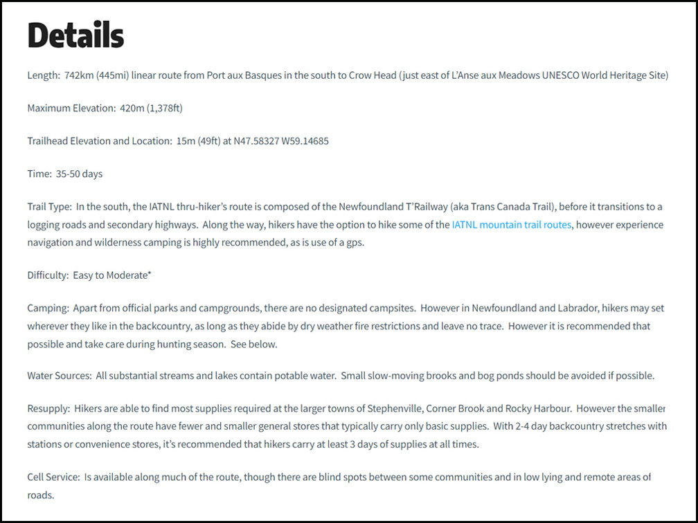
Details & Directions

Click here for IATNL Thru-Hike details and directions
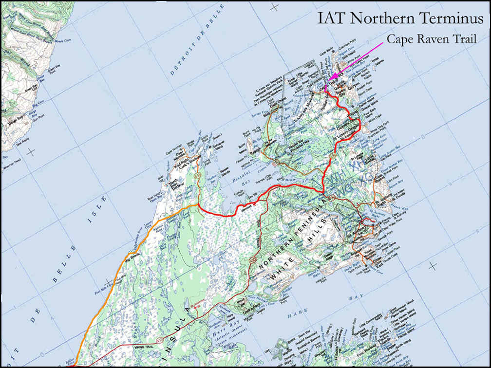
Topographical Map

Click here for IATNL Thru-Hike topo maps
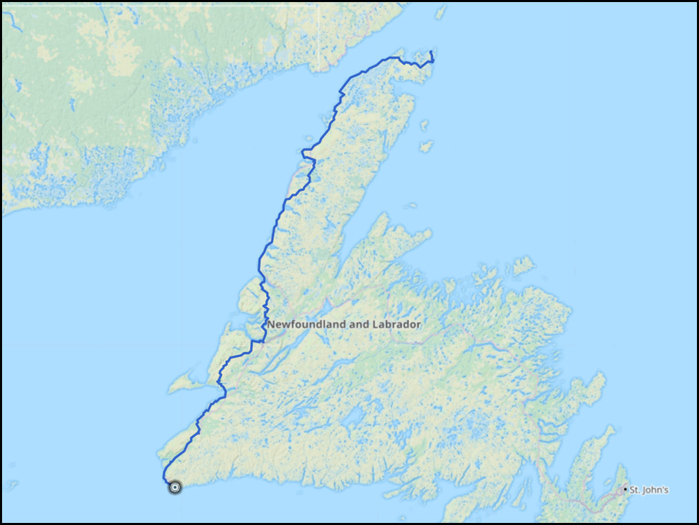
GPS Track

Click here for IATNL Thru-Hike gps track

Copyright © 2023 International Appalachian Trail Newfoundland and Labrador (IATNL)