The Newfoundland section of the IAT/SIA has been added to the FarOut trail guide app for long-distance hikers, the “No. 1 navigational app for the best long-distance trails in the world!” With over 700km/450mi of thru-hiker trail route and 280km/175mi of “backcountry trail routes”, the Newfoundland section includes some of the most dramatic scenery and challenging hikes on the entire IAT/SIA in North America.
Newfoundland joins IAT/SIA guides for Maine, New Brunswick and Quebec which were released in 2020 along with Prince Edward Island and Nova Scotia which were released earlier this year.
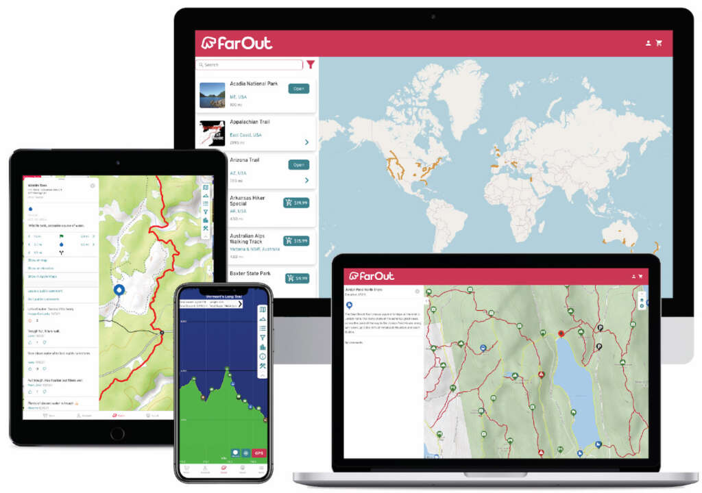
For those unfamiliar with FarOut Guides (formerly known as “Guthook”), they were first developed as an iPhone app in 2012 by AT thru-hiker (and Maine native) Ryan Linn and have become the most widely used trail app for long-distance hikers in the years since. The app allows hikers to download detailed, up-to-date maps and information on campsites, water sources, resupply opportunities and more to any smart phone. Additionally, users can share information about current trail conditions, hiker-friendly towns or places to get a good hamburger.
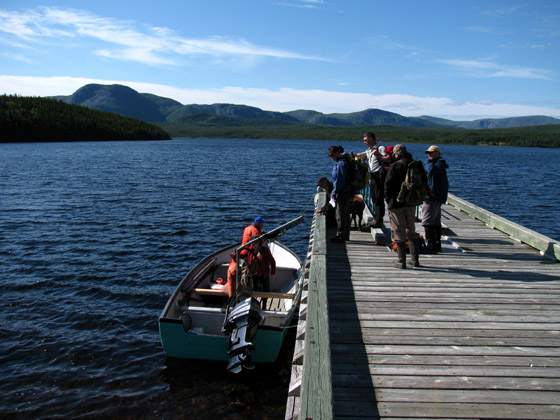
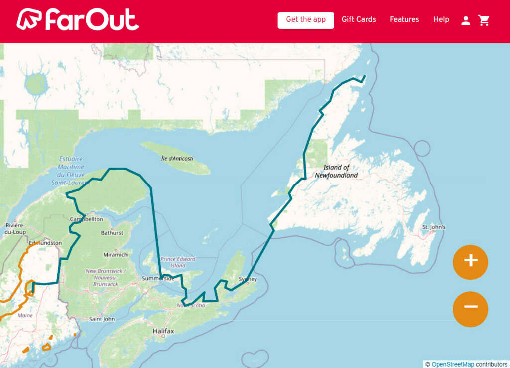
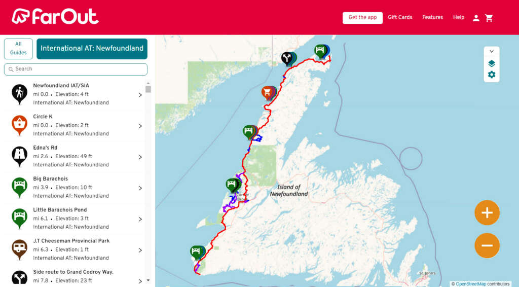
The Newfoundland section of the IAT/SIA begins near the Marine Atlantic ferry terminal in Port aux Basques at the southwest corner of the island of Newfoundland, then extends north along the west coast to Crow Head at the tip of the Great Northern Peninsula just east of L’Anse aux Meadows UNESCO World Heritage Site, the Vinland of the Greenlander Sagas.
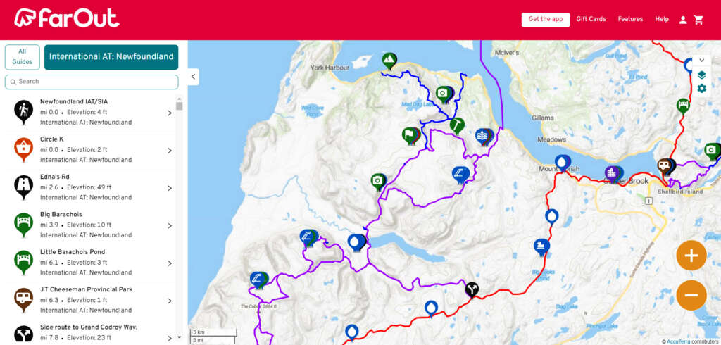
This section is composed of the Newfoundland T’Railway (aka Trans Canada Trail), an assortment of gravel logging roads, and little-traveled secondary highways. Along the way, experienced wilderness hikers can detour onto one of the IATNL backcountry mountain routes spread throughout Western Newfoundland, from the Grand Codroy Way east of Codroy Valley, Lewis Hills Trail and Blow Me Down Traverse between Stephenville and Corner Brook, Humber Valley Trail near the city of Corner Brook, North Arm Traverse on the North Arm Hills between Bay of Islands and Trout River Pond in Gros Morne National Park, and Indian Lookout Trail southeast of Portland Creek on the Great Northern Peninsula.
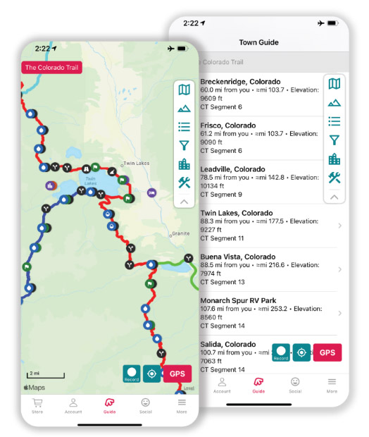
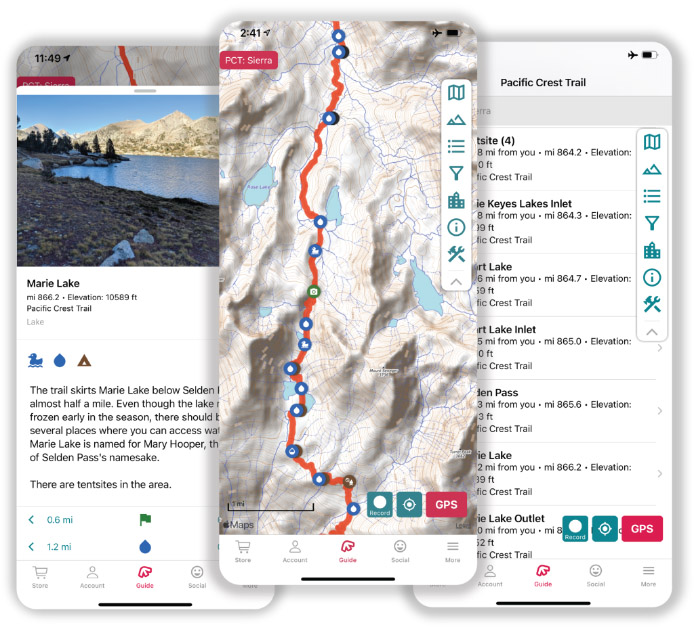
All of the data for FarOut routes is collected by trusted individuals and partner organizations, and is kept meticulously up-to-date. The track of each trail includes side trails and alternate routes, along with key waypoints. Our apps also offer comprehensive town guides, helping you resupply and access other services quickly.
Once you’ve completed the initial setup of the app, all of our trail guides work offline. They use your device’s internal GPS to display your current location and guide you along the route. Offline use includes access to all features of the guide, including the map, elevation profile, waypoint list, and more.
Waypoints are plotted on the map and elevation profile, and each waypoint includes its own detail page with photos and descriptions. Water waypoints offer the most up-to-date water information, gathered from trusted sources and checked by other users.
Stay informed about conditions ahead by reading other users’ waypoint comments, and let other users know about your experience by leaving your own comments. Keep your friends and family up to date by sharing a Check-in with your current location and a personalized message.
Plan your day by letting the app calculate the distance to the next campsite, water source, or waypoint. You can also create your own custom routes using our route building tool.
The Newfoundland sections is available for $14.99 (USD). The original Maine and New Brunswick sections are available for $7 (USD) each and the Quebec section is $13. You can buy all six sections for $41.99 – the thru hiker special! For more information visit the FarOut website.