Unable to travel to Newfoundland during the summers of 2020 and 2021 due to Covid-19, Lew Coty recently reminisced about his many adventures in Western Newfoundland while browsing his e-photo albums, and shared the following story about his West Tablelands Trek with us. Lew hopes to return again this August when he takes a break from his Vermont maple syrup grove.
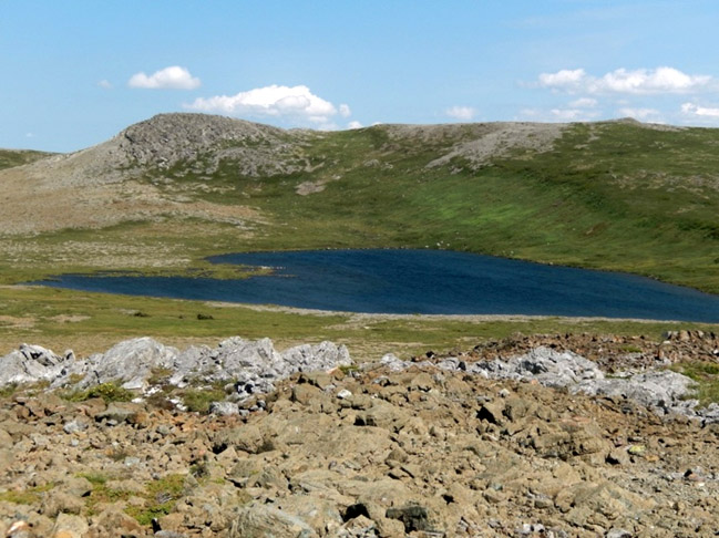
“Looking northeast across Trout River Pond from the Trout River campground, the western end of the Tablelands looms on the horizon. Centered in this scene is a deeply cut canyon that my topo map shows is cut by a stream that flows into Trout River about a kilometer before it spills into Trout River Bay. On my map this stream with a sizable watershed has no name, but I’ve been told it’s called Feeder Brook, and it supplies water for the town of Trout River. As is often the case with so much of the stellar backcountry terrain in Newfoundland, there is no trail to access it. Its vista was too intriguing to let that stop me.

I turned left off the Trout River Pond Trail about one and a half kilometers in, heading northeast on what looked like a poorly maintained access lane. It led me into barrens under the western end of the Tablelands plateau. Skirting a small pond, I headed north and dropped into Feeder Brook Canyon.

Hiking east up the brook I came to a fork and encountered the first of what would be many impressive waterfalls. It was a hot August day and the landing pool provided much needed refreshment.

I was at the outlet of a steep-walled winding canyon, and the way forward wasn’t obvious. I decided to follow the left fork up and circle the basin clockwise.

Hiking the gorge this brook created became increasingly difficult and I was soon forced up its steep left bank where I battled my way through stunted tuckamore.

Struggling through such dense vegetation has never been my idea of a good time, but anyone who has spent much time exploring the backcountry of Newfoundland knows that sometimes this is the only option forward. Ascending, I finally found relief in some moose paths.

Reaching the barren high-ground with a more friendly pitch, I swung back to the gorge’s edge where I could peer down into this twisting fissure, complete with two waterfalls in rapid succession. Such spirited leaps in such a concealed location! Enough to make one think that very few people have laid eyes on them.

The landing pools looked so seductive, but getting there without ropes was more than I dared consider.

I proceeded up the chasm’s rim for another half kilometer where glimpses of rushing water were the theme, and peeks of Trout River Pond to the south would occasionally show.

Exiting north over velvety grasslands my pace accelerated, and I ascended a rounded knob called Table Mountain.

A ptarmigan was doing its rounds on top, and being so well camouflaged, only its motions caught my eyes.

Following this hill’s gently sloping northside brought me to Manuels Brook Pond (the only pond on the Tablelands Plateau), which on that day was home to many squawking seagulls.

Heading east from there I traversed a couple acres of wetlands. The scattered fen pools made for some zig-zagging and hop-scotching.

This transitioned into the Tablelands proper with its distinctive orange-brown rock that is toxic to most plant life.

Hiking these peridotite barrens is like a trip to Mars, punctuated only by an occasional hardy flower, or patches of juniper that are immune to this poisonous soil.


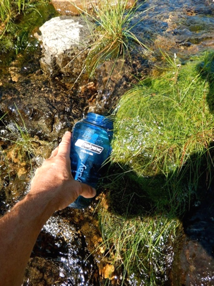
Arching south I descended into the headwaters of Feeder Brook where filling my water bottle on this hot day was not a problem.
Heading downstream the braided rivulets joined forces and pools began to form.

Soon I was marching through a succession of heavenly swim pools. I could have easily spent the whole day swimming my way down this section, mitigating the effects of the oppressive heat with every dive into a spring-fed chill.

The deeper ones held my attention with their deep-turquoise hue. If only the depths of this pristine water could be turned to stone what lovely jewelry it would make!

And then, the big drop when this gently cascading stream took a leap. I seated myself on a rock ledge at the top and was mesmerized by the relentless spray of hurtling water.

Circling around on the south rim gave a view of the full drop, and further down the rim revealed another with an s-curve intro.

I descended the highlands hiking south, and then over a hummock on the north side of Trout River’s Small Pond that gave a face-on view of The Elephant. Also known as Narrows Head this prominent rock face shaped like an elephant’s head can be seen from many locations around Trout River. It rises above The Narrows that separate Trout River’s big and small ponds.

A short scramble down from there had me back on the Trout River Pond trail.”