Skip to content Skip to sidebar Skip to footer

Cabox Geopark Submits Application Dossier

After several months preparing document and annexes, on February 26 Cabox Aspiring Geopark submitted its official application dossier to the Canadian Geopark Network (CGN). Submitting the dossier is the first step in a 2-3 year application process that, if successful, leads to the designation of Cabox as a UNESCO Global Geopark, one of three UNESCO designations.

Gregory River to Shoal Point Traverse

On August 9, 2024, IATNL Chairperson Paul Wylezol and Appalachian explorer Lew Coty from Stowe, Vermont made a Gregory Mountains traverse from Gregory River to Shoal Point Cove. The adventure began early in the morning at the intersection of Mogul ATV Trail and Chimney Cove Road 2km south of Trout River Campground where Gros Morne Transportation and Tours picked them up in a side-by-side all terrain vehicle and drove them 10 km to Gregory River.

Work Completed on Stage 1 of East Blow-Me-Down Trail

From spring to fall 2024, the International Appalachian Trail Newfoundland and Labrador (IATNL) in conjunction with Cabox Aspiring Geopark developed the first stage of the East Blow-Me-Down Trail off the Forestry Access Road above Benoit’s Cove on Route 450 on the south side of Humber Arm, Bay of Islands. The trail replaces an excavator track to the town’s second water supply that served as the primary hiking route to the East Blow-Me-Down Mountains.

Lew Coty’s Triple Crown

There they lie, lined up like bowling pins on the north side of Rt 430 (The Viking Trail), southeast of Rocky Harbour. Travelling from the north they are Big Hill, Killdevil Mountain, and an unnamed mountain I call Dicks Peak that rises up to the east of Dicks Brook. They aren’t really isolated peaks so much as prominences that are starkly visible from the road where the highland plateau to the north drops sharply down to the East Arm of Bonne Bay. Each of these peaks has a barren top with spectacular 360° views, and all are less than two kilometers from the main highway. They are centrally located in Gros Morne National Park, one of the most prestigious destinations in Canada. To my astonishment there isn’t a trail up any of them

Work Starting Soon on East Blow Me Down Trail

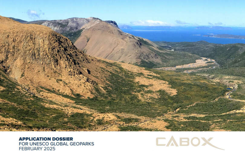
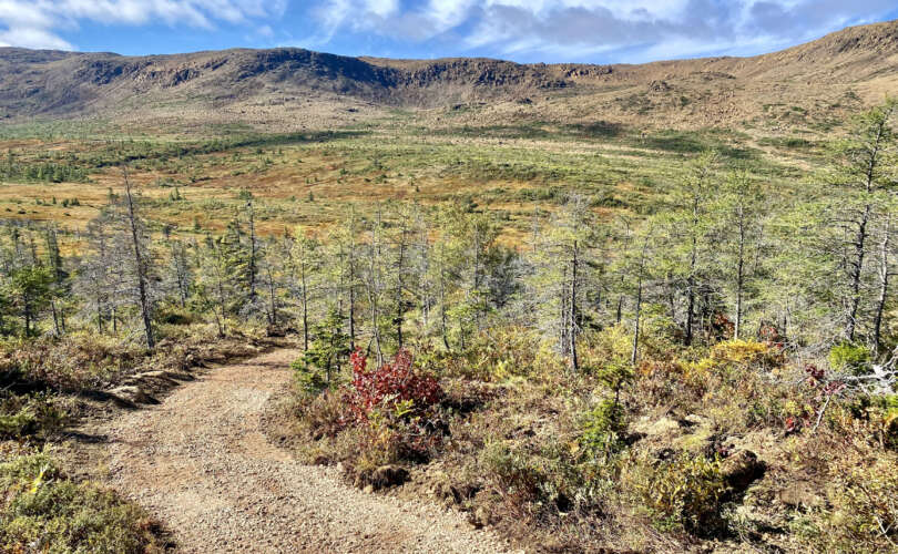
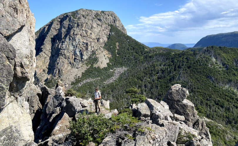
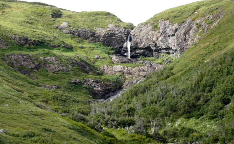
In Spring 2024, work will begin on the East Blow Me Down Trail, a 4km backcounty hiking route that will connect the Forestry Access Road above Benoit’s Cove on the south shore of Humber Arm to the eastern end of the Blow Me Down Ophiolite Massif. The new International Appalachian Trail Newfoundland and Labrador (IATNL) trail will be developed by Cabox Aspiring Geopark, with funding from the Atlantic Canada Opportunities Agency (ACOA), provincial department of Industry, Energy and Technology (IET), and Trans Canada Trail (TCT), of which it will form part of a spur line linked to the Newfoundland T’Railway, the principal TCT route in Newfoundland and Labrador. After crossing a shallow section of Clark’s Brook, the trail will wind its way approximately 1km up a gentle scrub-forest slope, before breaking out onto lowland barrens at the base of the Blow Me Down Mountains.

Celebrating the Solstice

Appalachian hiker Lew Coty from Vermont makes an annual pilgrimage to Western Newfoundland in August to spend a month exploring the mountains and coastlines of Newfoundland's Long Range Mountains, North America's northern terminus of the Appalachian-Caledonian Orogeny.  Some might wonder what he does at home in winter, besides tend to trees on his maple syrup farm.  Answer is, he waits for a sufficient blanket of snow so he can head out to the backcountry slopes around his home near the famed ski resort village of Stowe.  Below, Lew recounts one such sunny day in December! "We glide out on our lightweight backcountry skis and 3 pin boots, under a cold blue solstice sky to explore the Worcester Ridge that flanks the east side of my home town, Stowe, Vermont. Cold air is flowing in from the north, and the sun is on a tight leash not rising far above the southern horizon. The light coating of weightless snow has a radiance that only this time of year can produce. It stings my uncovered eyes on the southern aspects. We traverse the beaver swamps under the summit cone of Mount Worcester, and crest its north side ridge. Behold the crisp luminescence of low angle light where golden hour lasts all day. And skis dance on the solstice sun. Descending, we figure ski over the glades below  following the proper etiquette of leaving nothing but the eights." Lew Coty 12/21/23

Scouting the Virgin Mary Hills

Another chapter in the Adventures of Lew Coty! "It was near the end of my Newfoundland vacation when I spend over a month hiking into the backcountry every year. Paul Wylezol who heads the IATNL was eager to do some exploring and suggested hiking into the hills south of Little Port not far from the community of Lark Harbour, on the northwest side of Bay of Islands. There is an intriguing loop onto one coastal ridgeline near Little Port called Little Port Head Lighthouse Trail. It involves an invigorating climb and descent with dramatic views of the shoreline cliffs on top. Unfortunately, the southern end of this trail has seen serious erosion in recent years. Paul’s intent was to explore the ridgelines south of that trail. It all began so innocently as we headed south from Little Port on a well maintained ATV trail. Paul was familiar with the ATV trails in this area, but neither of us had ventured onto the ridgelines that parallel the coast. We scampered up the first hill we came to. Its barren top gave a nice view of Cedar Cove just south of Little Port. Paul, who has been the master mind of numerous trail cuts was thinking a nice trail could be made there.  (r-l) Murray Mountains, Bottle Cove, Little Port, Little Port Head, Cedar Cove, and Virgin Mary Hills (click photo to enlarge) The ridge south of there looked rather intimidating and probably not worth the energy attempting an ascent to its exposed…

IAT Newfoundland Guide Now Available!

The Newfoundland section of the IAT/SIA has been added to the FarOut trail guide app for long-distance hikers, the “No. 1 navigational app for the best long-distance trails in the world!” With over 700km/450mi of thru-hiker trail route and 280km/175mi of “backcountry trail routes”, the Newfoundland section includes some of the most dramatic scenery and challenging hikes on the entire IAT/SIA in North America. Newfoundland joins IAT/SIA guides for Maine, New Brunswick and Quebec which were released in 2020 along with Prince Edward Island and Nova Scotia which were released earlier this year. For those unfamiliar with FarOut Guides (formerly known as “Guthook”), they were first developed as an iPhone app in 2012 by AT thru-hiker (and Maine native) Ryan Linn and have become the most widely used trail app for long-distance hikers in the years since. The app allows hikers to download detailed, up-to-date maps and information on campsites, water sources, resupply opportunities and more to any smart phone. Additionally, users can share information about current trail conditions, hiker-friendly towns or places to get a good hamburger.

Cabox to Receive Phase Two Funding

At a combined federal-provincial press release at Lobster Cove Lighthouse in Gros Morne National Park, Cabox Aspiring Geopark was among a number of tourism-related projects in Western Newfoundland to share in a total of $2,744,563 in government funding intended to “help upgrade accommodations, host events and festivals, market the region, and develop new world-class attractions”

Cabox Installs BOI Ophiolite Panel at Saltbox

On June 24, Cabox Aspiring Geopark installed its latest interpretive panel, entitled Bay of Islands Ophiolite Complex, near the entrance to Saltbox Restaurant and Geopark Information Center in Benoit’s Cove. The panel is located above a mini ophiolite rock garden containing samples from both earth’s mantle and ocean floor, and features descriptions of all four ophiolite massifs, as well as rock types and flowers found in these unique landscapes

IAT Ireland Welcomes Western Way

After 2022’s successful launch of its new and improved IAT Ireland, IAT Europe’s most westerly chapter has welcomed the Western Way, a long-distance walking trail taking in spectacular scenery in the counties of Galway and Mayo in the west of Ireland.

Lew Coty Hikes Mount St Gregory Highlands

My trek begins with a boat ride from Cox’s Cove to Stowbridge Head where I spend the night at a cabin owned by Paul Wylezol (who heads up the International Appalachian Trail Newfoundland and Labrador) and Arne Helgeland. For the past several years they have been renovating what was once a dilapidated fishing shack into what they hope will become an active IAT and Cabox Geopark basecamp for hikers.

Copyright © 2023 International Appalachian Trail Newfoundland and Labrador (IATNL)