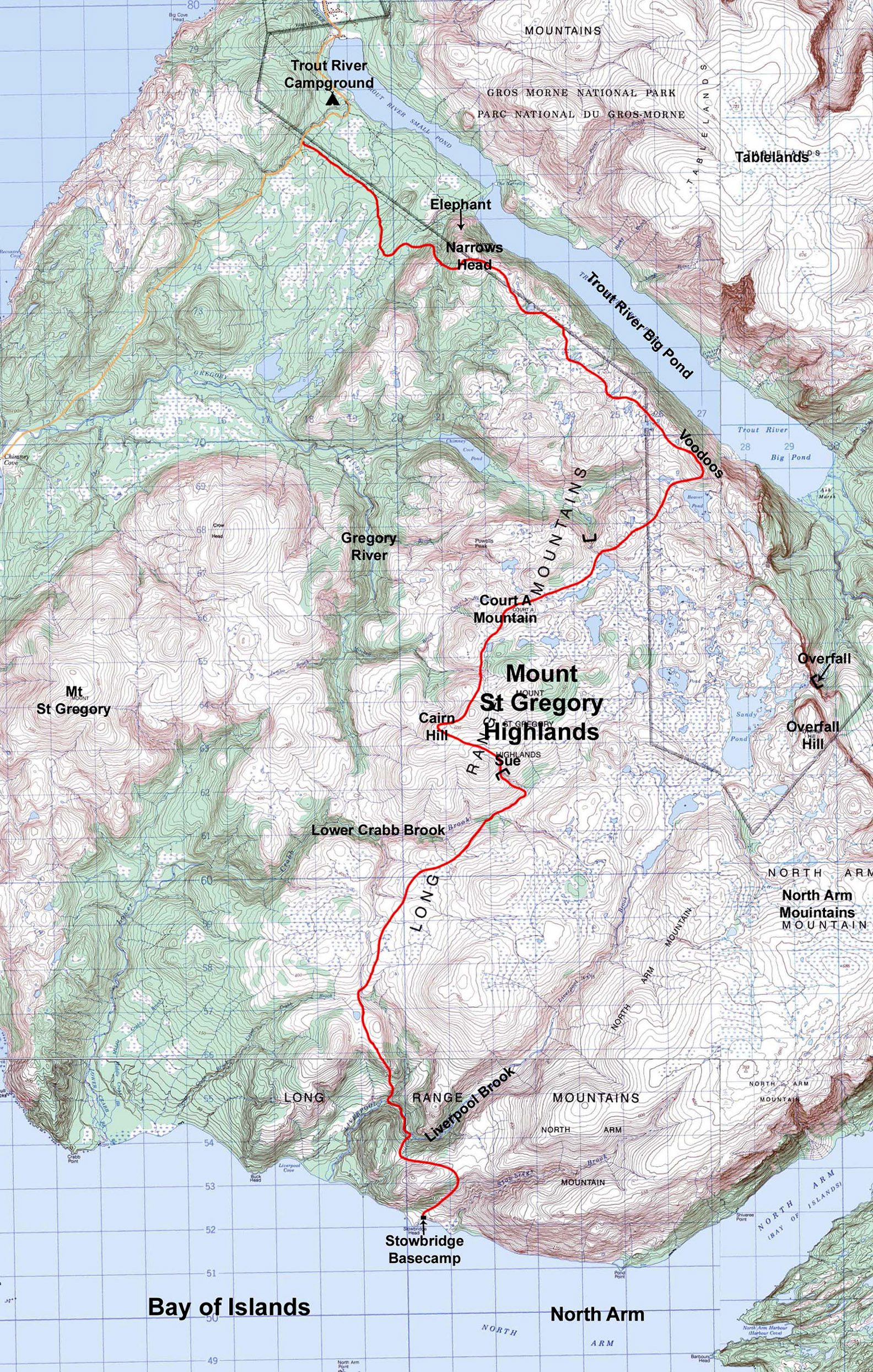


The great expanse of highland barrens between Trout River and the Bay of Islands has always intrigued me and I never tire of exploring its remote areas. The Liverpool, Crabb, and Gregory River basins, and the high plateaus of Mount St Gregory, North Arm Mountain, and Trout River Big Pond’s South Rim are each worthy of being excursions by themselves. In past treks I have only skirted what shows on my topo map as Mount St Gregory Highlands which I would describe as a ridgeline of highland mounds centrally located in this wilderness. My goal in August 2022 was to trek through this area, hiking from Stowbridge Head at the mouth of Bay of Island’s North Arm on the south end, to Trout River Campground on the north end.
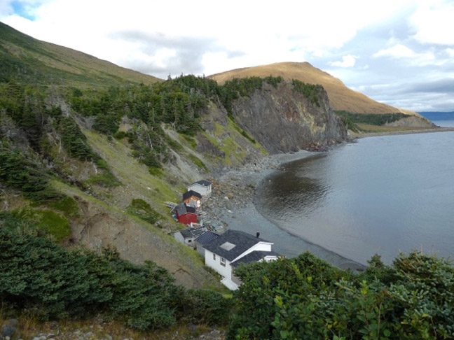
My trek begins with a boat ride from Cox’s Cove to Stowbridge Head where I spend the night at a cabin owned by Paul Wylezol (who heads up the International Appalachian Trail Newfoundland and Labrador) and Arne Helgeland. For the past several years they have been renovating what was once a dilapidated fishing shack into what they hope will become an active IAT and Cabox Geopark basecamp for hikers.
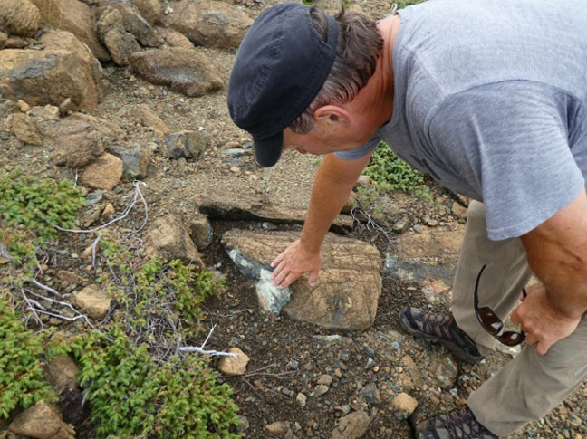
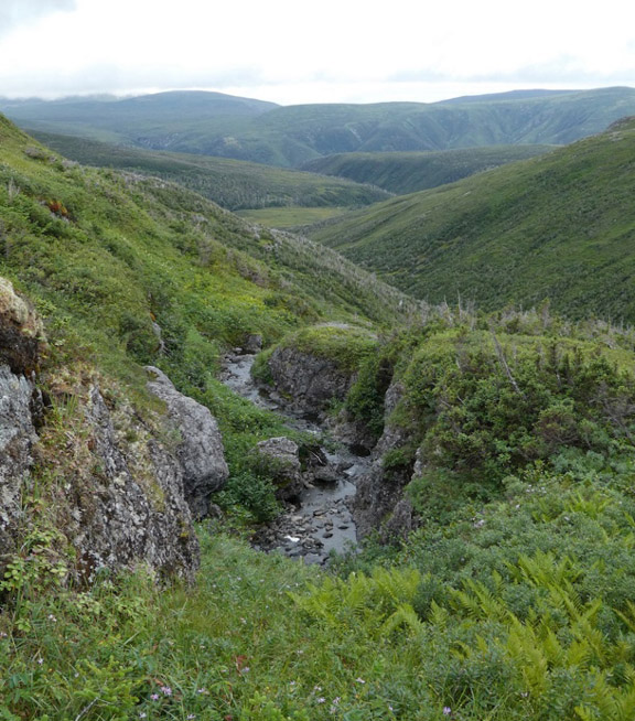
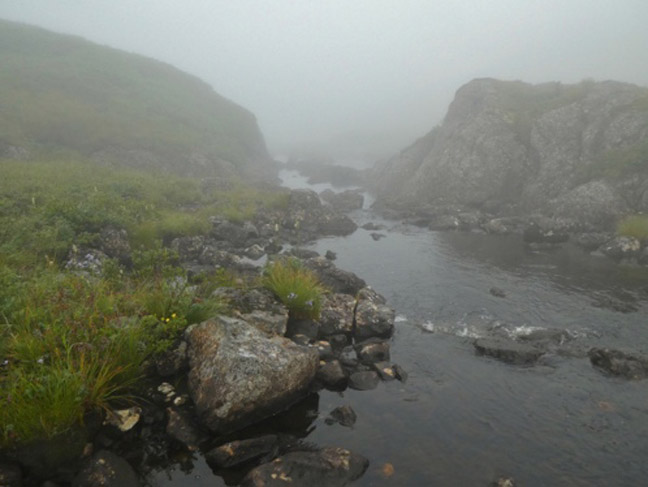
Paul, who is an explorer at heart and knows this area well, takes time to help me find a way across the Liverpool Brook Canyon. He is also a knowledgeable geologist; as we ascend the peridotite barren above camp he’s fully engaged pointing out the many rock types and formations that are unique to this kind of terrain.
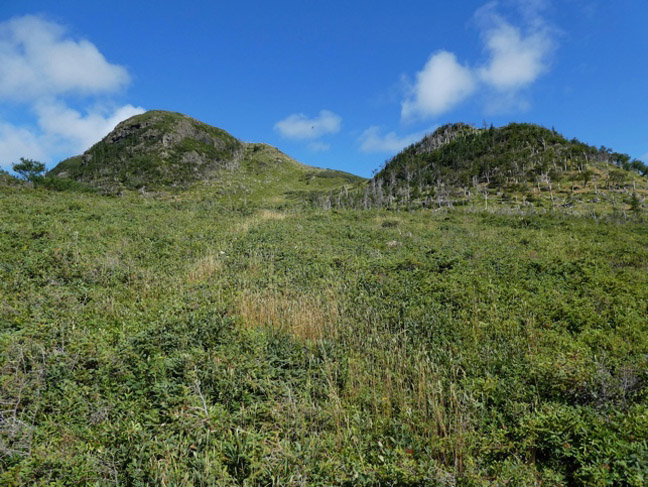
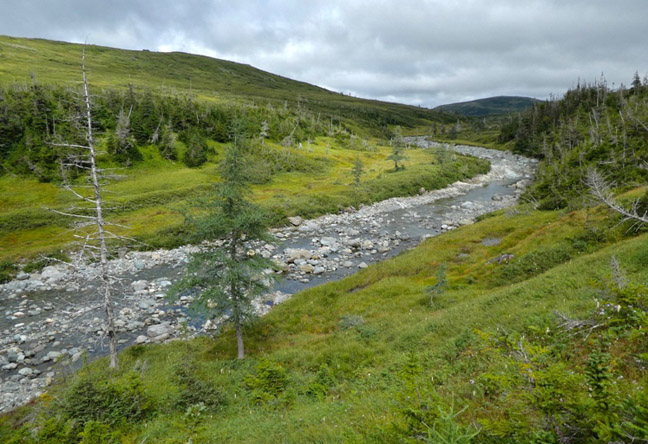
At the crest of Liverpool Canyon we zig-zag down to the river, weaving through spotted grassland and bush, following moose trails wherever we can find them. At the river Paul heads upstream returning to camp, and I head down river where I can see an open slope to the north that leads up into the highlands. This mostly grassy slope is accessed from Liverpool’s first major tributary and is thankfully an easy ascent.
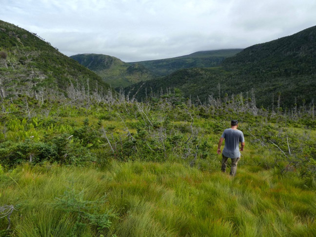
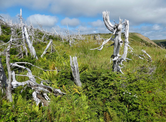
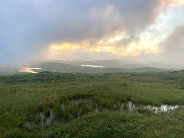
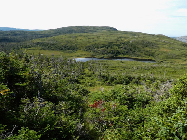
Heading north, at the top I am met with the silver ghosts of what must have once been a thriving spruce forest. Continuing north the terrain opens into seemingly endless grasslands that make the distant hills look like they’re covered in green velvet.
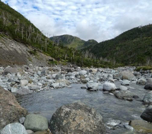
This rolling grassy terrain ends abruptly at the deep chasm of Lower Crabb Brook to my west. I drop down into the brook higher up where the canyon is considerably shallower and easy to cross.
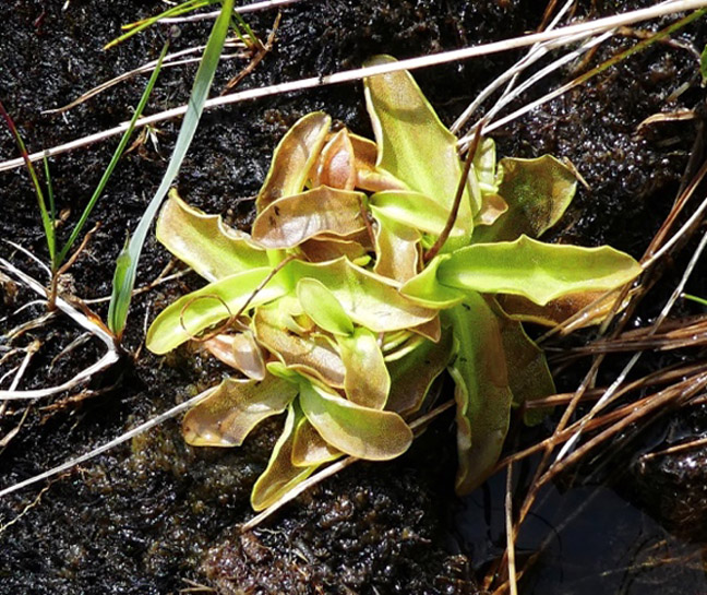
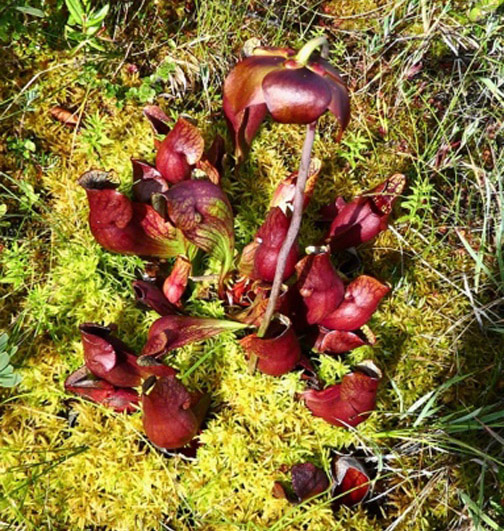
The ground here is covered with bright patches of colorful insectivores including pitcher plant, butterwort, bladderwort, and sundew.
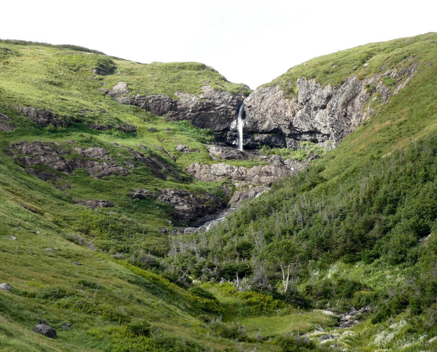
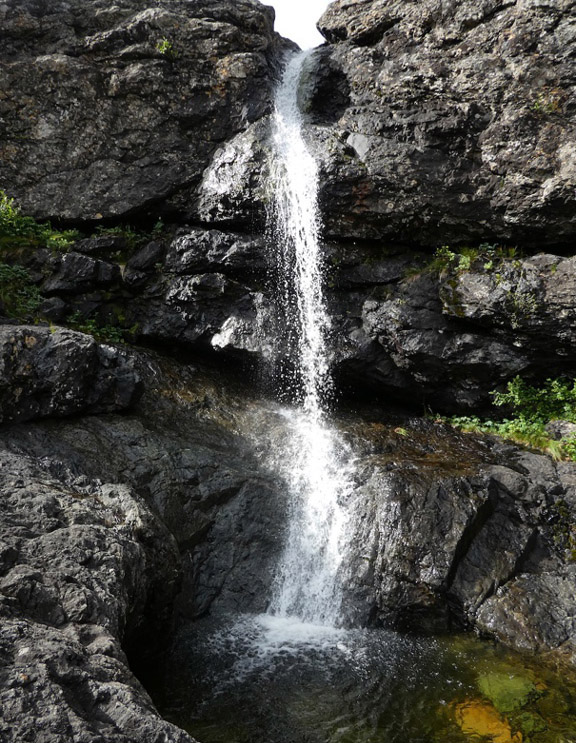
I am now in terrain I have traversed before and am delighted to get my first glimpse of a waterfall I’ve affectionately named Sue. Sue resides on a smaller tributary of Lower Crabb, and shows clearly from the east on an exposed ledgy slope. She is not a very spectacular fall nor particularly big, like so many pouring off the Newfoundland highlands, but she is none the less alluring with subtle curves. She is definitely a flirt and I’ll have to admit she’s always had a hold on me.
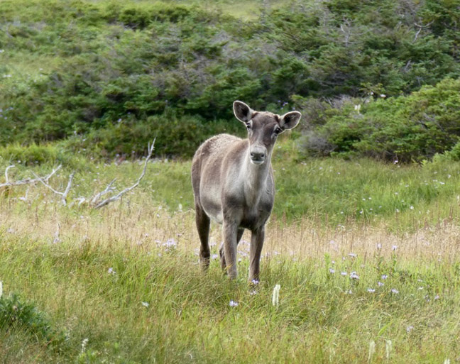
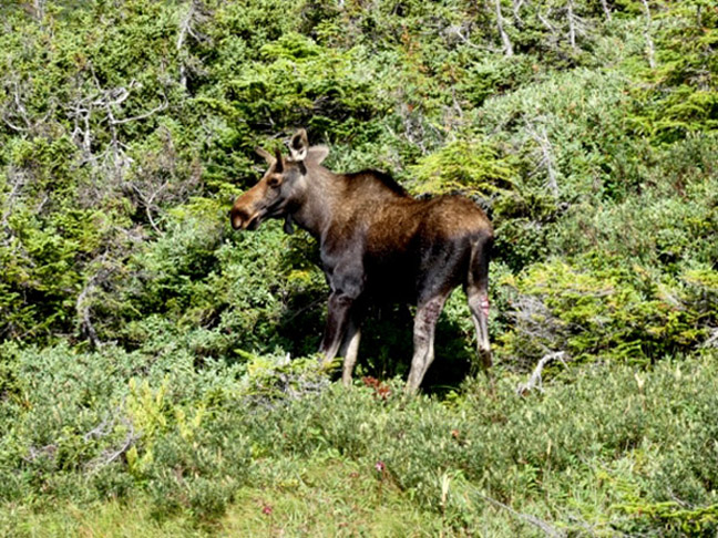
Above the falls heading into the Gregory Highlands I cross over meadows encountering a few caribou. One displays the confident stature of age, and another the timid curiosity of youth.
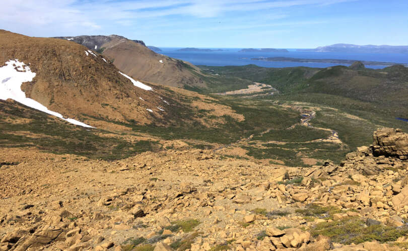
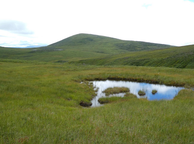
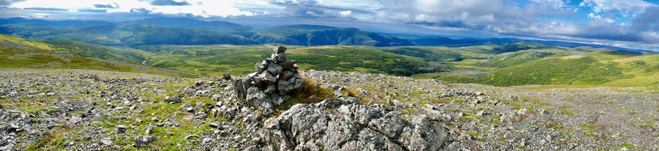
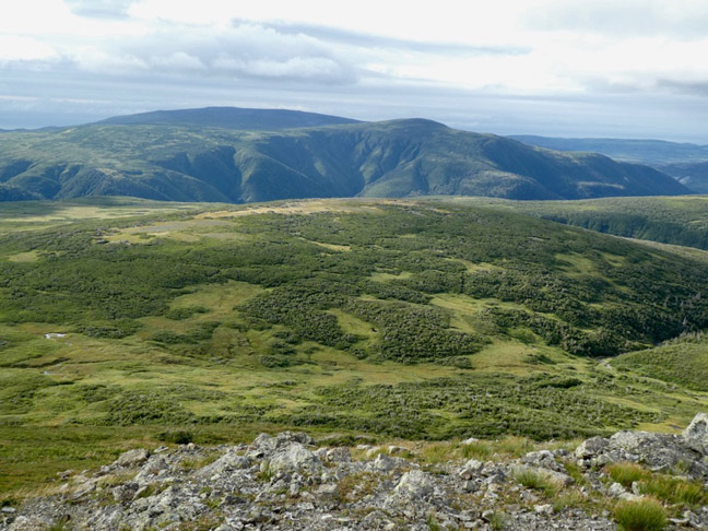
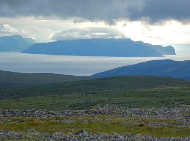
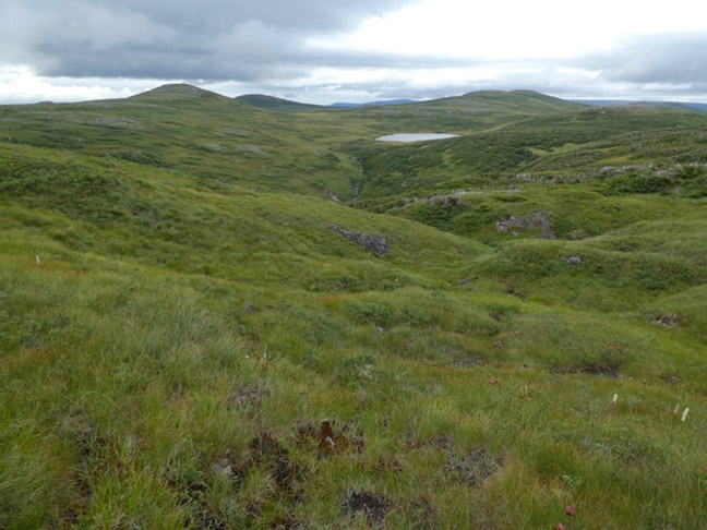
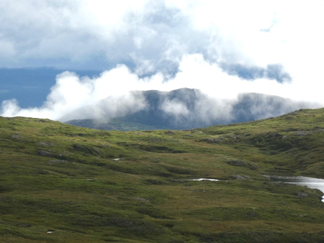
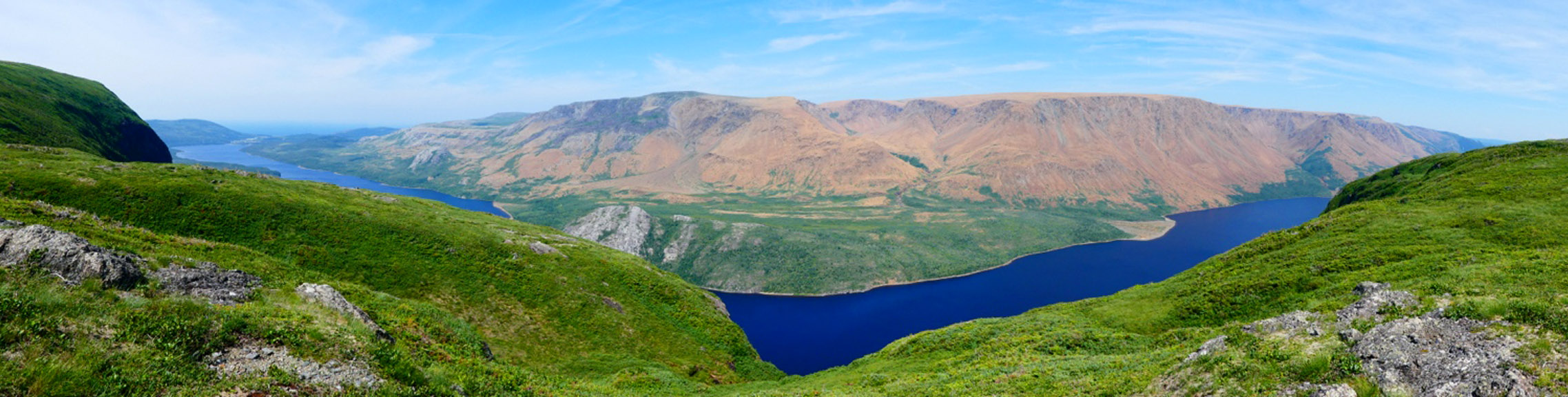
Above and to both sides of me rise rock-covered mounds. I head to one further west that’s topped with a cairn. At its summit I take in an encompassing view: directly below to the west lies the upper Gregory Brook canyon with all its corrugated tributaries flowing down from this headland, to the south the Bay of Islands shimmers in the distance, to the east looms Overfall Hill that sits directly over one of the most spectacular waterfalls in Newfoundland, and far to the north above the Gregory Highland hills the rusty colored Tablelands are barely visible.
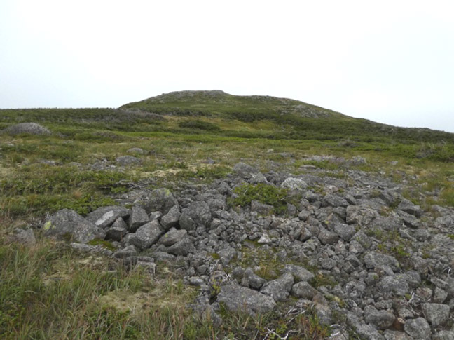
From here I set my crosshairs on Court A Mountain to the north. Though about three kilometers away, it looks so easy to traverse and proves to be hiker friendly until I come to a hidden intervening valley formed by the headwaters of Mitchell Brook. The sides of this drop are deep and steep, forcing me to use all fours and butt-slide in places.
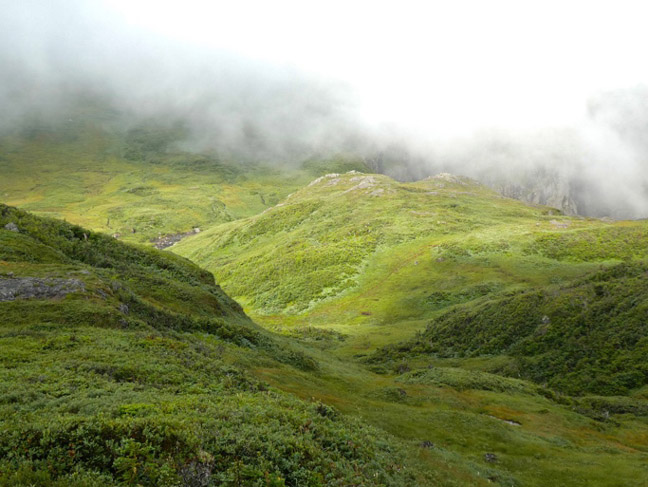
As I ascend Court A Mountain in the late afternoon the clouds begin dropping onto the hilltops. The summit view is limited, and I’m soon enveloped in a swirling mist. I set up my tent a ways down the northern slope where the wind is less severe.
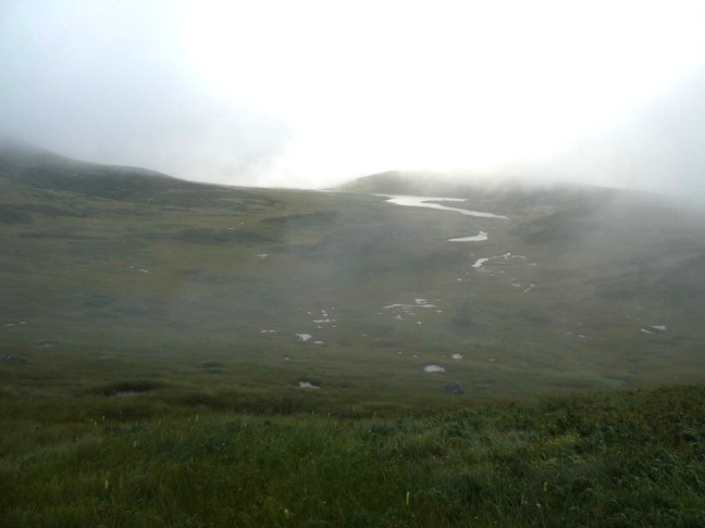
The daybreak is windless and the sky gives hope for a nice day, but the optimism quickly fades as a thick blanket of fog wraps the landscape, making navigation a miserable exercise.
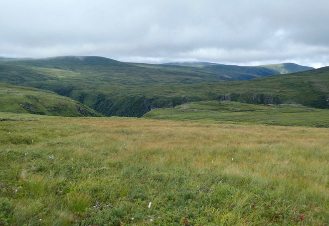
Heading easterly towards Trout River Pond I cross a watershed divide and the August sun begins dissipating the mist, thankfully giving me a clear vision of what lies ahead.
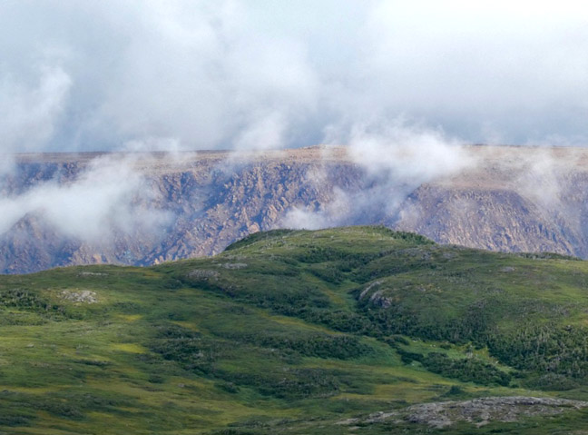
As I descend onto the south rim of TRP the rusty-red soils of the Tablelands glow through the lifting mist across the pond to the north.
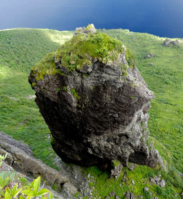
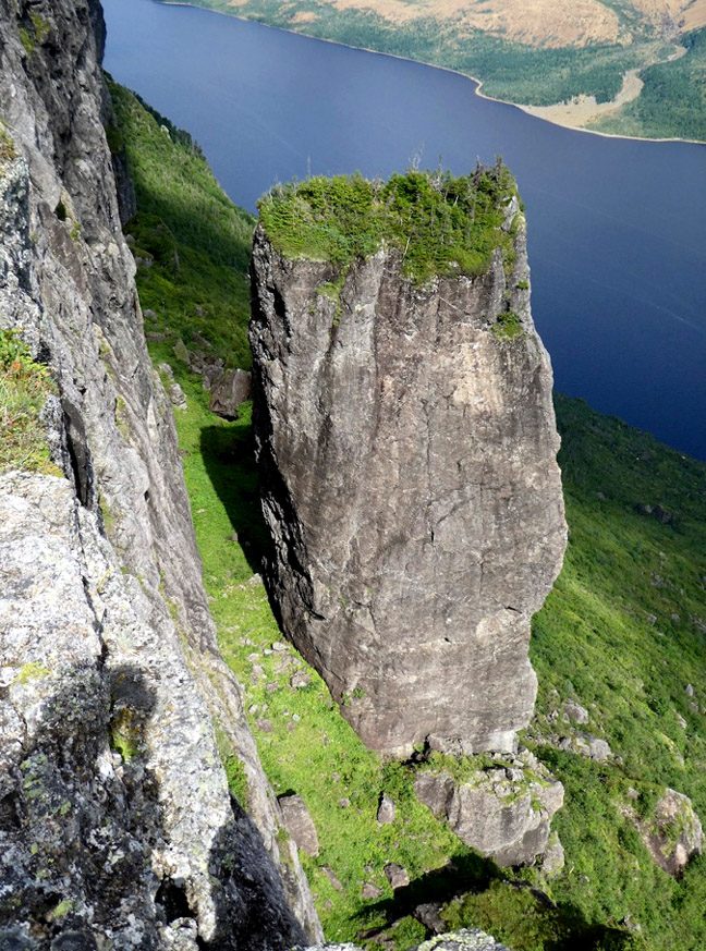
A scamper up the backside of a high cliff band that butts up to TRP on its eastern end – and peering trepidatiously over the edge – reveals some remarkable stone columns which I’ve been told are called the Voodoos.
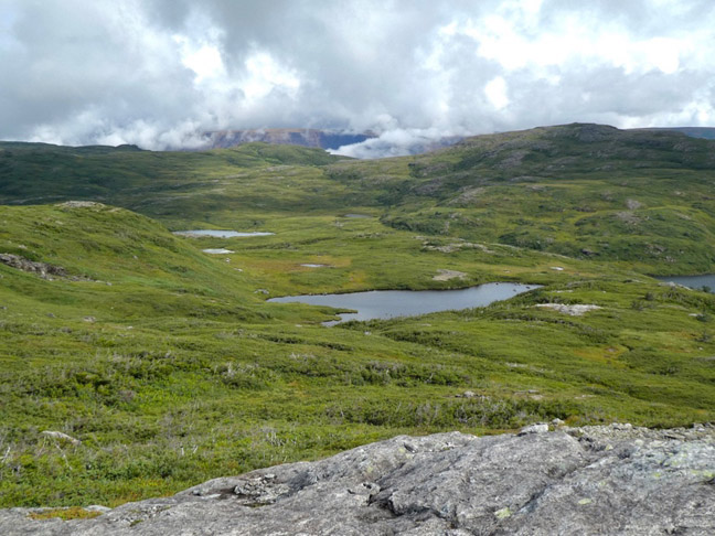
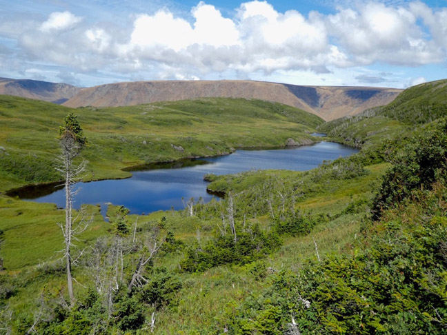
Basking in the afternoon sun I proceed northwesterly along the south rim, never far from the pond, where pristine lakes and views of the Tablelands emerge around every corner.
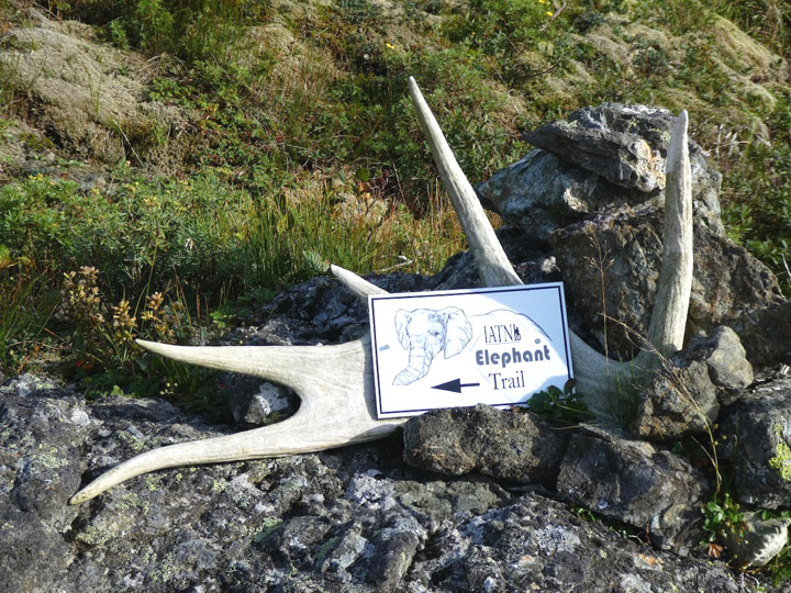
The rim highlands end at Narrows Head and the two-kilometer ascent of this hill brings me to the Elephant Trail, so named as the north face of Narrows Head is shaped like an elephant’s head. This trail was recently created by Paul and crew, and affords me with an easy exit to Trout River Campground.