

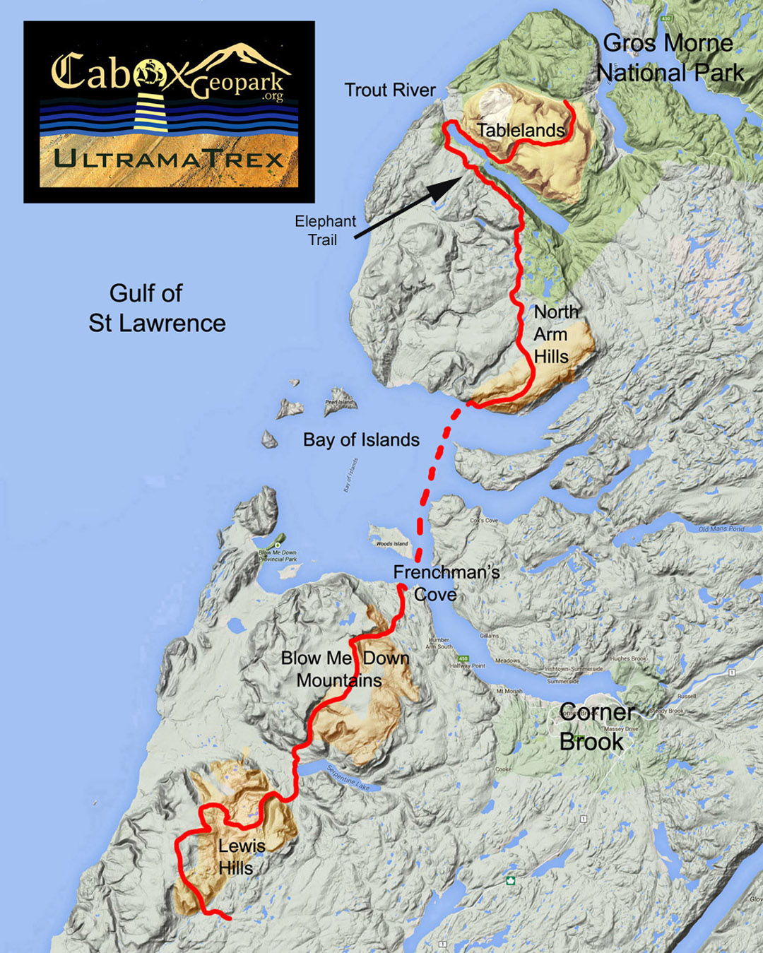
Cabox Aspiring Geopark’s UltramaTrex long-distance hiking route across the ultramafic sections of the four Bay of Islands Ophiolite Massifs is nearing completion and good to go for the brave of heart! The 145 kilometer (90 mile) trek is divided into 4 stages that can be completed individually, in groups of two (north and south of the Bay of Islands), or in a single 6-8 day trek.

The UltramaTrex is the trail route spine of the planned Global Geopark, and extends from Winterhouse Brook in Gros Morne National Park in the north to Fox Island River east of the Lewis Hills in the south. Between the two northern massifs (Table Mountain and North Arm) and the two southern massifs (Blow Me Down and Lewis Hills) is the Bay of Islands, which must be crossed by boat between Stowbridges (aka Stone Brook) and Frenchman’s Cove, or between Stowbridges and Cox’s Cove, then by ground transportation to Frenchman’s Cove.
For more on the UltramaTrex, go to the Cabox Geopark website.
