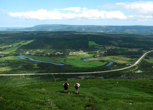
For one week in July, long-distance hiker Geoff Rose of Ontario took on the challenges and rewards of Western Newfoundland’s UltramaTrex, a 6-8 day trek across the ultramafic sections of the four Bay of Islands Ophiolite Massifs, from Tablelands in the north, across the North Arm Hills, Bay of Islands, Blow Me Down Mountains and Lewis Hills to the south. “It was a photographer’s dream!” he said.

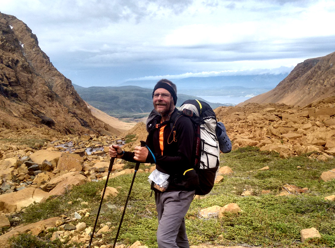
“It was a great trip. Having just finished the Long Range Traverse in Gros Morne National Park, in far less than ideal conditions, I was ready for anything, but more than a little worried I may have bitten off more than I can chew. In the end, it was tough, but still doable for this 59-year-old body. It certainly helped that the weather was near ideal for the UltramaTrex (the opposite of my experience in Gros Morne). It is amazing what some additional warmth and wind can do to make one more comfortable and less bug-infested.”

“The UltramaTrex is a grand route. You experience many challenges and view a wonderful range of terrain, flora and fauna. Yet with some care, the right gear, and some prior hiking experience, it is safe. I loved the ultramafic sections (part of the earth’s mantle) for their surreal landscape. It was also great seeing caribou in the alpine reaches, as well as moose nearer the treed areas.”

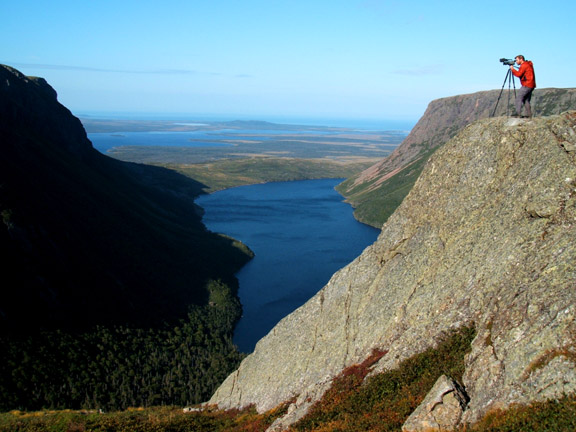
“Scrambling over rock fields was tough. Climbing was exhausting sometimes, and descending periodically felt a little intimidating. Every day there was a mix of experiences, from tiptoeing through the bogs trying to keep my boots dry, to removing my boots and walking with my crocs across thigh-deep streams. And the views! So many incredible and sometimes surreal landscapes. A photographer’s dream.”

“After crossing the Tablelands and North Arm Hills (the northern half of the hike), I arrived at the IATNL basecamp at Stowbridges in North Arm of the Bay of Islands. My time there was really special. I love the location, such a nice beach with awesome views of the bay, the islands, and the steep cliffs and mountains. The company, both Paul and Arnie, made it extra special, and one must not forget the Lambs rum. It helps one forget the occasional pesky blackfly!”

“The trek was made possible because of support from the IATNL, from picking up my food drop for the 2nd part of the trip, to hosting and entertaining me at the base camp, to transporting me across the bay and around Humber Arm to the starting point for the 2nd half of the hike, which was equally challenging and scenic.”


“The GPS route provided was incredibly helpful, especially on the North Arm Hills where there were many alternate routes around waist-high scrub, that with few exceptions, if I didn’t take the way indicated by the route, I ended up doing a fair bit of bush-whacking, or had to retrace my steps when presented with an unexpected cliff or even denser impenetrable bush.”

“This brief story hardly scrapes the surface of my adventure and certainly does not do justice to the experience. The description on the related Cabox Geopark website provides a lot of good detail. I would just add that there are infinite good locations for campsites, and the trip would be easier if given more time to do it. And for most of us mere mortals, it will likely be the toughest and perhaps the most meaningful physical adventure we experience (especially if you add in the Long Range Traverse as part of the same trip). It’s certainly not for everyone, but I highly recommend it.”