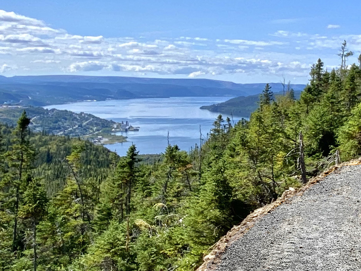
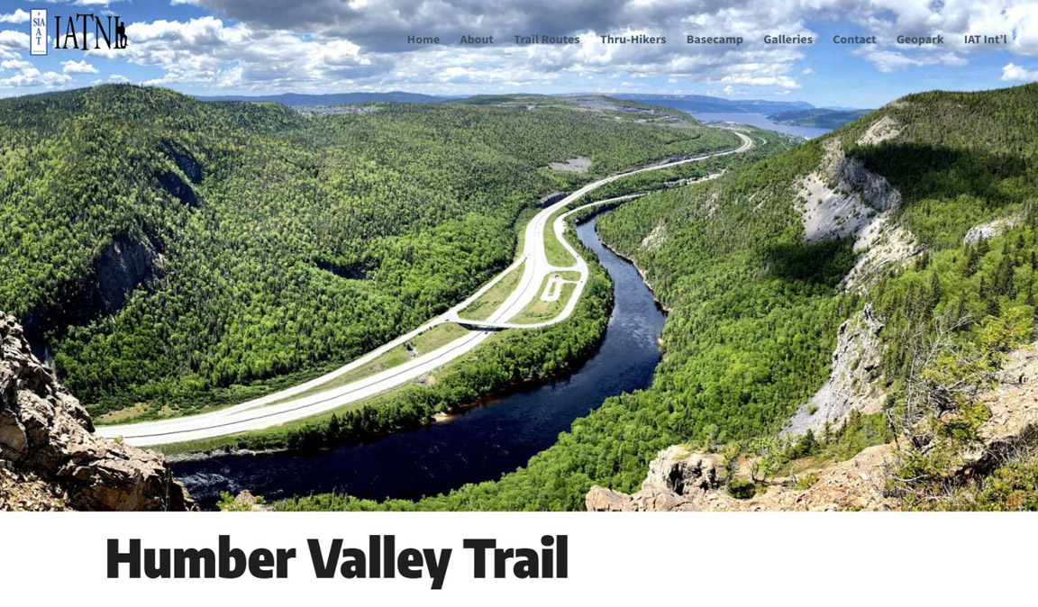
After 6 months of cutting trees, grubbing sod and spreading aggregate, work has been completed on Phase One of the new and improved Humber Valley Trail to Man in the Mountain in the lower Humber Valley, aka Humber Gorge.
The 20-year-old backcountry trail was initially developed as a narrow footpath by the IATNL. However because of its spectacular vistas and proximity to the City of Corner Brook, the trail received a high number of users and was in need of substantial upgrade to improve safety and accessibility and to fulfil its potential as a major “destination trail”. This view was reinforced by the STAR (Strategic Tourism for Areas and Regions) Humber-Bay of Islands trail master plan which prioritized redevelopment of the trail along with the Cape Blow-Me-Down Trail in York Harbour, which also saw redevelopment begin in 2025.
The redevelopment of the trail is a partnership between the IATNL and Cabox Geopark, with funding provided by the Atlantic Canada Opportunities Agency (ACOA), Newfoundland and Labrador Department of Industry, Energy and Technology (IET) and the Trans Canada Trail (TCT), which recognized the need for a non-motorized hiking/biking route through the lower Humber Valley which incorporates the values of its Greenway Principles. The need is especially evident given there is no longer a Newfoundland Railway corridor (now Newfoundland T’Railway) through the Humber Valley between Corner Brook and Pasadena.
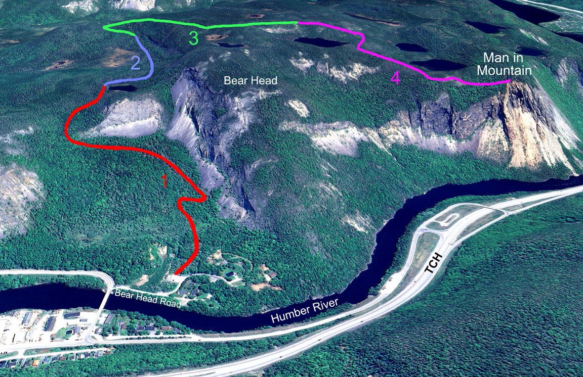
The two-year plan to redevelop the trail includes use of mechanized equipment such as mini excavator and skid steer, and can be divided into four components:
while the new 5.5 km route – which rises to a height of 340 meters – can be divided into four trail sections:
Phase One (2025) of the trail redevelopment plan included completion of Trail Sections 1 and 2 and significant development of Trail Section 3, minus the top coat of Class A aggregate, which is to be applied from the inside out at the end of Phase Two to avoid surface deterioration. Tasks included:
Work began on Section 1 during the last week of April and continued until mid-June, at which time the original section of trail to the first pond above the Western Foothill (now the intersecting point between the new and old trail routes, which will become part of the nearby Bear Head Trail) was widened, grubbed and surfaced with Class B aggregate (1.5 inches and less). New sections were also developed to bypass more challenging sections of the older route.
For more on the story, go to Cabox Geopark’s website …