On August 2, IAT Chairperson Paul Wylezol took advantage of a rare and beautiful free day to make a solo east-west traverse of the Blow-Me-Down Mountains on the south shore of the Bay of Islands. The goal was to find an IAT trail route connecting Cape Blow-Me-Down to the Hummock and Blow-Me-Down Brook Trails in the lowlands near Frenchman’s Cove.
The adventure began with a 20 minute drive from the city of Corner Brook to the parking lot of the Blow-Me-Down Brook Trail. Here one gets a fantastic view of Rattling Brook Falls, which by day’s end will be circumtrekked.

At 9:30am, Paul headed out on the Blow-Me-Down Brook Trail, winding his way southeast between scrubby pines and wildflowers above the right bank of the brook, below the towering mountains of granite and peridotite.


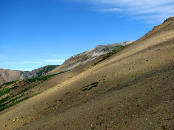
After 5 kilometers (3 miles) the trail peters out before the planned IAT route climbs the gradual slope of the “Sands” at the inside corner of a 90 degree right turn into the upper Blow-Me-Down Brook valley.

This other-worldly landscape is a geologic playground, with unique rock and mineral discoveries at every turn.

Climbing the Sands (from 400ft to 1800ft elevation) provides a good vantage point of the upper and middle valley, as well as the nearby Hummock and surrounding foothills.


Once on top the landscape changes dramatically, and is characterized by rolling hills covered with low heath, scrub, and wildflowers.

(Note one of the last patches of snow in center background.)
Between Blow-Me-Down Brook Valley and the Cape to the northwest lies Mad Dog Pond, a 2 kilometer long, irregularly-shaped shallow pond that drains both north into Rattling Brook (and Falls) and south into Blow-Me-Down Brook (and Falls).

The planned IAT route follows a course between the pond to the west and the mountain slope to the east, which provides fantastic views of the Bay of Islands and Humber Arm, from the North Arm Hills to Corner Brook.


Once at Rattling Brook, Paul was pleasantly surprised to find an easy crossing point just above the lip of the falls, where a large deep warm pool with a protective rock guard was an ideal place to take a refreshing afternoon dip.


View Video of IAT Chairperson Paul Wylezol swimming in Rattling Brook Falls Pool
From the falls pool at 1300ft elevation, Paul made the gradual 2km 800ft elevation climb to Cape Blow-Me-Down, where after taking in the spectacular 200+ degree view, he took the Copper Mine To Cape Trail back to Route 450.
(To view photos of the Copper Mine To Cape Trail, go to IATNL Flickr …)
From there he walked the final 6.5 kms (4 miles) back to the Blow-Me-Down Brook Trail parking lot. The entire 25km (16 mile) trek took 10 hours, including the 1.5 hour highway walk and half-hour poolside stop.
To view more photos from the Solo Traverse of the Blow-Me-Down Mountains, go to IATNL Flickr…


