

To download, right click and Save
This page is currently under construction. Sorry for any inconvenience.
To download, right click and Save Thru-Hiker Topo Map 4 (Scale=250k:1) Highlands of St. John to Crow Head Thru-Hiker Topo Map 3 (Scale=250k:1) Bonne Bay to Highlands of St. John Thru-Hiker Topo Map 2 (Scale=250k:1) Stephenville Crossing to Western Brook Pond Thru-Hiker Topo Map 1 (Scale=250k:1) Port aux Basques to Stephenville

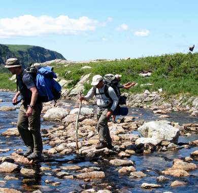
Details Length: 742km (445mi) linear route from Port aux Basques in the south to Crow Head (just east of L’Anse aux Meadows UNESCO World Heritage Site) in the north. Maximum Elevation: 420m (1,378ft) Trailhead Elevation/Location: 15m (49ft) at N47.58327 W59.14685 Time: 35-50 days Trail Type: In the south, the IATNL thru-hiker’s route is composed of the Newfoundland T’Railway (aka Trans Canada Trail), before it transitions to a series of gravel logging roads and secondary highways. Along the way, hikers have the option to hike some of the IATNL mountain trail routes, however experience with backcountry navigation and wilderness camping is highly recommended, as is use of a gps. Difficulty: Easy to Moderate* Camping: Apart from official parks and campgrounds, there are no designated campsites. However in Newfoundland and Labrador, hikers may set up camp essentially wherever they like in the backcountry, as long as they abide by dry weather fire restrictions (https://www.gov.nl.ca/ffa/public-education/forestry/forest-fires/fire-hazard-map-forecast/) and leave no trace. However it is recommended that they be as discreet as possible and take care during hunting season. See below. Water Shuttle: Be sure to check the start and end date of the Bonne Bay Water Shuttle while planning an IATNL thru-hike. Water Sources: All substantial streams and lakes contain potable water. Small slow-moving brooks and bog ponds should be avoided if possible. Resupply: Hikers are able to find most supplies required at the larger towns of Stephenville, Corner Brook and Rocky Harbour. However the smaller towns and communities along the route have fewer and…
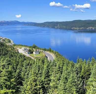
The IATNL Thru-Hiker Route begins near the Marine Atlantic ferry terminal in Port aux Basques at the southwest corner of the island of Newfoundland. From there the route follows the Newfoundland T’Railway (aka Trans Canada Trail) all the way to Stephenville Crossing on Route 461 in Bay St. George. Along the way hikers have the opportunity to turn off onto the Grand Codroy Way, including the Starlite Trail, which is the first of several IATNL backcountry wilderness routes across the Long Range Mountains as well as visit the Qalipu First Nations Museum and take a dip in the ocean at St. George’s on Route 461. From Stephenville Crossing, the thru-hiker route continues on the Indian Range Trail to Route 460 near Stephenville, which it follows for 4kms to Cold Brook Road. Indian Range Trail One kilometer into Cold Brook Road, the route turns right onto a gravel logging road that extends 28kms (16.8mi) to the IATNL Lewis Hills Trail southern trailhead. After another kilometer, hikers come to a snowmobile warm-up cabin with wood stove, which is normally unlocked and makes a good place to spend a rainy night. Half kilometer further, the gravel road ends and the route follows a rough ATV trail across 2km of barrens, before connecting to the southern end of another logging road (i.e., Logger School Road) headed north. After 19.3km (11.6mi) the road comes to a fork, with the left branch headed west to Serpentine Valley (location of the Lewis Hills northern trailhead and Blow…
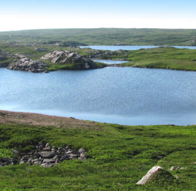
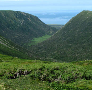
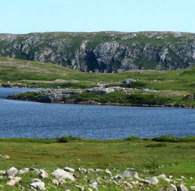
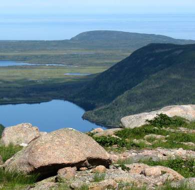
Details Length: 43km (26mi) loop around Portland Creek’s Southwest Feeder Gulch, along the way taking in the view of Portland Creek Inner Pond, Outer Pond and the Gulf of St. Lawrence from Indian Lookout. Maximum Elevation: 670m (2,198ft) Trailhead Elevation/Location: 140m (460ft) at N50.09219 W57.56866 Time: 3 days / 2 nights in tent Trail Type: Mostly barren (i.e., both dry rock and damp vegetation) with some minor bushwhacking. Cut trail from trailhead to scrubline on Flat Hills, through a few short sections of mountaintop scrub, and down a hillside near the end of the route on the north side of Southwest Feeder Gulch. Difficulty: Challenging* Condition: The cut sections of this trail route have not received maintenance for a few years. However, as the majority of these sections are through slow-growing scrub, access should not be impeded. Nevertheless, there are a few short sections of forest at the beginning of the trail at the base of the Flat Hills and in a hillside valley near the end of the trail on the north side of Southwest Feeder Gulch that may contain windfalls that need to be bypassed. Hopefully these sections will receive maintenance during the next hiking season. Experience: This is primarily an unmarked wilderness route across barren mountaintop terrain, with a cut access trail at each end and a few short sections of trail in between. Experience with backcountry navigation and wilderness camping is a must, and use of a gps (ideally with trail route track) is highly recommended.…
To download, right click and Save