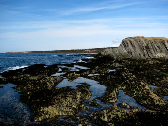
On the western coast of Newfoundland’s Great Northern Peninsula, just 10 kilometers (6 miles) north of Bonne Bay and mid-way through Gros Morne National Park, lies a grassy headland with a geologic stature far exceeding its low-lying geographic profile. Unless IAT thru-hikers decide to camp at the nearby campground or trek the pebbly beach, they are likely to bypass this unassuming site.

Annie Wentzell overlooking Green Point, Gros Morne National Park

For more than half a billion years, plants, animals, and sediments have passed this way, many ending their journey embedded in the horizontal layers of rock and fossils now turned on their edge by tectonic forces.


In the year 2000, one of these hundreds of layers was designated the global stratotype for the Cambrian / Ordovician boundary in geologic time, as the conodont Iapetognathus Fluctivagos first appeared here approximately 492 million years ago.


In more recent times, Green Point has been used as a base for seasonal lobster and inshore cod fisheries since the 19th century.


To view more photos from Green Point, Gros Morne National Park, go to IATNL Flickr…


