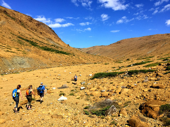
On a beautiful August 16, IAT Chairperson Paul Wylezol and local adventurers Delano Pittman, Sharon MacDonald Lahey, Ulrica Murley-Pye and Ryan Oxford set off for Cabox on the IATNL Lewis Hills Trail on a mission to find a new hiking route connecting the highest point on the island of Newfoundland to the upper Fox Island River valley. Along the way they viewed cascading clear waterfalls, a vast landscape of ultramafic peridotite, winter’s last snow and a family of caribou napping in the midday sun.

(l-r) Sharon MacDonald Lahey, Ulrica Murley-Pye, Ryan Oxford, Delano Pittman and Paul Wylezol
The trek began with an approximately one hour drive on Cold Brook logging road (just north of Stephenville) to the Lewis Hills Trail’s southern trailhead above the mid section of Fox Island River. From there the group walked on a short forest trail, across a dry bog and around a small pond until they came to a commanding view of the river and eastern flank of the Lewis Hills.
After descending the easy slope and crossing the river

Ulrica Murley-Pye and Sharon MacDonald Lahey crossing Fox Island River
the trail route winds past a series of small cascading waterfalls and crystal clear pools then gradually climbs out of an east draining gulch that slices through the Lewis Hills’ large assemblage of earth’s mantle, forced to the surface of the earth by tectonic forces during the closing of the Iapetus Ocean more than 350 million years ago.

Once above the gulch, the landscape changes dramatically to the mafic gneiss and deformed mafic dykes of the Mount Barren Complex.

(l-r) Ryan Oxford, Sharon MacDonald Lahey, Ulrica Murley-Pye and Delano Pittman at an IATNL trail marker
Soon the group encounters the last of winter’s snow
sprawling in a depression with an ice cave melting through it.

The final ascent to Cabox – at 814 meters the highest point on the island of Newfoundland – is a long gradual climb across dry barrens of mixed rock and grass.

Inspite of the early start, our group of hikers were beaten to the summit by another group of mountain enthusiasts, a family of caribou napping in the midday sun.
At the nearby Cabox is a bronze marker placed by the Geodetic Survey of Newfoundland, marking the precise location of the highest point on the island.

After a 15 minute break, the fearless five started down the north side of Cabox, swinging by for a distant view of Molly Ann Gulch

headed for the south branch of upper Fox Island River.

The purpose of the day-long trek was to scout out a new trail route for the planned Cabox UNESCO Global Geopark, as well as a southern link for the IAT UltramaTrex, a 6-8 day route spanning the four ultramafic massifs of the Bay of Islands Ophiolite Complex, a major feature of the Aspiring Geopark.

Near the confluence of the north and south branches of the river is another series of cascading waterfalls and pools, ideal for a cool dip on a hot day.
Below, the upper Fox Island River carves east through the Lewis Hills Massif before making a right turn south and following the eastern margin of the hills, essentially dividing them into northern and southern halves.

During the spring runoff and after a summer deluge the river swells considerably, as the sparse vegetation of the ultramafic landscape holds back little moisture. This makes river crossing unpredictable, though quite easy on this beautiful and dry summer day when Sharon MacDonald Lahey’s feet didn’t get wet!
Down river IAT Chairperson Paul Wylezol finally succumbs to the heat and temptation and jumps into a sandy pool for a refreshing cool dip in the shade.

Before long the group takes the 90 degree turn in the river
and climbs its east bank, which provides a commanding view of the valley.

(l-r) Ulrica Murley-Pye overlooking Fox Island River Valley as the sun begins to set on a spectacular day in the hills
The 29km 11hr trek ends with a pleasant walk across a series of lush green but dry bogs, as the setting sun casts long shadows behind the hills and into the valleys of a long day’s hike.


