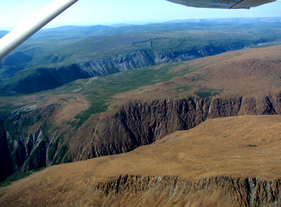
On August 16, IATNL Transportation Director Robert Bradbury took IAT President Paul Wylezol and Humber Economic Development Board (HEDB) Executive Director Connie Taylor on a one-hour flight over the North Arm Hills in his Cesna 172.

The goal was to survey potential trail routes from North Arm, Bay of Islands across the hills to Trout River Pond in Gros Morne National Park. The trio set off at 5:00pm when the sun was in the southwest, providing good views from the south and west.

The bird’s eye view was in stark contrast to July’s porpoise eye view from a tour boat on North Arm. From above one could clearly sea the earth’s barren peridotite mantle as it straddles – and erodes over – the more fertile coastal hills.


Also visible are the deeply carved valleys and contrasting rock types, from the ophiolite peridotite to igneous gabbro.

An especially beautiful and lush valley, which residents of the outer Bay of Islands like to fish after a mid summer’s rain, is Liverpool Brook. With its sinuous curves, fast flowing rapids, and geographical alignment with the Overfall, it is an exciting candidate for new trail development.

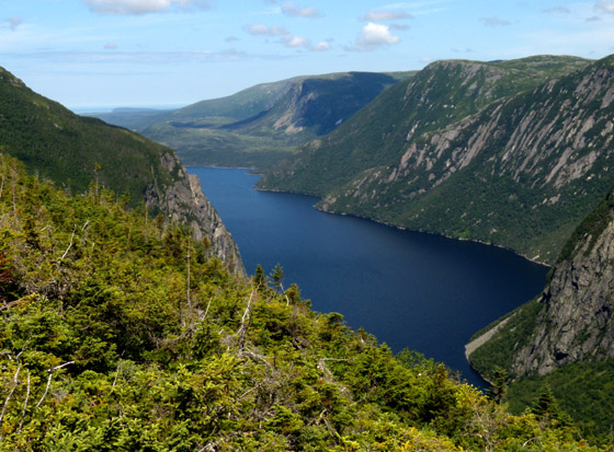
Leaving the southern edge of the North Arm Hills, the flight – and planned trails – head north to Chimney Cove Valley, a glacier-carved valley with small pond and stream that is an IATNL – CBPPL (Corner Brook Pulp and Paper Ltd) Special Management Area.

Just north of Chimney Cove Valley is Gros Morne National Park and its scenic Trout River Pond and Tablelands, another ophiolite mountain of metamorphic – and rust-colored – peridotite.

To the east is Trout River Valley and the Overfall, where the IATNL and Gros Morne National Park will soon partner to develop a gently sloping day-hike trail with scenic views and refreshing cool dips.

After now seeing the North Arm Hills from both water and sky, there’s one great adventure left:
to view this beautifully rugged landscape on foot … or on knees under a heavy pack, if it comes to that!
To view more photos of Taking Flight Over The North Arm Hills go to IATNL Flickr…
Â


