

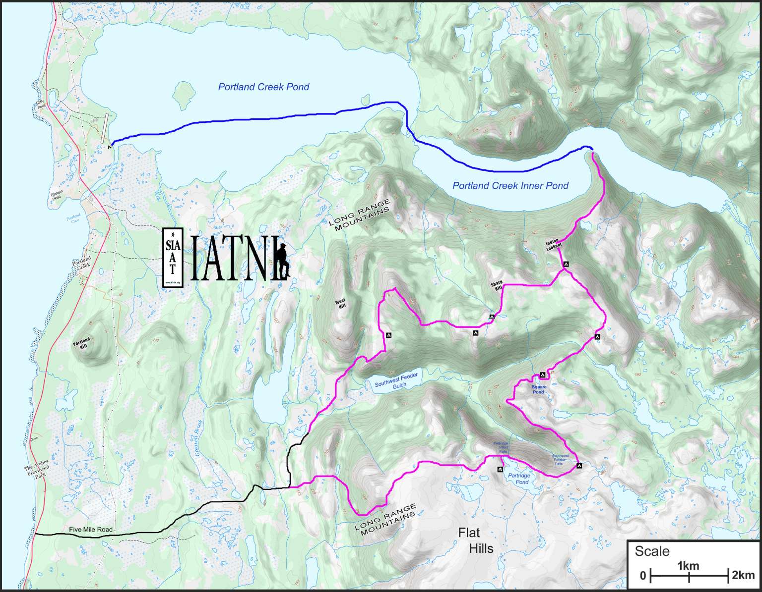


The IATNL Indian Lookout Trail is a challenging 43km (26mi) 3-day hiking loop around Portland Creek Pond’s Southwest Feeder Gulch on Newfoundland’s Great Northern Peninsula.
To reach the trailhead, hikers must turn off Route 430 (Viking Trail) approximately 2kms south of Arches Provincial Park, then travel 7kms on a gravel road.
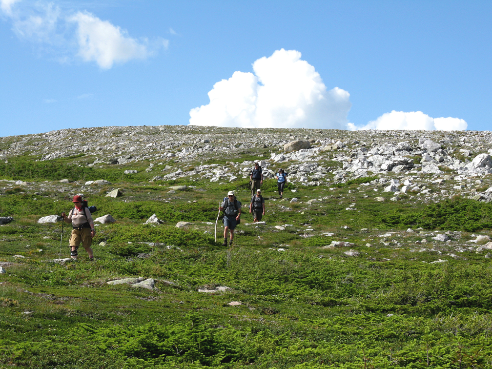
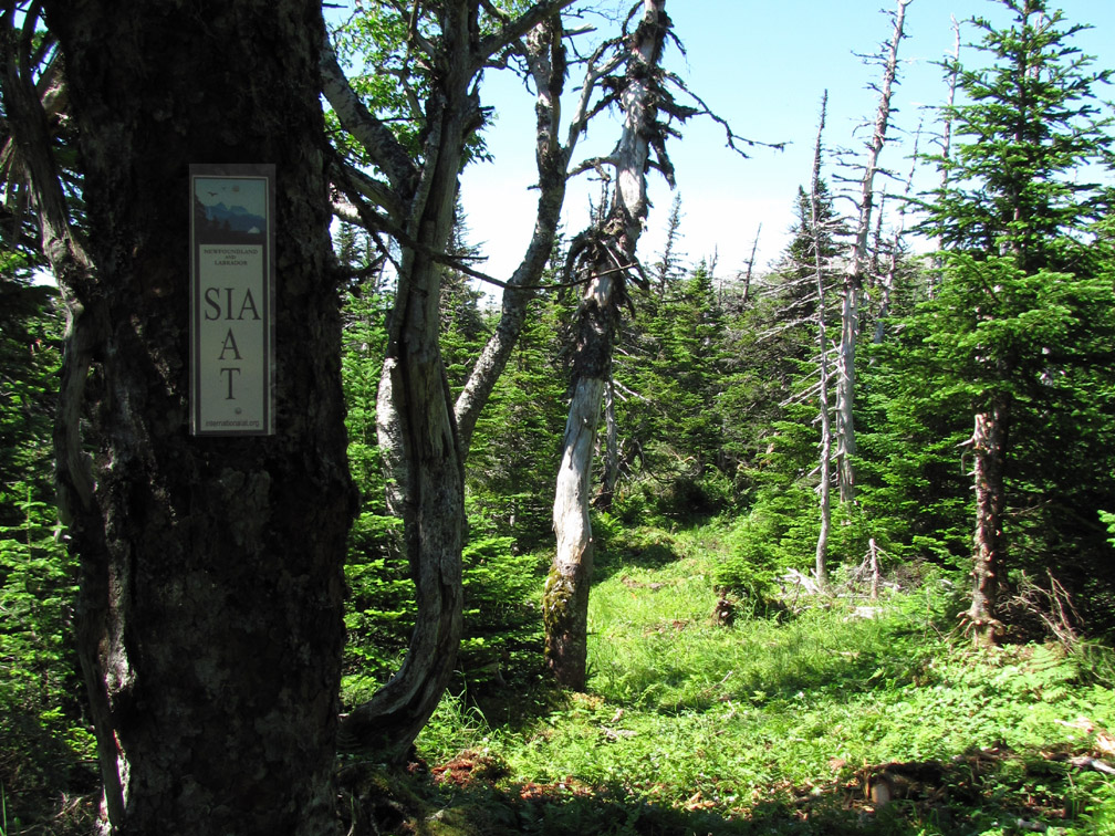
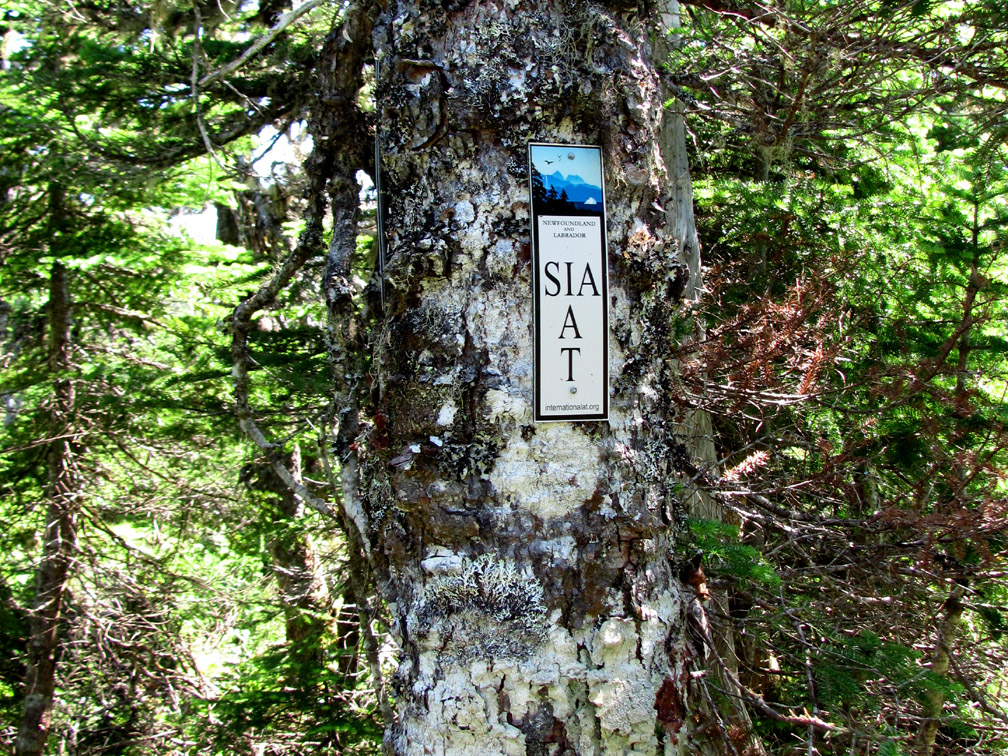
From the trailhead, which is marked by a rock cairn and sign posts, it’s a 1.8km climb up a foothills-forest trail, followed by another 1.8km trek across then up through a scrub-and-scree trail at the base of the Flat Hills, to reach the wide-open sub-arctic barrens.
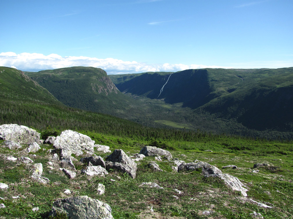
This a good spot for a little breather after taking in the breath-taking view of the coastal lowlands and Gulf of St. Lawrence from Daniels Harbour in the north to Parsons Pond in the south.
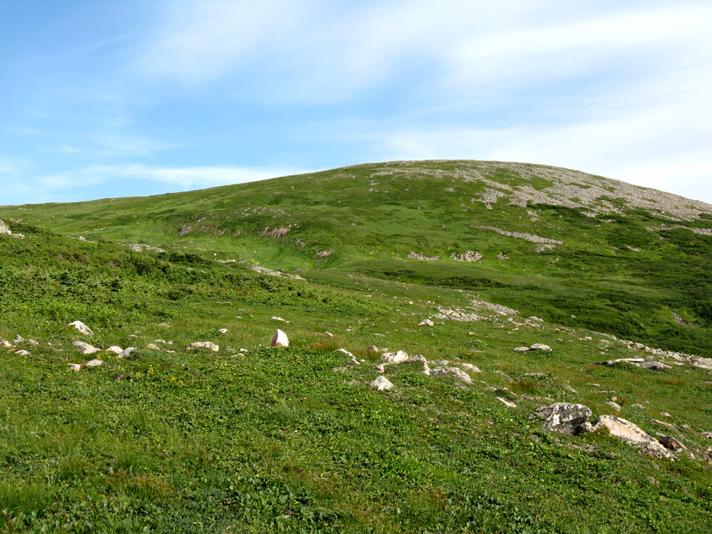
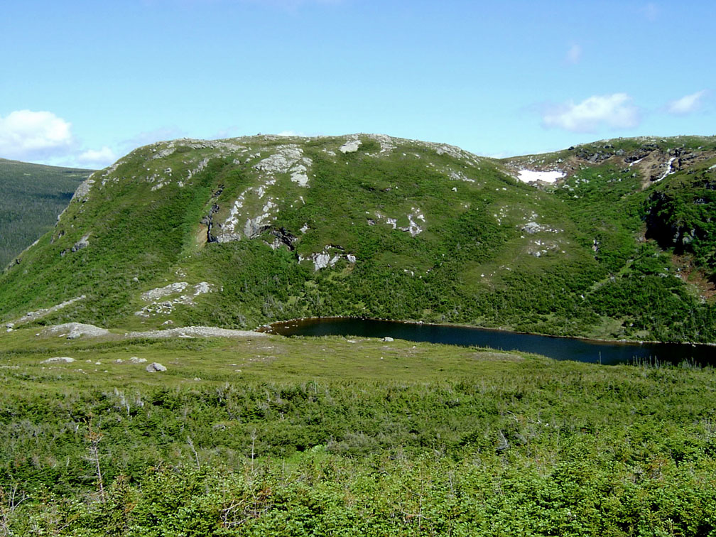
The climb from here is up a wide and gently sloping grassy gully between the two most northern Flat Hills.
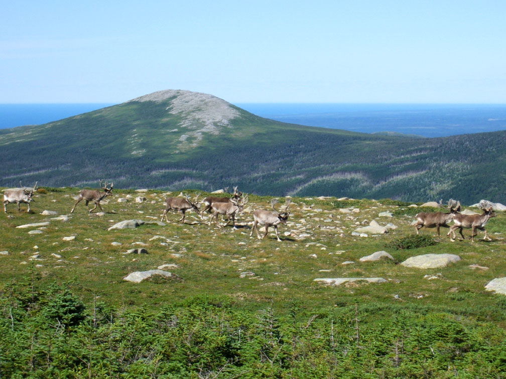
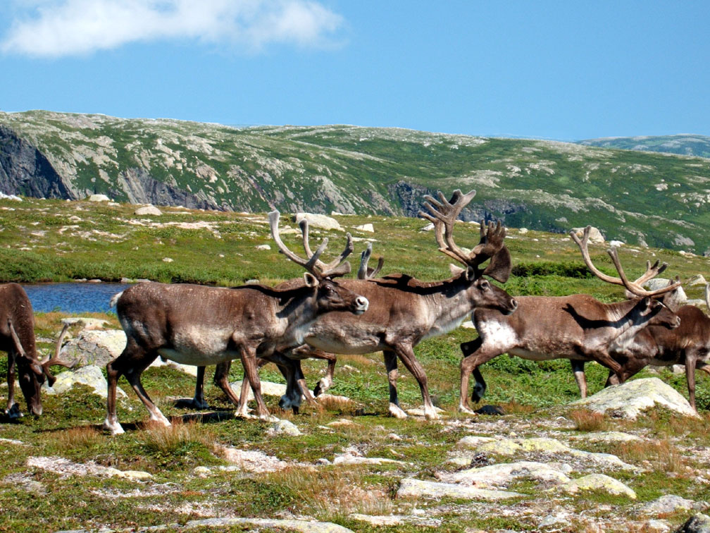
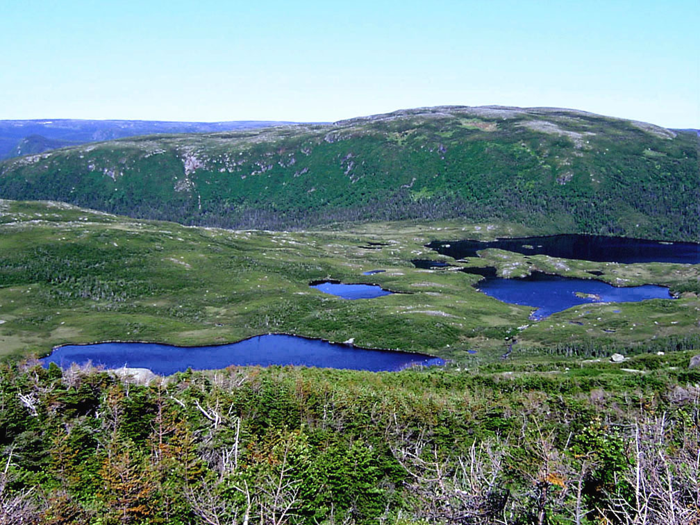
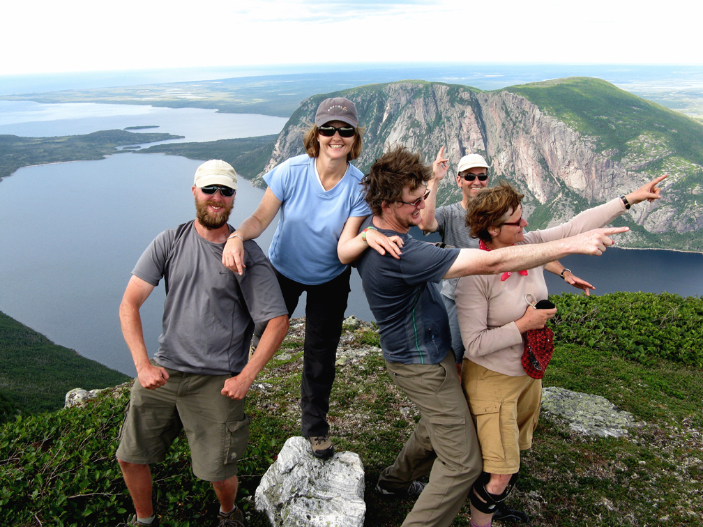
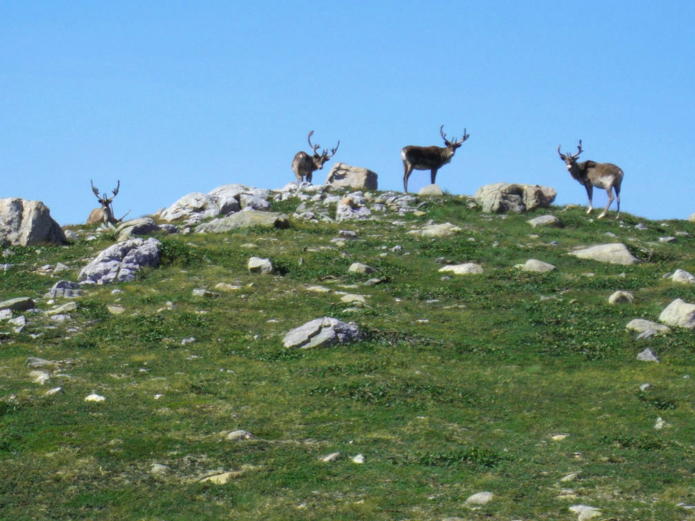
Once on top of the 650m (2133ft) plateau, hikers may see the first of many caribou that roam these hills in summer.
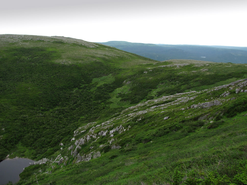
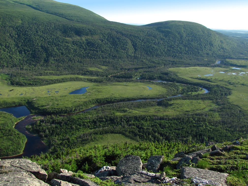
But it’s important not to get too carried away and veer off course while following these wild yet curious animals. With few landmarks to follow, hikers should head east, staying within sightline of Southwest Feeder Gulch to the north, characterized by a deep valley with long high rocky ridge above.
Before long the gulch forks into an east and south branch, which the trail route circumtreks in counterclockwise direction.
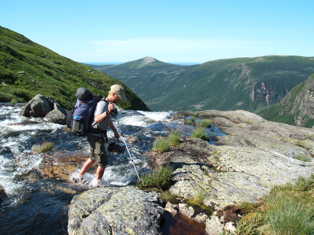
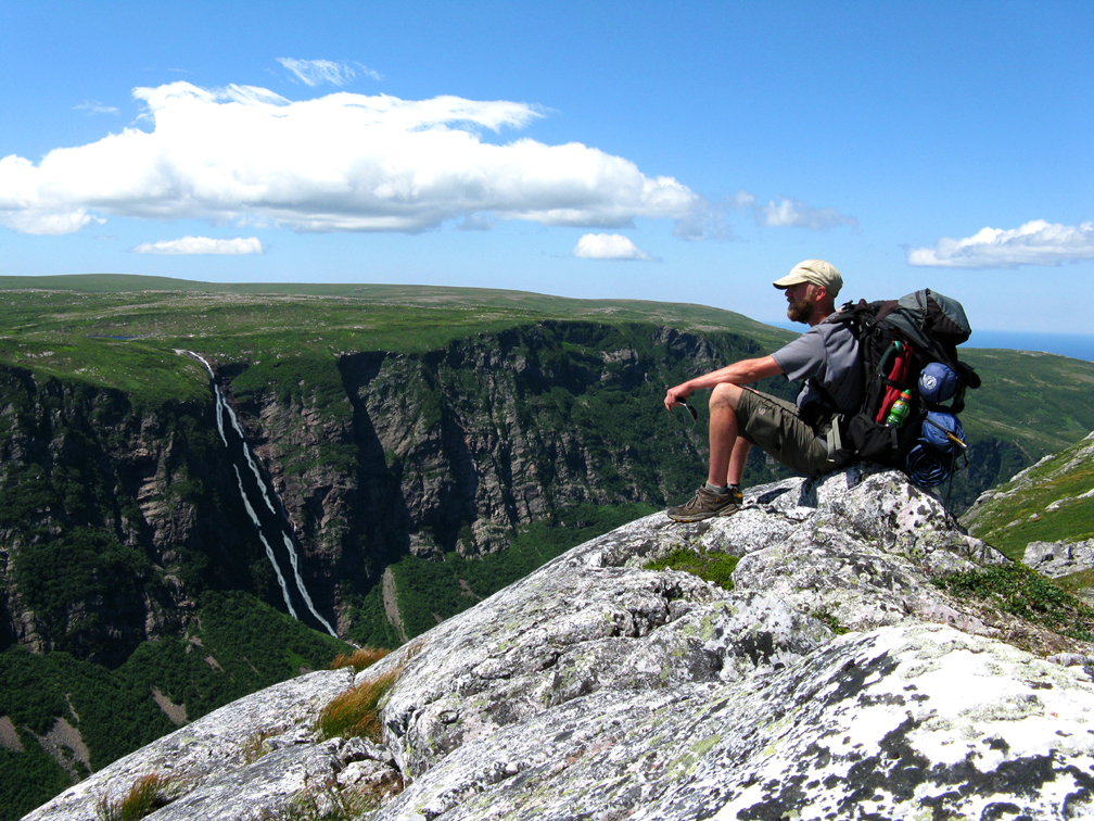
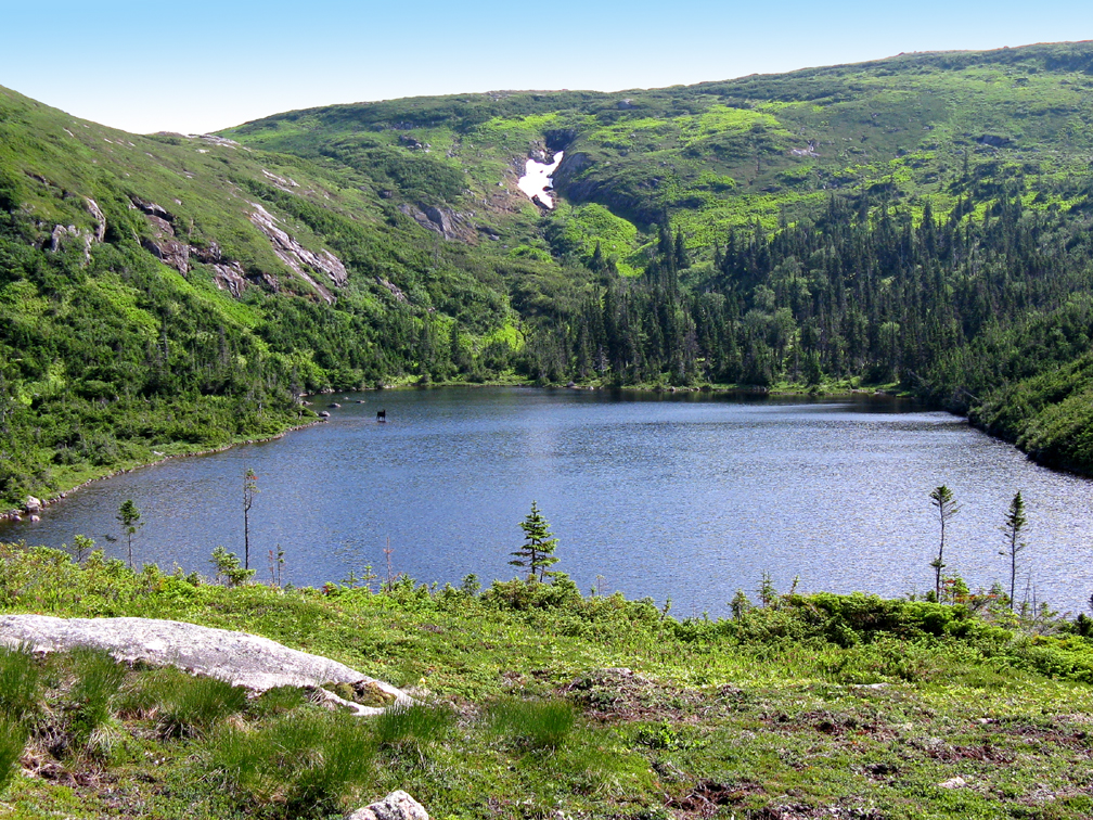
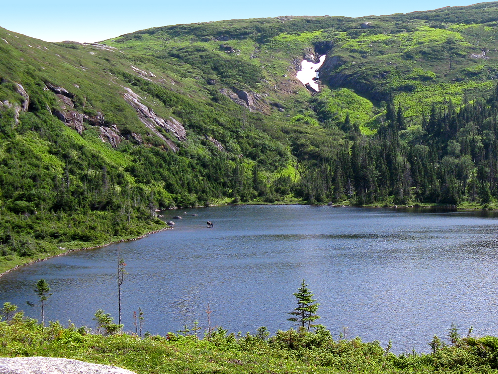
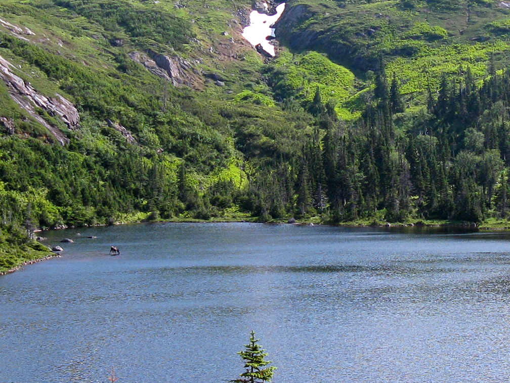
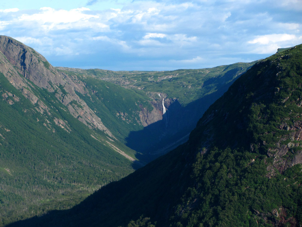
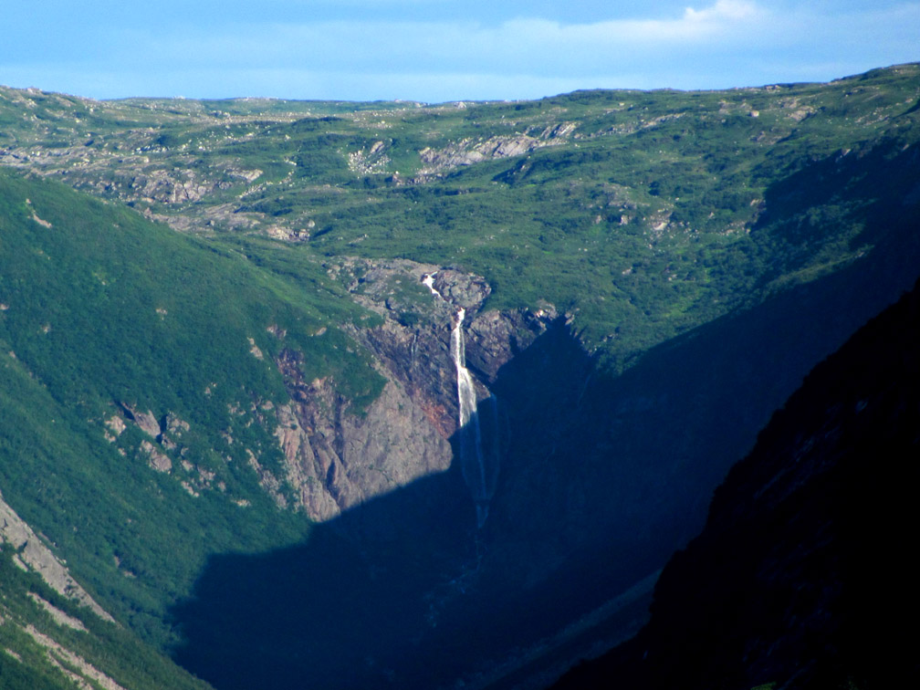
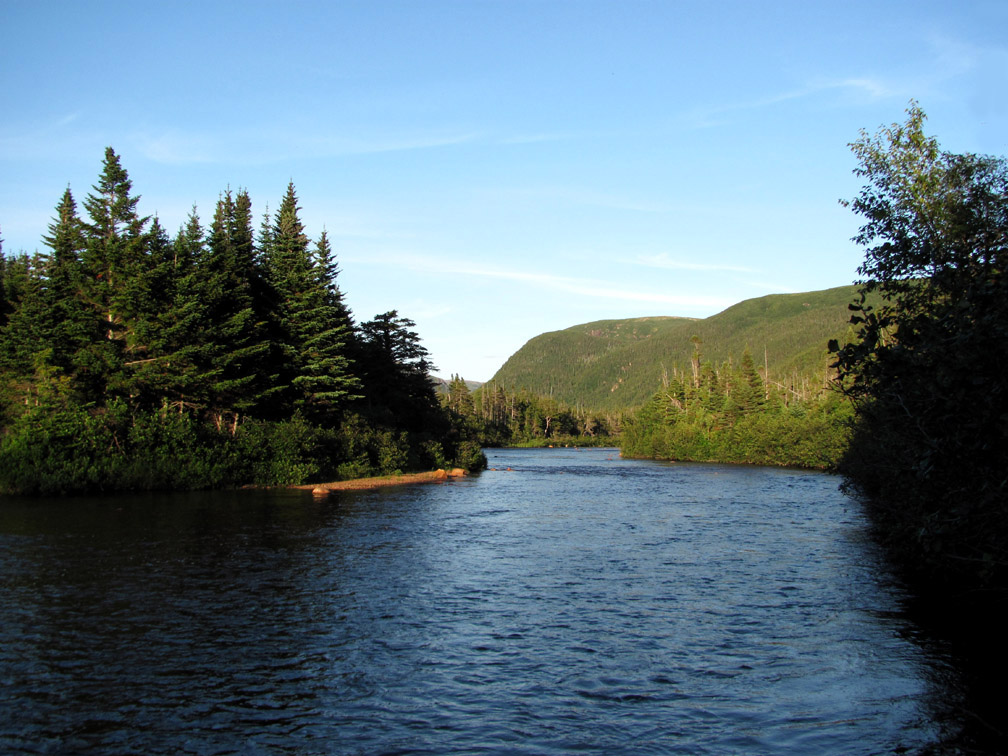
Once at the rim of south branch, hikers come to a short stream flowing out of Partridge Pond that cascades over the edge to form 1,000ft high Partridge Pond Falls.
This stream has to be crossed, so fortunately isn’t too fast or too deep when selecting the right crossing point.
But in the event that water levels are especially high, it is always possible to follow around the western side of the pond instead of the east
and reconnect with the route before it descends into the upper valley and crosses the south branch of the feeder.
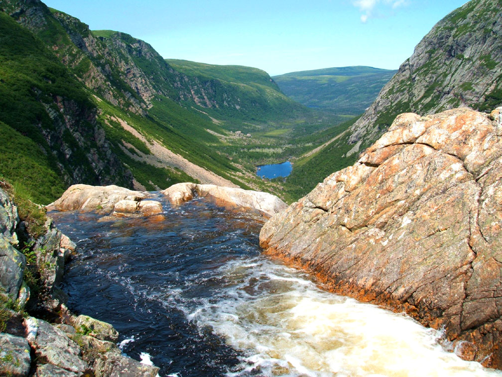
Later the eastern side of the south branch will provide spectacular views of Partridge Pond Falls, but not before the trail route passes equally scenic views of Southwest Feeder Falls.
The angle from the top of the falls is also noteworthy, being worth a short detour for a long view
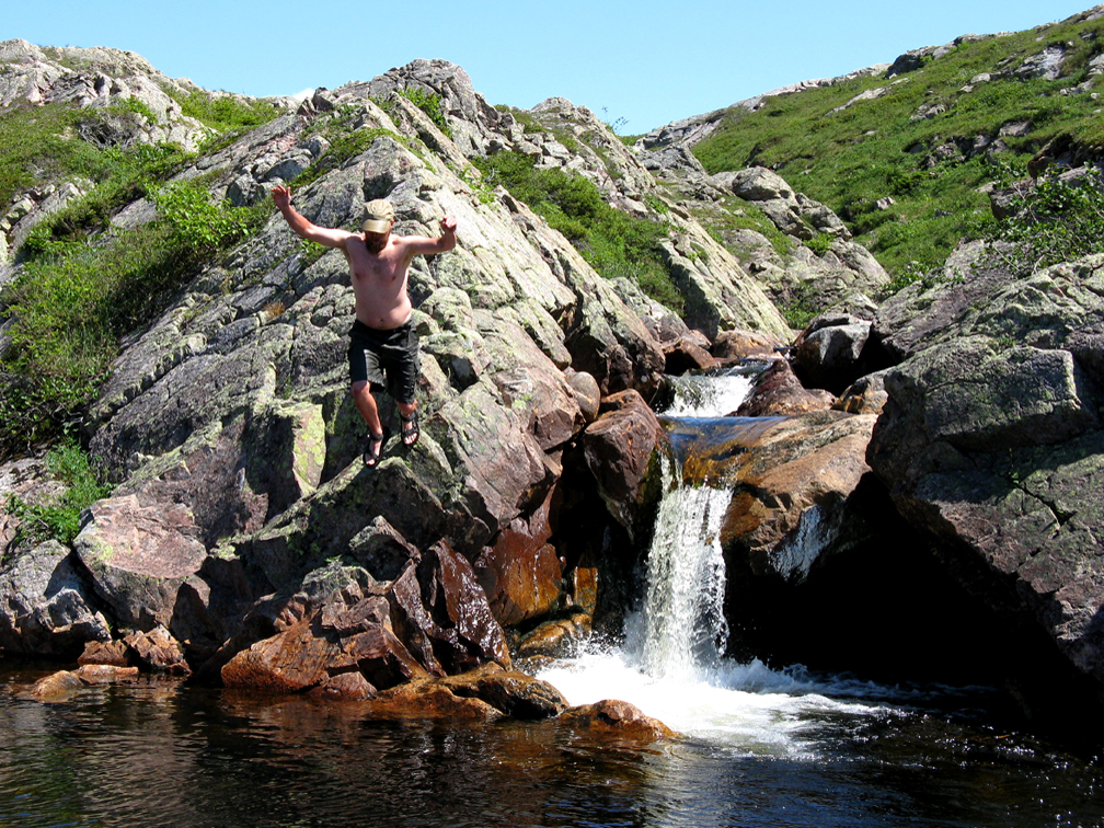
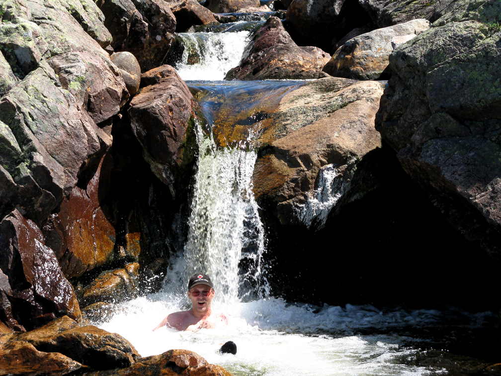
before backtracking a few hundred meters upstream for a refreshing dip under a much smaller waterfalls.
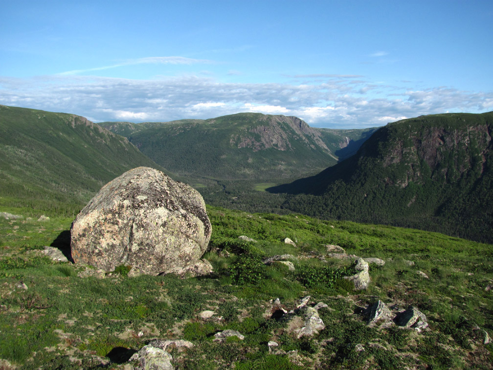
After crossing the brook, the 150m (492ft) vertical climb to the top of the east rim is a zigzagging switchback up the irregular rock face of quartz-feldspar gneisses and granites from the basement of the Grenville Orogeny, which characterizes the mountainous Long Range Inlier from Wiltondale at the entrance to Gros Morne National Park in the south to the Flat Hills and beyond. Once on top, hikers get more views of Southwest Feeder Falls
before turning north for a spectacular view of Partridge Pond Falls.
The walk along the 2.5km (1.5mi) eastern rim alternates between steep gorge and dry flat barrens
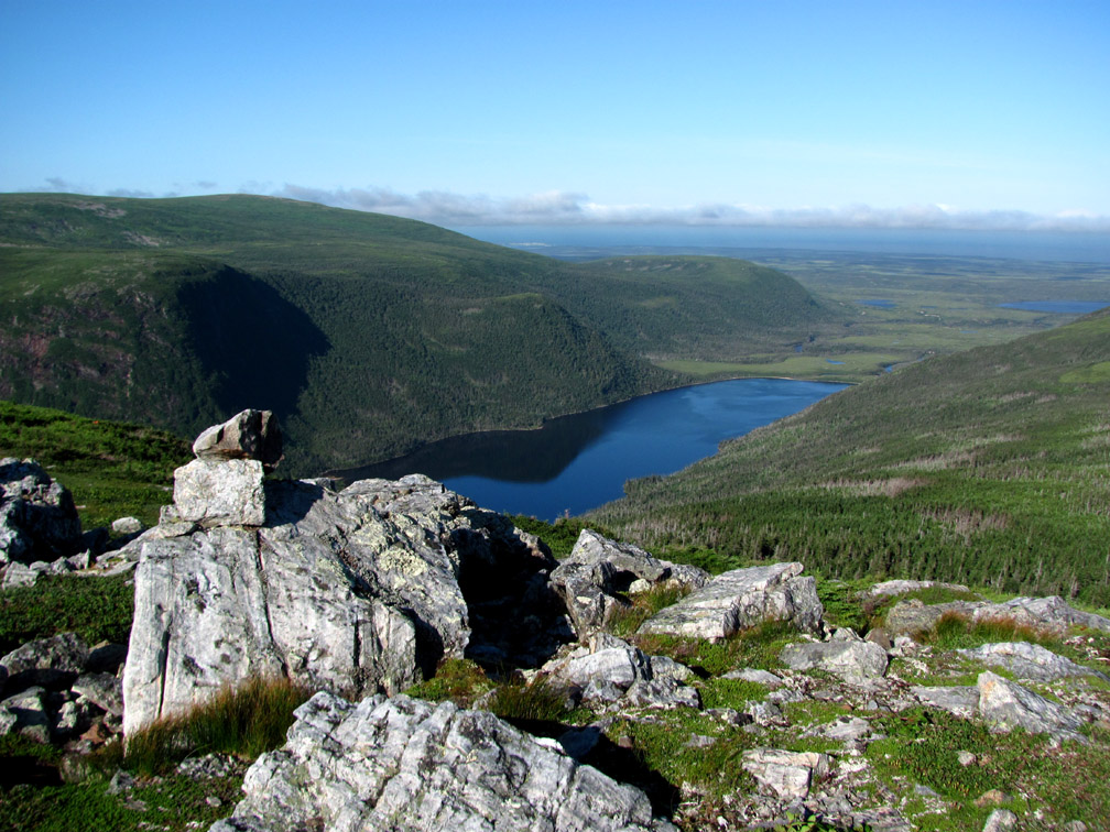
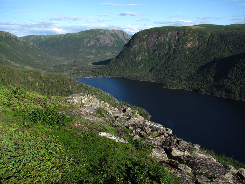
and ends at the highland intersection between the feeder’s south and east branches, with its dramatic view of Southwest Feeder Inner Pond, Portland Head (named by renowned explorer, surveyor and cartographer James Cook in 1767) and the Gulf of St. Lawrence beyond.
Camouflaged amongst the rocks here and elsewhere are rock ptarmigan (can you spot the bird at right among the rocks at left?), similar to but different than the reddish brown partridge found around the shores of Partridge Pond on the Flat Hills.
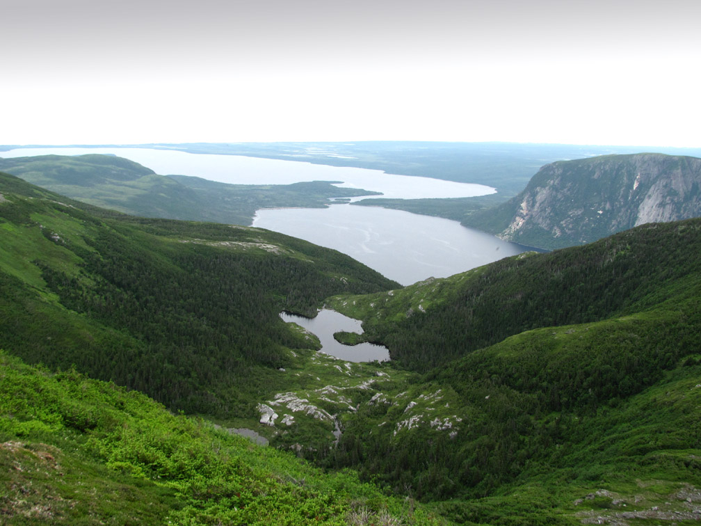
Looking to the right, hikers can see the long rocky ridge on the north side of feeder pond, which hikers will climb on Day 3 of the trek.
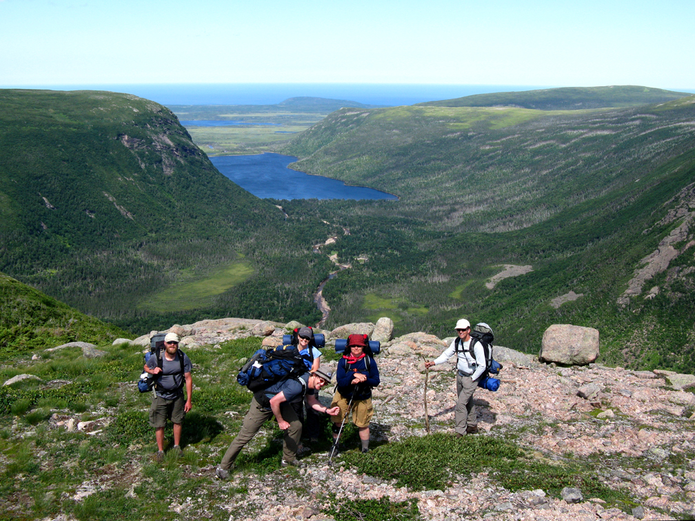
But from here, hikers must turn in the opposite direction and walk 1km downhill through a cut scrub trail to Square Pond, a good place to set up camp for the night.
When approaching these sheltered valleys, hikers may be rewarded if they tread lightly and remain as quiet as possible.
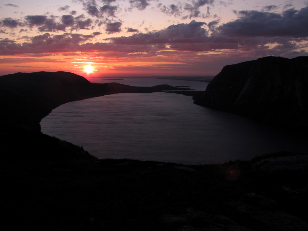
On a clear night, they may also be treated to a colorful sunset out through the gulch.
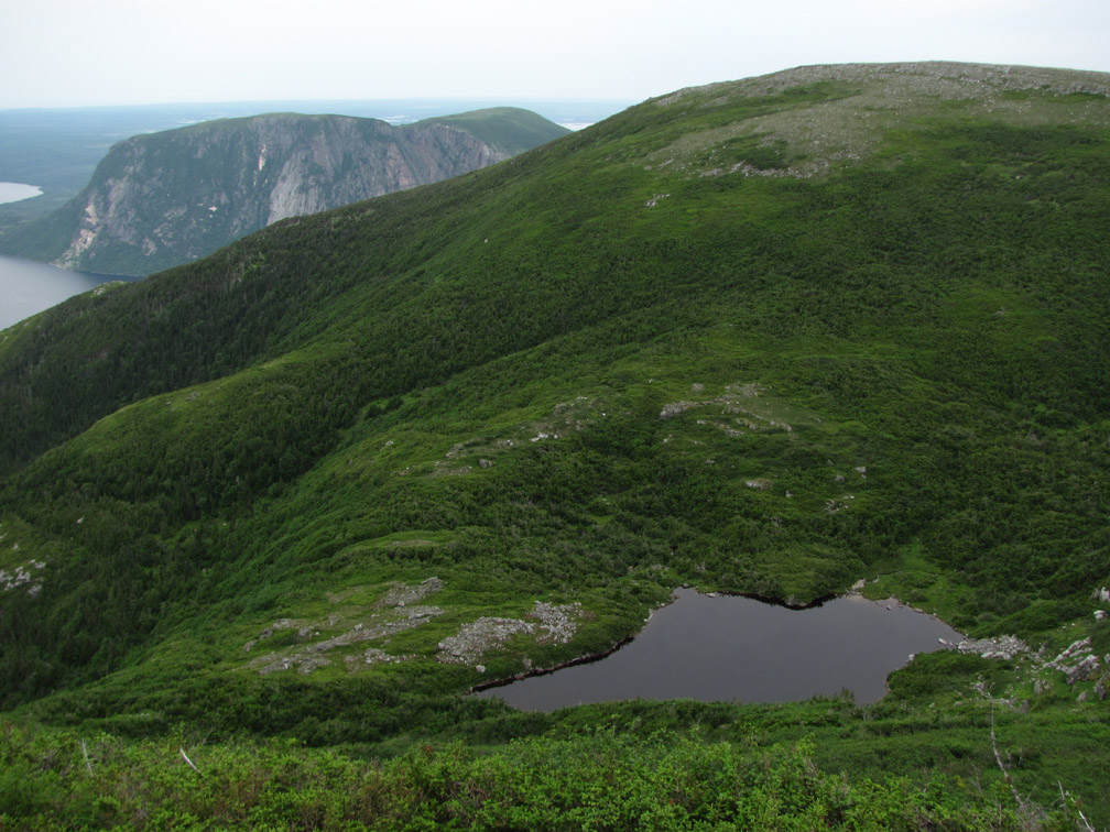
From Square Pond the trail route continues east, first up the 100m (328ft) high hill overlooking the pond
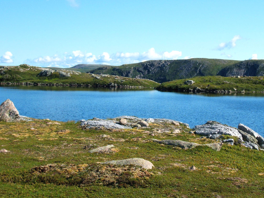
where they find Tripod Rock and a view west through east branch
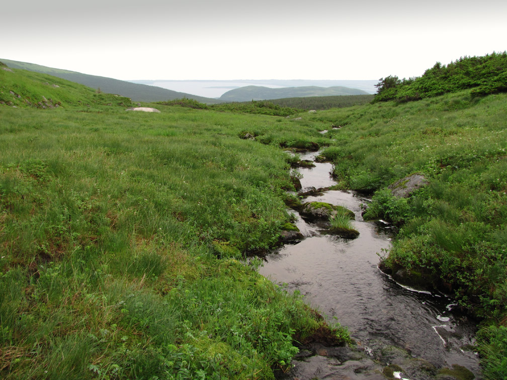
then down another 100m (328ft) vertical hill and through another cut scrub trail to cross the east branch’s headwaters brook just below the first of two 1km+ ponds that empties into it.
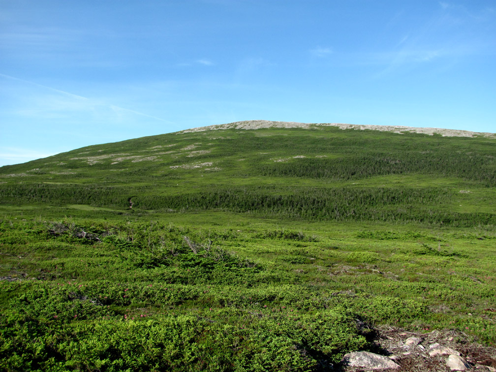
After climbing 150m (492ft) vertical over 1.5kms, hikers reach the top of a 3km (1.8mi) long dry rocky ridge, whose maximum elevation of 670m (2,198ft) is the highest point on the Indian Lookout Trail route.
that provides a good view into a picturesque eastern valley that drains into Portland Creek Inner Pond. (A gps track is also available for an 8km add-on into this more-rugged-partly-bushwhacking-land-of-lakes-terrain that reconnects on the top of Indian Lookout.)
After walking north along the ridge and descending 50m (164ft) vertical to the top of Indian Lookout
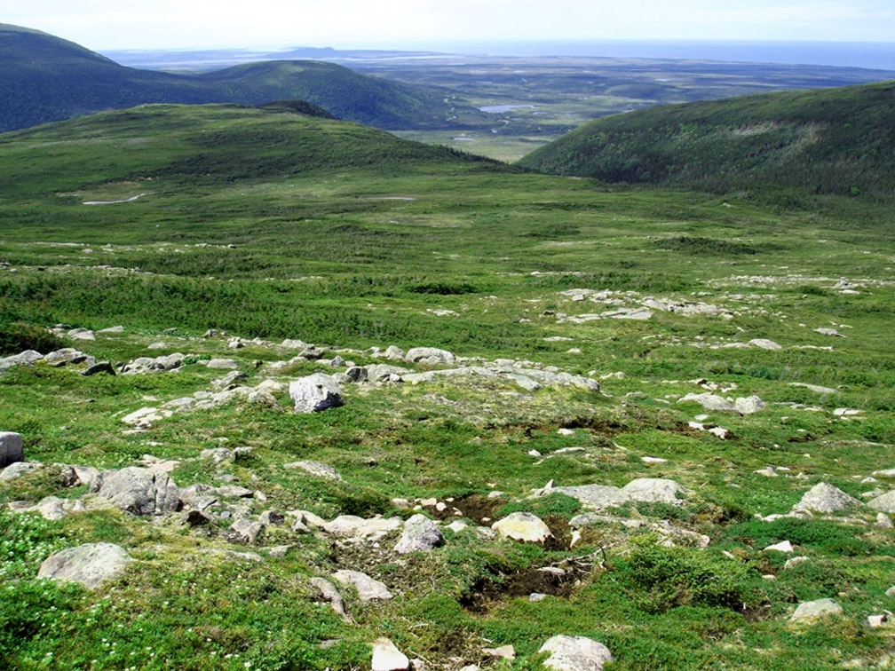
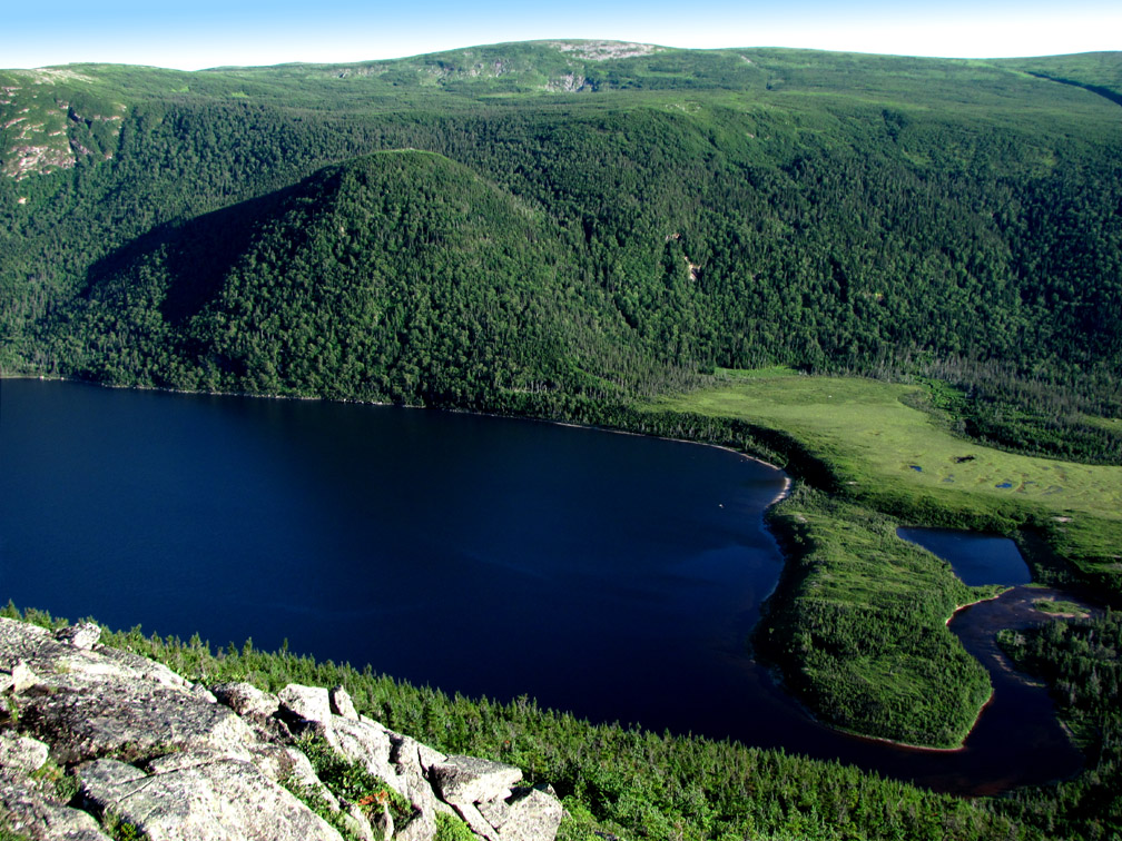
hikers are greeted with a telescopic view of Portland Creek Inner and Outer Ponds and the Gulf of St. Lawrence, 15km (9mi) to the west.
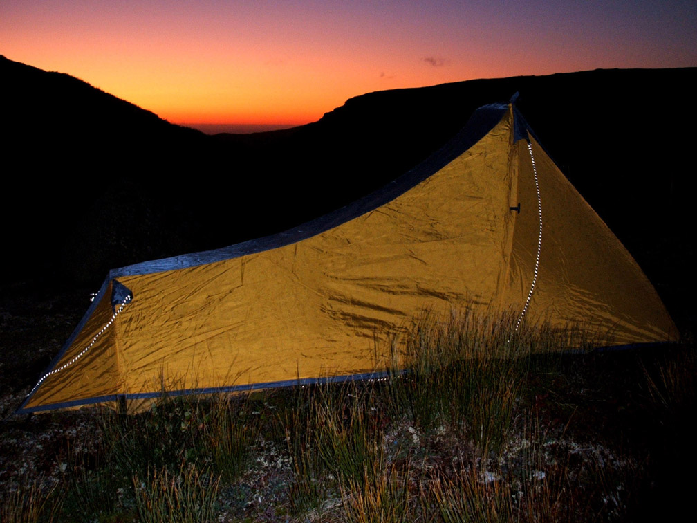
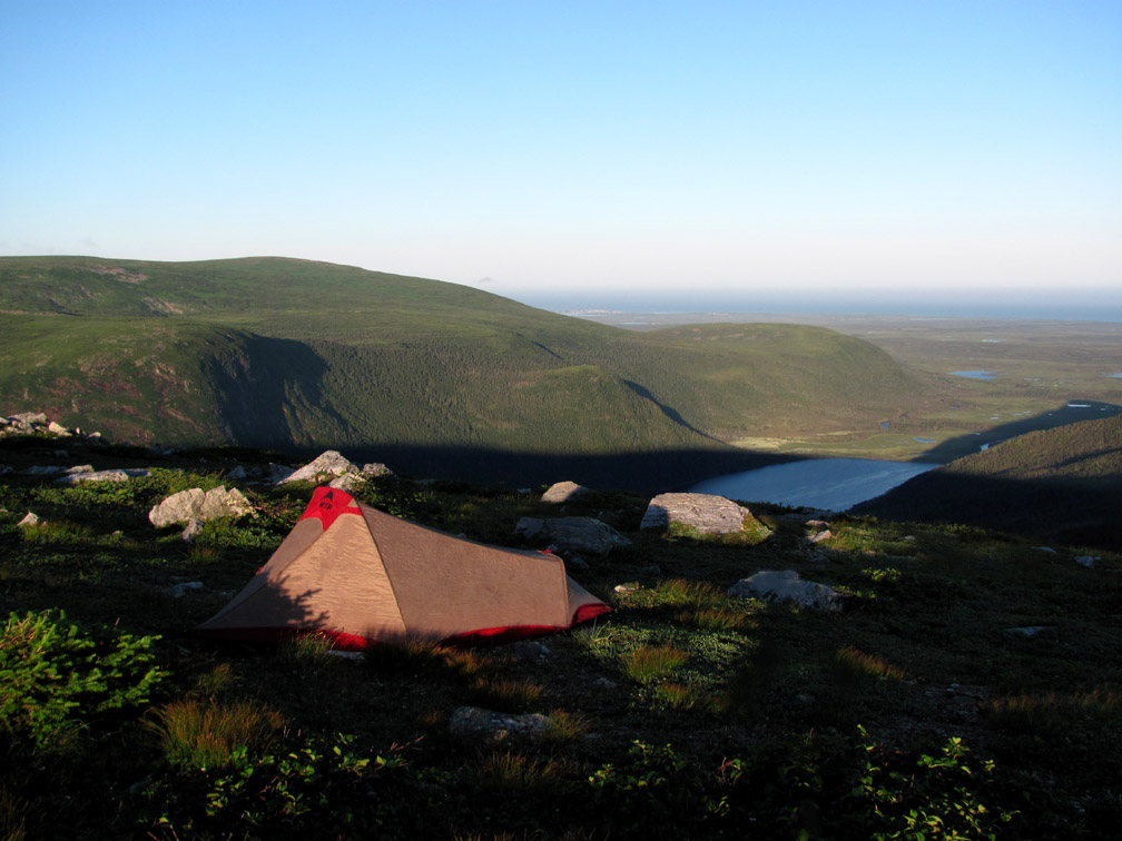
When weather cooperates in June and July, the Lookout (actually 600m to the south near a cold water spring) is also a good place to set up camp and watch the sun set over three bodies of water.
From Indian Lookout, the trail route heads west for the next 15km (9mi), following the high ground on the north side of Southwest Feeder Gulch and its east branch until it descends the mountains and crosses Southwest Feeder Stream at the end of Five Mile Road. This is an important point to remember, since at any time and especially overnight, low clouds may envelope the mountains and eventually limit visibility like fog.
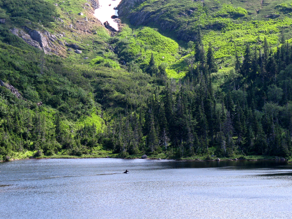
With less rocky barrens, increased vegetation, and remote sheltered valleys, the north side of Southwest Feeder Gulch is prime moose country.
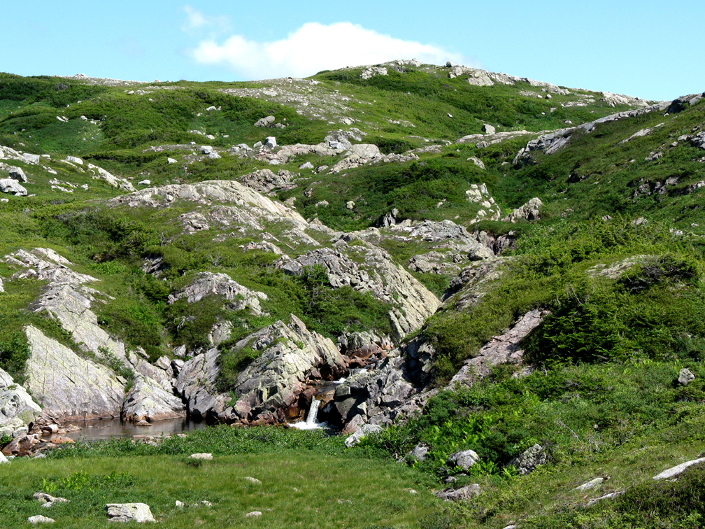
After bypassing a couple small ponds and crossing a mountain stream
hikers come to the back end of Southwest Feeder Pond, a high and dry scenic location to set up camp after refilling water bottles at the last stream crossing and hoping for a pleasant sunrise to the final day of the trek.
After breakfast or just stopping to admire the view of the pond
and south branch’s Partridge Pond Falls
hikers must descend 75m (245ft) vertical and cross a 1km (.6mi) wide forested saddle between mountain peaks, taking care to follow the track in this remote and hard to maintain section of trail.
Once on the far side, they get another terrific view of Partridge Pond Falls
before ascending the long south-to-north rocky ridge that rises to a height of 565m (1,854ft)
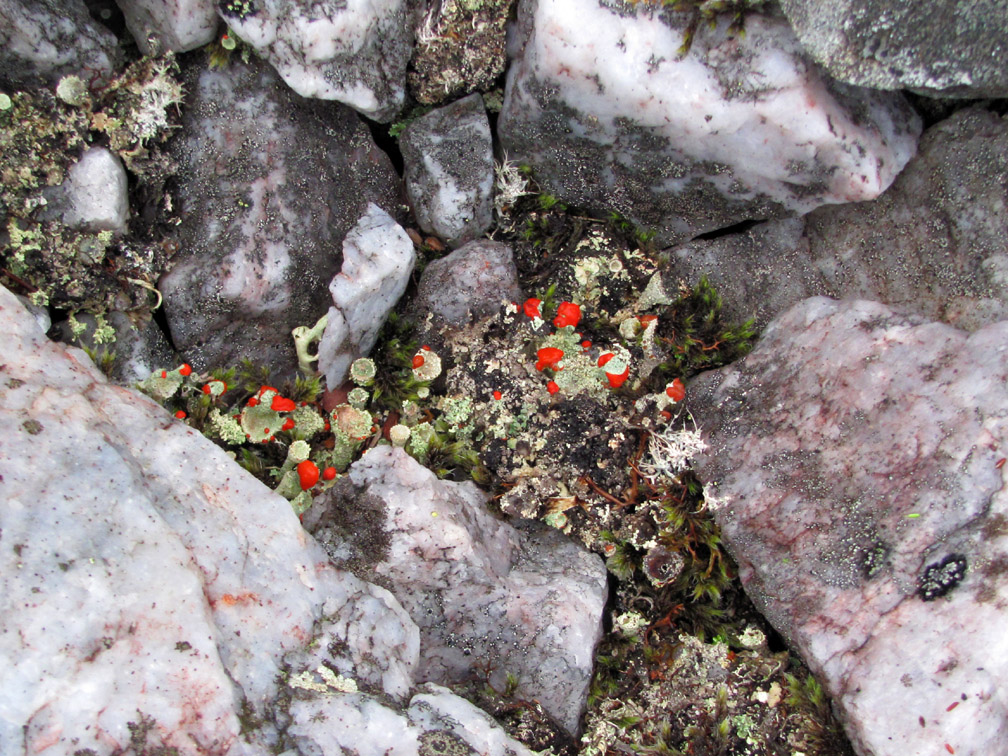
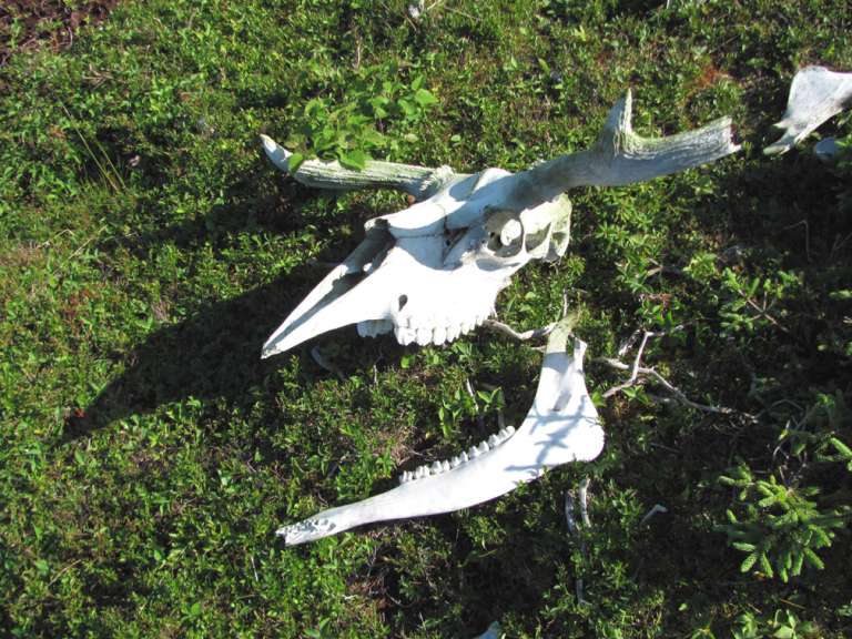
where in addition to the big picture views, they never know what tiny colorful life forms
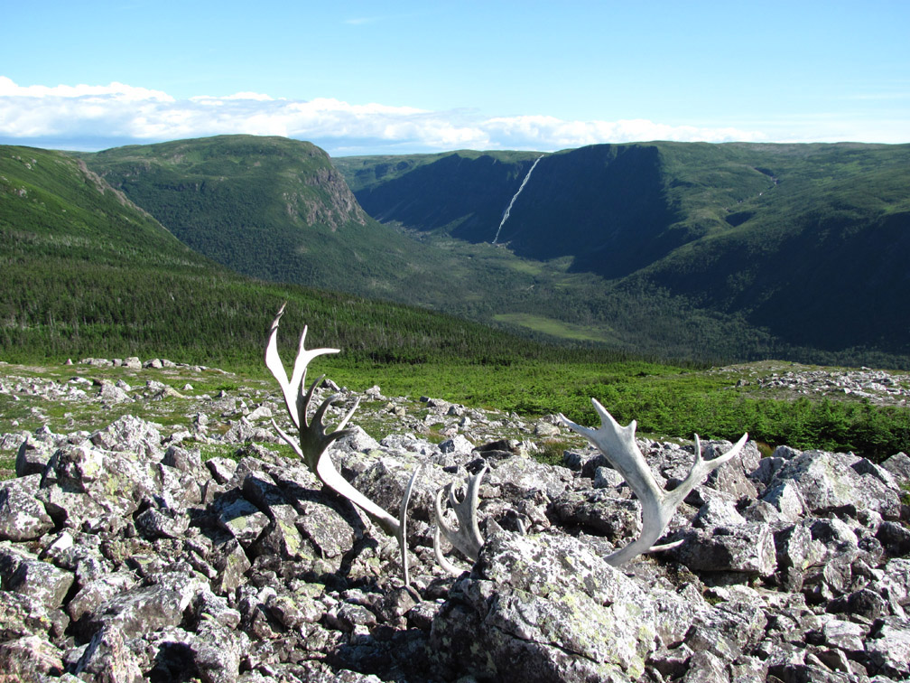
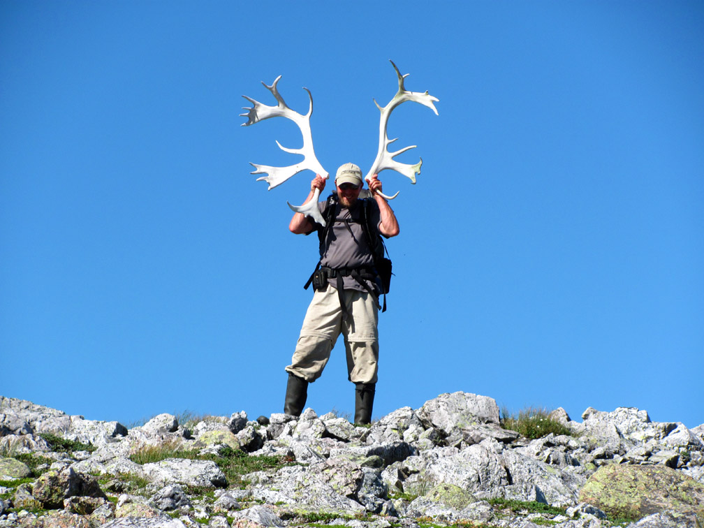
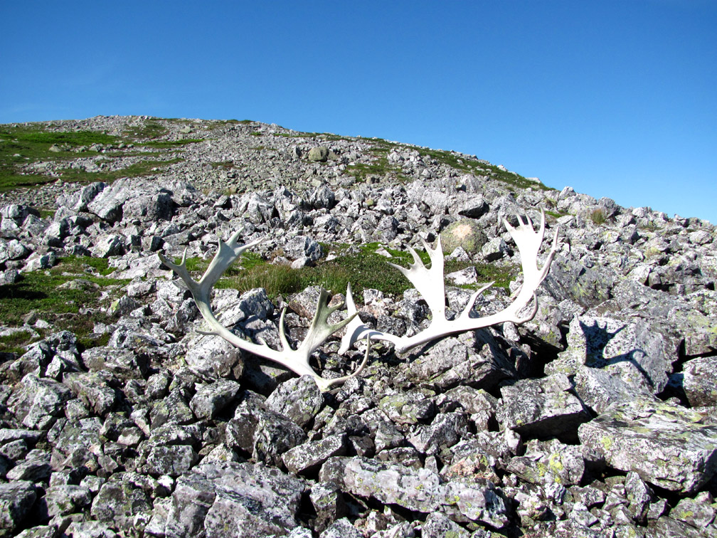
or bleached lifeless remains they’ll find at their feet.
But as tired as they may be, hikers must never forget to look up and down and all around, so as not to miss the more mobile features of this wild and wonderful landscape.
After a well-deserved break and view of Portland Creek (Outer) Pond and Gulf of St. Lawrence
as well as a telescopic profile of the mountains and valleys to the north
it’s essentially all downhill to Southwest Feeder Stream
with a stop or two to admire the moose or a dead caribou’s remains.
At the base of the north-south ridge
hikers are sufficiently aligned to get a long view of Southwest Feeder Falls
followed by a rimside panorama of Southwest Feeder Pond.
From here, the route descends a hillside forest trail and exits the mountains at the entrance to a small wooded valley just north of the western end of Southwest Feeder Pond.
After a 2km (1.2mi) walk across knee-high shrubs and an ATV trail (enroute to the pond), hikers reach Southwest Feeder Stream, which they must cross via the shin-high shallows straddling both sides of a small island just upstream from a waist-high pool.
Once across the stream and up a short slope to the end of Five Mile Road, hikers can look back with satisfaction and relief before tackling the remaining 2.7km (1.6mi) of this challenging trek.