


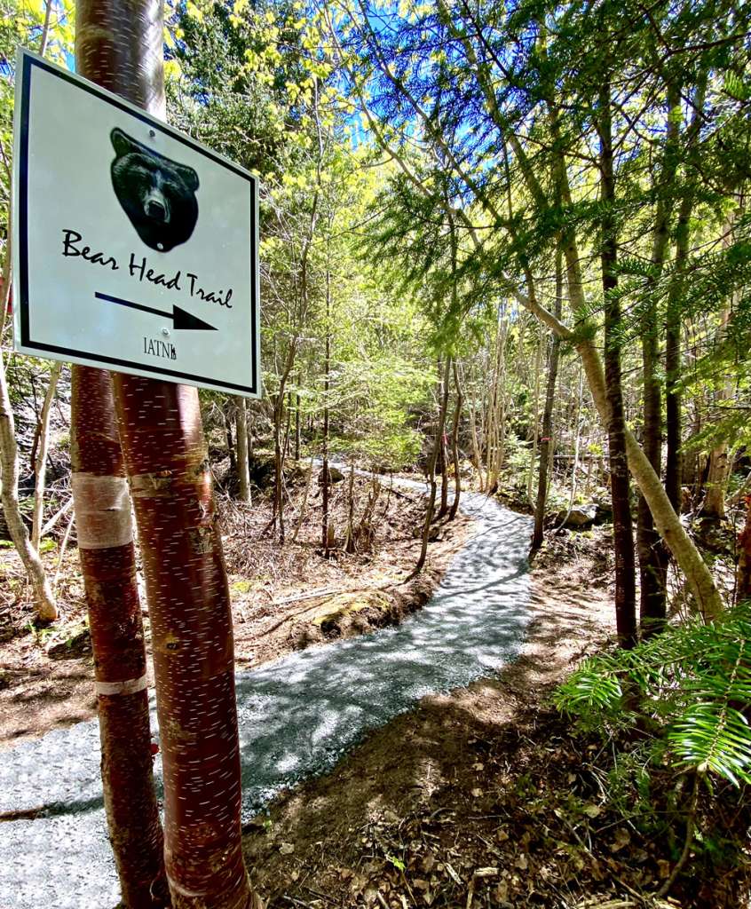


Bear Head Trail is a 1.6km (1mi) alternate trail route up Bear Head to Arne’s Lookout on the Humber Valley Trail.
In addition to being shorter and generally steeper than the original Humber Valley Trail route to Arne’s Lookout, Bear Head Trail bypasses the steepest switchback on the HVT and has more scenic viewpoints both into the valley and “out the bay”.
It starts at the same Ballam Bridge trailhead as Humber Valley Trail, which can be found soon after turning right immediately after crossing Ballam Bridge on Route 440.
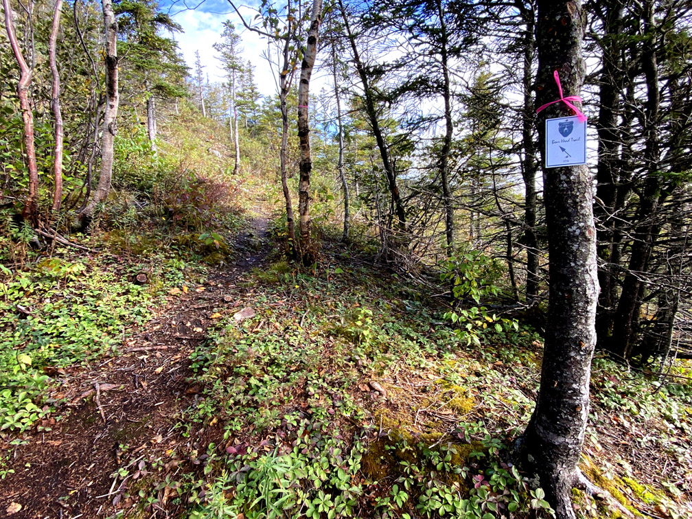
After walking 175m (574ft) up Humber Valley Trail, hikers must turn right onto Bear Head Trail and follow the crushed limestone path
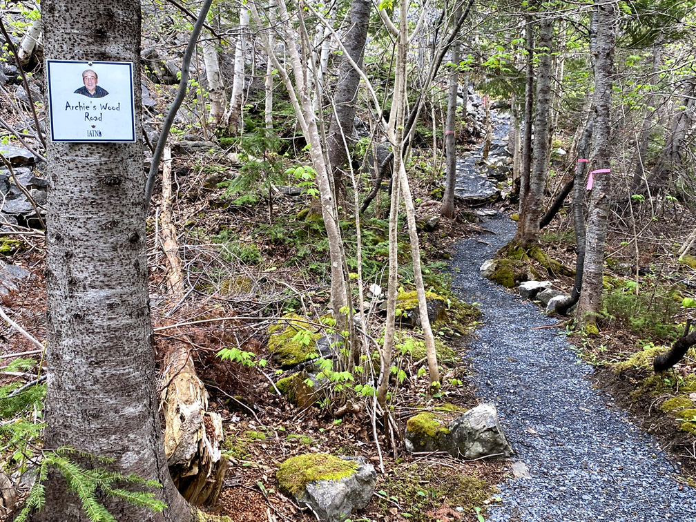
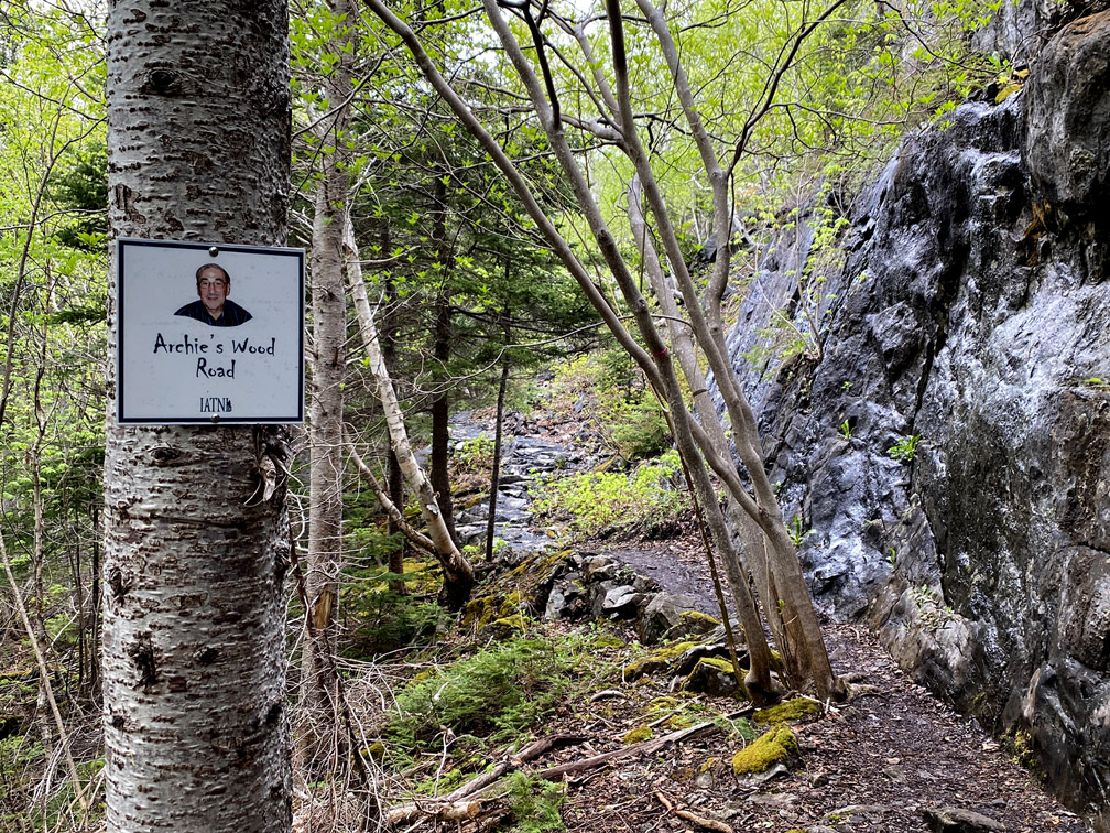
named Archie’s Wood Road after neighbour, carpenter and craftsman Archie Young
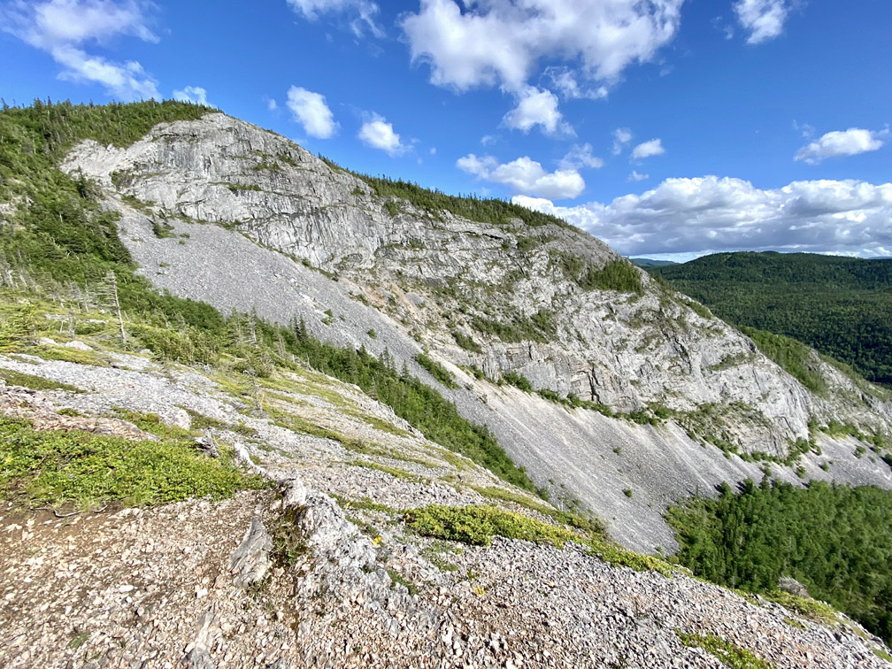
across the bottom of Bear Head rock face until it makes a left hand/right angle turn up the 345m (1,132ft) high limestone ridge.
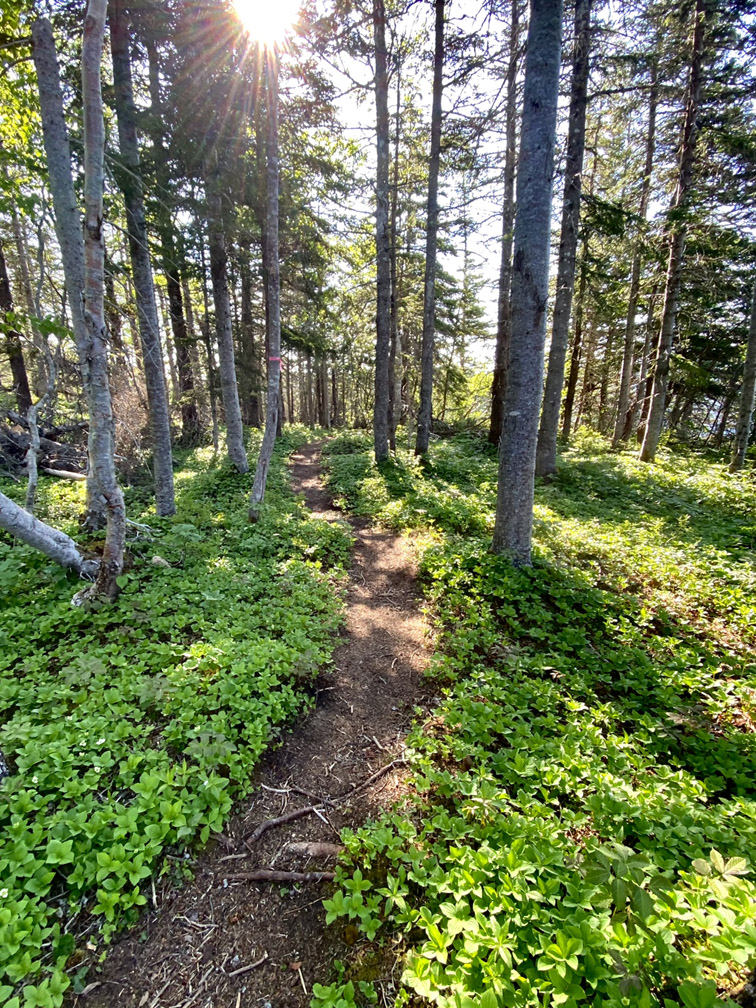
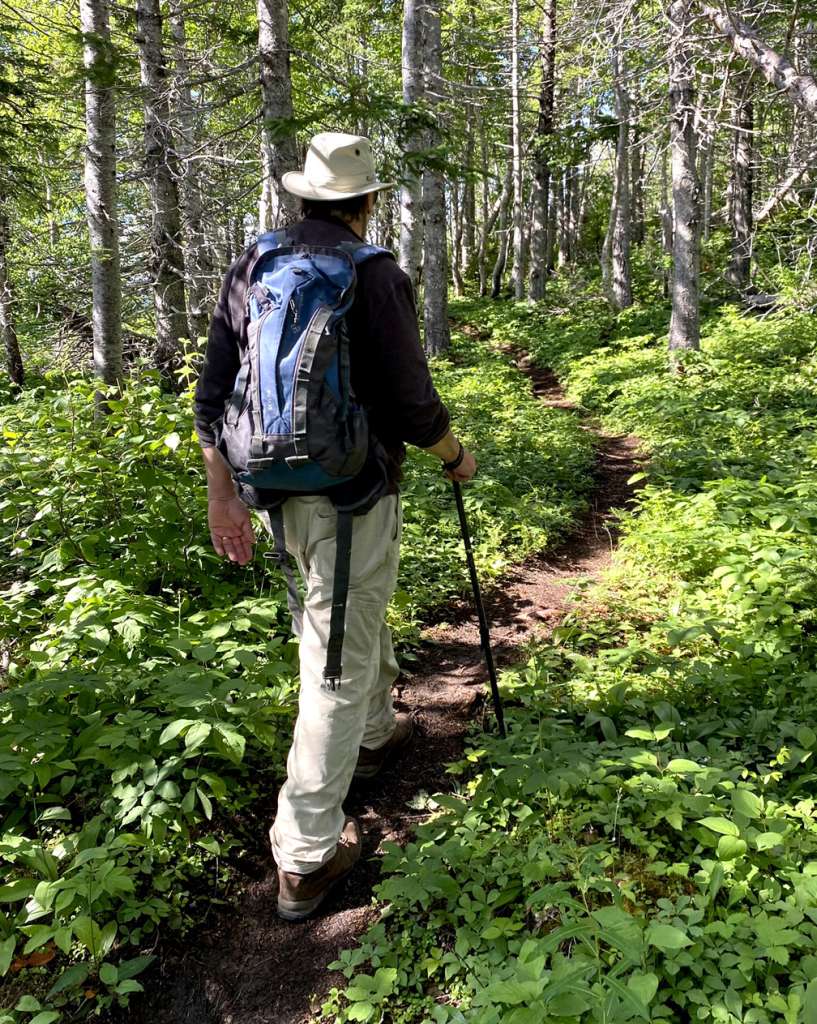
After Archie’s Wood Road, the trail becomes a well-trodden dry dirt and rock path through mixed hillside forest
that alternates between relatively steep and not-so-steep inclines that connect the scenic viewpoint dots.
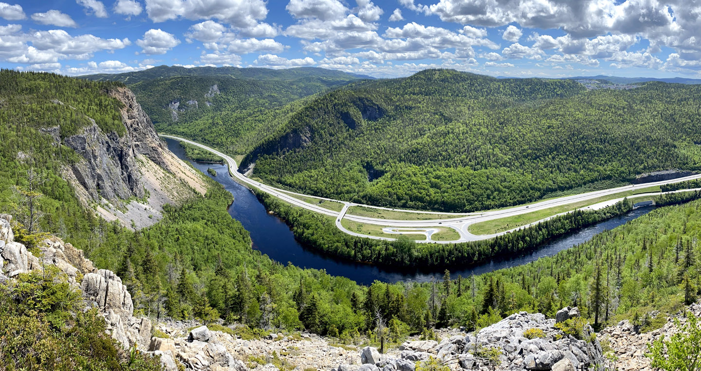
After the first significant view of Humber Valley on the eastern side of the ridge, the trail swings back to the western side for a view of Humber Mouth and Humber Arm, all the way to Blow Me Down Mountains.
Though Bear Head Trail is an inspiring trek any time of year, one of the best times is mid-June when the yellow lady slippers are blooming in the hundreds, if not thousands.
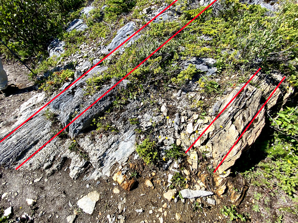
The colorful flowers thrive on the ridge’s limestone, which was formed under water by the accumulation of corals and shells on the ancient continental slope of Laurentia (i.e., proto North America) approximately 480 million years ago when the region was located in the Tropics. The gray sedimentary rock is in stark contrast to the rust-colored igneous rock from earth’s mantle (i.e., peridotite) found on the south side of Humber Arm in the Blow Me Down Mountains (aka Blow Me Down Ophiolite Massif) which was forced to the surface by plate tectonics during the closing of the Iapetus Ocean.
Bear Head Trail provides a great opportunity to see evidence of plate tectonics in the form of a massive U-shaped sedimentary fold called “syncline”, with younger rock layers closer to the center of the structure. As in the case of the Blow Me Down Mountains and other three Bay of Islands Ophiolite Massifs (i.e., Lewis Hills, North Arm Hills/Gregory Mountains, and Tablelands in Gros Morne National Park), Humber Syncline was formed during the closing of the Iapetus Ocean and formation of the Appalachian Mountains.
Along sections of Bear Head Trail, hikers can view rocky outcrops composed of diagonal layers of limestone aligned top right to bottom left, possibly indicating that Bear Head itself is an older, hidden and eroded, section of the Humber Syncline.
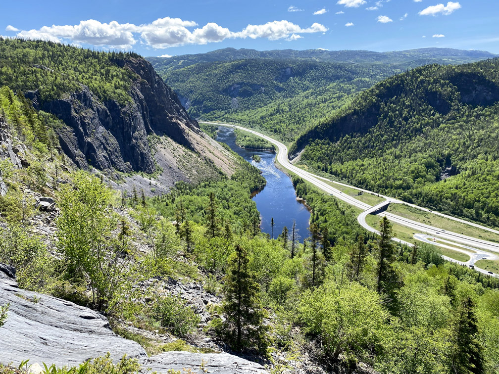
The trail also provides good vantage points to observe the geological effects of glacial erosion during the Pleistocene, approx 110,000 to 15,000 years ago.
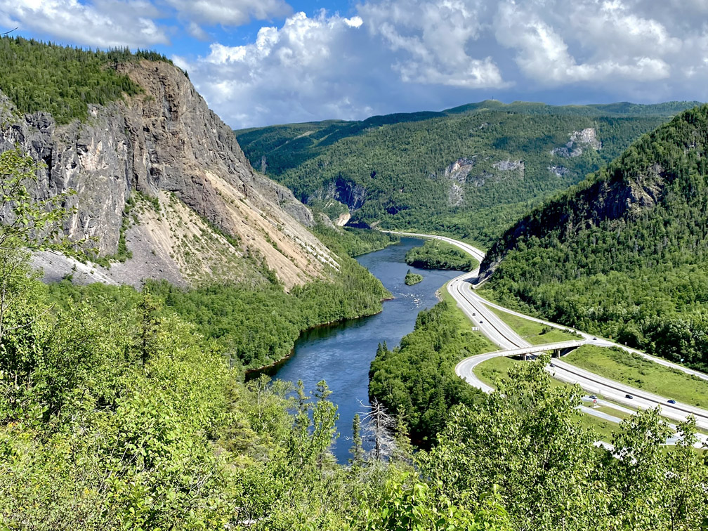
After crisscrossing back and forth up the ridge, hikers reach the most complete view of the glacier-carved valley, including the forested north shore (opposite the Trans Canada Highway), where plans call for a new riverside trail connecting to the Humber Valley Trail near Man In The Mountain Lookoff.
After a gradual ascent up the side of a broad valley, the trail proceeds through a level patch of forest that provides welcome shelter on a windy day
before it crosses the barren rocky brow of the Head with the unlikely name “Bear” – possibly derived phonetically from “Bare” – with a commanding view of Humber Arm and Blow Me Down Mountains.
From there the trail passes through another level patch of forest
then up a gradual rise until it intersects with the Humber Valley Trail at Arne’s Lookout, where hikers can choose to continue on to Man In The Mountain Lookout or loop back to Ballam Bridge trailhead.
Like the Humber Valley Trail, the Bear Head Trail is ablaze with color in mid-October, and only minutes from the city of Corner Brook. (See Bear Head Trail Photo Gallery.)