In October 2012, Coast Alive partner Vest-Agder County Council released a new Flagler Films produced video on The Child Wanderer Path, now part of IAT Norway.
The path extends 136 kilometers across Southern Norway, and introduces visitors to the scenic landscapes, friendly villages and heart-wrenching story of child wanderers who left their homes in search of work to help support their families through difficult times.
In the nineteenth century there was extreme poverty in the western part of the Agder region, and as a consequence, children from this area were sent to the richer eastern part of the region to work as shepherds and farm workers.
From the ages of seven to sixteen children wandered back and forth in larger groups, leaving their parents home for months at a stretch to provide a vital contribution to the economy of their household.
The path follows in their footsteps, crossing the valleys and hillsides in Agder that are now seen as beautiful and tranquil landscapes, but which convey the harsh reality in whch the children lived.
From Kvinesdal in the west to Landvik (Grimstad) in the east you can follow in the footpaths of the Childwanderers, as seen in the movie Yohan – the Childwanderer.
View The Child Wanderer video:
In October 2012, England's North Downs Way National Trail became the newest section of the International Appalachian Trail in Western Europe. IAT hikers can now follow in the footsteps of pilgrims on an inspirational journey from Farnham to Canterbury
and the White Cliffs of Dover
through a landscape rich in scenery and heritage.
The North Downs Way offers walkers 153 miles of spectacular scenery,
picturesque villages
and glorious rolling countryside.
But then you would expect nothing less from a route that passes through both the Surrey Hills and Kent Downs Areas of Outstanding Natural Beauty (AONBs).
There is always something new to explore along the way, as the route contains a wealth of wildlife, history, landscapes, attractions, villages and towns, all waiting to be discovered.
With excellent public transportation links to the trail - it is easily reached by train from London - and a wide choice of accommodation along the route, there is plenty of opportunity to explore the North Downs Way National Trail, whether as a day trip or walking holiday.
To learn more about this new scenic section of the International Appalachian Trail in the south of England, visit their website.

In October 2012, Beyond Ktaadn, a collaborative research and outreach organization focused on alpine landscapes in eastern North America, will publish an Eastern Alpine Guide including IAT mountains of Newfoundland. Contributors include academics and experts in the U.S. and Canada, as well as IAT Chairperson Paul Wylezol.
In summer 2012, IAT partner Blue Ice Explorer in South Greenland designated a new International Appalachian Trail route across the legendary Norse Erik The Red Land of the Eastern Settlement, from Qassiarsuk (Brattahlid) to Narsaq, then on to Igaliku (Garðar) and Illerfissalik (Burfjeld) mountain. It is the IAT's first re-emergence across the Atlantic Ocean, after departing northern Newfoundland near Leif Erikson's historic settlement at L'Anse aux Meadows.
View of Illerfissalik (Burfjeld) mountain from Leif Erikson monument in Qassiarsuk (Brattahlid)
The approximate 100km (60 mile) trek begins with a visit to the Blue Ice Cafe (http://www.blueice.gl) near the airport in Narsarsuaq, where hikers can purchase maps, arrange boat transportation, and obtain overnight accommodation in a variety of locations along the route.
Jens Kjeldsen's statue of Erik the Red lifting his son Leif Erikson onto his horse, at Blue Ice Cafe
From the cafe, hikers must take a short 15-minute boat ride across Tunulliarfik (Eriks Fjord) to Qassiarsuk (Erik's historic settlement Brattahlid) where they can visit the bronze statue of Leif Erikson (European discover of America) before beginning their 4-5 day trek.
From Qassiarsuk, the IAT route heads north along the western shore of the fjord, before turning southwest and crossing Erik The Red Land to Tasiusaq, Sermilik (Isa Fjord).
View of Tasiusaq Inlet, Sermilik (Isa Fjord)
From Tasiusaq, the route visits Nunataaq
Nunataaq, with 800m (2,625ft) Eqalorutsit Killiit Glacier in…
(Excerpt from Appy Trail's next 75 years: 'There's a need for constant vigilance' on Knoxville News Sentinel website knoxnews.com.)
Over the course of its 75-year history, the Appalachian Trail has earned a reputation as one of the most popular long-distance footpaths in the world.
The AT's status as a true icon is evident in recent efforts to develop an "International Appalachian Trail" that eventually will extend from Canada across the Atlantic to Iceland, Scandinavia and Great Britain before dipping south to France, Portugal, and finally, Morocco.
Story by Morgan Simmons for Knoxville News Sentinel - Photo by Bill Lea/Special to the News Sentinel
The rational behind the International Appalachian Trail is that the Appalachian chain in North America actually extends undersea to emerge as the Caledonides Mountains of Scandinavia and Scotland, and the Atlas Mountains of northwest Africa.
Officials with the Appalachian Trail Conservancy are quick to point out that the International Appalachian Trail is a side trail of the AT, not an extension of the official Maine-to-Georgia route.
But Mark Wenger, executive director of the ATC, said the Appalachian Trail's worldwide name recognition is a valuable asset as the trail heads into the 21st century.
"We are blessed that we have a famous symbol to work with," Wenger said. "The AT garners tremendous support across political divides. It's something everyone can rally around. ...
We're now looking at it as a laboratory to monitor climate change, a vehicle for training teachers, and an economic engine that can help…

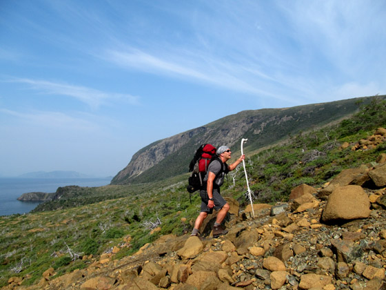
On August 27-28, IAT Chairperson Paul Wylezol and IAT Hiker Sean LeMoine hiked across the North Arm Hills, from Stowbridge Head in the Bay of Islands to Trout River Pond in Gros Morne National Park. The goal was to identify a route for the new IATNL North Arm Traverse. The two-day trek requires a 45 minute boat ride on each end, provided by True North Charters out of Cox’s Cove in the south, and Ocean Quest Adventures out of Trout River in the north.
IAT Founder Dick Anderson and Maine Chapter President Don Hudson recently hosted a seafood dinner on the Portland, Maine waterfront for three key officials of the Appalachian Trail Conservancy (ATC): Mark Wenger, new ATC Executive Director/CEO; Amy McCormick, Assistant Development Director, and Bill Plouffe, ATC Board Vice-Chair.
(L - R) Dick Anderson, Mark Wenger, Don Hudson, and Bill Plouffe
The dinner was a great opportunity to hear about ATC’s new programs and IAT’s new developments (including the IAT Annual General Meeting in Reykjavik, Iceland, and IAT expansion across the North Atlantic and into Western Europe), as well as strengthen friendships and build on the long-term, close relationship with the folks at the Appalachian Trail Conservancy.
On behalf of the IAT, Don invited Mark to attend and participate in the 2013 International General Meeting in Inverness, Scotland. Mark said he would like to attend, and would make a firm decision as soon as a specific date has been chosen.

From July 31 – August 1, IAT Chairperson Paul Wylezol, Recording Secretary Caroline Swan, and Maine hiker Loren Johnston did a 2-day hike in the Blow Me Down Mountains to add trail markers to the IATNL Blow-Me-Down Mountain Trail, and look for route improvements and additions. The trek began at the parking lot of the Copper Mine To Cape Trail, a partnership of the IATNL and Outer Bay of Islands Enhancement Committee.
Sendero Internacional de los Apalaches has recently released a slideshow presentation highlighting the IAT route in west central Spain, where "Las Villuercas-Ibores-Jara is the best place in Europe to admire the Appalachians Mountains."
In this region of Spain, IAT hikers can walk from one village to another, and overnight in a hostel or rural guesthouse. In villages where there is no tourist accommodations, walkers are permitted to spend the night in a gymnasium or other public building.
Once the Las Villuercas-Ibores-Jara section of IAT Spain is completed, the route will extend north to connect with Portugal, and south to connect to Ciudad Real and Córdoba.
The IAT in Spain utilizes existing trails and walking routes, some of which date back to Roman times.
Already 100 kms of the Villuercas region has been marked with gps, accounting for nearly half of the trail length in this area. The distance between villages is between 10 km and 25 km.
When complete, IAT Spain will extend approximately 900 kms.
View the IAT Spain Slideshow Presentation

In August 2012, National Geographic included the International Appalachian Trail in the World’s Best Hikes: 20 Epic Trails. “We looked for walks that travel deeper into a location’s history and culture. Sure, there’s outdoor adventure on each of these 20 hikes, but the trails also tell a rich story.”
In August 2012, National Geographic included the International Appalachian Trail in the World's Best Hikes: 20 Epic Trails.
"A truly great trail winds into the essence of a place, so when assembling this list of the world’s great hikes we kept an eye on more than the footpath. We looked for walks that travel deeper into a location’s history and culture. Sure, there’s outdoor adventure on each of these 20 hikes, but the trails also tell a rich story. So here they are, the holy grails of trails across the world." - Doug Schnitzspahn
Best For: Appalachian Trail thru-hikers looking to beef up their resumes; hikers with a fondness for primordial geology.
Distance: The current trail includes approximately 1,862 trail miles from the end of the U.S. Appalachian Trail in Maine to the North American trail terminus at Crow Head, Newfoundland.
The IAT is an attempt to connect a primordial mountain range that traversed part of the supercontinent of Pangaea more than 200 million years ago before separating into multiple ranges. What remains of those peaks in North America has become the famed Appalachian Mountains of the United States, but few of the Appalachian Trail's thru-hikers will want to admit that the mountains continue on into Canada—and don't stop there. The remains of those mountains stretch from Labrador to Greenland and then down to the European continent, with vestiges in Scotland, France, Spain, and even across Gibraltar to Morocco.
For the full story of the International Appalachian Trail as a National Geographic World's Best…

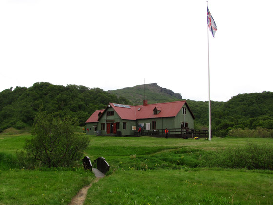
On June 26, after the IAT AGM in Reykjavik, Icelandic Touring Association Manager Palli Gudmundsson took IAT Chair Paul Wylezol and IATNL Vice Chair Arne Helgeland on a day-long tour of Thorsmork (named after the Viking God of Thunder) and one of the ITA’s most popular backcountry huts. The day began with a 2-hour drive from Reykjavik to the famous Seljalandsfoss waterfalls, at the off-road entrance to the valley and the ITA’s Laugavegur Trail, the most popular hiking trail in Iceland.

