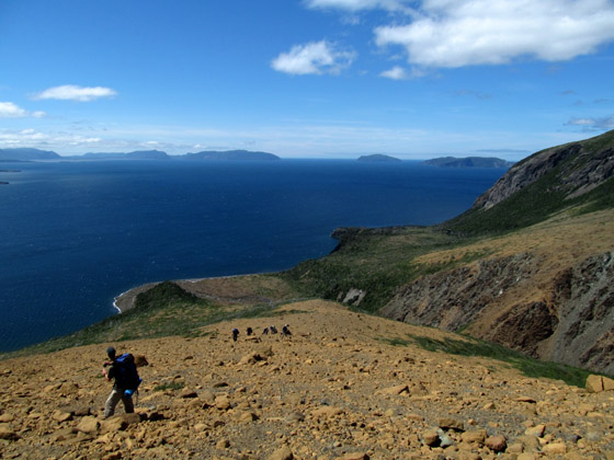
From June 30 to July 2 IATNL Chairperson Paul Wylezol and volunteers Troy Gaulton and Caroline Swan made a 3-day trek into the Lewis Hills to survey the northern end of the IATNL’s Lewis Hills Trail.

In 2008 the southern end of the trail was completed from Cold Brook Road above Fox Island River to Cabox, at 2,672 ft (814 m) the highest point on the island of Newfoundland. On July 7 work will continue on the northern access from Loggers’ School Road, across Blue Brook, to the the northeastern corner of the “hills”.

The 60 kilometer (36 mile) “Canada Day Trek” was under ideal conditions, with clear blue skies, dry barrens, cool clear streams (for drinking and dipping), and a pleasant light breeze to keep down the few flies and mid-20C’s (80F) heat. The only challenge was hopping through the peridotite and granite scree fields and stream beds.

As you can see from the photos, highlights include views of an assortment of valleys, canyons and gulches – including Serpentine, Rope Cove, Molly Ann, and Middle Brook – and the beautiful little waterfalls and pools contained within. Add to that the geologic marvels and abundant wildflowers and you have a special other-worldly place that will soon be accessible to backcountry hikers of the IATNL’s Lewis Hills Trail.


