

Trail Route Description
Click here for detailed trail route description
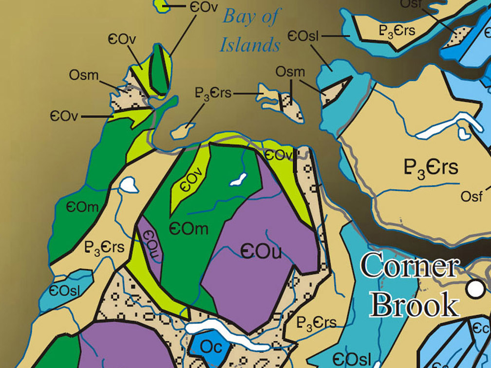
Geographic Information
Click here for info on the Blow Me Down Mountains
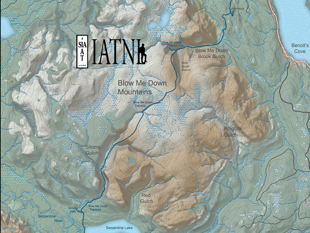
Topographical Map
Click here for trail route topo map
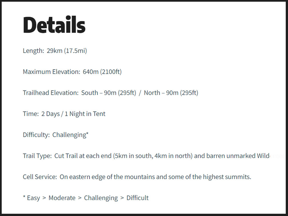
Details & Directions
Click here for summary details and directions
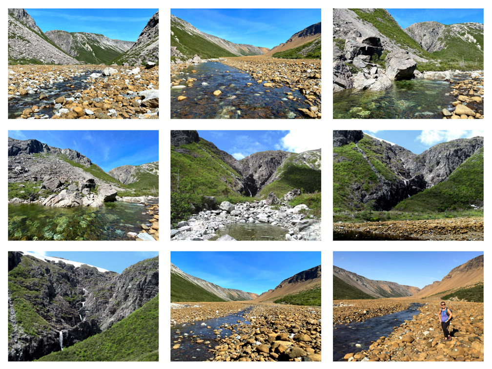
Photo Gallery
Click here for Trail Route Photos
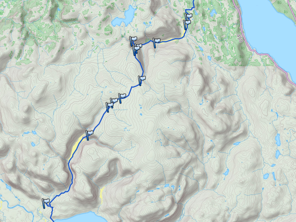
GPS Track
Click here for trail route GPS Track
I have consent to use Google Maps and having this website store my submitted information so they can respond to my inquiry Privacy Policy