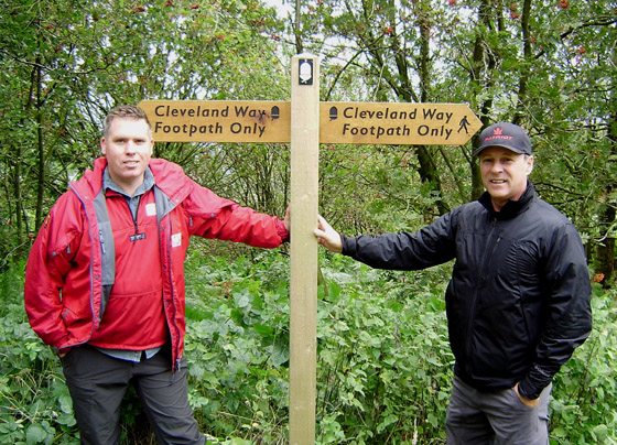
In March 2011, the UK’s Cleveland Way National Trail joined the IAT as a member of the Coast Alive group of North Sea trails. Its 109 miles (176 kms) of ever-changing and beautiful landscapes was opened in 1969, as the second National Trail in England and Wales.

The route follows a horseshoe line of great variety around much of the beautiful North York Moors National Park. Starting from the attractive market town of Helmsley, The Cleveland Way heads across the inspirational, and sometimes vibrant heather Moorland of the North York Moors, before reaching the coast at Saltburn. From here it’s a visual feast along the dramatic North Yorkshire coastline to Filey, passing old fishing villages and lively coastal towns.


Along the way there is a wealth of history and heritage to enjoy. Helmsley Castle, Rievaulx Abbey, Mount Grace Priory, Gisborough Priory, Whitby Abbey and Scarborough Castle to name just a few special sites.

Scarborough Castle, Scarborough, North Yorkshire
The combination of moors, dales, woodland and coast that make up the Cleveland Way give it a unique character. These are special landscapes. So much so that most of the route falls within the North York Moors National Park and along the North Yorkshire and Cleveland Heritage coasts.

Coastline Above Maw Wyke Hole
Moorland dominates the western part of the Cleveland Way. The North York Moors itself contains the largest continuous area of heather moor in England. These wild and remote moors offer far reaching views over the dales and the Vale of York. In late Summer the heather blooms to turn the moor into a stunning swathe of bright purple. You would be forgiven for thinking that such a landscape had naturally evolved. In fact the moors have been shaped by human activity, replacing the mixed deciduous woodland that was destroyed by Stone Age and then Bronze Age farmers.

There is no greater contrast to the remoteness of the Moors, than the dramatic coastline, which the Cleveland Way follows for 50 miles from Saltburn by the Sea through to Filey. This seascape is outstanding – sometimes marked by rugged cliffs, rising to 666 feet (203 metres) above sea level at Boulby – the highest point on the eastern seaboard of England.

At other times marked by traditional fishing villages such as Staithes, Runswick Bay and Robin Hoods Bay, with tightly knit houses that appear to cling to the cliff edge. Here again man has played his part in shaping the landscape. For centuries the minerals in the rocks have been exploited to transform the coastal profile and to leave a rich industrial heritage.

Robin Hoods Bay
With such a wide variety of landscapes it is not surprising to find an equally wide range of wildlife which may be seen and heard along the Cleveland Way. Amongst the large expanse of heather moorland, you will see, in addition to the heather or ling, clumps of bilberry which show up as bright green patches against the browner heather. On the edge of the moor, heather gives way to grassland, with the small yellow flowers of tormentil and tiny masses of white-flowered heath bedstraw. Bracken is also common, often spreading out from woodland with wind sculpted oak, birch and red berried rowan or mountain ash. In the sheltered valleys, the woodlands provide a fine display of bluebells in spring, often accompanied by the white clusters (and strong smell!) of wild garlic. Birds can be hard to see among the trees and mammals may be hidden, but they will use the Cleveland Way as well, so look out for signs. Rabbit droppings, a badgers blunt footprint or black and white hairs caught under a fence, tell you they are there.

Bluebell Woods
Along the coast the grassland, brambles and bushes harbour a wealth of colourful wild flowers such as cowslips, wild violets and knapweed. Looking out to sea you may see many bird species flying past, not only seagulls flying high, but also black cormorants and shags, or smaller razorbills, guillemots and puffins, skimming the waves as they make their way to and from their breeding cliffs.

Fulmar at Boulby
In addition to diverse topography and wildlife, the Cleveland Way traveller will come across an astonishing number of historical sites and landscapes as they journey along the National Trail. High on the moors the shapes of stone and bronze age burial sites can still be seen. Along the coast are the sites of Roman signal stations. And within the first few miles alone you will have passed Helmsley Castle and the incredible ruins of 800 year old Rievaulx Abbey. You will follow ancient routes, including the Hambleton Drove Road along which Scottish Drovers brought their cattle through to various markets as far south as London.

Rievaulx Abbey
As you stand on top of the moors surveying the wild and tranquil moorland landscape, you may find it hard to believe that these moors also hold an industrial past. In fact the most remote point on the Cleveland Way at Blowarth Crossing marks the junction of an old road and a former railway, bringing ironstone mined out of the moors to feed the blast furnaces of Teeside and Durham. Alum – for fixing dye – and Jet – for jewellery – were also mined along the moors and coast. The coastal villages also have tales to tell. In the 18th century smuggling was a profitable business along the Yorkshire coast, as the fishing villages provided ideal landing spots for illicit cargo. The premium illegal trade was in tea, spirits, salt and lace.

Bloworth Crossing
Along the Way you will be reminded of one of the regions most famous sons, the explorer Captain James Cook. The young Cook went to school in Great Ayton and grew up in the shadow of Roseberry Topping. Memories of Captain Cook are also found in Staithes and Whitby from where he first set sail in 1747 and from where as a Royal Navy Officer he had his famous ships, Endeavour, Resolution, Discovery and Adventure built.

James Cook Monument, Whitby
To learn more about the Cleveland Way National Trail,
visit their website
…. and take a leisurely walk on the North York Moors and historic coastline.


