
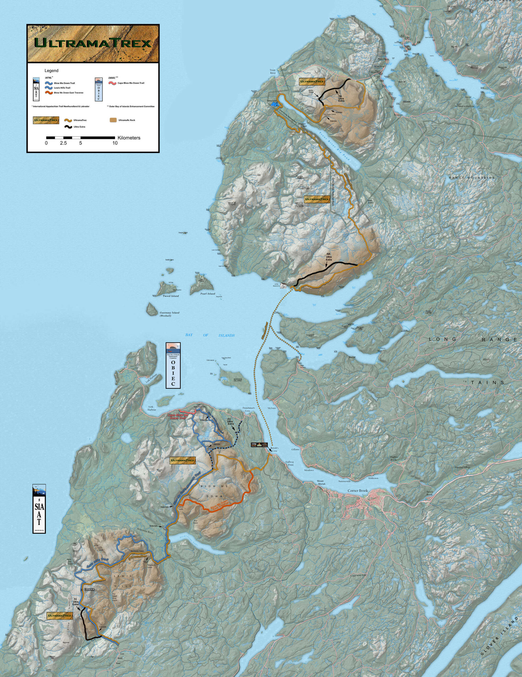


The IATNL UltramaTrex is the trail route spine of Cabox Geopark which traverses the rust-colored “ultramafic” sections of the four Bay of Islands Ophiolite Massifs. These ancient sections of Earth’s upper mantle composed primarily of peridotite were forced over the eastern edge of Laurentia (Proto-North America) during the closing of the Iapetus Ocean (pre-cursor of the Atlantic Ocean) approximately 400-500 million years ago.
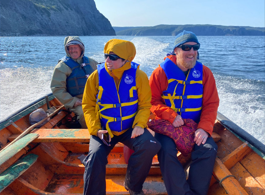
This north-south route extends from Winter House Brook Gulch above Woody Point in Gros Morne National Park to Cold Brook Road above Fox Island River east of Lewis Hills. Between the two northern massifs (Tablelands and North Arm Hills) and two southern massifs (Blow Me Down Mountains and Lewis Hills) is the Bay of Islands, which must be crossed by boat between Stowbridges (aka Stone Brook) and Benoit’s Cove, or between Stowbridges and Cox’s Cove, then by ground transportation to Benoit’s Cove.
In addition to the primary UltramaTrex route, there are also 4 secondary routes named Ultra Extra (one each on Tablelands, North Arm Hills, Blow Me Down Mountains and Lewis Hills) which provide alternatives for those with special interests, such as Mohorovičić discontinuity (aka Moho), or those who would like to make the trek again across different land and viewscapes. Collectively these routes form the Ultra Extras.
The Ultra Extras is approximately 134 kilometers (80.5 miles) in length and is divided into four stages, one for each of the four ophiolite massifs. The stages can be completed individually, in pairs (northern and southern), or together as a single trek. In total, the UltramaTrex requires 6 – 8 days to complete.
Stage One – Tablelands with Ultra Extra
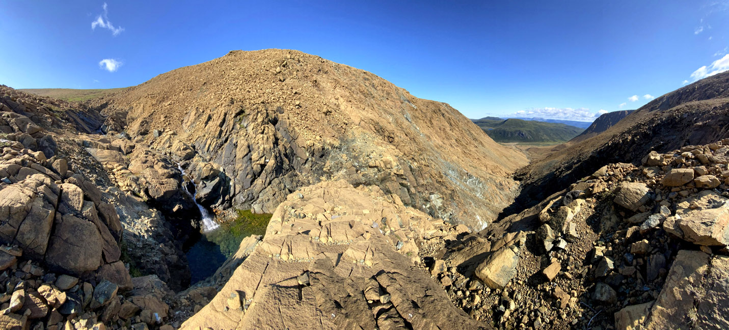
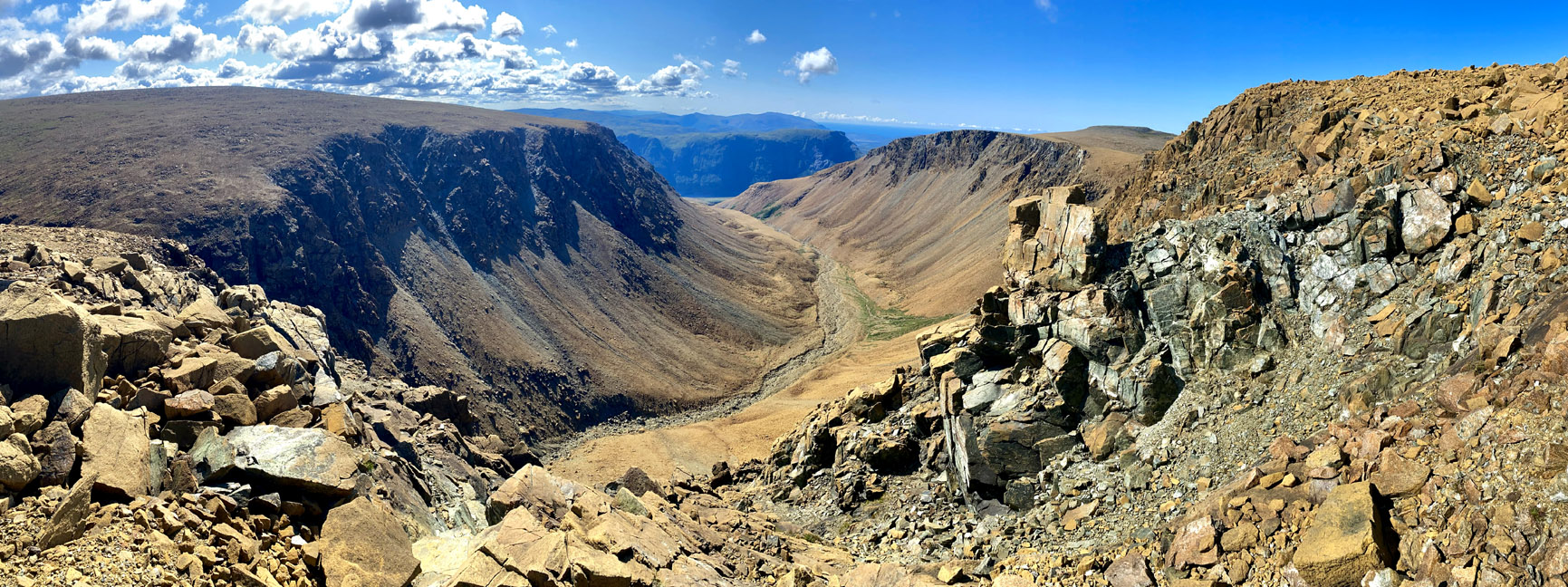
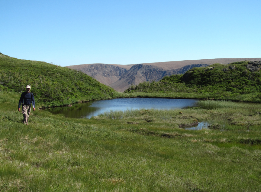
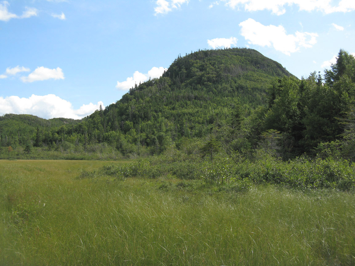
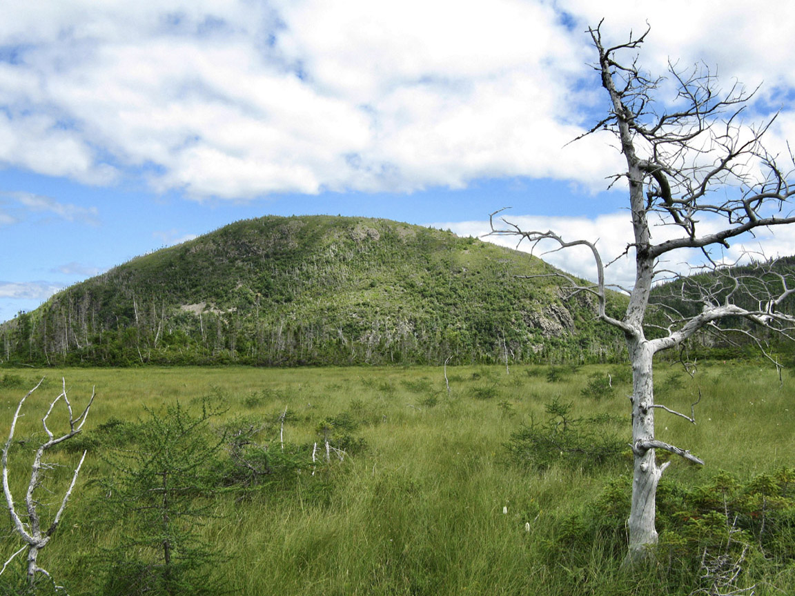
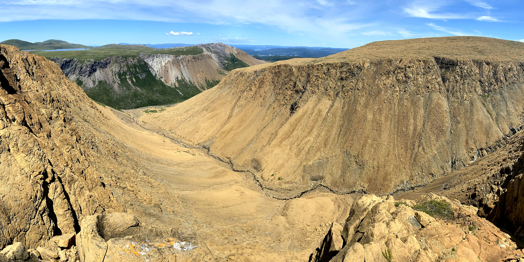
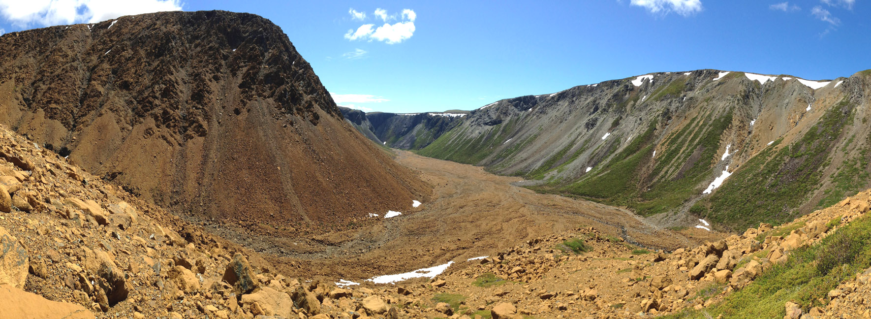
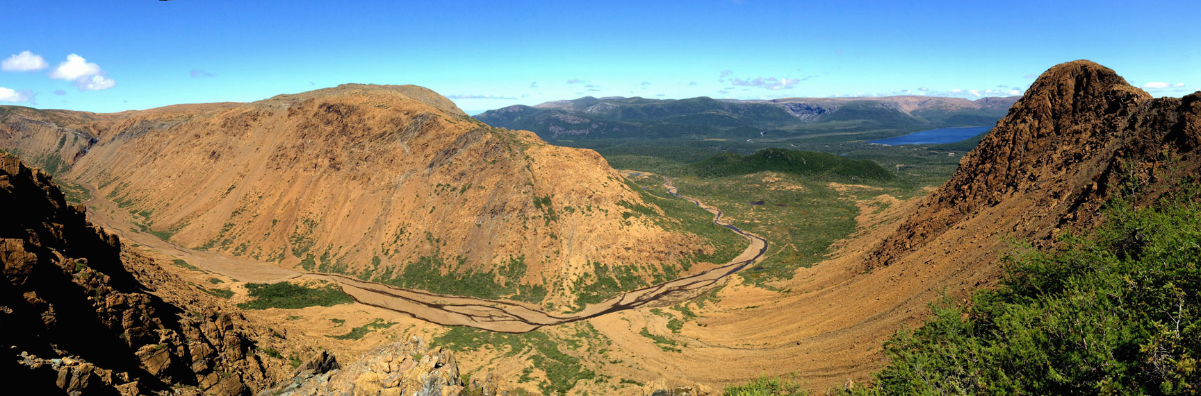
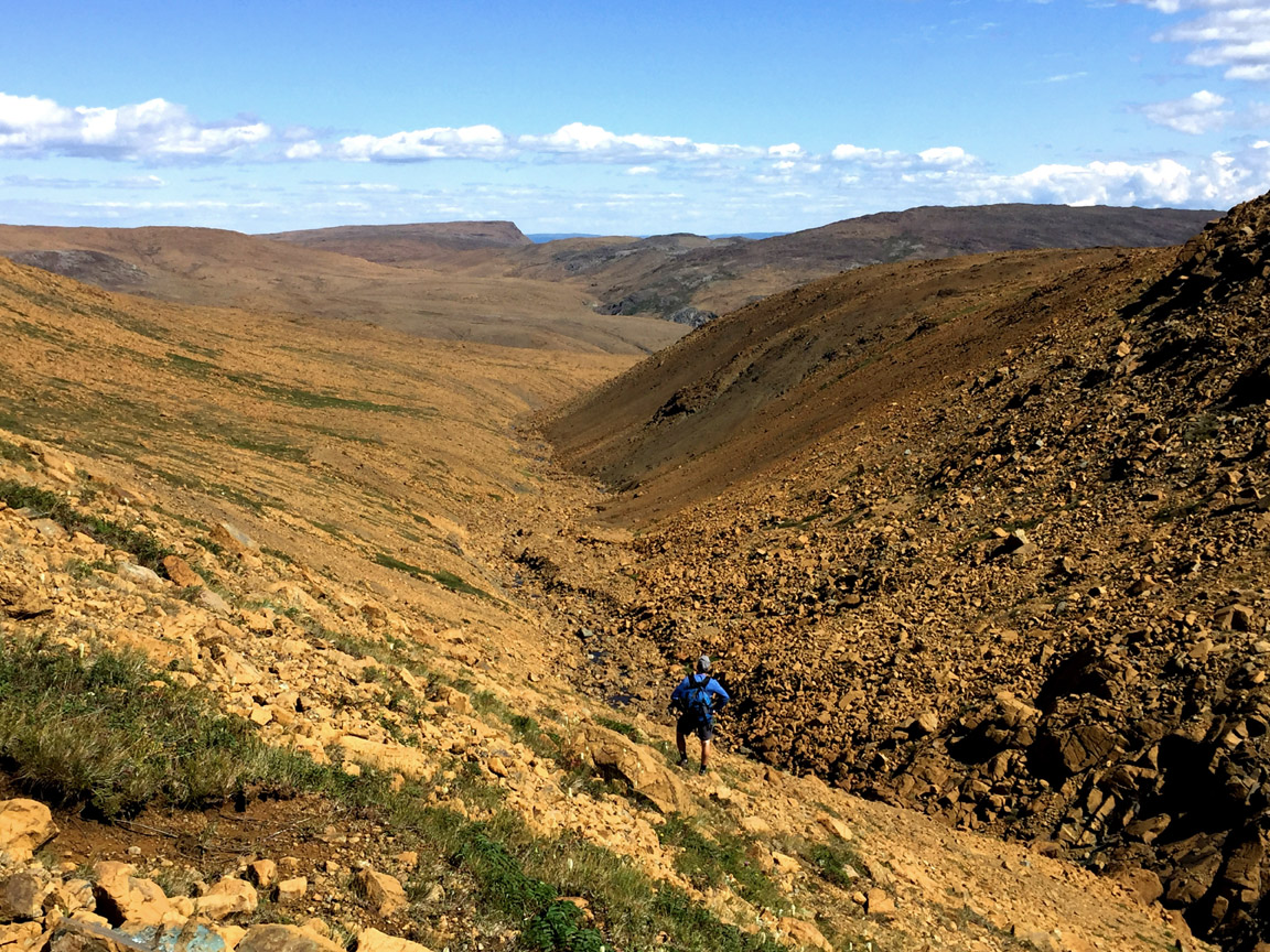
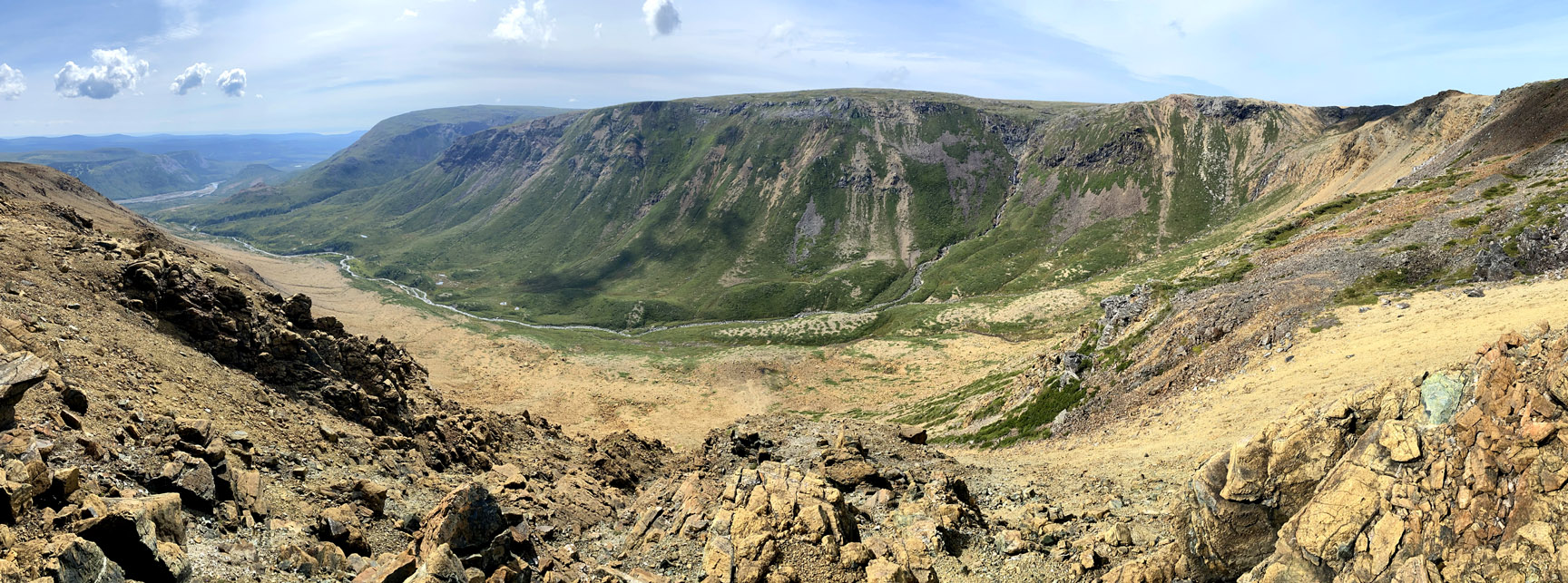
is approximately 20 kilometers (12 miles) in length and can be completed in approximately 9 hours, 9.5 hours to the Trout River Pond campground. From the start at 150 meters (492 feet) above sea level at the entrance to the forked “gulch” west of Winter House Brook Gulch, the trek climbs up the relatively gentle slope to the left of the west branch
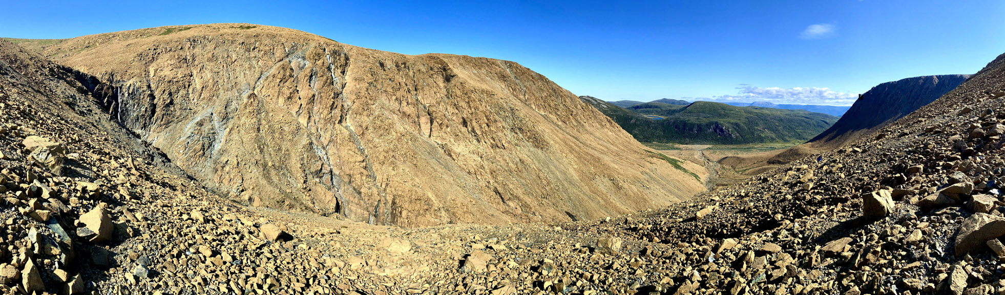
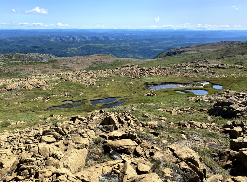
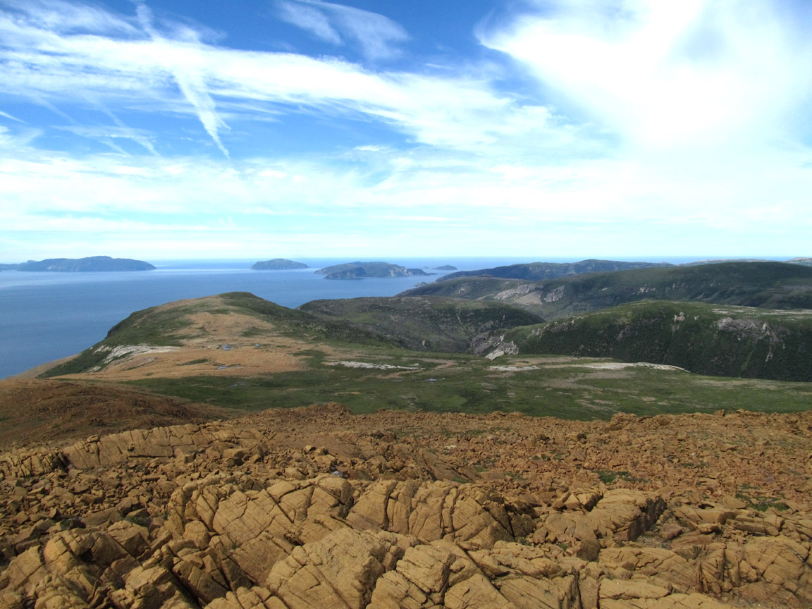
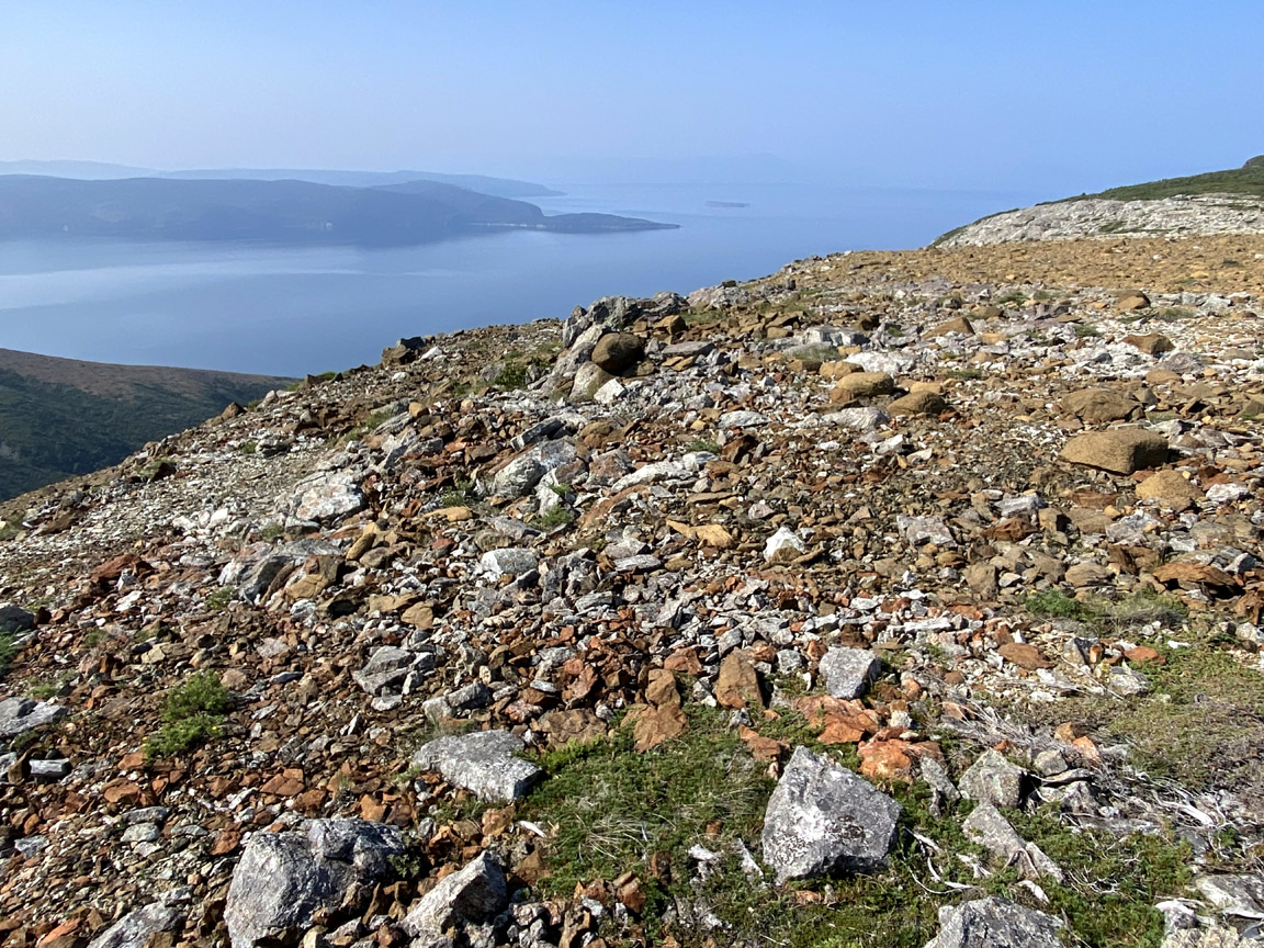
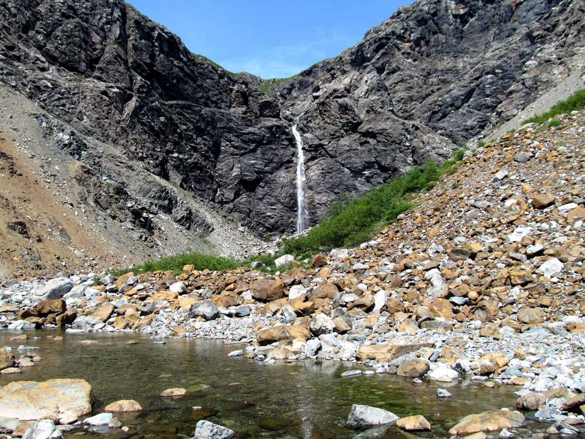
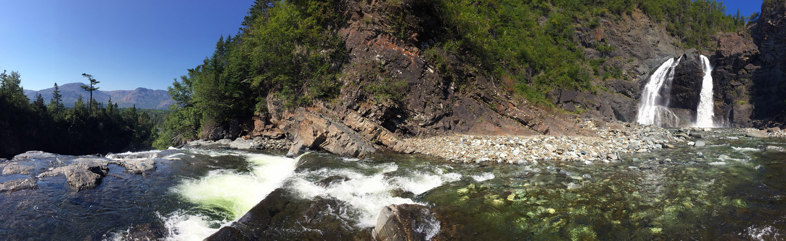
where at 400 meters (1,312 ft), hikers are rewarded with a nice panoramic view north through the gulch and south along its west wall to a 30 meter (100 ft) high waterfalls that spills out of the upper valley.
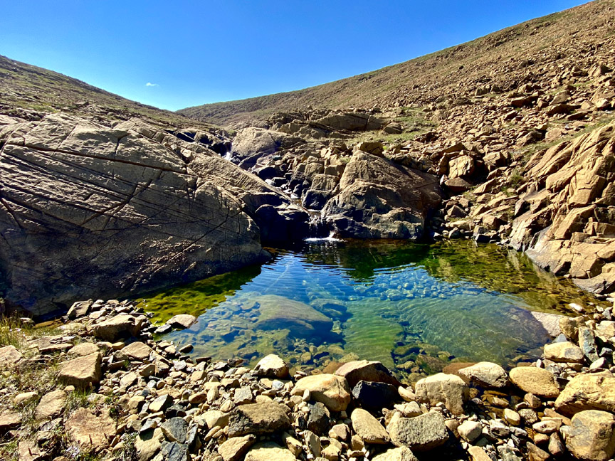
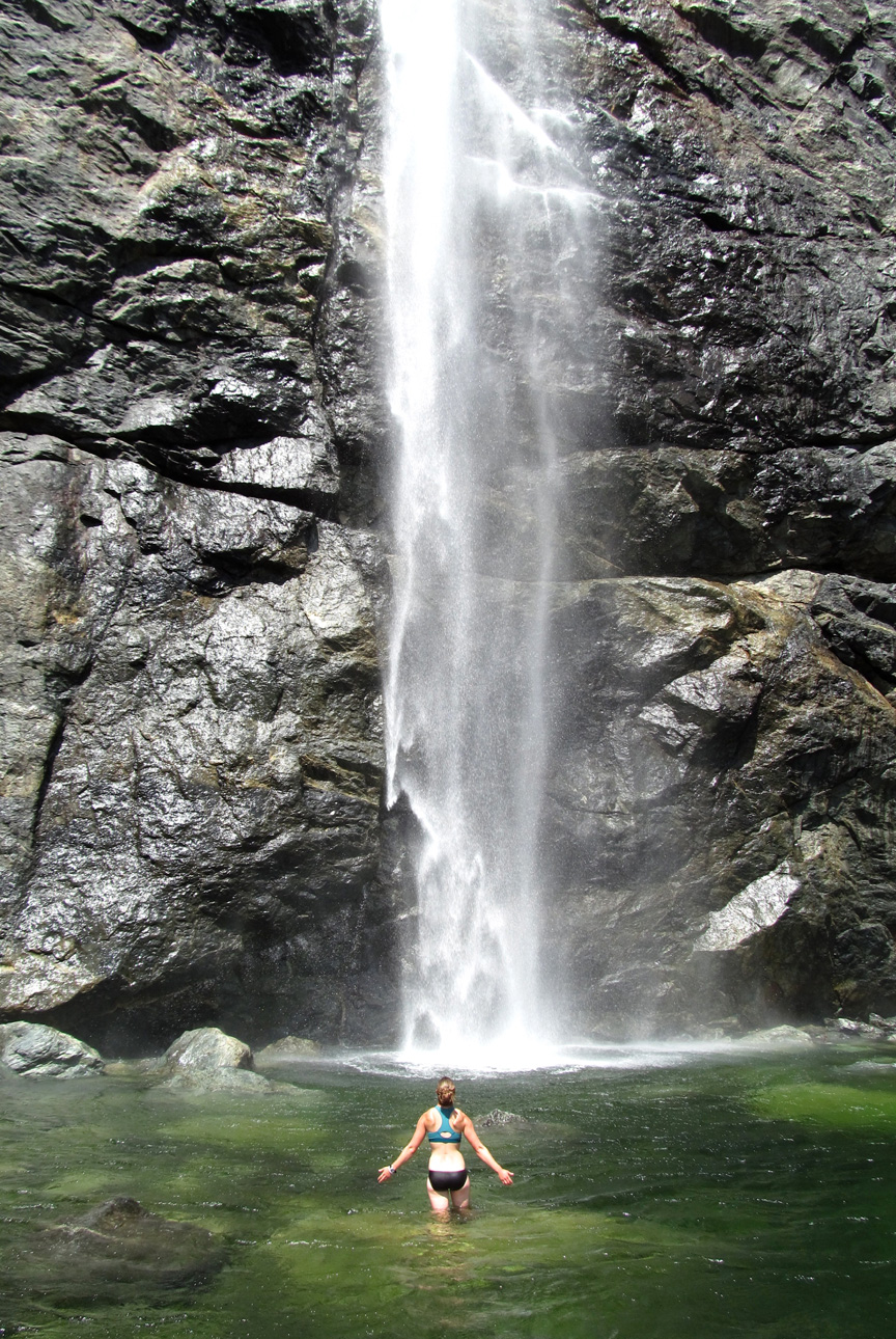
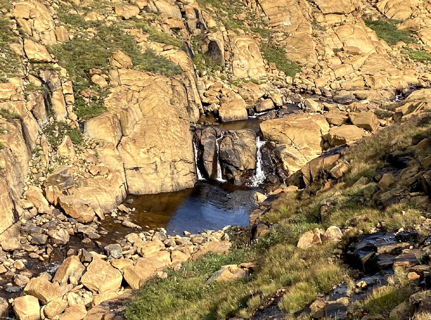
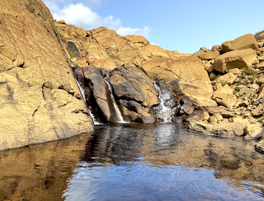
At 480 meters (1,575 ft), the grade levels off and a series of crystal-clear waterfalls provides hikers with a good opportunity for a cool dip on a hot summer day.
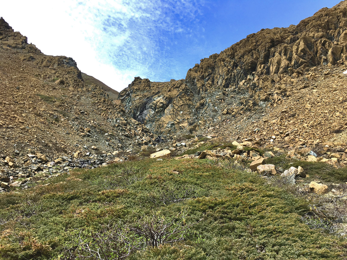
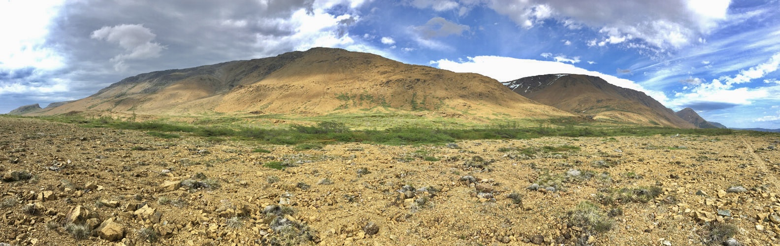
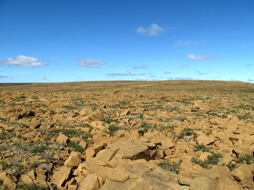
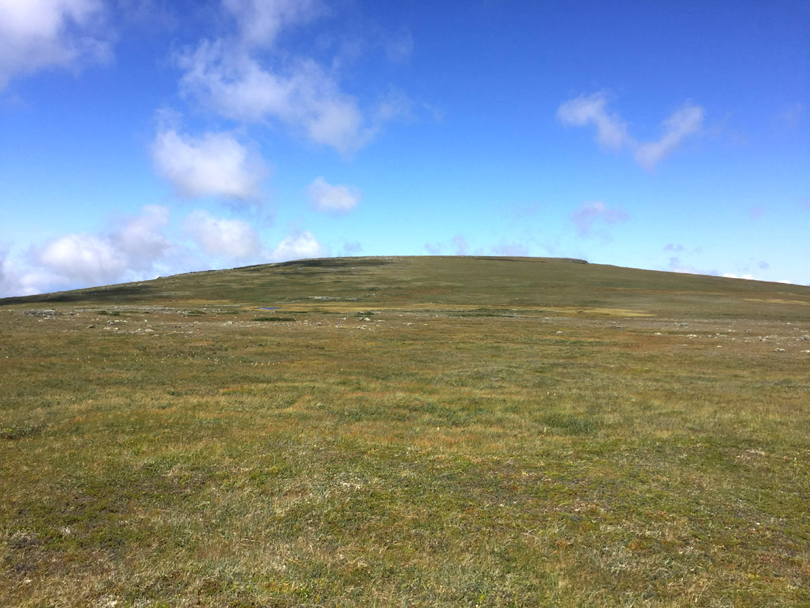
The upper valley is composed almost exclusively of peridotite, with little patches of grass and moss and the occasional wildflower taking advantage of every opportunity
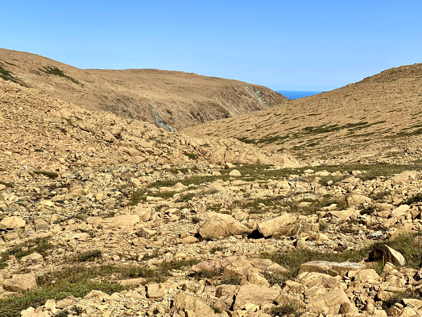
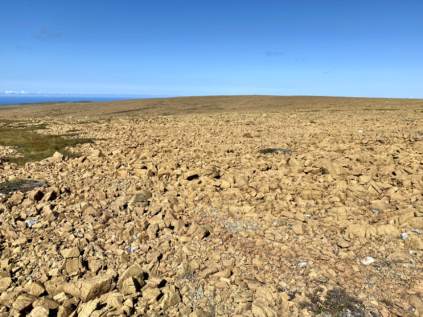
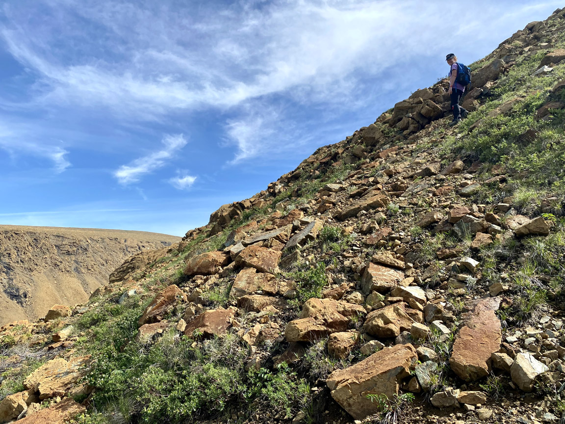
A short climb west out of the valley leads to big sky country and expansive peridotite barrens
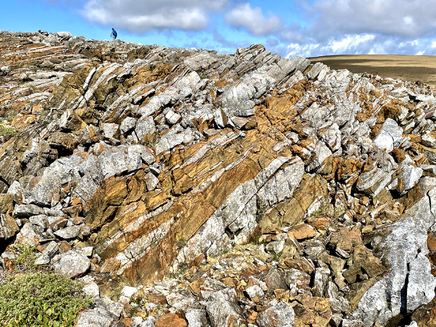
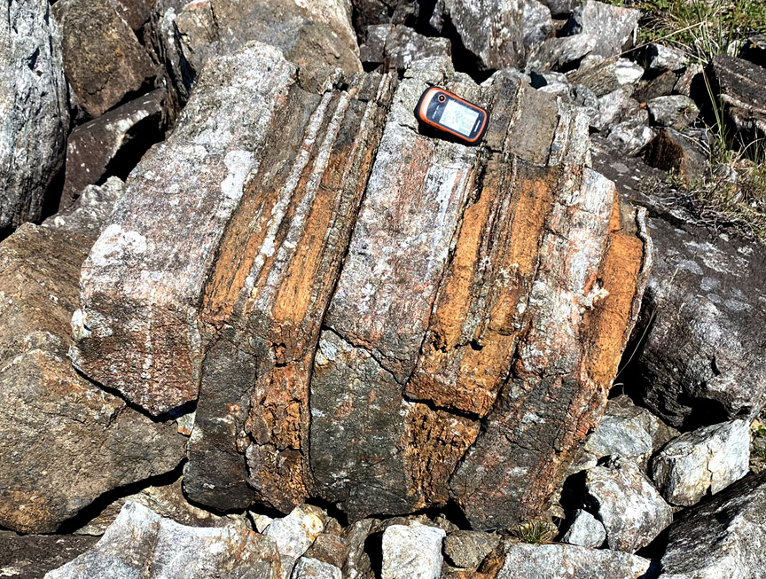
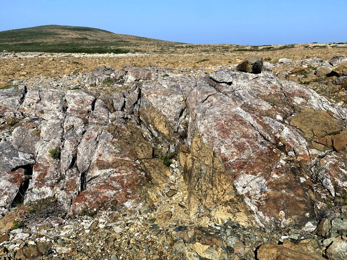
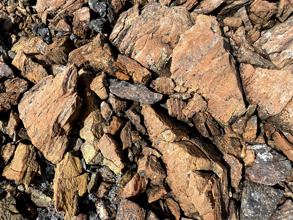
followed by a 2km gradual descent to Moho Ridge, where rust-colored periditote from the earth’s mantle collides with light-gray gabbro from the ocean floor above, in a geological pas de deux nearly 500 million years old.
The Moho, or Mohorovičić Discontinuity, is the boundary between earth’s crust and mantle and is defined by the distinct change in velocity of seismic waves as they pass through changing densities of rock. It is typically found 5 to 10 kilometres (3–6 miles) below the ocean floor, and 20 to 90 kilometres (10–60 mi) beneath continental crusts, and is identified on earth’s surface by alternating bands of peridotite and gabbro.
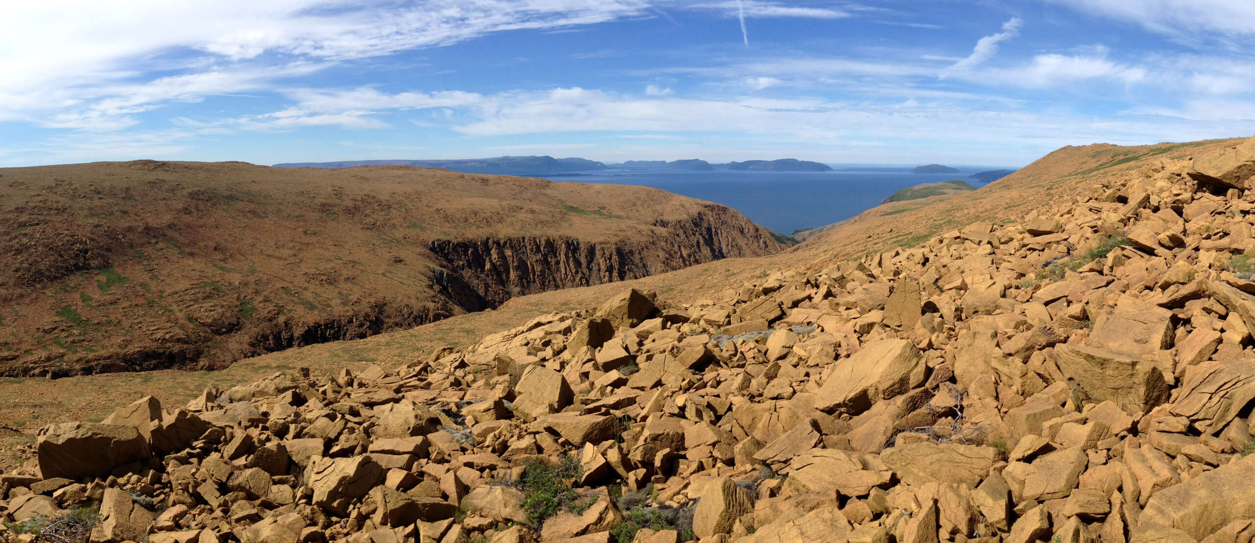
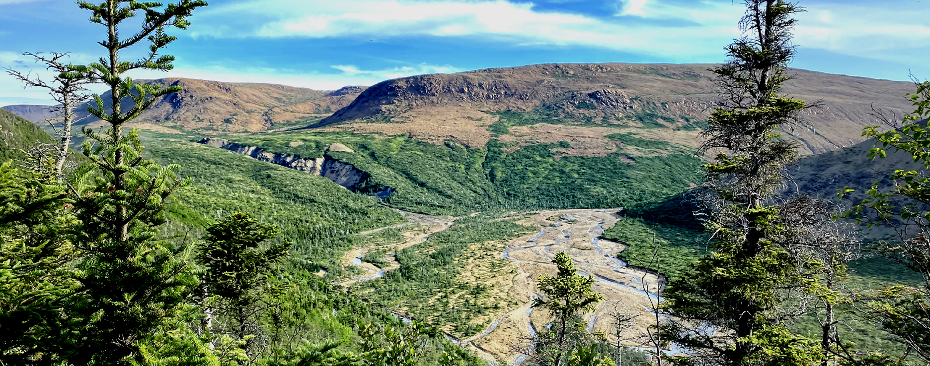
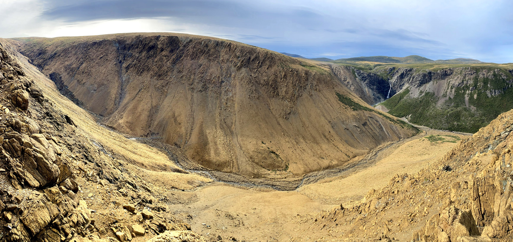
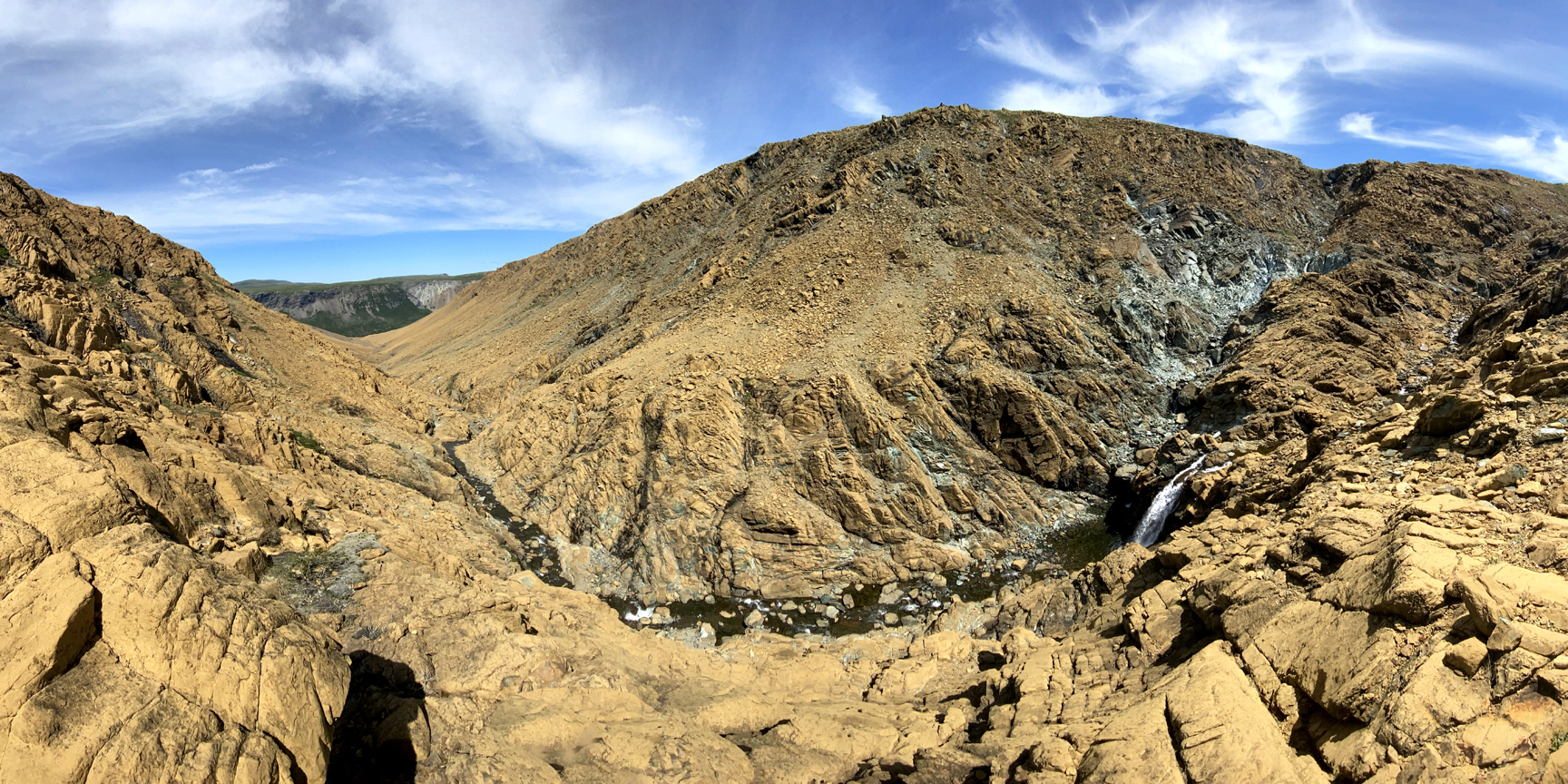
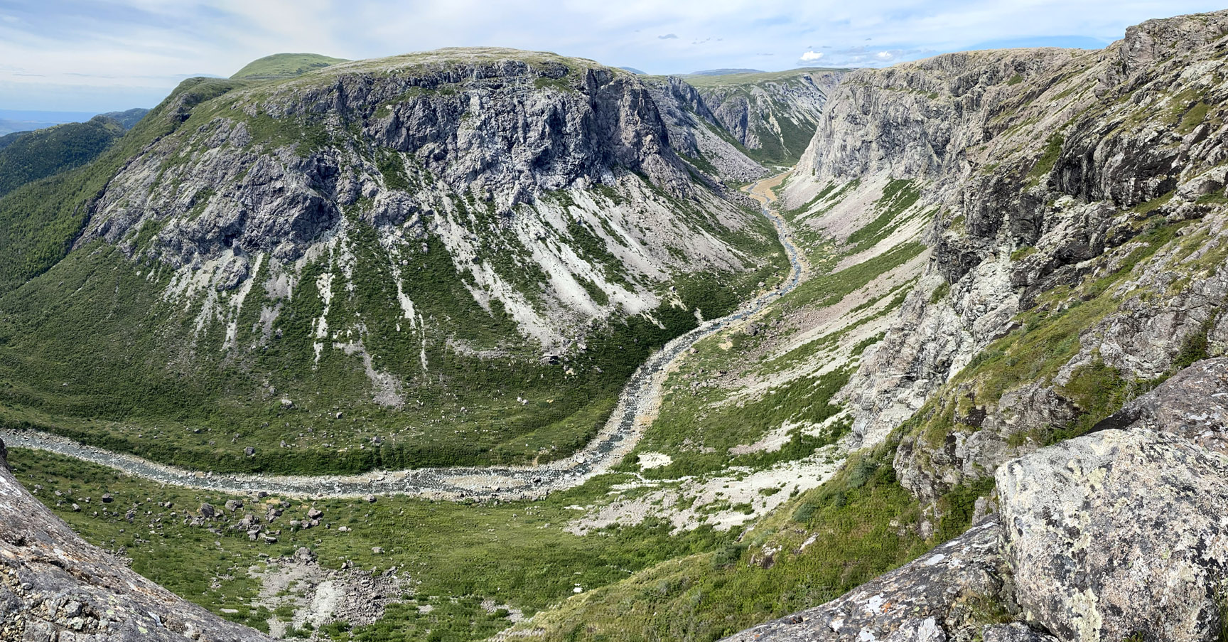
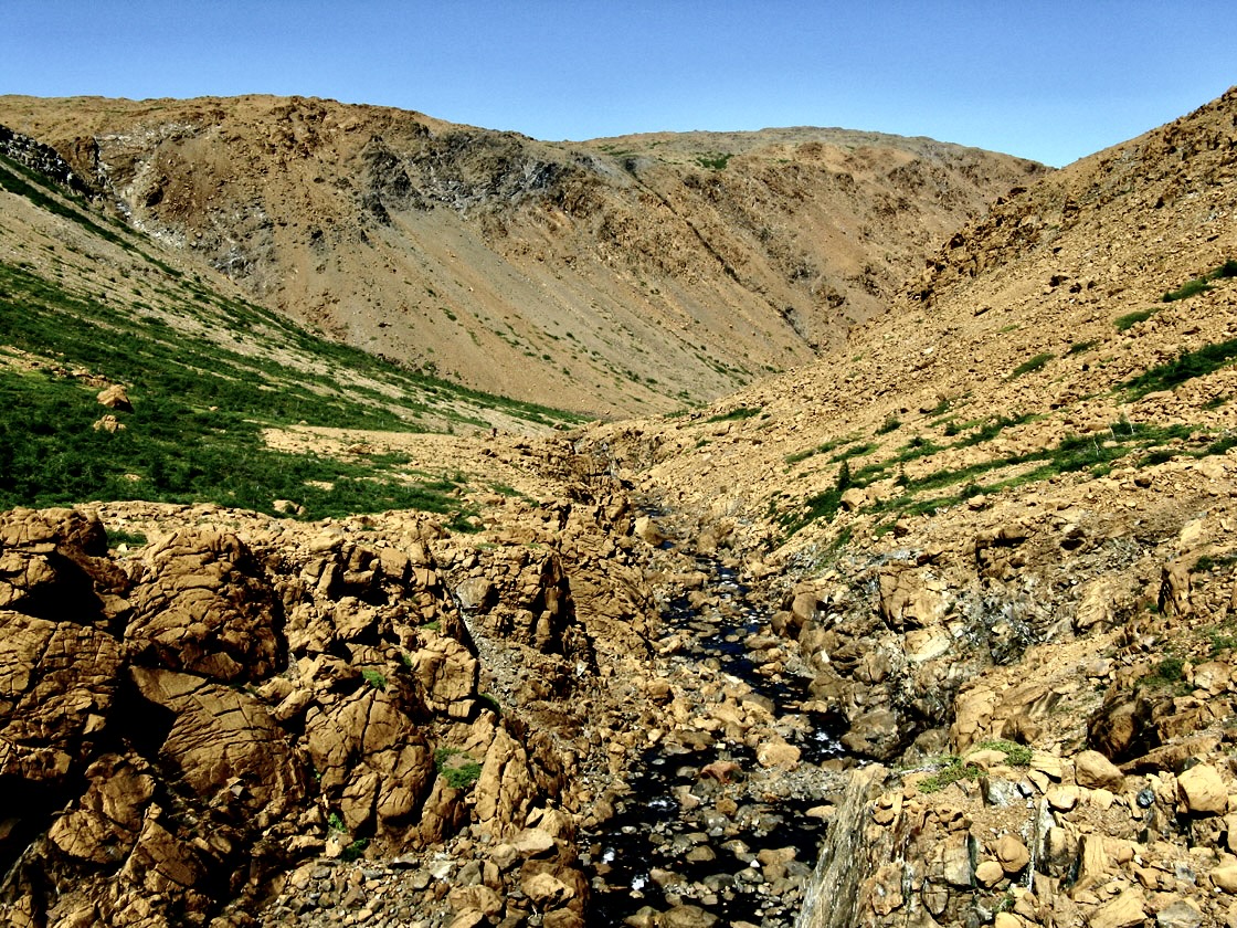
From Moho Ridge, hikers must traverse a 1km-wide valley to the back end of Fox Point Gulch.
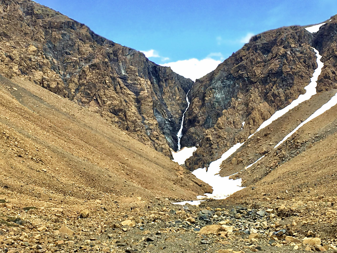
Before descending into the gulch via a gap in the canyon wall, a 1km round trip trek up a 50m-high slope provides a spectacular view south through the gulch toward Elephant Head, overlooking the narrows between Trout River inner and outer ponds.
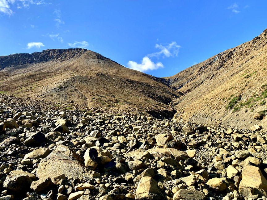
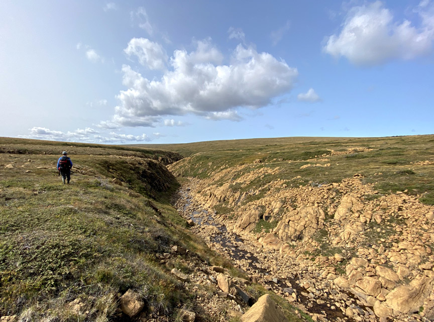
The descent to the canyon floor is down a short scree field in a narrow gully.
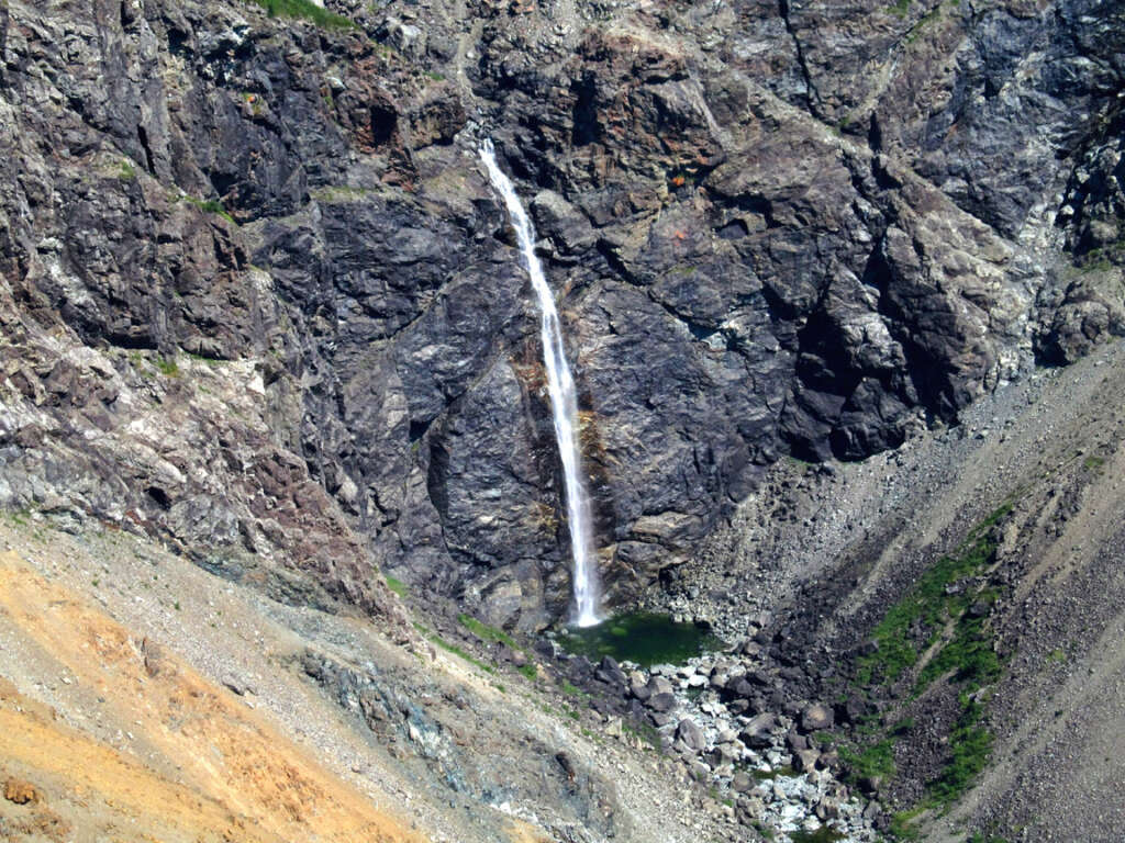
Immediately to the left is a 130m (400ft) impassable waterfalls that drains the plateau and remaining winter snow and ice that can fill the shady depressions until mid summer.
From here it’s an easy 2 km stroll out of the gulch, past a winding cascade that turns east and empties into Trout River Pond.
After crossing the shallow stream, it is now just an easy 7 km (4 mile) stroll along a park trail to the wharf at the end of the pond. Another 2 kms on gravel road will take hikers to an ideal campground within striking distance of the Elephant.
Stage Two – North Arm Hills with Ultra Extra
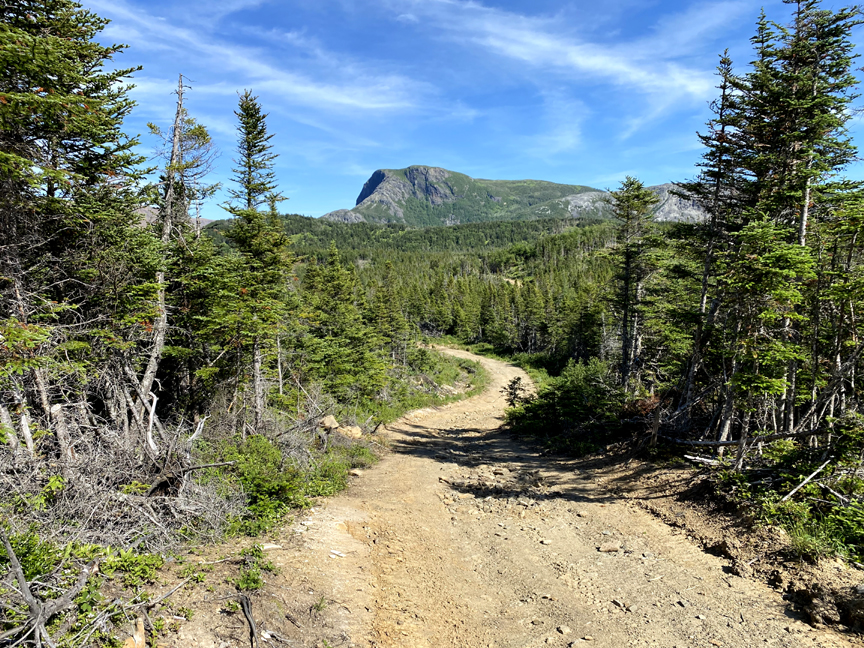
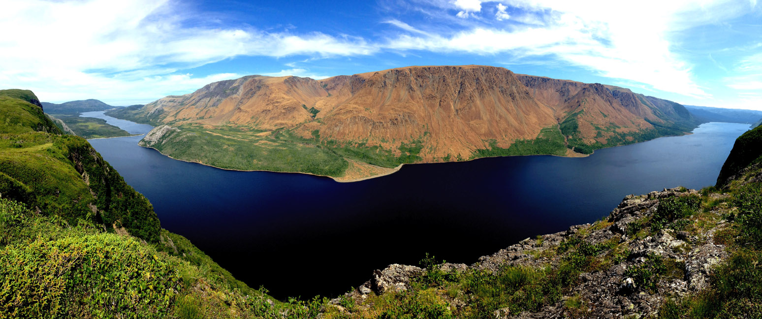
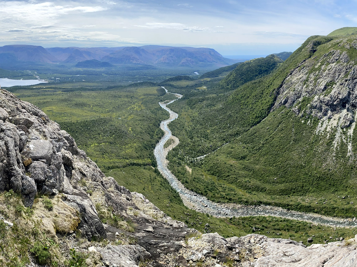
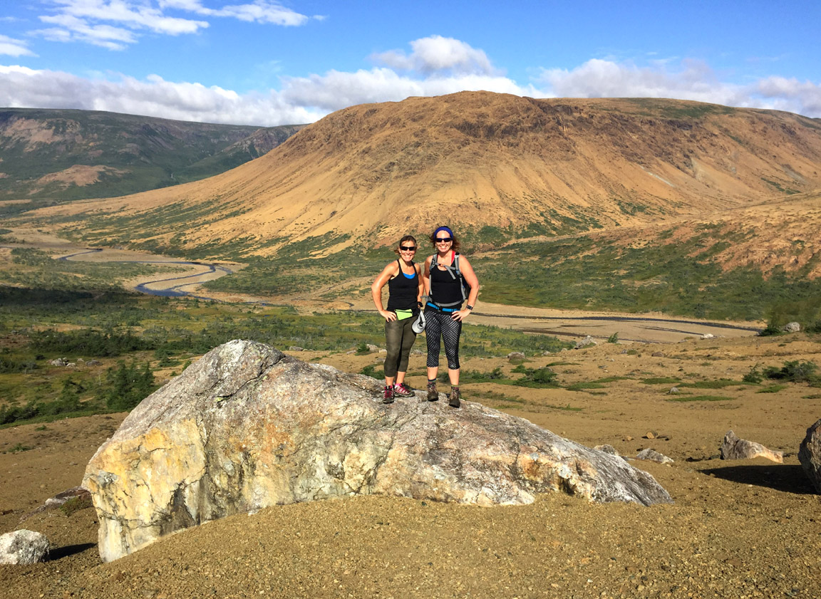
is the longest stage of the UltramaTrex at approximately 47.5 km (28.5 miles) and can be completed in 2 to 3 days, depending on month and fitness. From the start at 30 meters (98 feet) elevation near Trout River Pond campground, the route follows an ATV trail for approx 5 kilometers (3 miles) before climbing up the side of the Elephant to a height of 400 meters (1,310 feet).
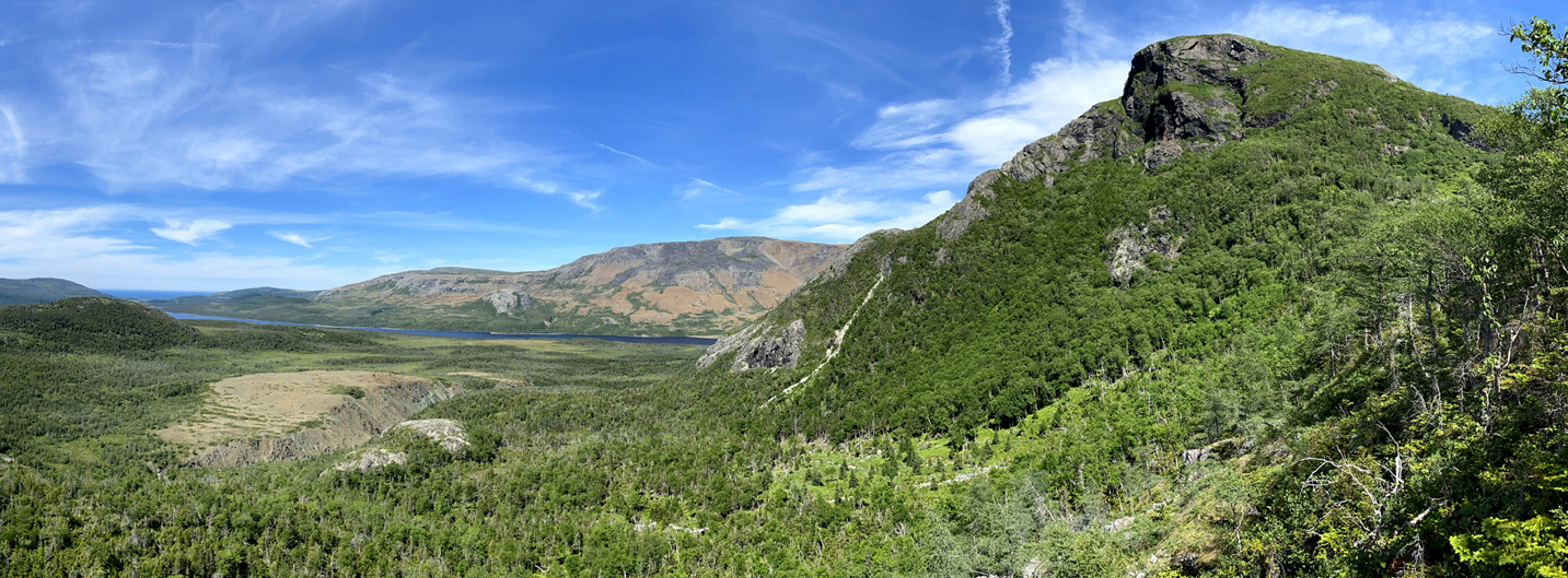
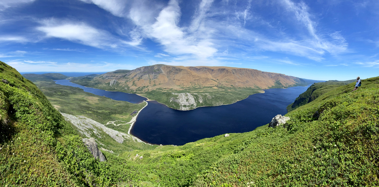
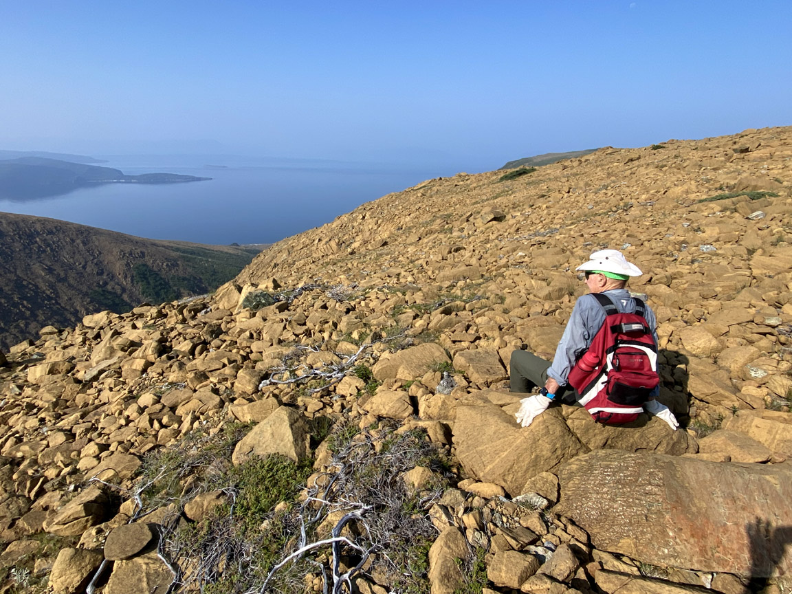
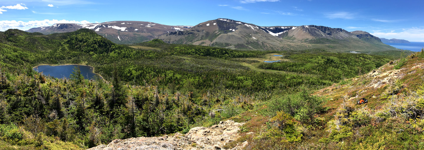
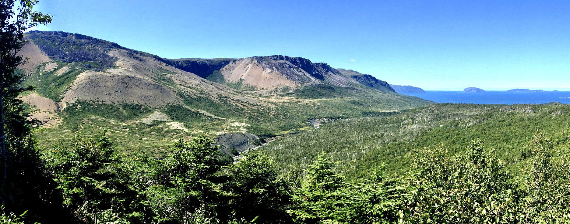
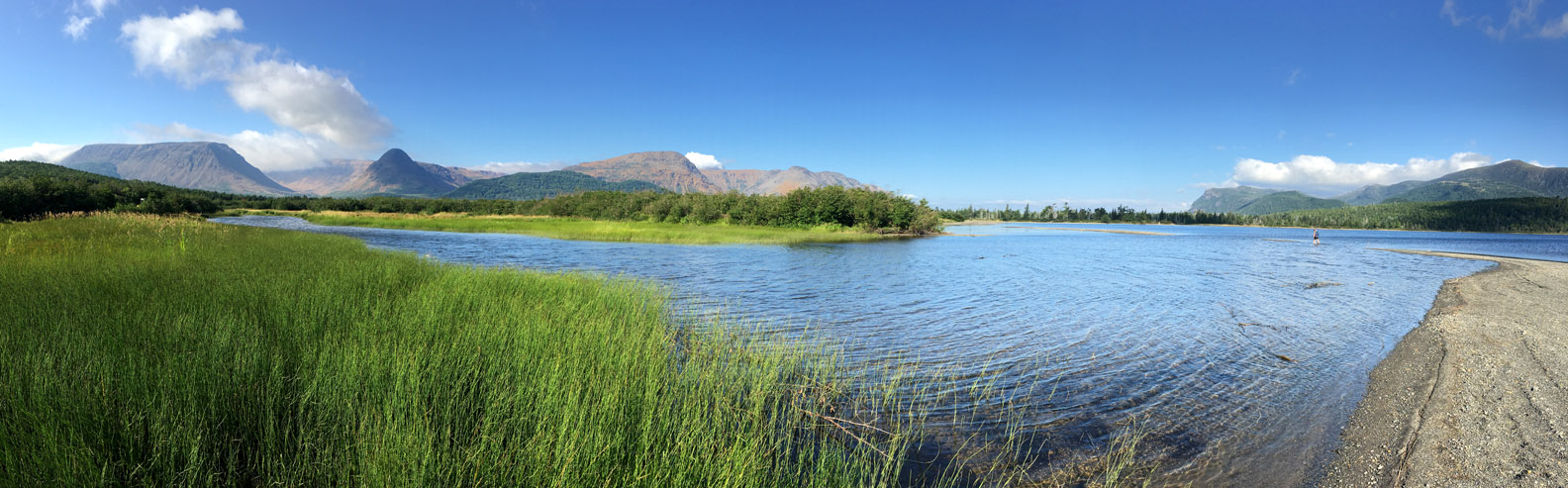
The plateau on top of the Elephant’s Head provides fantastic views of Table Mountain Massif (i.e., the Tablelands) and Trout River Pond, all the way to the town of Trout River on the gulf coast.
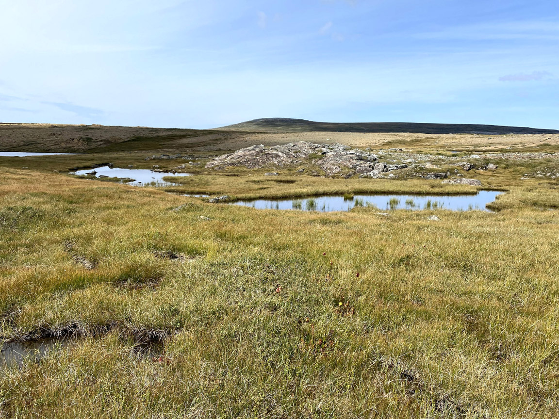
East of the Elephant Head, the trek along the south rim of Trout River fiord weaves and bobs around various small ponds and patches of tuck and scrub
while stopping here and there to take in another view of the ridges and canyons of Table Mountain.
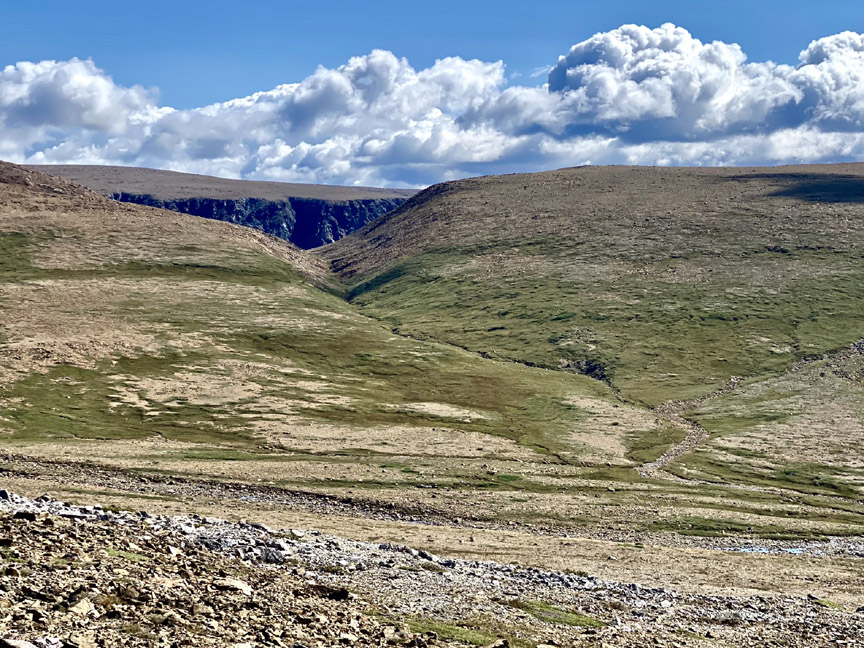
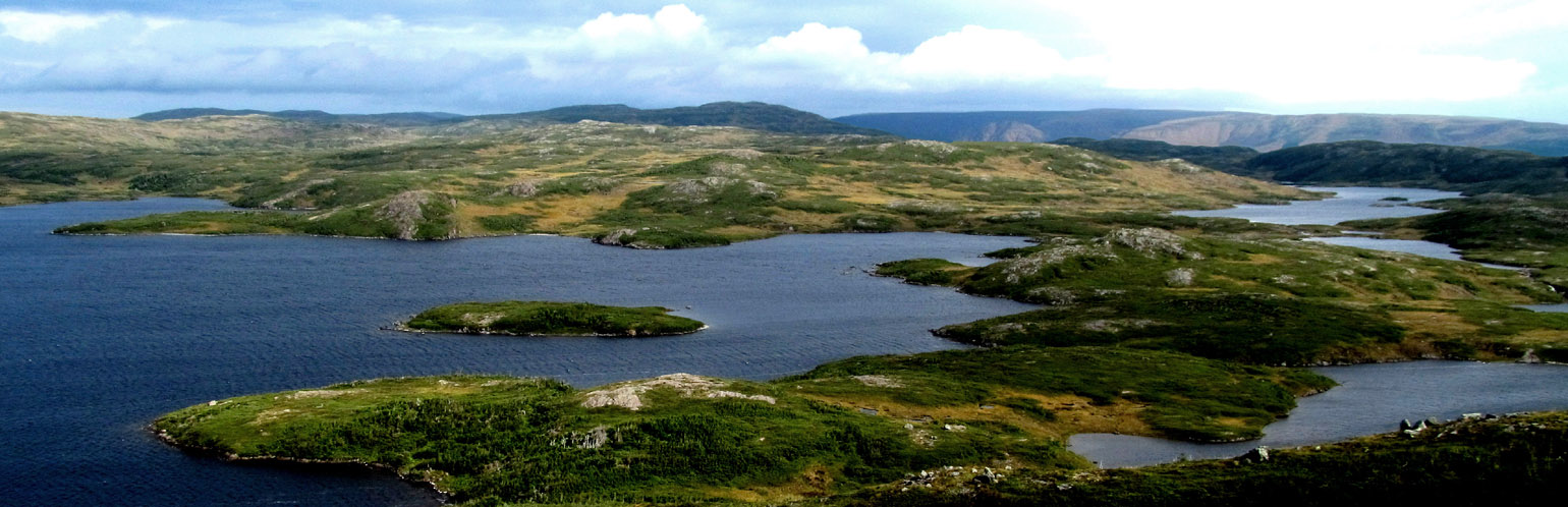
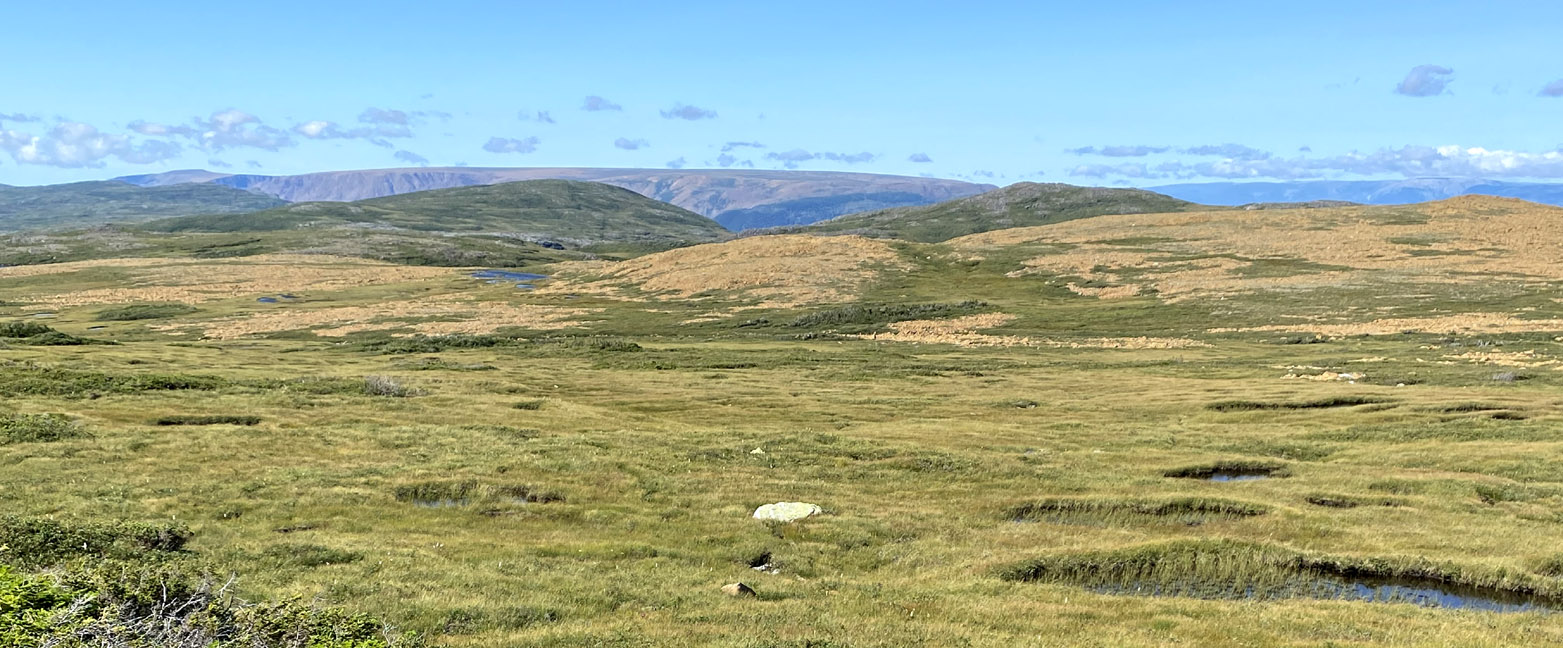
Near the end of the fiord, the route turns south and follows a series of mountaintop valleys that drain a number of large lakes, ponds and wetlands.
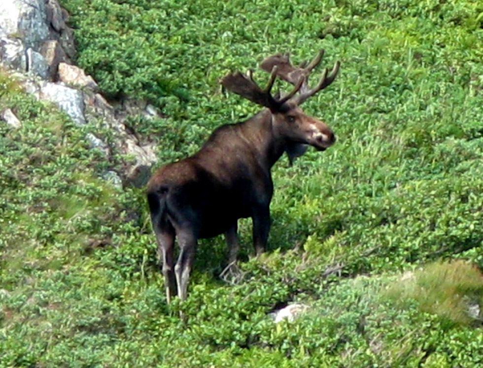
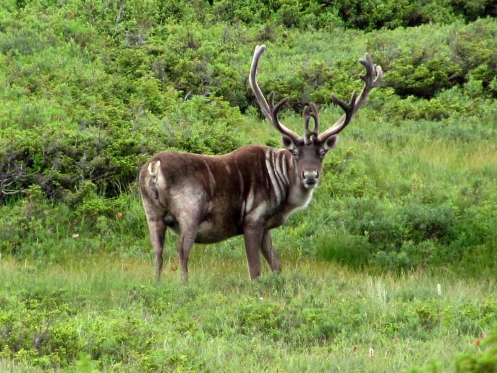
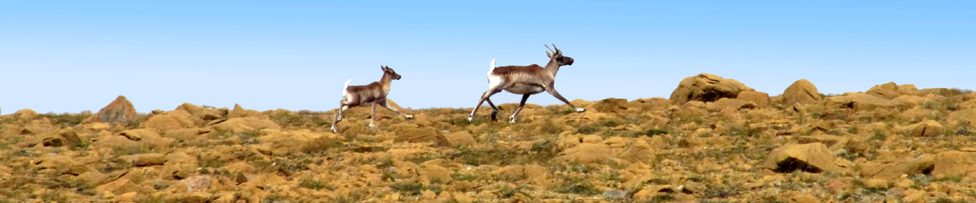
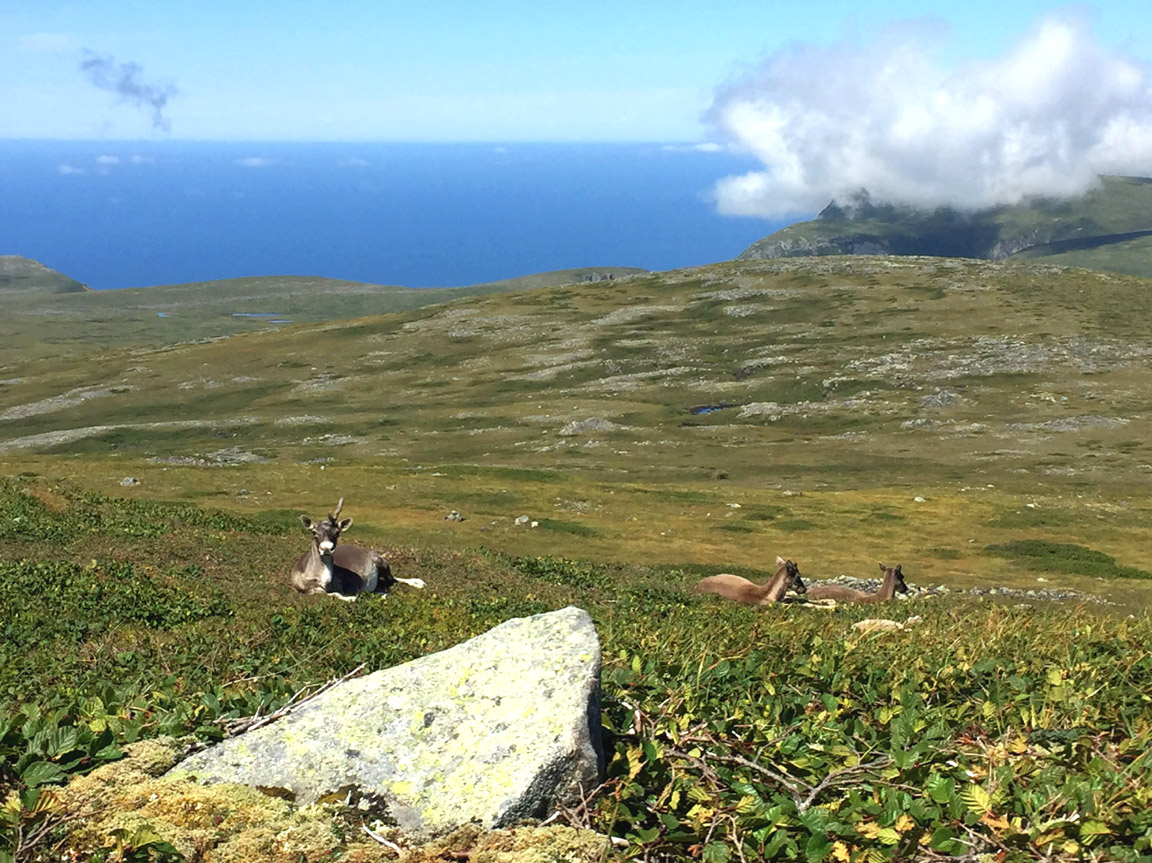
This is some of the most remote backcountry in Western Newfoundland, where it is much more likely to encounter a moose, caribou, arctic hare or black bear than a two-legged backpacker. But have no fear, like other friendly Newfoundlanders, the black bears and coywolfs here are quite harmless and more likely to run off in the opposite direction than approach with curiosity.
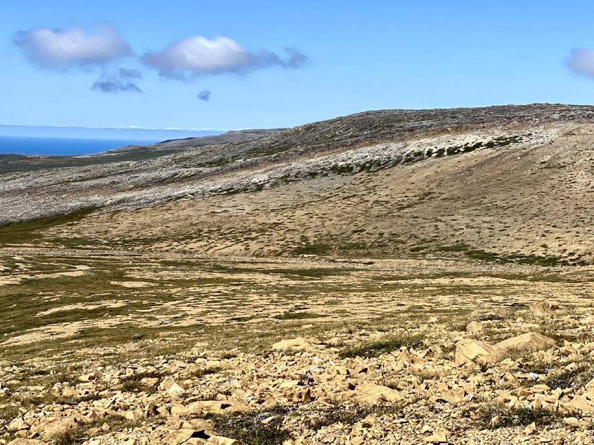
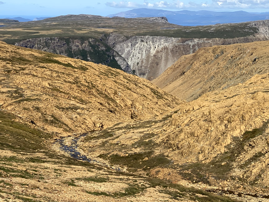
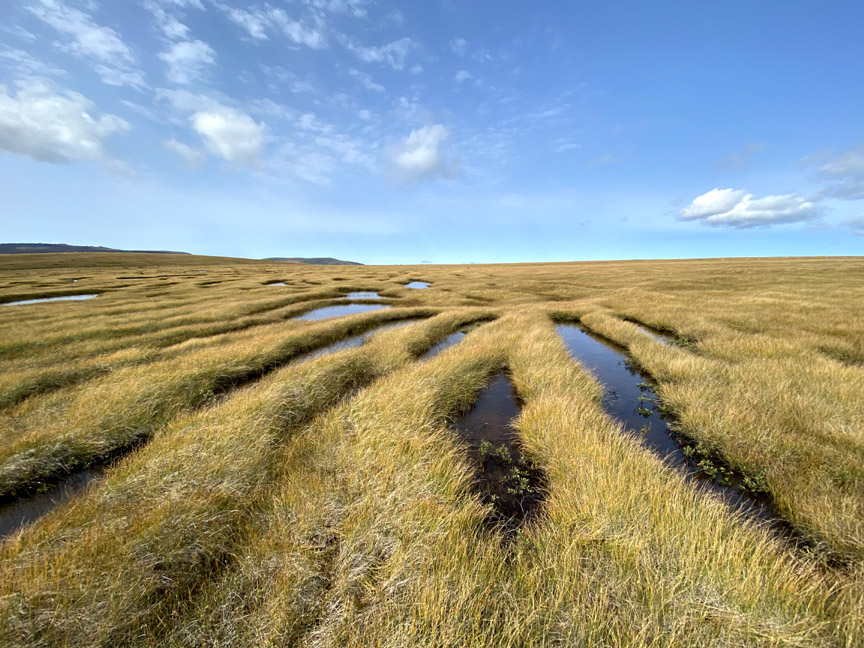
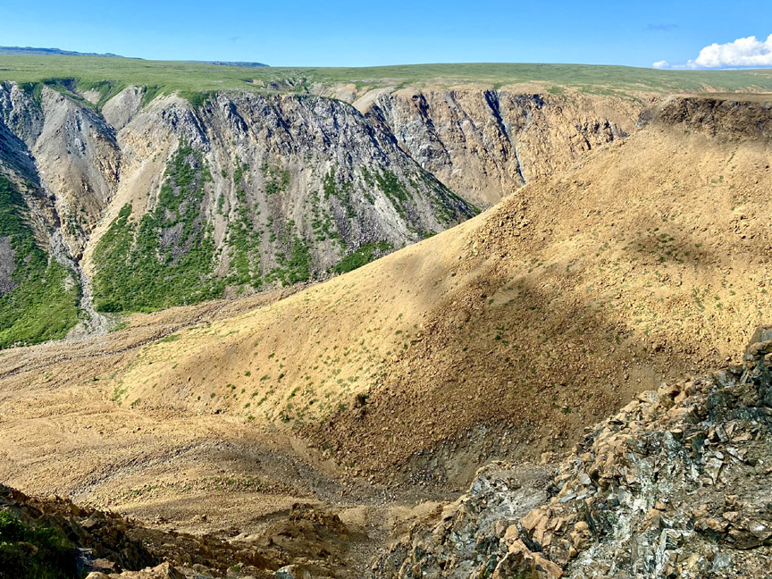
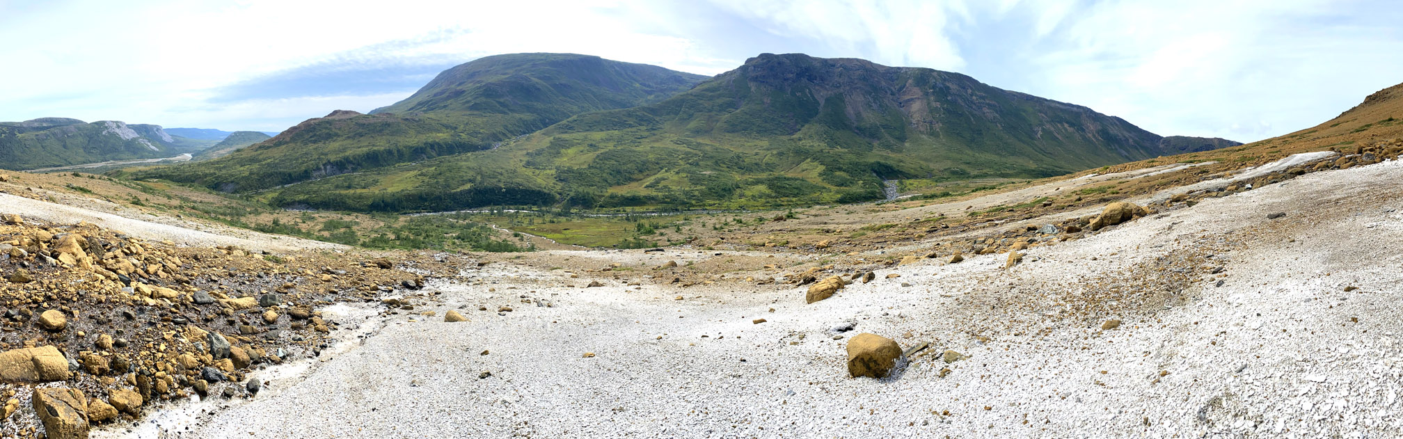
After 13 or 14 kilometers of this sub-arctic landscape, hikers once again encounter the Mars-like ultramafic mantle of the Bay of Islands Ophiolite
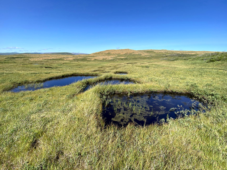
which is essentially devoid of trees and bushes but occasionally blanketed by large sections of wild grasslands perforated by small wetland ponds
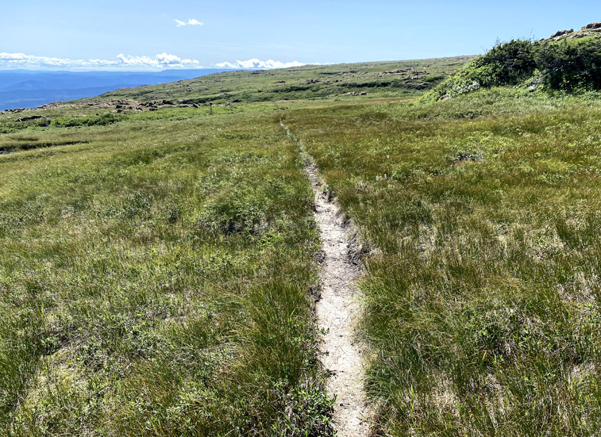
or bisected by single file caribou trails
that wind their way around or down through the many gullies and ledges along the southeastern edge of North Arm Massif.
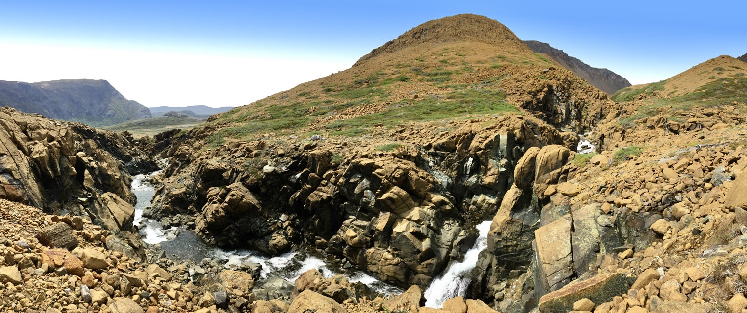
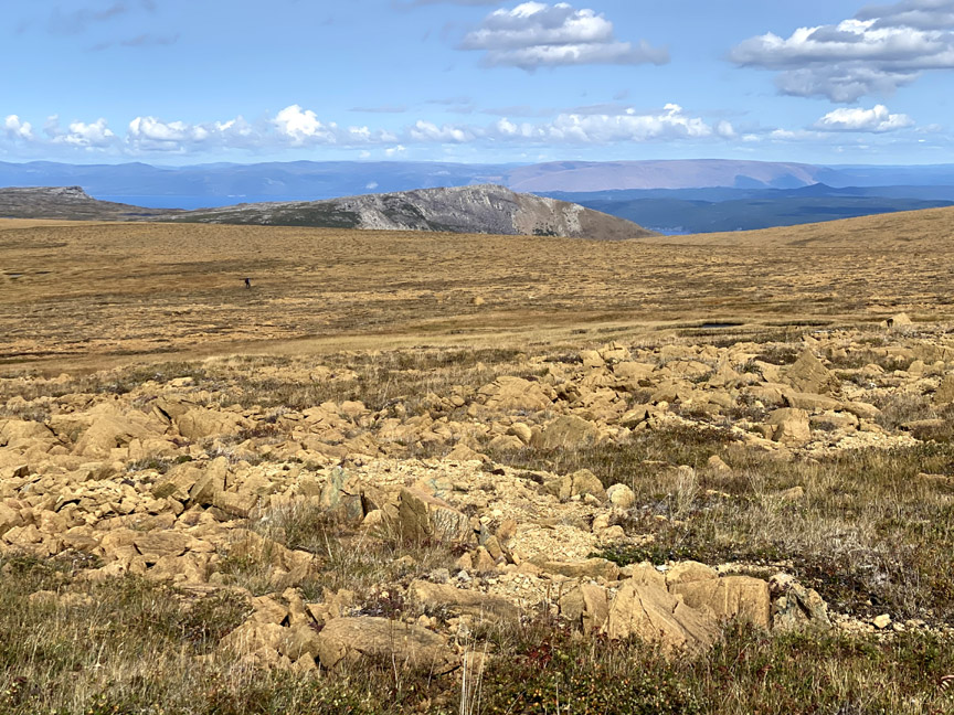
Before long hikers will traverse a rocky peridotite plateau that rises to 650 meters (2,130 feet)
after which the North Arm Ultra Extra veers off to the right in a northwest direction toward the back end of Rocky Brook (aka Stowbridges) Gulch, where it crosses the headwaters brook and continues west on the north side of the gulch.
The height of land on the north side of the gulch rises to 650 meters (2,133 feet), before it descends to a 1 kilometer square plateau at 340-50 meters above sea level.
This 3 km stretch provides a nice view into Rocky Brook Gulch, with the outer Bay of Islands in the background.
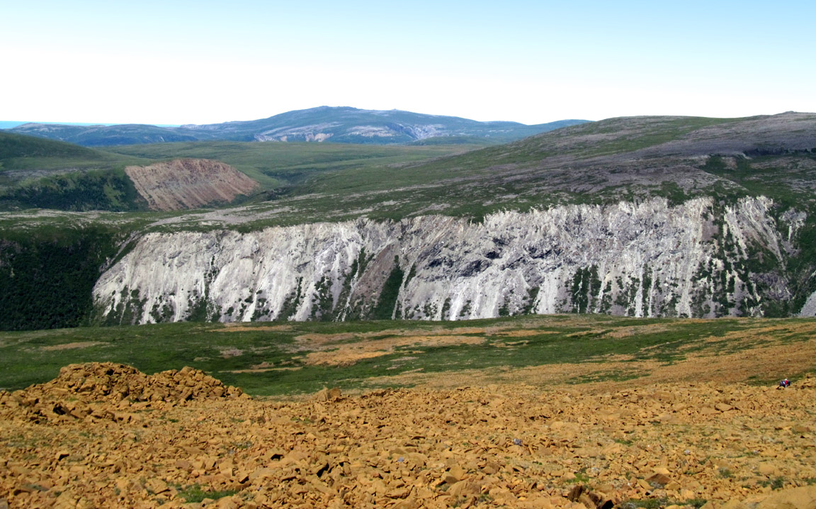
To the northwest, hikers can see the gabbro cliffs above Liverpool Brook Gulch, which was formerly oceanic crust on the bottom of the Iapetus Ocean.
Soon the route crosses the boundary between Earth’s upper mantle and oceanic crust which is marked on the surface by a small outcrop of the Mohorovičić Discontinuity (aka Moho) where peridotite comes into contact with gabbro, often in layer cake-like formations.
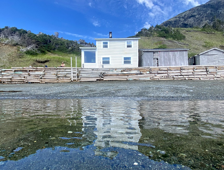
From here it’s a 1.5 km downhill trek to the IATNL Basecamp in Stowbridges Cove.
Along the way hikers have an opportunity to view large outcrops of serpentinite (metamorphic igneous rock derived from peridotite) overlooking Rocky Brook Gulch.
Those interested in spending a night or two at the Basecamp must contact us in advance to make arrangements.
From the basecamp in North Arm, it is necessary to take a boat ride – dory or zodiac – across the Bay of Islands to Frenchman’s Cove or Benoit’s Cove in Humber Arm, or to Cox’s Cove in Middle Arm, then take ground transportation to the intersection of Salt Water Route and Route 450 above Frenchman’s Cove where Stage 3 of the Ultra Extras begins.
Stage Three – Blow Me Down Mountains with Ultra Extra
is 26.5 km (16 miles) in length and starts at the intersection of Salt Water Road with Route 450 above Frenchman’s Cove on the south side of the Bay of islands. From there, the route follows Hummock Trail until it intersects with the FC Ultra Extra at the side of the Hummock.
If time permits, it’s worthwhile to continue along the Hummock Trail to the top (in approximately 10 minutes), which provides good views of the Blow Me Down Mountains and the trail route ahead.
Shortly after proceeding on the FC Ultra Extra, hikers must cross a generally not-so-wet 400m long wetland
before making a sharp turn left (i.e., south) and continuing along a 800m long forest trail to a mini hummock which also provides good views of the Blow Me Down Mountains and outer Bay of Islands.
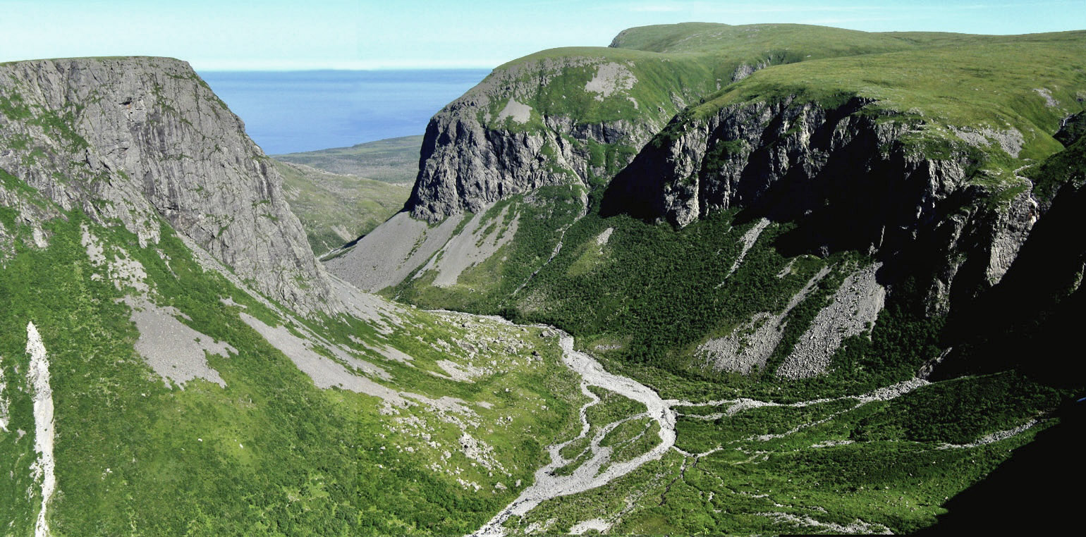
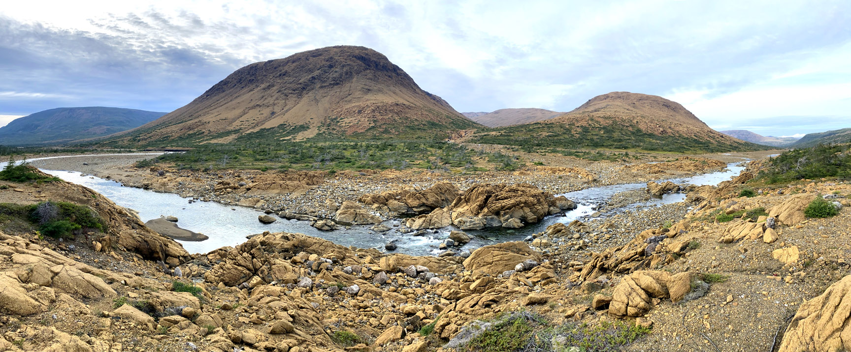
To the south is a bird’s eye view of the braided bend in Blow Me Down Brook, where the cut trail descends and ends on the river bank.
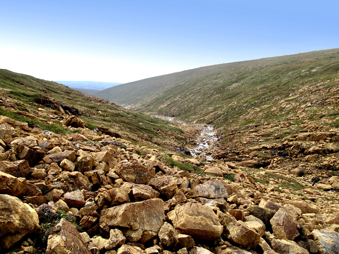
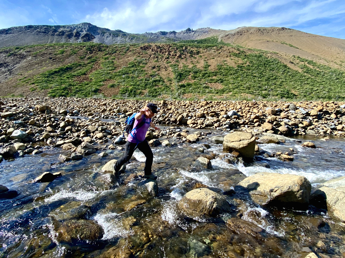
From there hikers must cross the ankle-to-knee-deep fast-moving stream
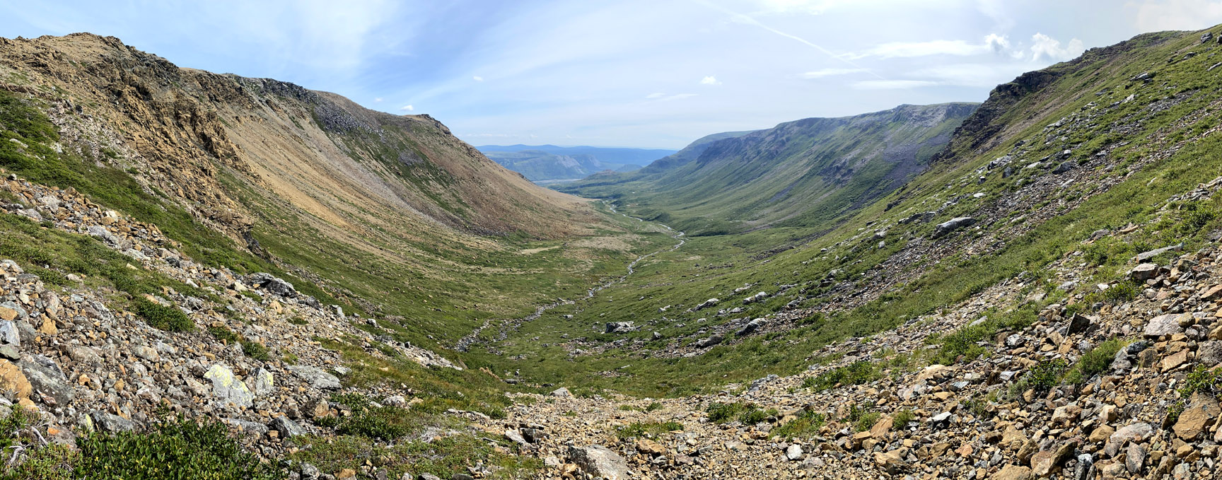
then proceed into the 4 km long peridotite-walled canyon
topped on the north side with a crown of oceanic crust, where light-gray gabbro comes into contact with rust-colored peridotite to form outcrops of Moho.
Here and there on the canyon floor are good places to camp for the night
while at the end of the canyon’s west branch is a 60m (200ft) high waterfalls with a large pool suitable for swimming on a hot summer day.
Just before the western branch, the much larger south branch turns off to the left. Though it looks enticing, the upper end of this 2km long canyon isn’t passable
which leaves the relatively steep slope between the two branches as the only feasible exit out of (or entrance into) the western end of Blow Me Down Brook Gulch.
In spite of the steep ascent, this route provide excellent views of Blow Me Brook Gulch and Falls.
Once on top of the slope, hikers must turn left (south) and walk along the rim of South Branch
which transitions into a rugged peridotite gorge with serpentinite exposures above cascading waterfalls.
After 2 kms and a last look at Blow Me Down Brook Gulch
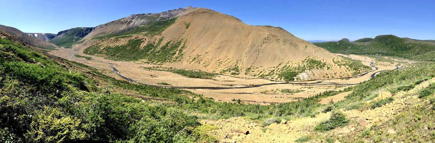
the route turns southwest to cross the broad, rocky meadow at top center of Blow Me Down Massif.
Before descending into the Simms Gulch watershed, the route passes a small, easily navigatable wetland
then follows the headwaters stream of Simms Gulch’s north branch
passing Three Sisters Waterfall
before descending into and out of Simms Gulch on a “stone glacier” of primarily ultramafic peridotite rocks that either tumbled down the steep eastern cliff wall or were washed down one of two upper tributaries that normally flow underground.
Like the northern slope of Blow Me Down Gulch, the western cliff wall of Simms Gulch is composed of a distinct light grey gabbro, part of the ocean floor of the ancient Iapetus Ocean.
It extends all the way to the entrance to the gulch where it crosses the streambed and spans both sides of the canyon, which is approximately 300 meters (984 feet) at its narrowest and 600 meters (1,970 feet) at its widest, and rises from a height of 200 meters (655 feet) on the canyon floor to 600 meters (1,970 feet) on both flanks.
Leaving the gulch, hikers follow along the edge of Simms Brook before descending a trail through a coniferous forest to the shore of Serpentine Lake.
Along the way a short detour can be made back to Simms Brook for a series of waterfalls that are a great place to cool off.
Once at the lake, hikers are reminded to cross to the other side by walking on a sandbar on the western end of the lake, not by crossing the deeper river a short distance away. This crossing is not recommended on foot before July, as winter snowmelt may raise the lake level to waist deep or higher. (Summer levels are normally between knee and thigh.) Once on the other side, the beach near the logging road is a great place to camp for the night.
An alternative UltramaTrex route across the Blow Me Down Mountains is the equally spectacular IATNL Blow Me Down East Traverse. (See above map)
Stage Four – Lewis Hills
is 40 km (24 miles) and begins with a 2.5 kilometer (1.5 mile) walk on a gravel backcountry road to the trailhead of the IATNL Lewis Hills Trail. After a shallow stream crossing and 2 kilometer (1.25 mile) trek up a forested trail to the base of the mountains, hikers are afforded a terrific view of the route from Simms Gulch
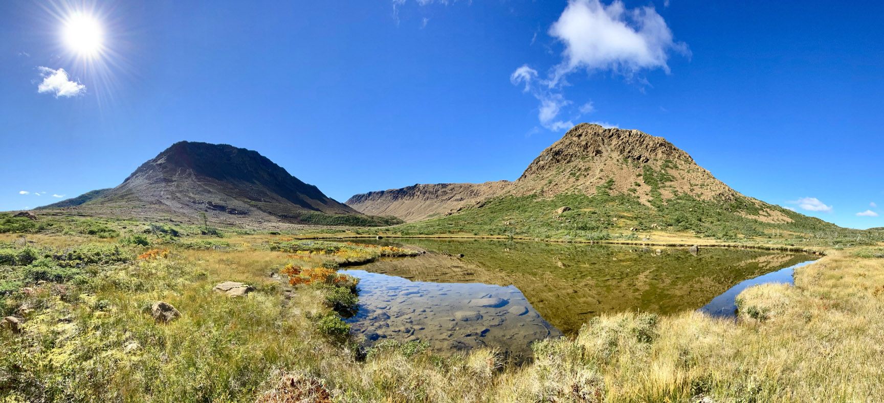
before navigating around boulders and across stream to a small pond at the entrance to Wheelers Gulch.
From there it’s a 1 km walk to the entrance to Red Rocky Gulch and another Mars-like peridotite landscape from Earth’s upper mantle.
It’s a 5 kilometer (3 mile) trek up through the gulch, which begins by walking on small rocks along the side of the brook and ends by weaving around large boulders on the west bank of the upper gulch, which rises to an elevation of 620 meters (2,035 feet).
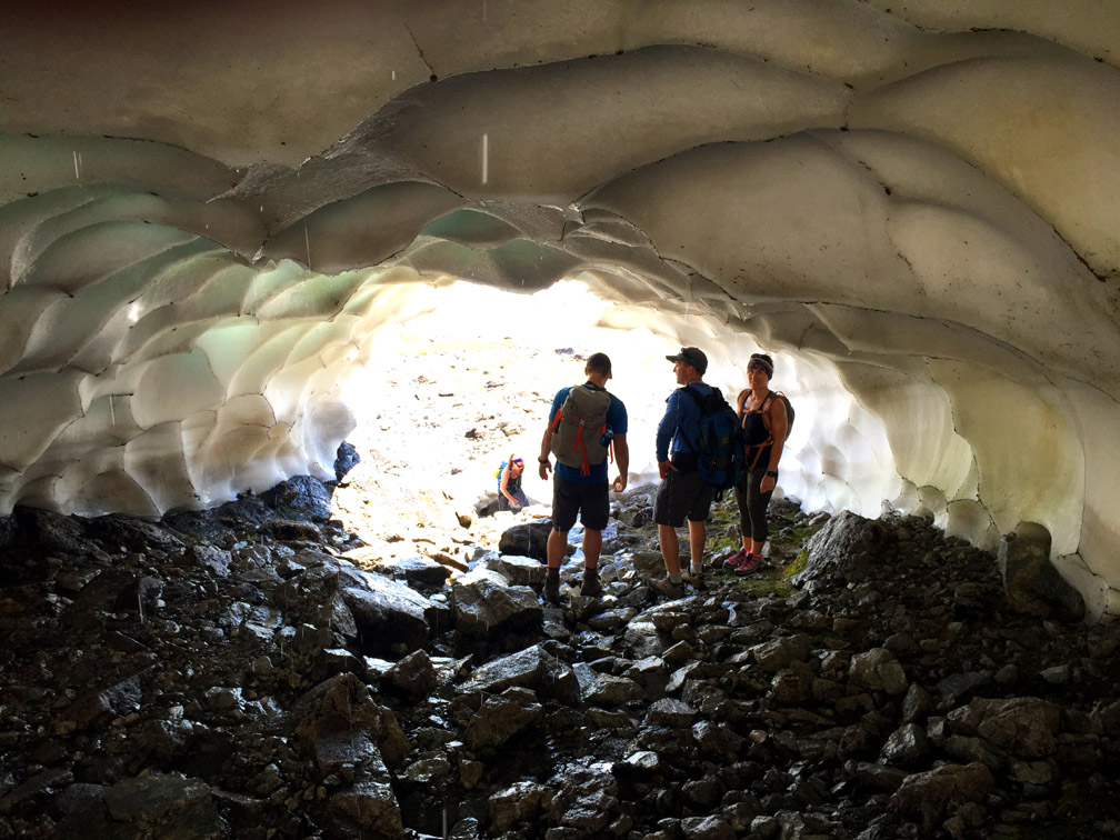
Once in the high country above 500 meters (1,640 ft), it is quite possible to cross snow fields in summer and discover an ice cave with cool shade on a hot day.
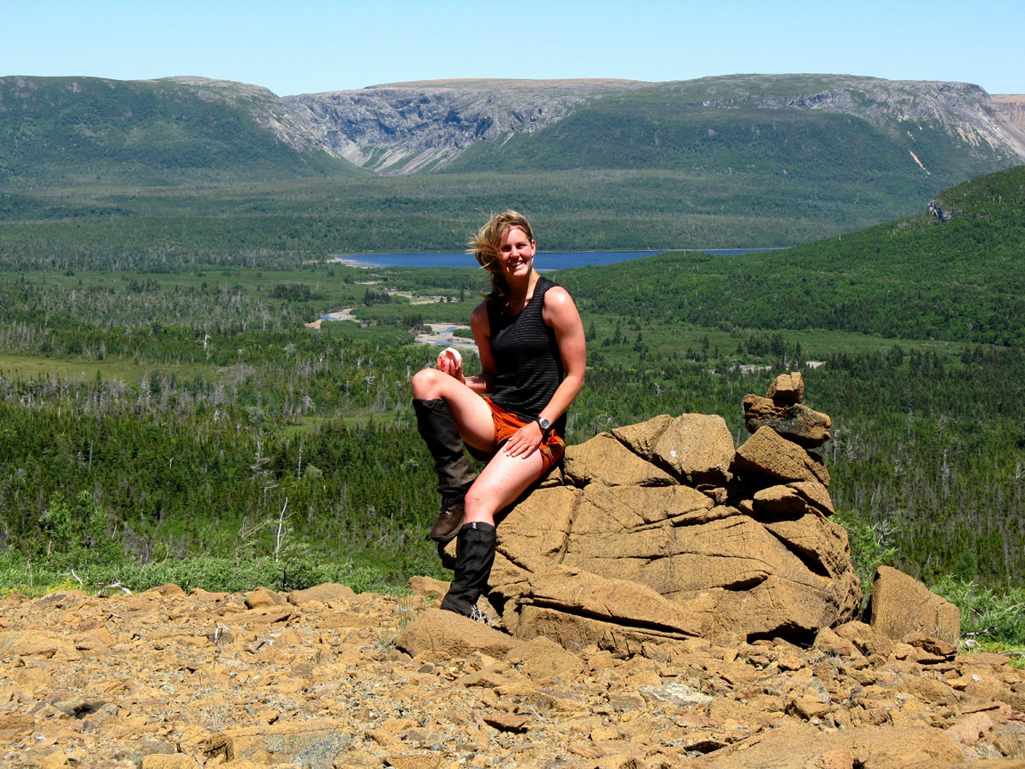
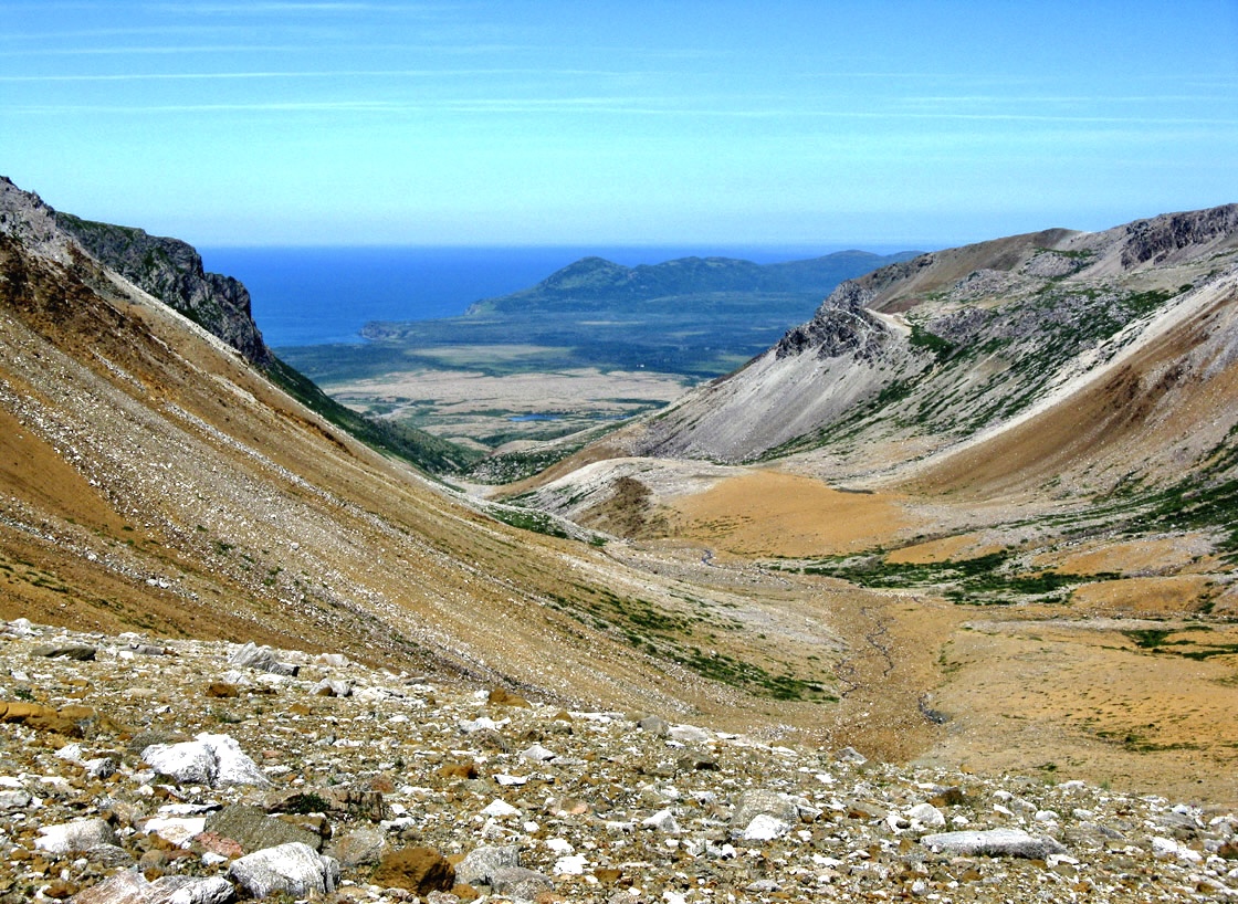
Just 3 kilometers (2 miles) from the top of Red Rocky Gulch is the back end of Rope Cove Canyon, which affords a magnificent view of a multi-colored valley composed of peridotite on the southern end and mafic gneiss and amphibolite of the Mount Barren Complex on the northern end, with the Gulf of St Lawrence in the background. This is a good place to camp for the night, with a small stream to cook and wash.
Day Two of this stage is a 19 kilometer (12 mile) trek that begins with sweeping vistas of the headwaters of Fox Island River and a perpendicular tributary flowing from Cabox
which at 814 meters (2,670 feet) is the highest point on the island of Newfoundland. Lucky hikers may encounter a family of caribou resting there in the midday sun.
An alternate route to the Cabox from Rope Cove Canyon is via Molly Ann Gulch along the IATNL Lewis Hills Trail, just a short distance away but in the substantially different Mount Barren geological formation
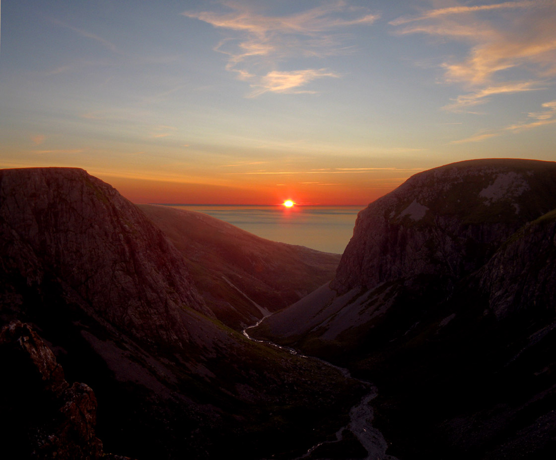
where like Rope Cove Canyon, campers may be fortunate enough to watch the sun set into the Gulf of St Lawrence.
No matter what route you take to the summit, it’s all downhill from there! … first across a broad gentle slope and patchwork of grassland, wetland and gabbro outcrops
then down the Travertine Canyon
the back of which crosses a colorful and little understood Moho-like zone between Earth’s upper mantle and the Mount Barren Complex with its reddish tinted igneous rocks.
The walk along the east rim of the canyon provides terrific panoramic views
as well as an easy walk and gentle descent off the Lewis Hills.
Once off the hills, it’s just a short 750m walk into the gulch to visit the travertine seepages from which the canyon takes its name.
From the entrance to the canyon, it’s just a 2.5 km walk up and across the generally calf-to-knee-deep Fox Island River to connect to the main UltramaTrex route and Lewis Hills Trail
which climbs a 160 meter (525 feet) moderate slope with good views of the mountains and river
before weaving 2 km through a relatively dry wetland and forest trail to the southern trailhead.
Be sure to pre-arrange transportation from this point, which is a 1 – 1.5 hour drive over gravel backcountry road (in ATV, SUV or pickup truck) from Stephenville.