
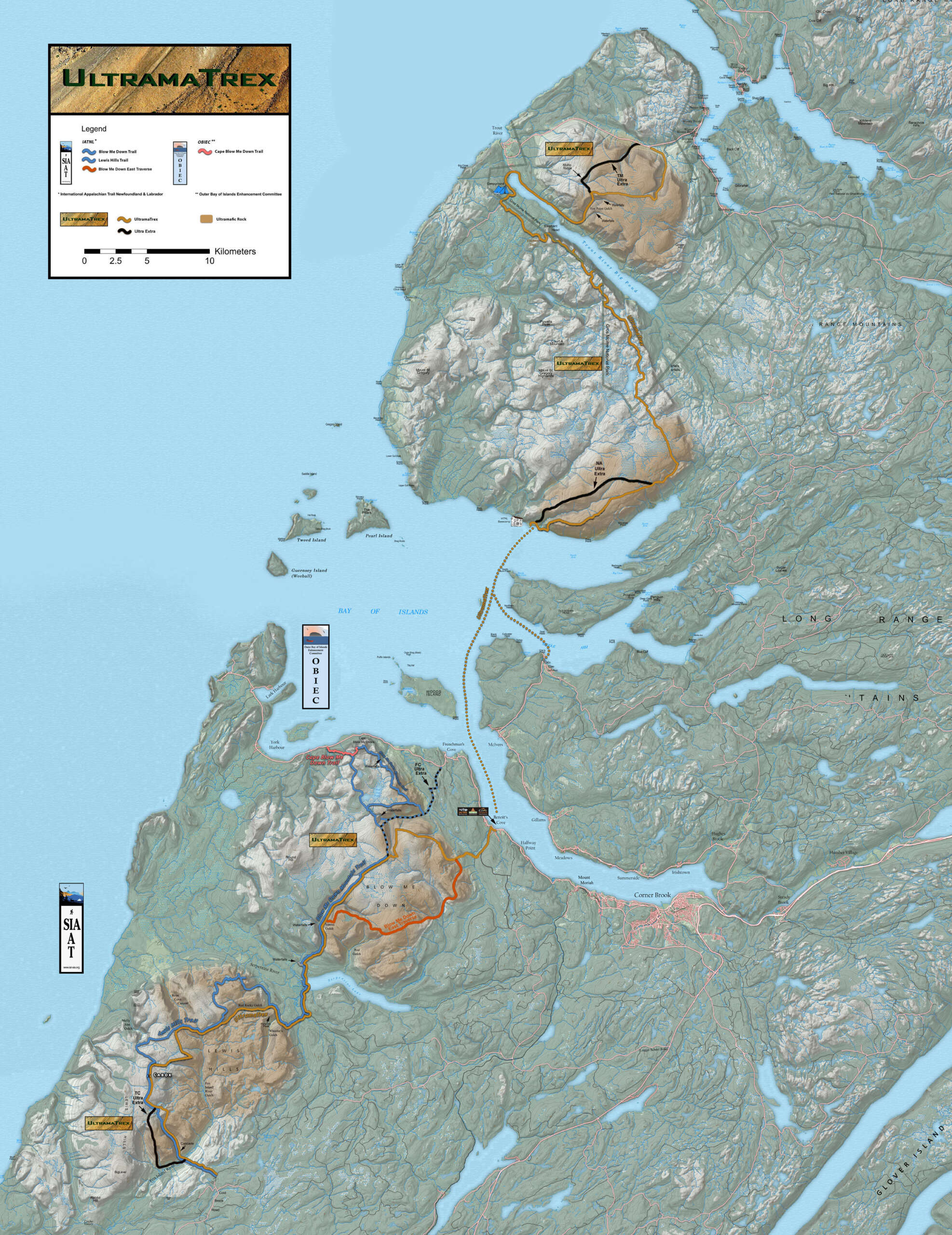
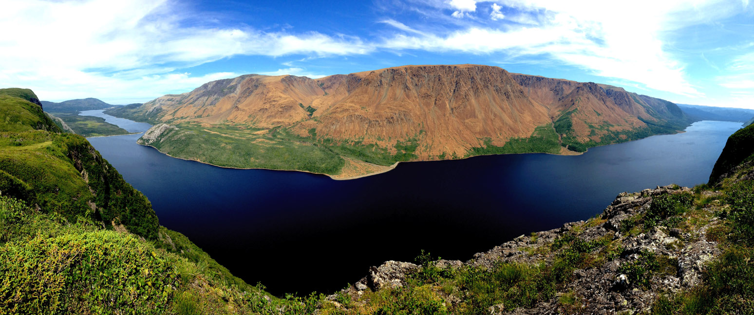


The IATNL UltramaTrex is the trail route spine of Cabox Geopark which traverses the rust-colored “ultramafic” sections of the four Bay of Islands Ophiolite Massifs. These ancient sections of Earth’s upper mantle composed primarily of peridotite were forced over the eastern edge of Laurentia (Proto-North America) during the closing of the Iapetus Ocean (pre-cursor of the Atlantic Ocean) approximately 400-500 million years ago.
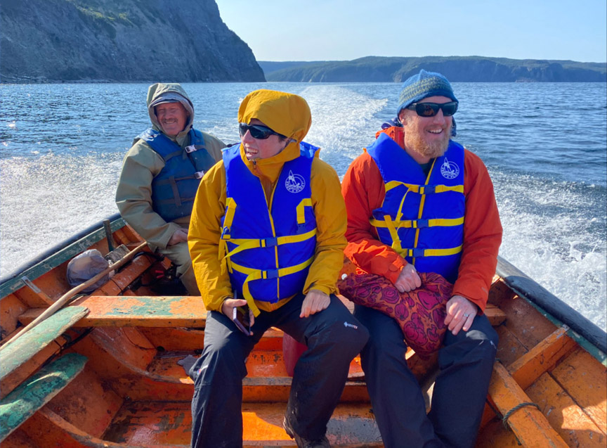
This north-south route extends from Winter House Brook Gulch above Woody Point in Gros Morne National Park to Cold Brook Road above Fox Island River east of Lewis Hills. Between the two northern massifs (Tablelands and North Arm Hills) and two southern massifs (Blow Me Down Mountains and Lewis Hills) is the Bay of Islands, which must be crossed by boat between Stowbridges (aka Stone Brook) and Benoit’s Cove, or between Stowbridges and Cox’s Cove, then by ground transportation to Benoit’s Cove.
In addition to the primary UltramaTrex route, there are also 4 secondary routes named Ultra Extra (one each on Tablelands, North Arm Hills, Blow Me Down Mountains and Lewis Hills) which provide alternatives for those with special interests, such as Mohorovičić discontinuity (aka Moho), or those who would like to make the trek again across different land and viewscapes. Collectively these routes form the Ultra Extras.
The UltramaTrex is approximately 140.5 kilometers (84 miles) in length and is divided into four stages, one for each of the four ophiolite massifs. The stages can be completed individually, in pairs (northern and southern), or together as a single trek. In total, the UltramaTrex requires 6 – 8 days to complete.
Stage One – Tablelands
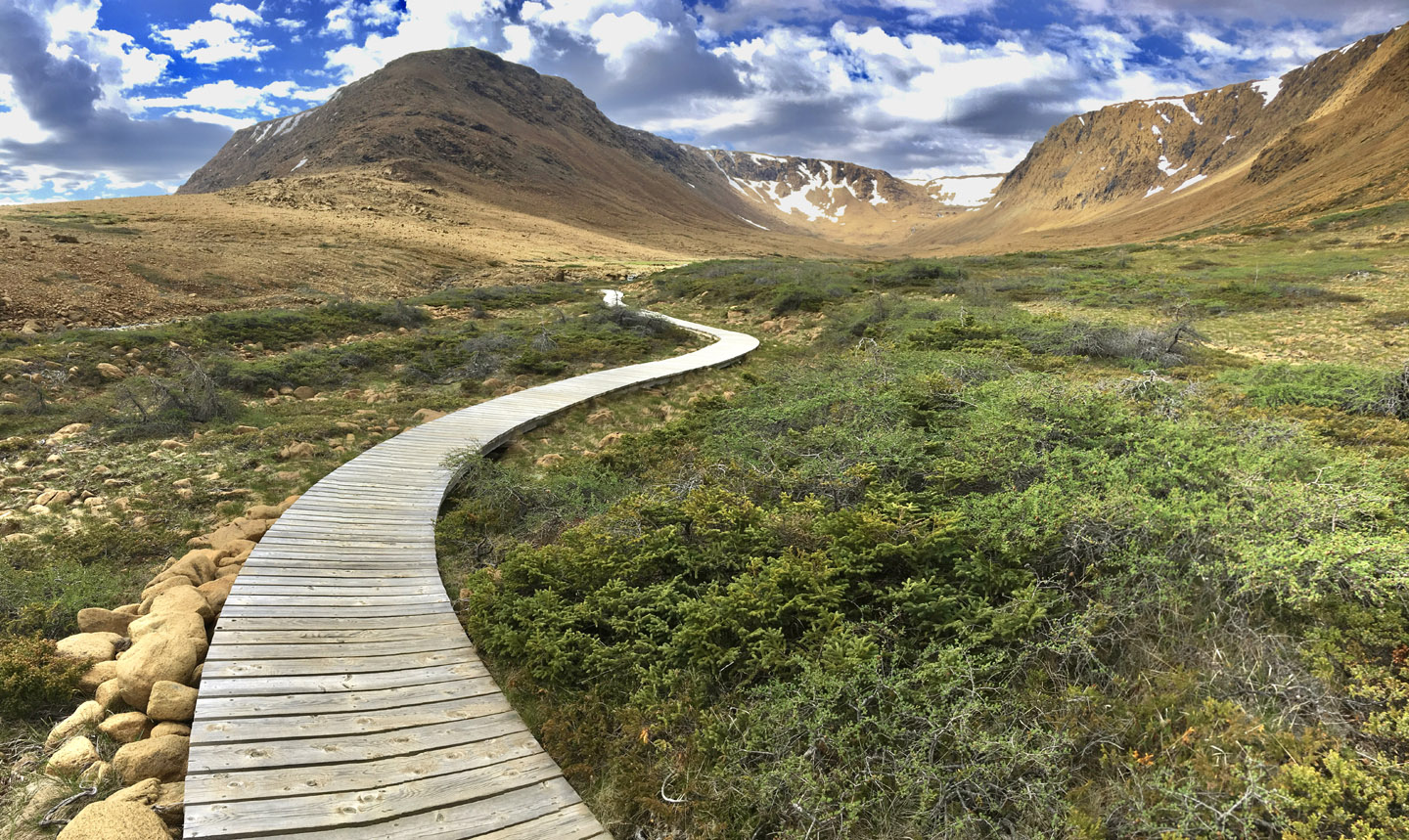
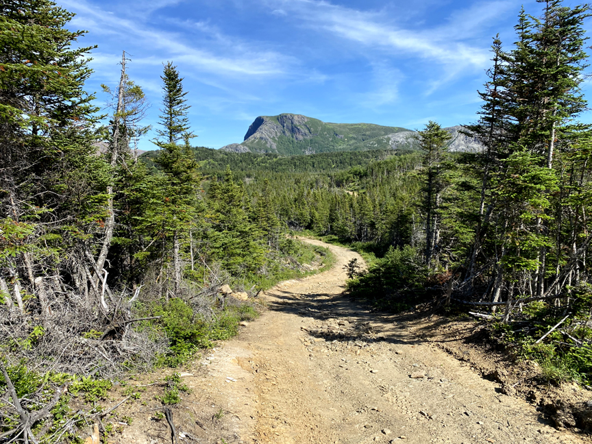
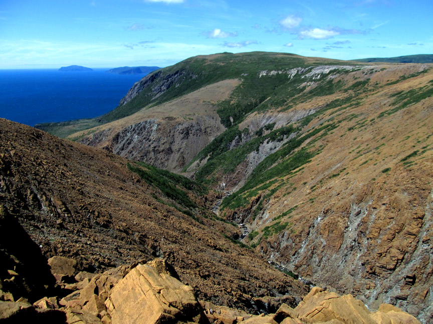
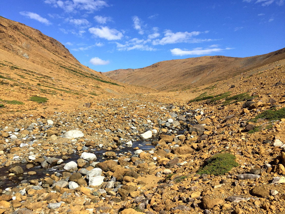
is approximately 24 kilometers (14.5 miles) in length and can be completed in approximately 9.5 hours, 10 hours to the Trout River Pond campground. From an elevation of 160 meters (525 feet) above sea level at the parking lot for Tablelands Trail, the trek climbs to 700 meters (2,297 feet) at the back end of Winter House Brook Gulch.
Along the way, hikers must walk the 2km Tablelands Trail
including a section of boardwalk
before gradually climbing 100 meters over 2 kms
followed by a steeper more challenging ascent of 320 meters over 1.5 kms.
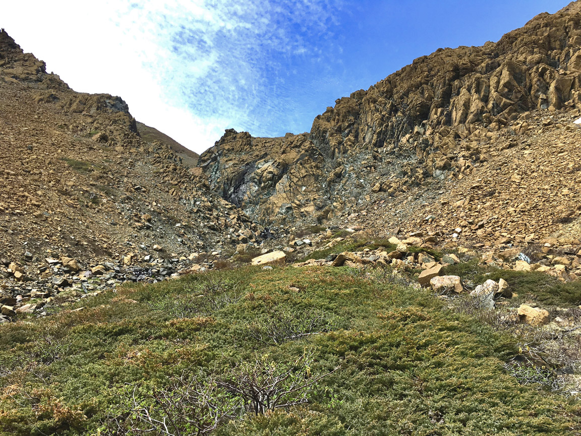
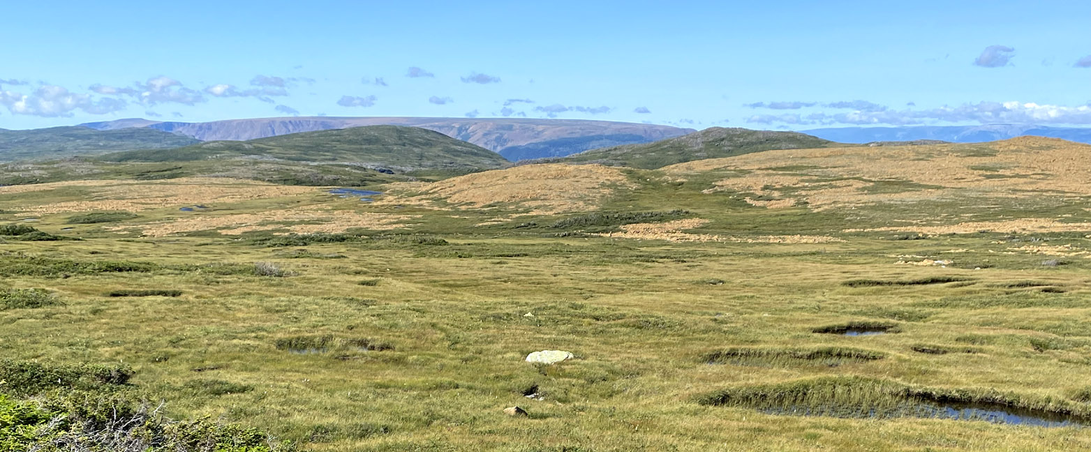
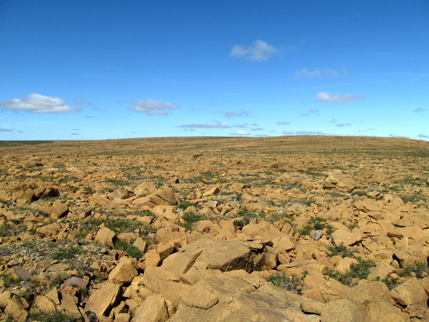
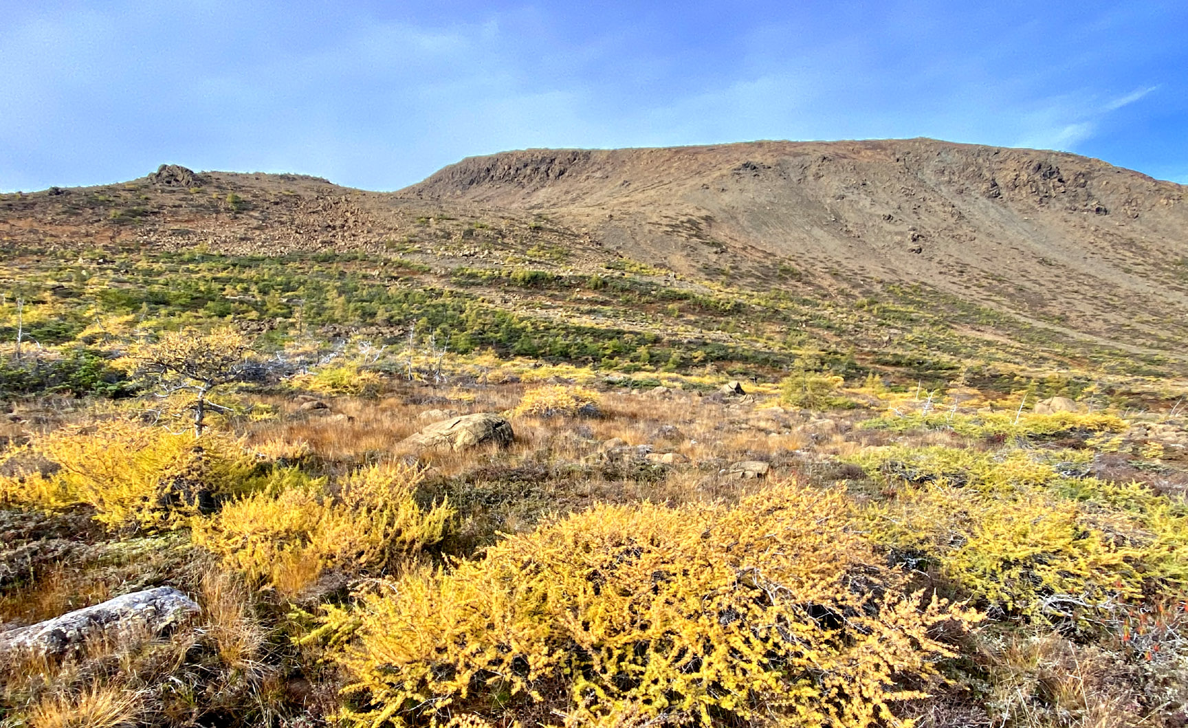
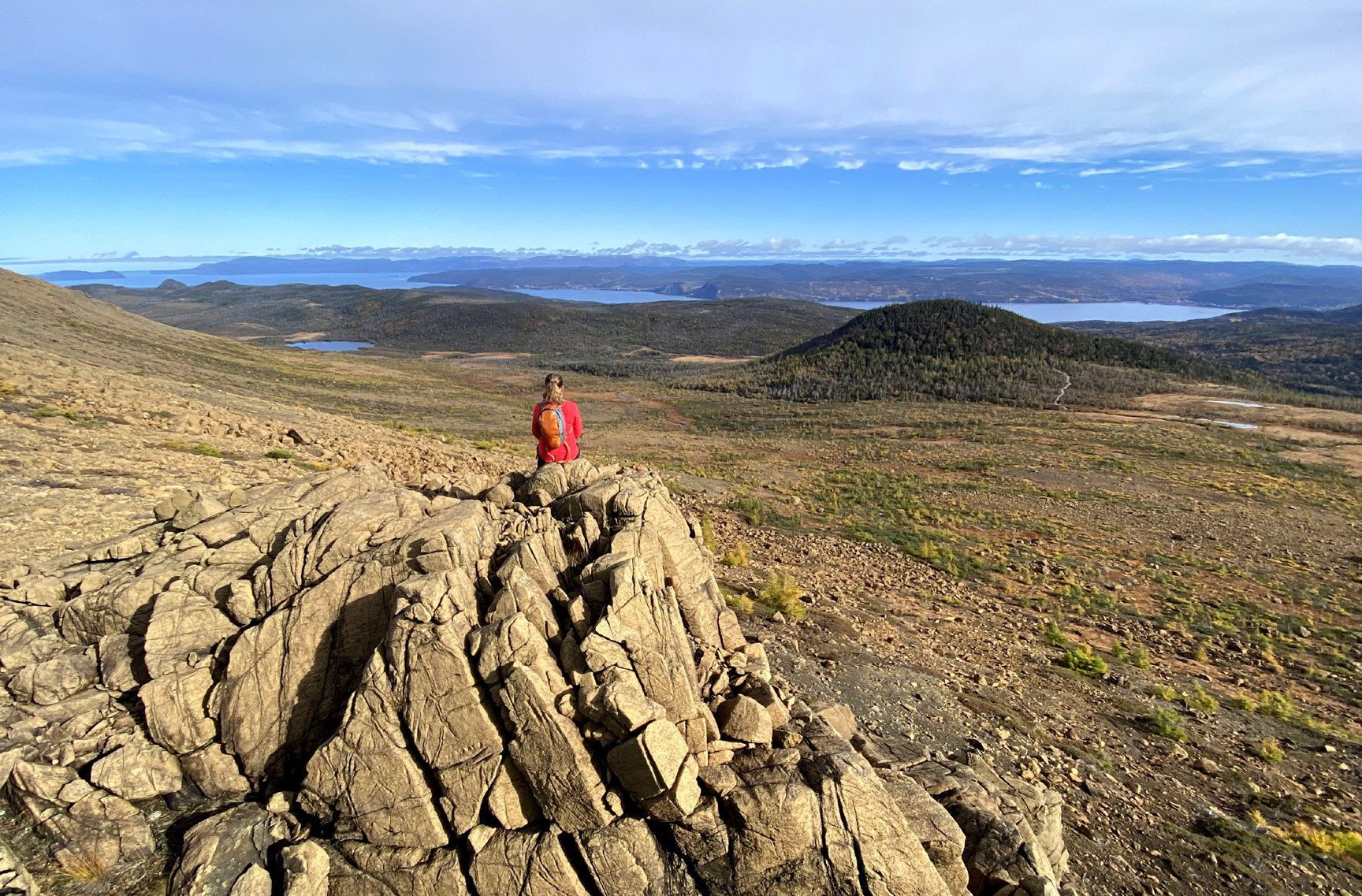
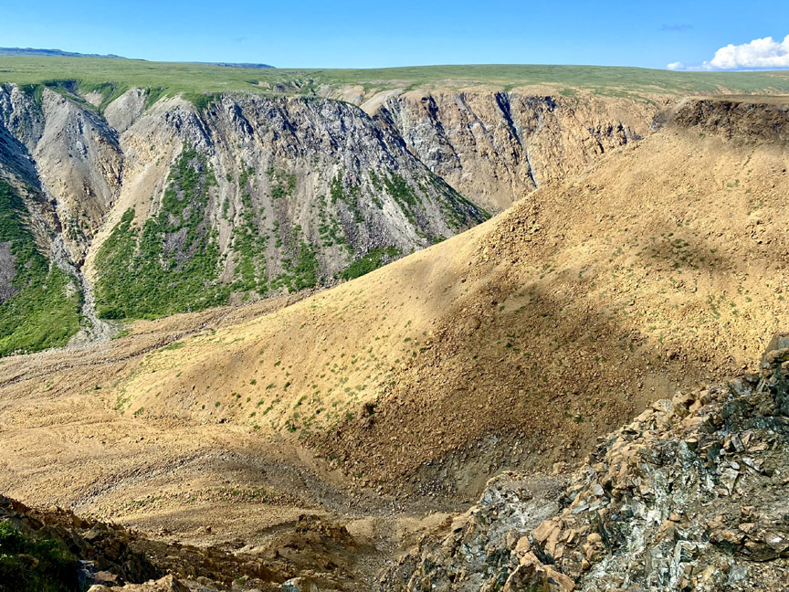
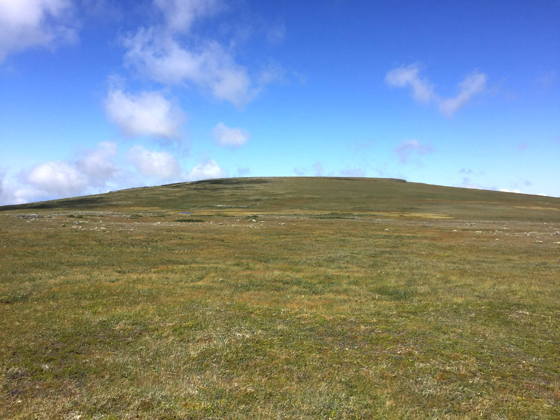
Once on top, it isn’t hard to see why this most northerly of the Bay of Islands ophiolite massifs is named Tablelands (aka Table Mountain), since it’s about as flat as a large mountaintop can be.
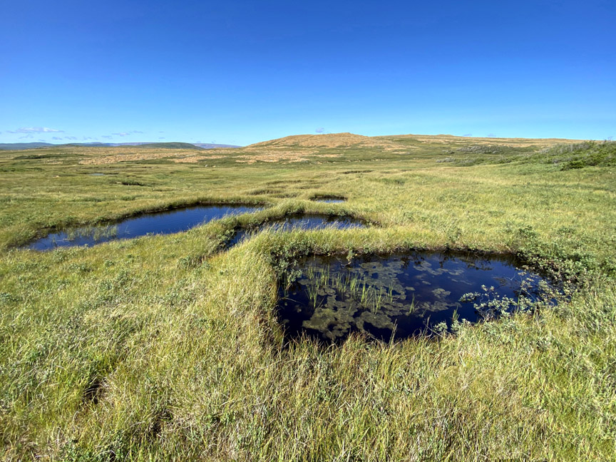
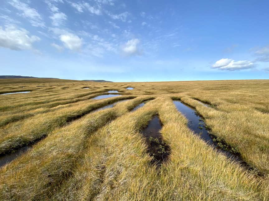
However soon the rocky peridotite landscape transitions to a wet boggy grassland that must be navigated
in order to connect with the scenic back end of Fox Point Gulch.
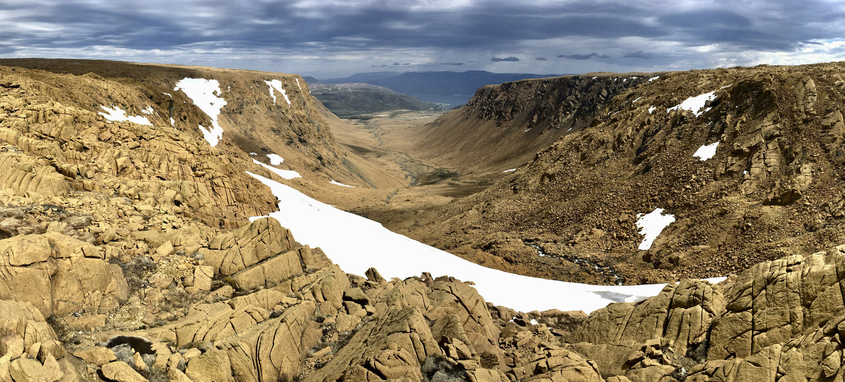
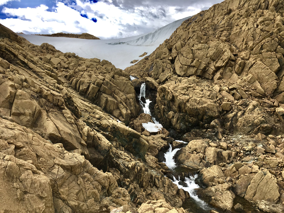
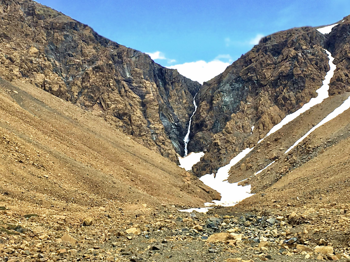
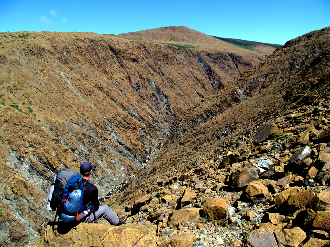
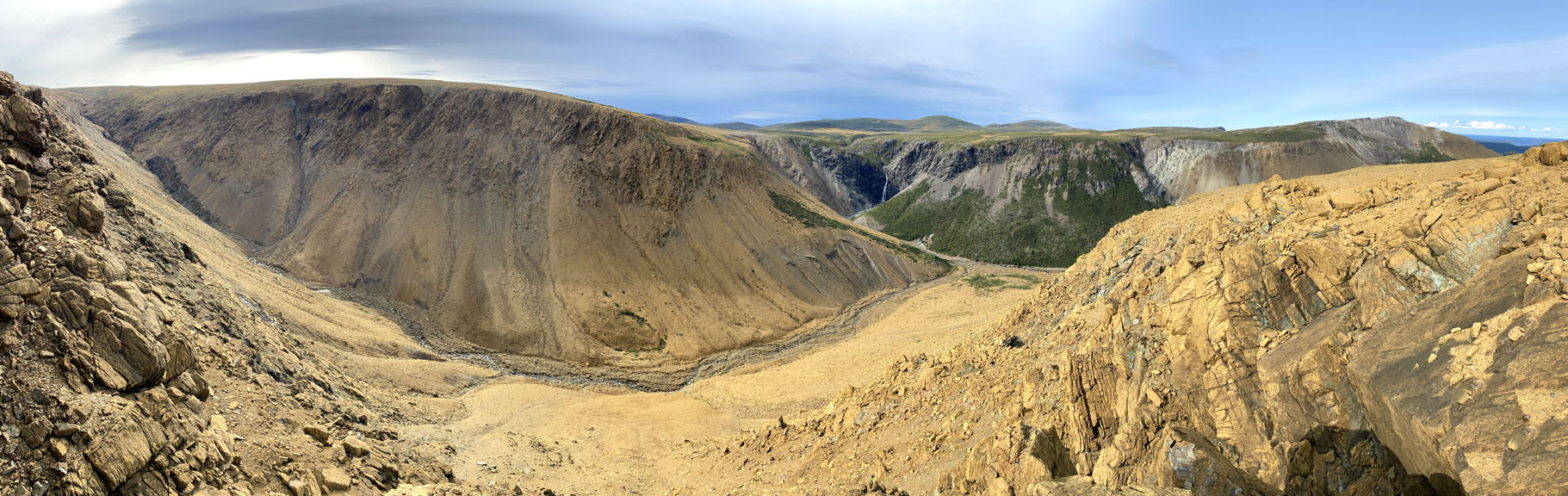
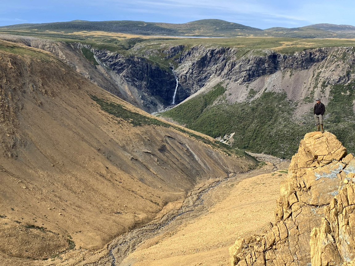
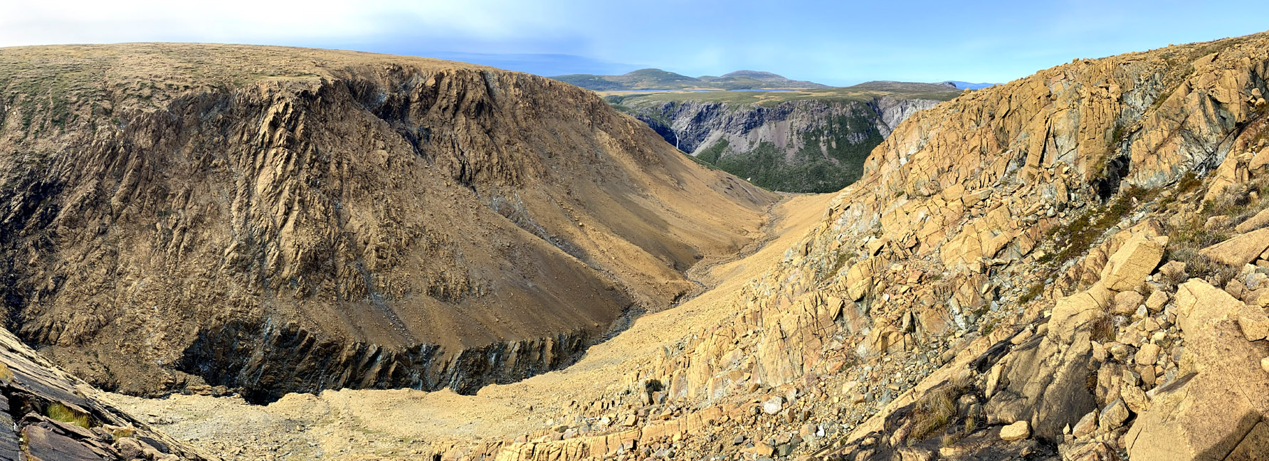
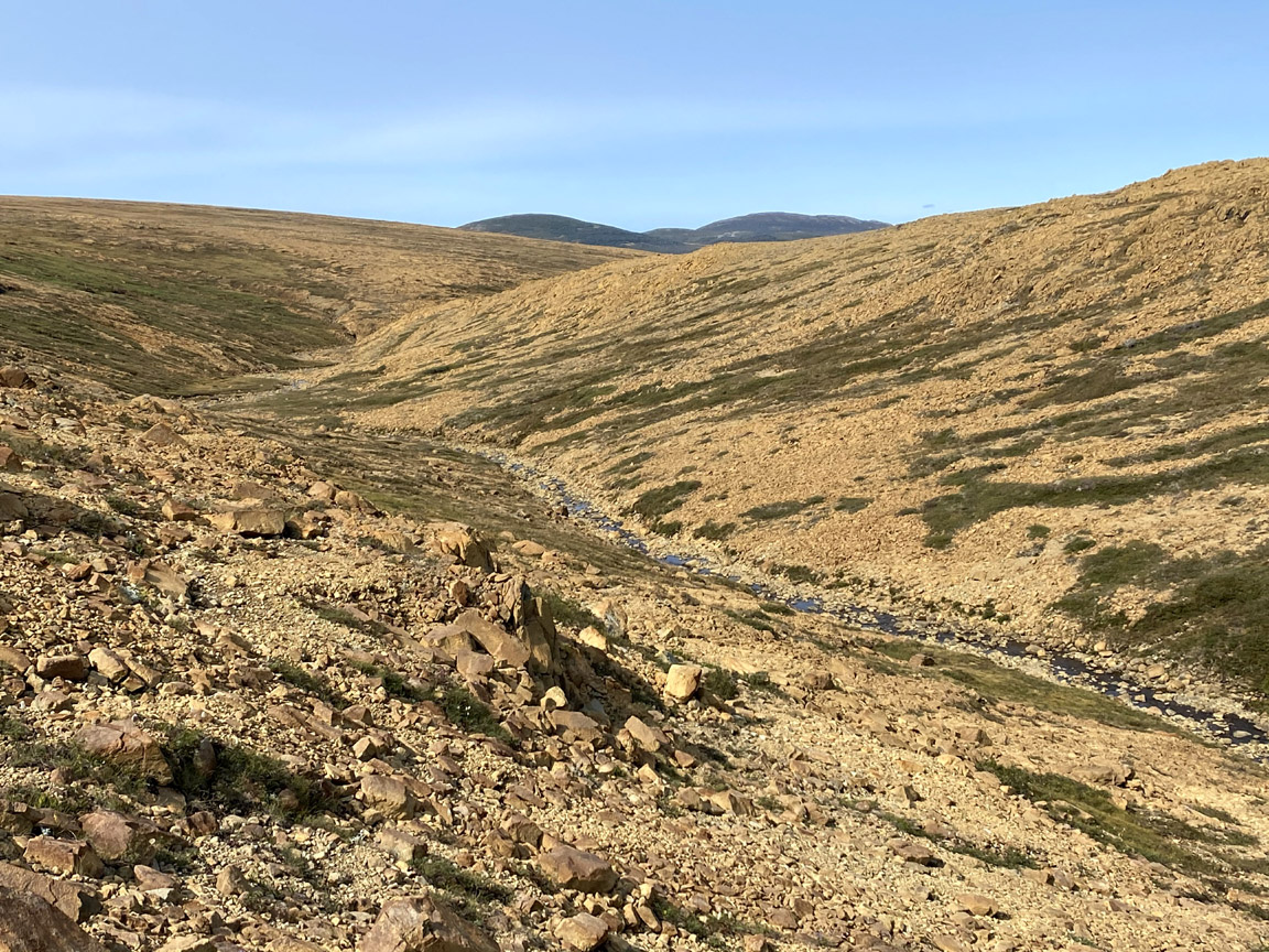
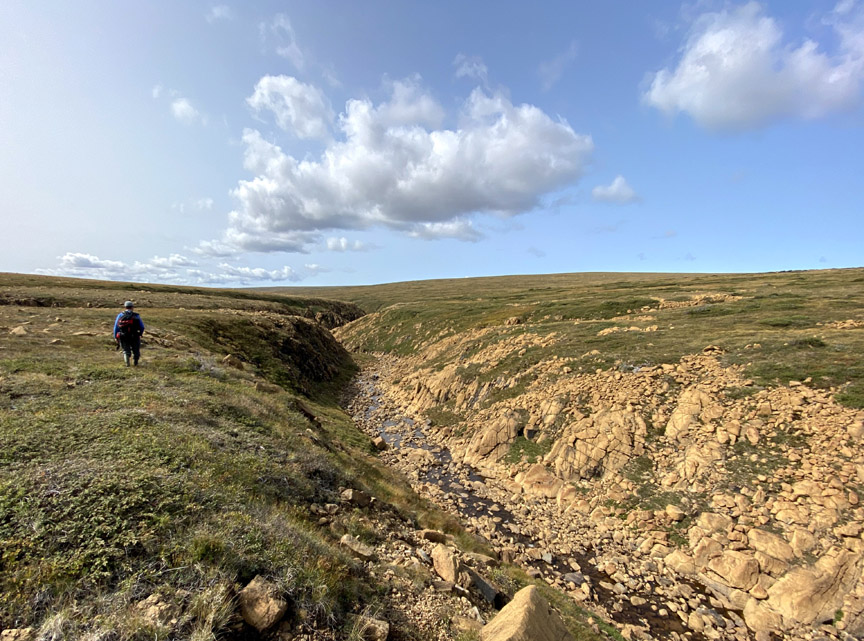
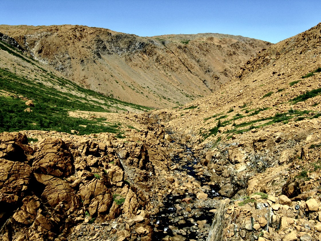
This 3.5 km northeast to southwest canyon leads directly to Trout River Pond and must be accessed via a relatively steep narrow gully that leads to the canyon floor.
Nearby is a pretty 100 meter high waterfalls that flows into the back end of the canyon from the wetlands above.
From here it’s an easy 3 km stroll out of the gulch, past a winding cascade that turns east and empties into Trout River Pond.
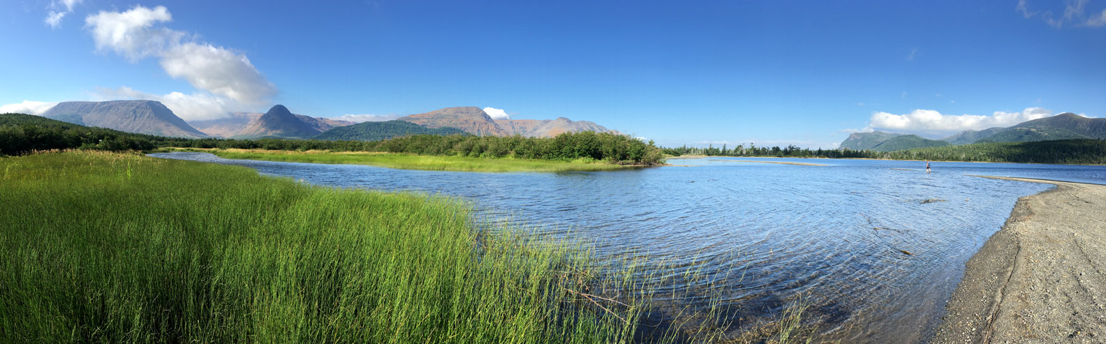
After crossing the shallow stream, it is now just an easy 7 km (4 mile) stroll along a park trail to the wharf at the end of the pond. Another 2 kms on gravel road will take hikers to an ideal campground within striking distance of the Elephant.
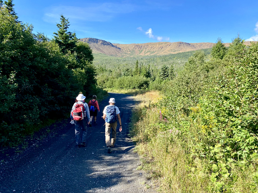
Stage Two – North Arm Hills
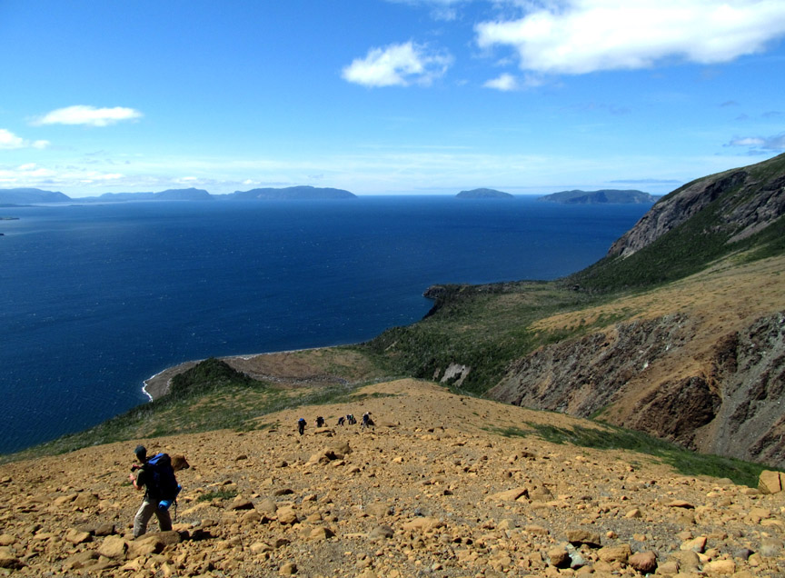
is the longest stage of the UltramaTrex at approximately 48.5 km (29 miles) and can be completed in 2 to 3 days, depending on month and fitness. From the start at 30 meters (98 feet) elevation near Trout River Pond campground, the route follows an ATV trail for approx 5 kilometers (3 miles) before climbing up the side of the Elephant to a height of 400 meters (1,310 feet).
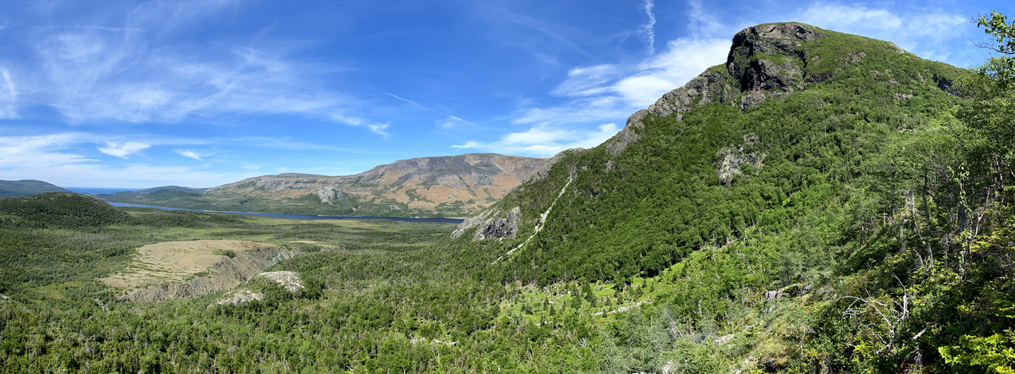
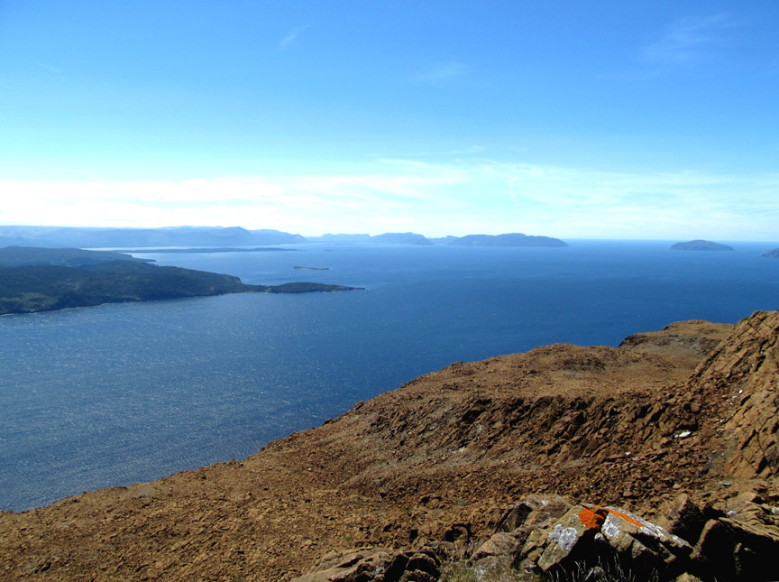
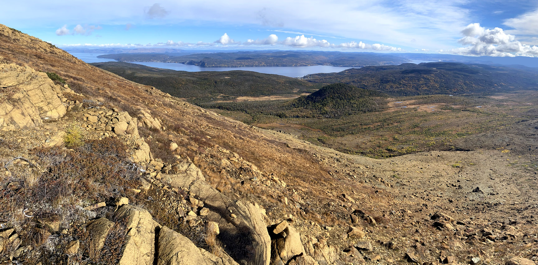
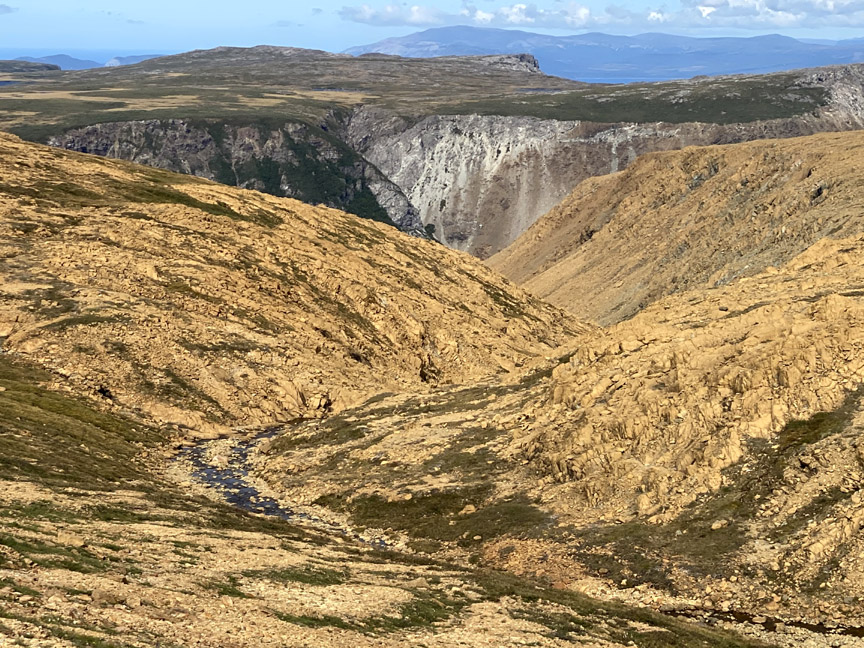
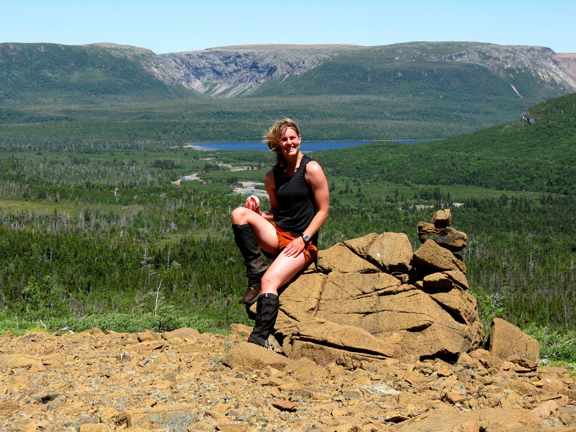
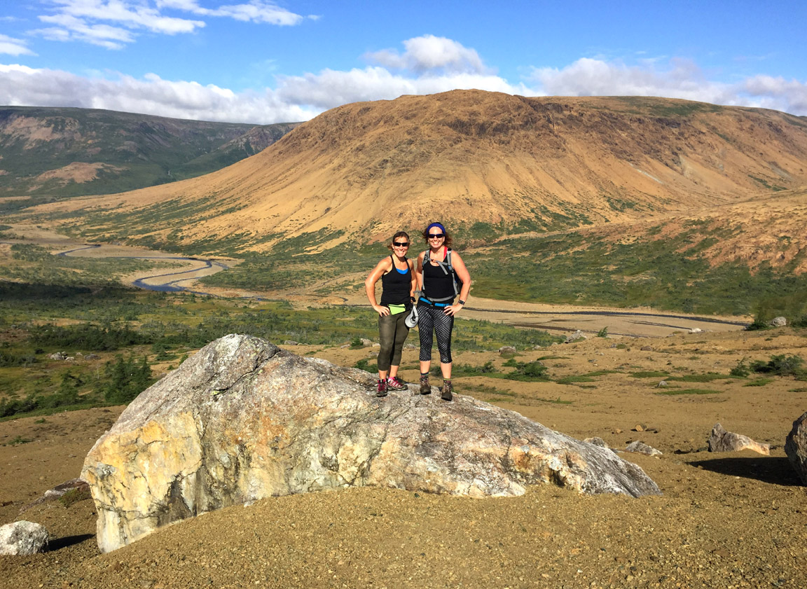
The plateau on top of the Elephant’s Head provides fantastic views of Table Mountain Massif (i.e., the Tablelands) and Trout River Pond, all the way to the town of Trout River on the gulf coast.
East of the Elephant Head, the trek along the south rim of Trout River fiord weaves and bobs around various small ponds and patches of tuck and scrub
while stopping here and there to take in another view of the ridges and canyons of Table Mountain.
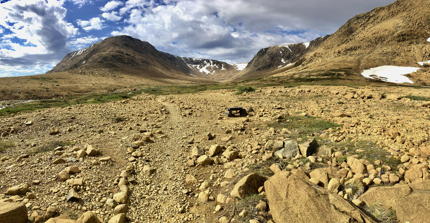
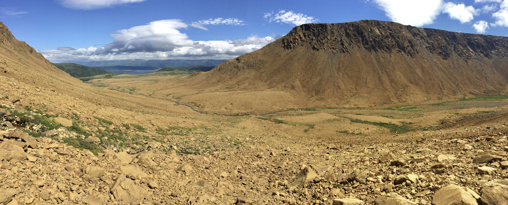
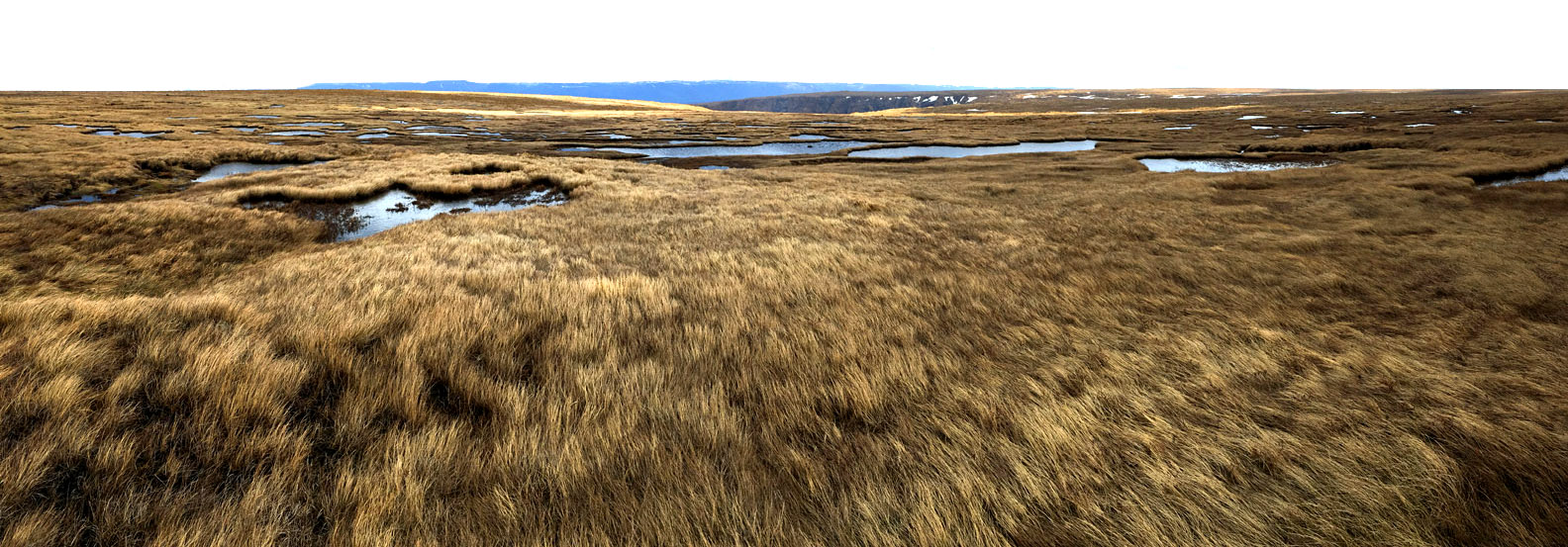
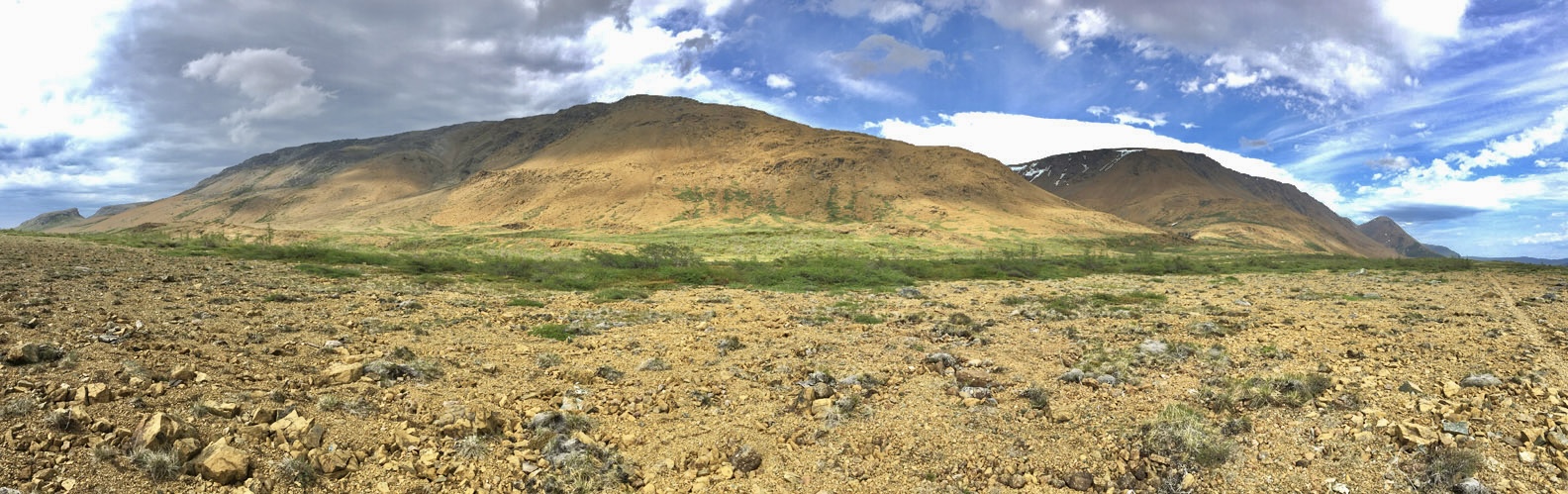
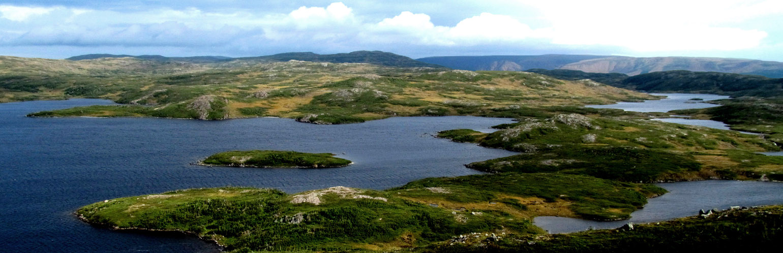
Near the end of the fiord, the route turns south and follows a series of mountaintop valleys that drain a number of large lakes, ponds and wetlands.
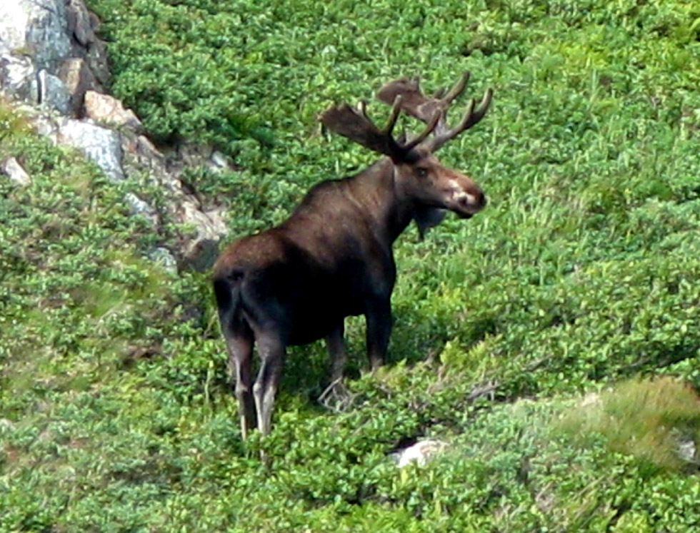
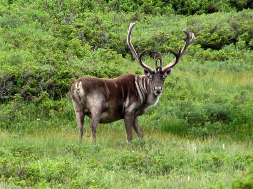
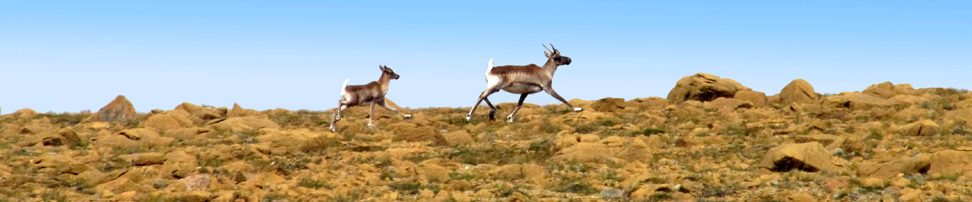
This is some of the most remote backcountry in Western Newfoundland, where it is much more likely to encounter a moose, caribou, arctic hare or black bear than a two-legged backpacker. But have no fear, like other friendly Newfoundlanders, the black bears and coywolfs here are quite harmless and more likely to run off in the opposite direction than approach with curiosity.
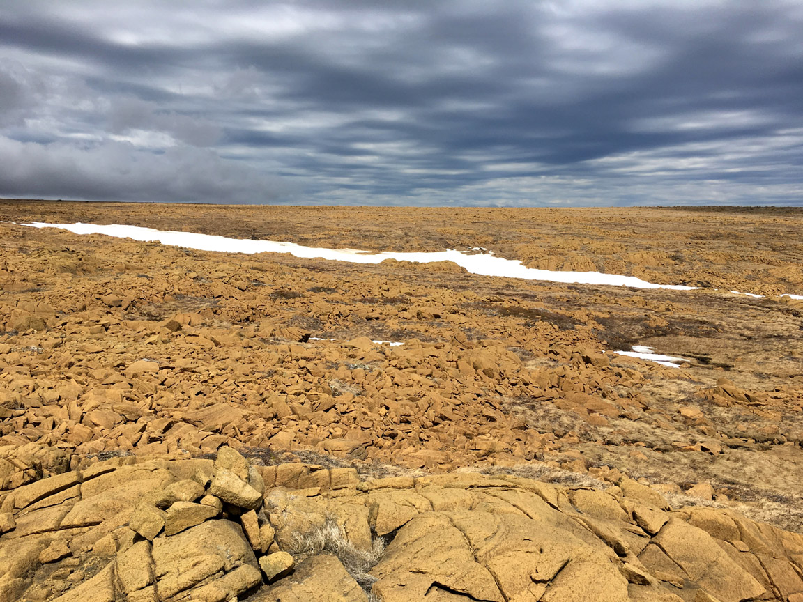
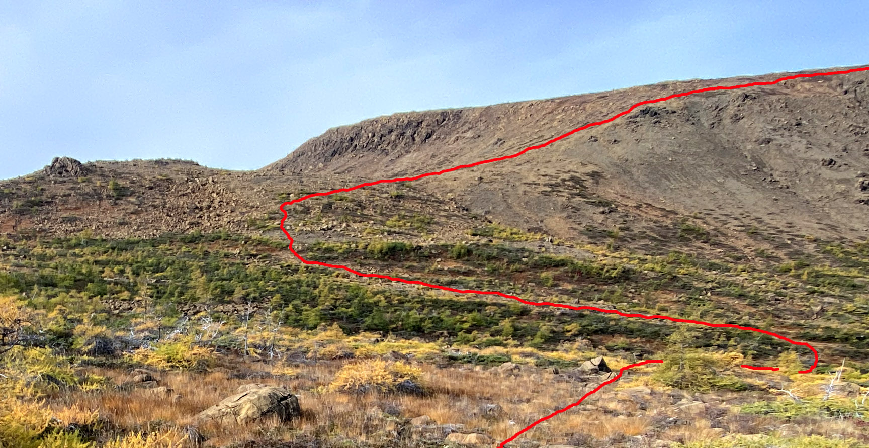
After 13 or 14 kilometers of this sub-arctic landscape, hikers once again encounter the Mars-like ultramafic mantle of the Bay of Islands Ophiolite
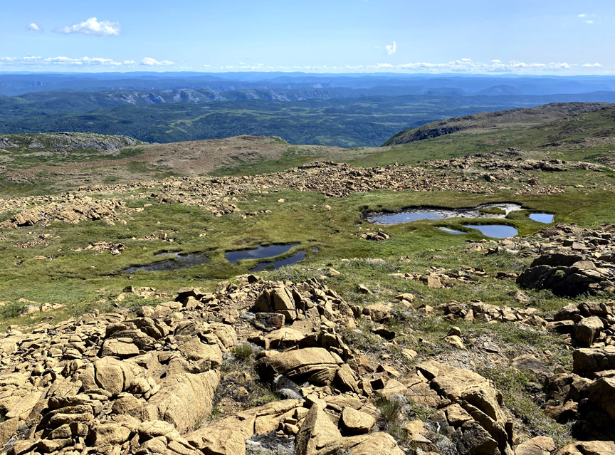
which is essentially devoid of trees and bushes but occasionally blanketed by large sections of wild grasslands perforated by small wetland ponds
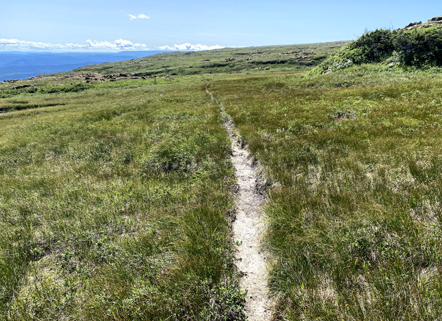
or bisected by single file caribou trails
that wind their way around or down through the many gullies and ledges along the southeastern edge of North Arm Massif.
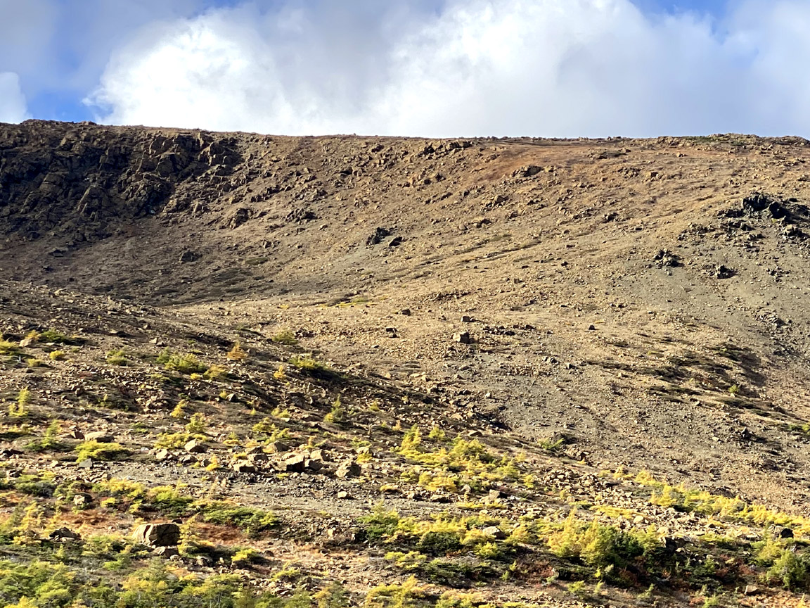
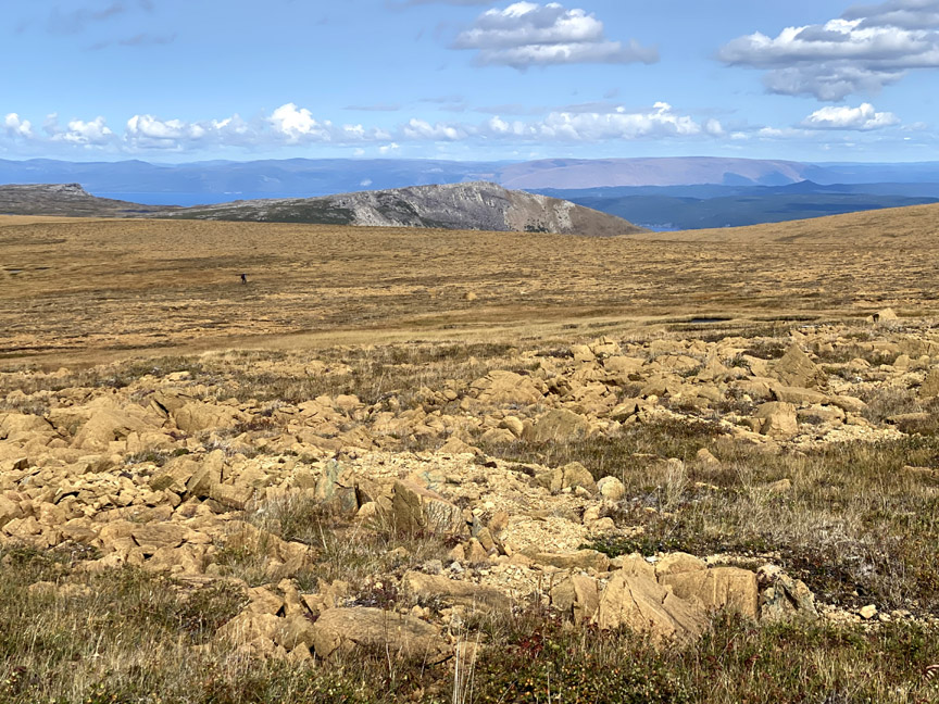
Before long hikers will traverse a rocky peridotite plateau that rises to 650 meters (2,130 feet)
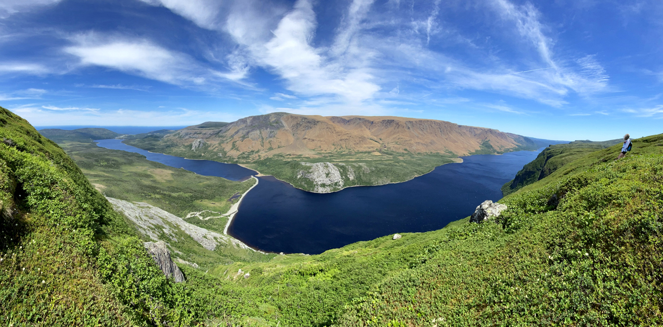
followed by spectacular views of North Arm and the outer Bay of Islands to the south and west
and Stowbridges Gulch to the north.
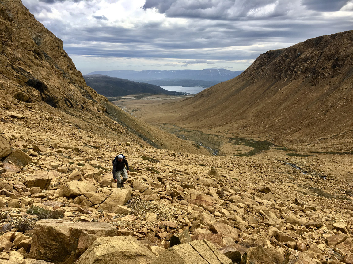
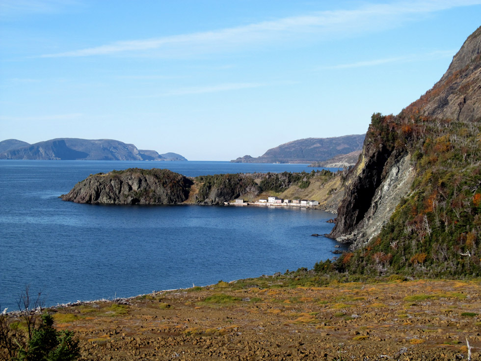
After descending a long slope to the west and walking a short distance around shore,
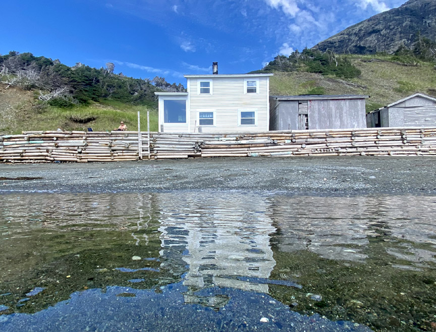
hikers will find the IATNL Stowbridges Basecamp where they can pre-arrange a night’s accommodation.
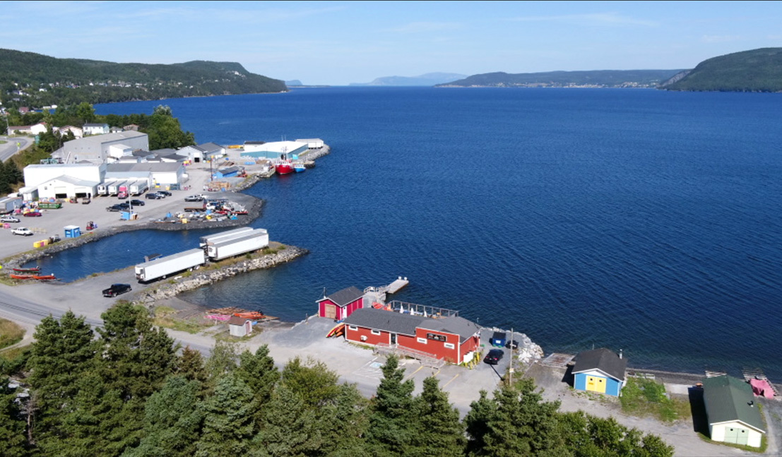
From the basecamp in North Arm, it is necessary to take a boat ride – dory or zodiac – across the Bay of Islands to Benoit’s Cove in Humber Arm, or to Cox’s Cove in Middle Arm, then take ground transportation around Humber Arm to Benoit’s Cove where Stage 3 of the UltramaTrex begins.
Stage Three – Blow Me Down Mountains
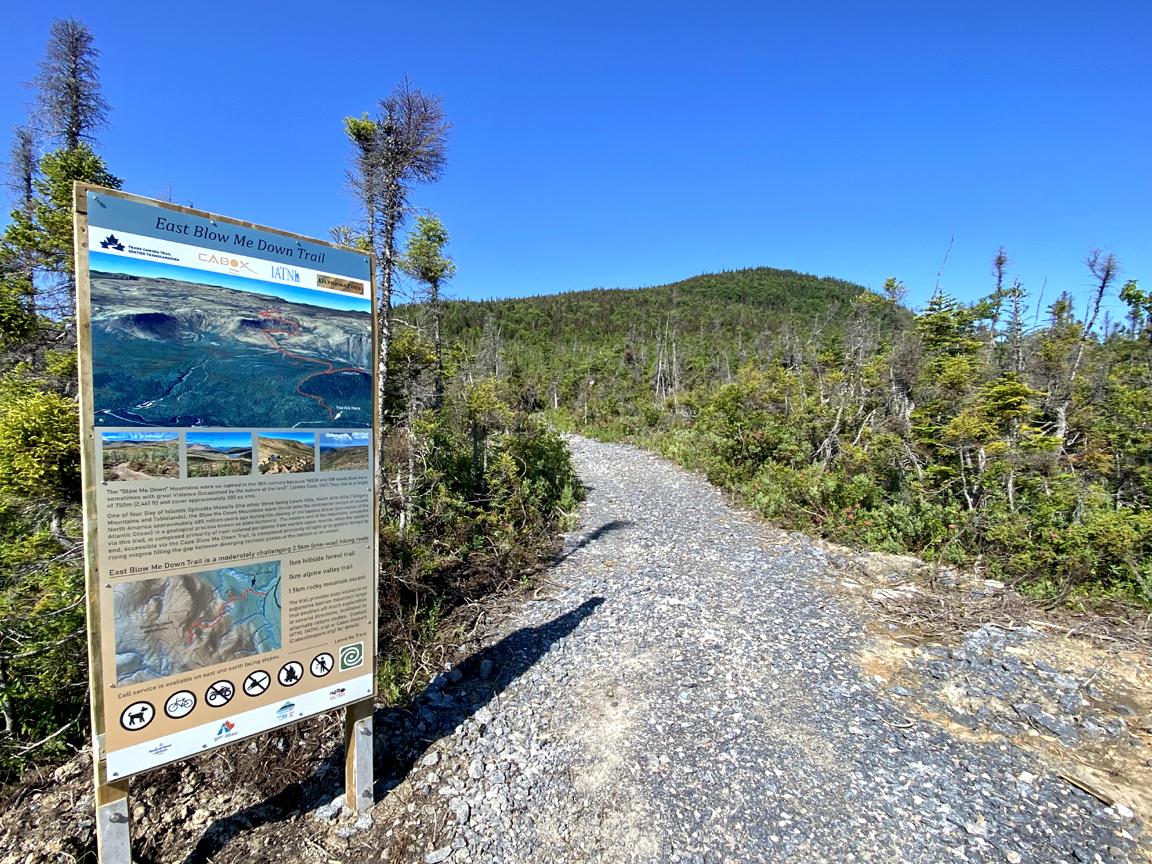
is 31.5 km (19 miles) in length and starts at sea level from the Cabox Information Center at Saltbox Restaurant in Benoit’s Cove.
The 34 kilometer (20.5 mile) trek to the western end of Serpentine Lake begins with a 1/2 km walk west along Route 450 to the gravel forestry access road that runs parallel to Clarks Brook. After a 2.5 km hike up that road, then another 1/2 km on the town’s water supply road that turns off to the right, hikers reach the East Blow Me Down Trail parking area. Along the way hikers get a view of the mountains they will soon climb.
The 2 km East Blow Me Down Trail connects the water supply road to the base of the Blow Me Down Mountains, from where hikers must self-navigate up and across the top of the barren ophiolite massif to Serpentine Valley via Simms Gulch.
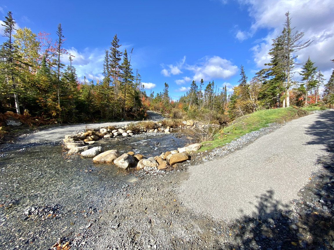
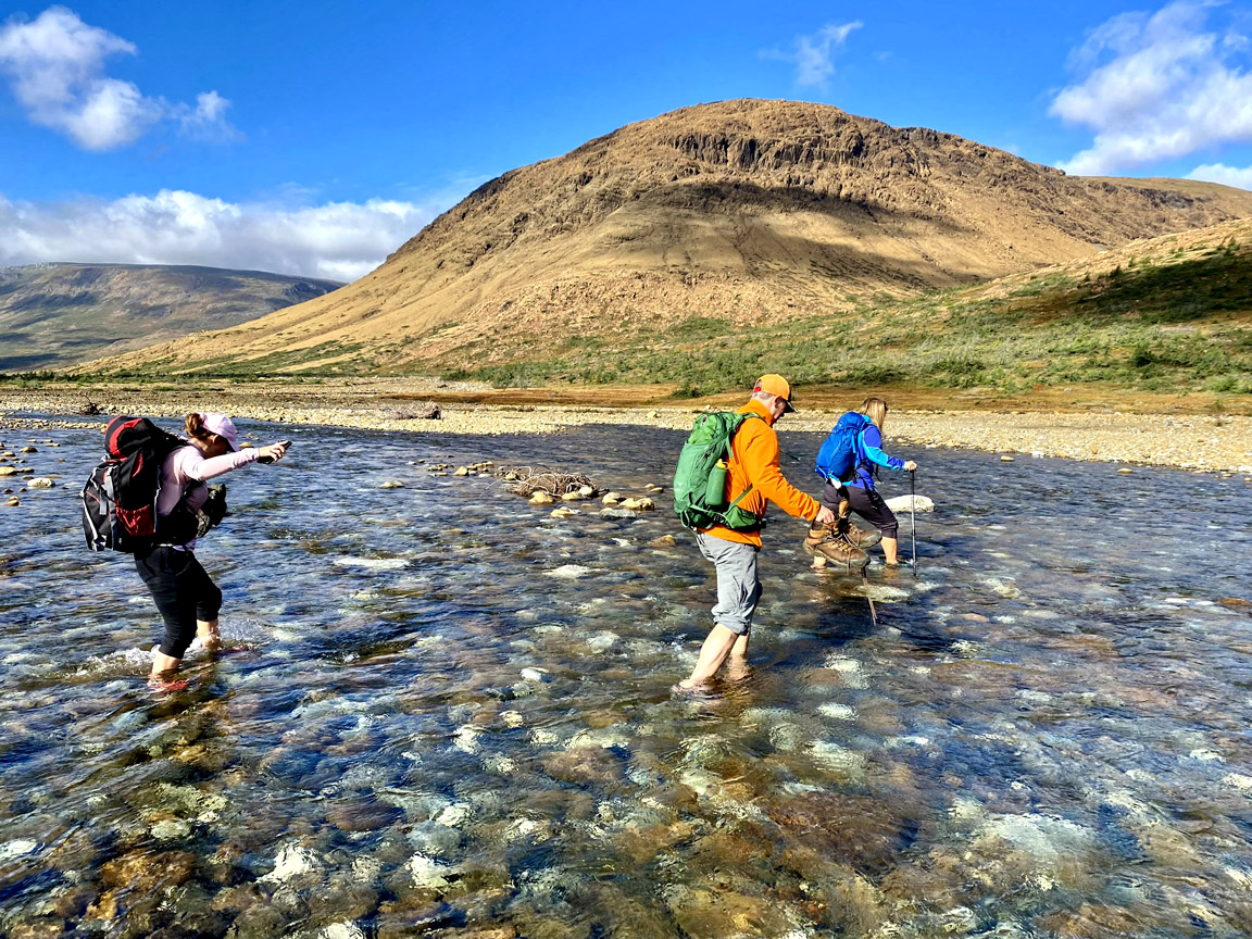
But before walking the trail, hikers must first cross Clarks Brook, where strategically positioned boulders serve as stepping stones when the water is too high to cross on the normally shallow riverbed.
1/2 km after crossing the brook, a trailhead sign marks the spot where the trail turns off to the left and begins its ascent of a low forested hillside.
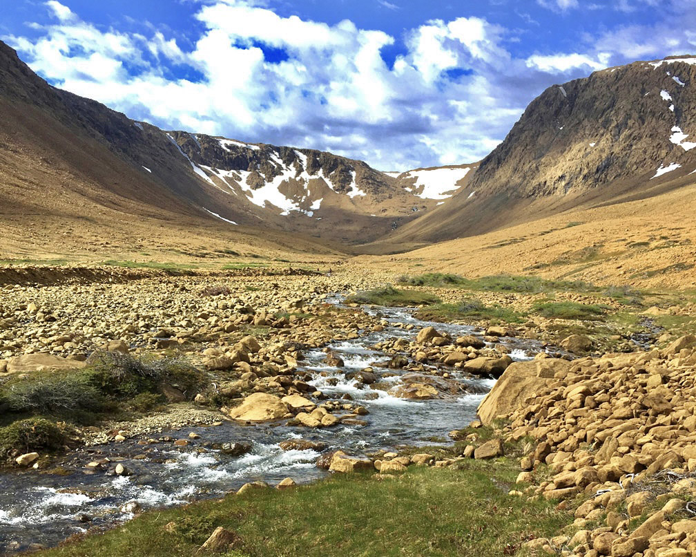
The 1 km long, 140 meter high ascent begins by passing through a lowland forest of birch and spruce and ends in an alpine valley spotted mostly with larch.
After a short 250 meter descent to an alpine stream
the trail weaves around low shrubs and peridotite boulders
until the grade increases to 250 meters over 1 kilometer, a not too difficult climb over mostly easy mountain terrain.
Along the way, hikers get good views across the mountains
and across the valley and bay.
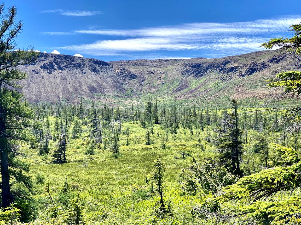
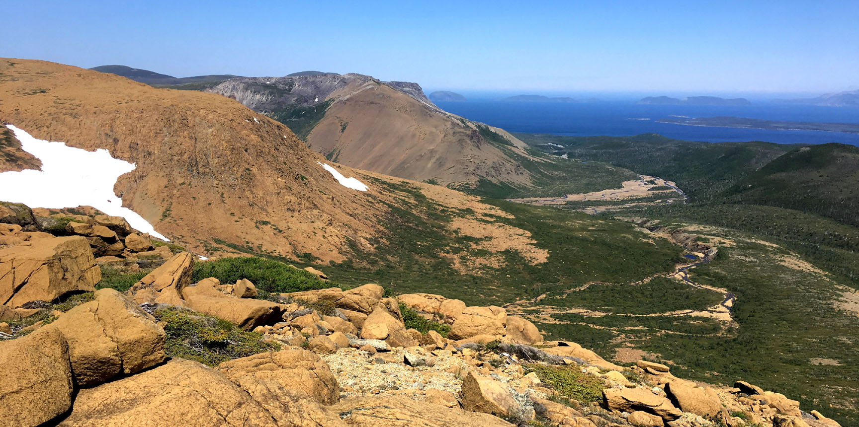
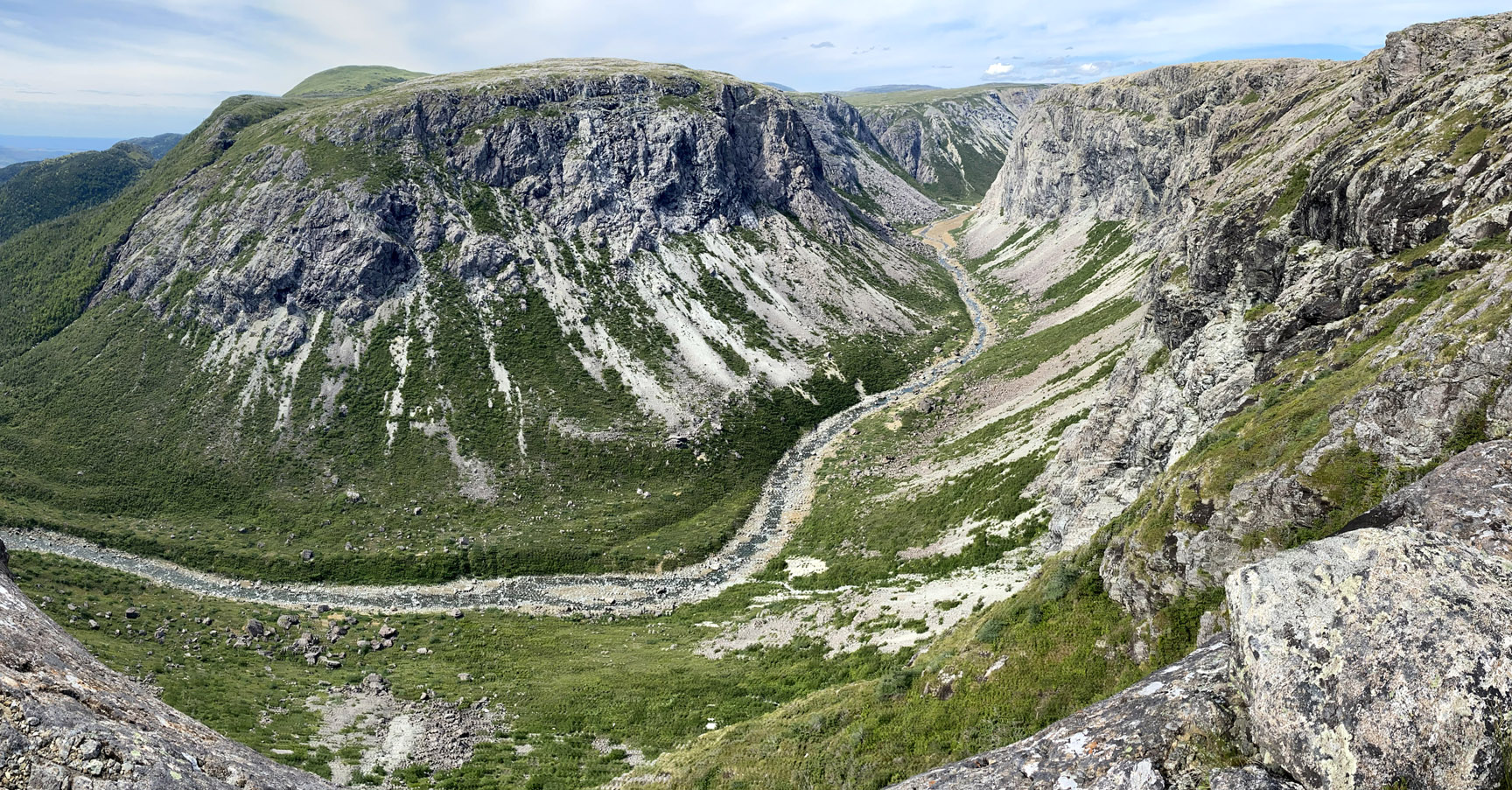
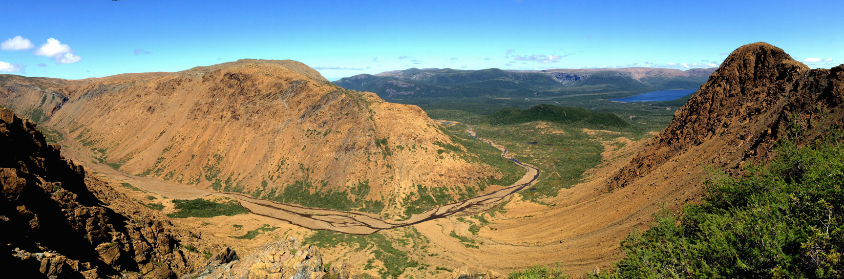
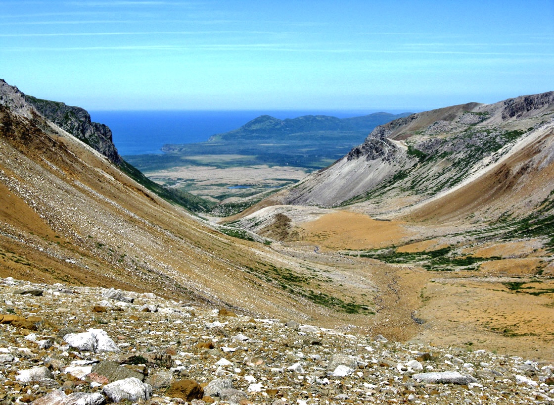
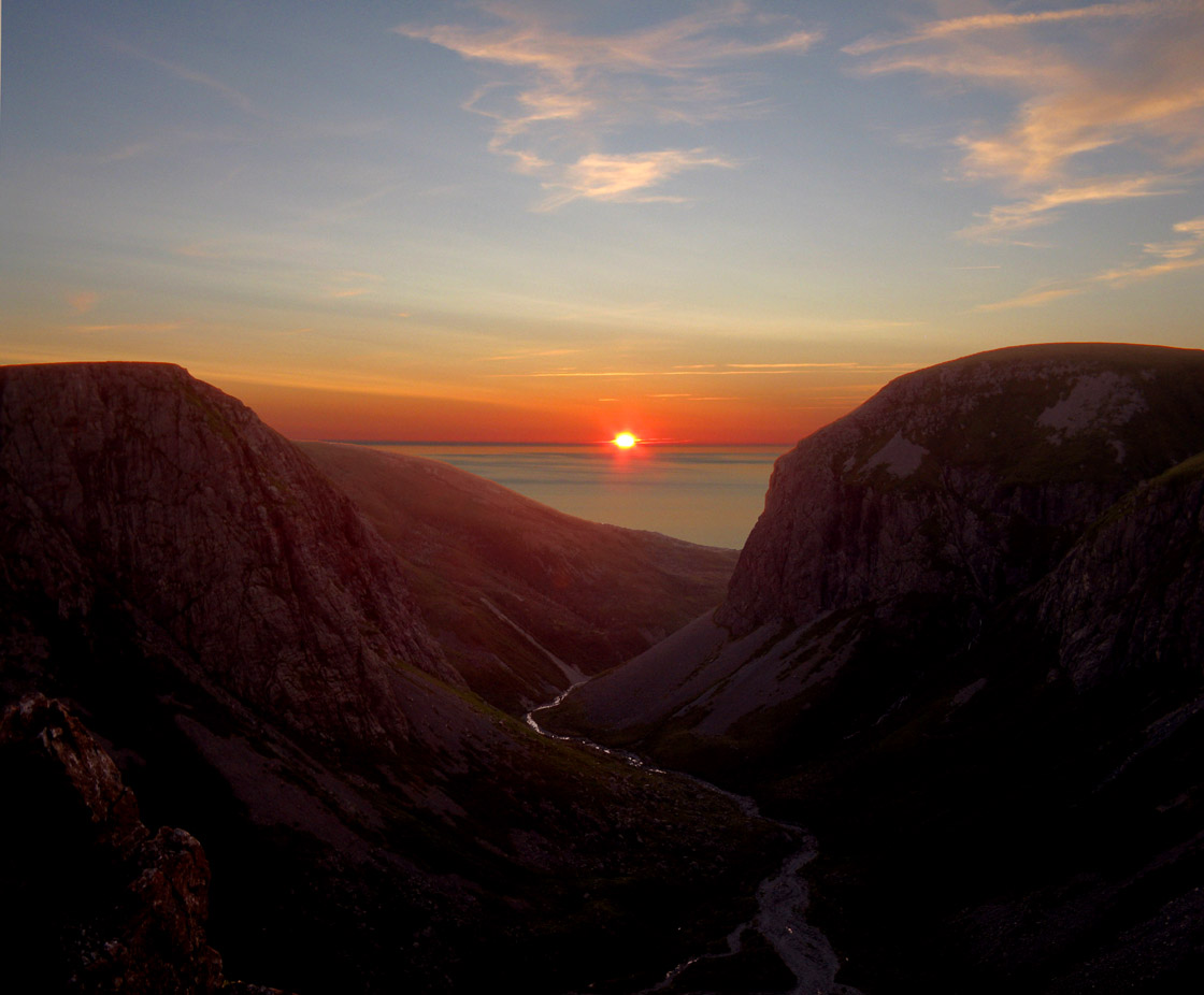
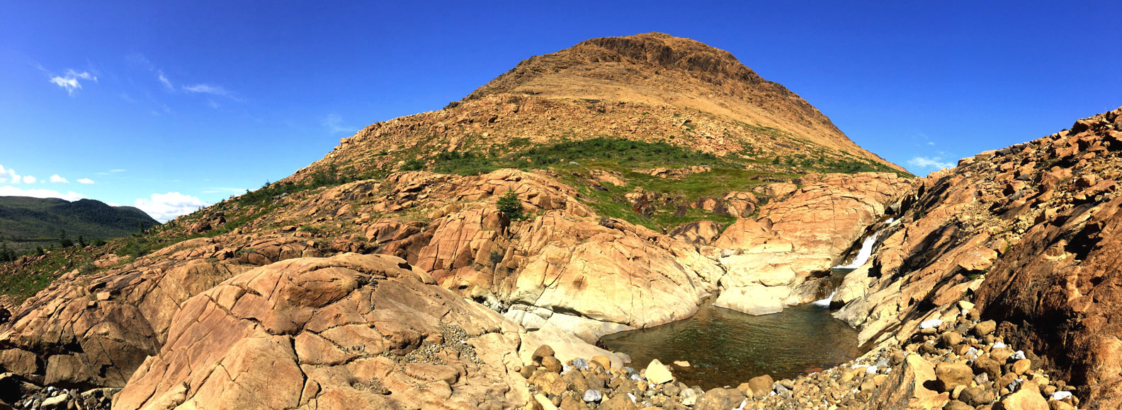
Once on top of the mountain, which here rises to 600 meters, the route turns north and follows the eastern edge of the mountains for 1 kilometer until it reaches the eastern flank of Charlie’s Bottom, which provides a panoramic view extending to the entrance of Blow Me Down Brook Gulch and the outer Bay of Islands beyond. In early summer, it is not unusual to see large patches of snow filling in the northeast depressions along the edge of the mountains.
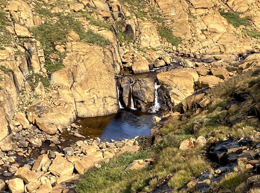
After descending to the brook running down Charlie’s Bottom, hikers can take a short detour to a series of cascades, an ideal spot for a midday lunch or to cool off on a hot summer day after the snows have melted.
Once under way again, hikers must climb 200m (650ft) higher to the top of Charlie Bottom’s western flank, then after another 1km walk will be rewarded with a dramatic view of Blow Me Down Brook gulch, falls and south branch.
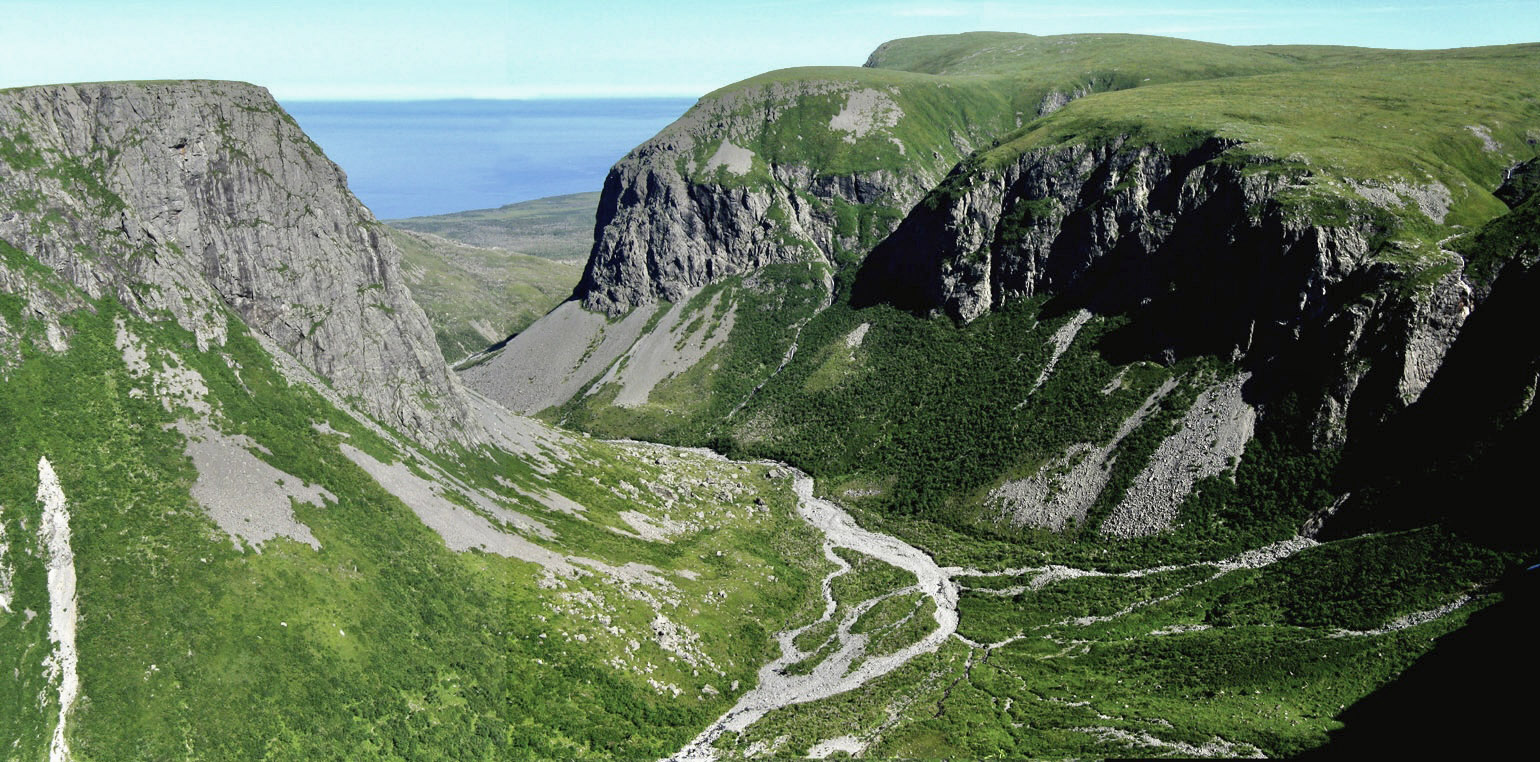
The main glacier-carved gulch also marks the geological boundary between ocean crust (primarily grey gabbro) to the north and earth’s mantle (primarily rust-colored peridotite) to the south.
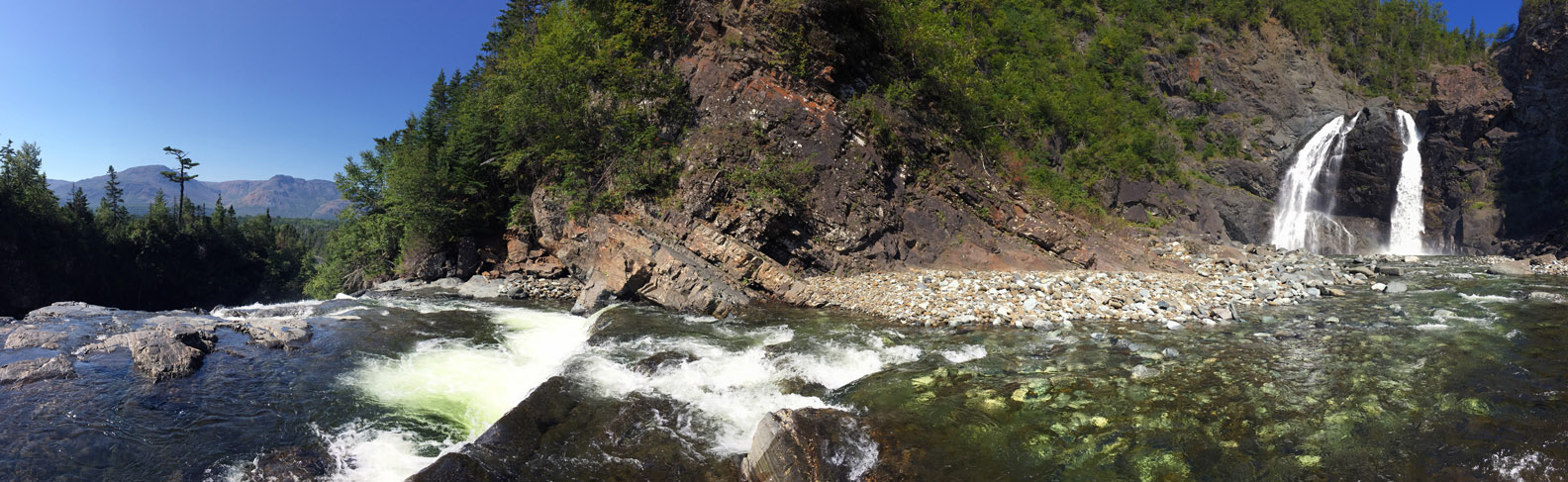
3.5 kms (2 miles) into the gulch at the back end of west branch, Blow Me Down Brook Falls is approximately 80m (260ft) high, with a wide deep pool at its base, ideal for a cool refreshing dip.
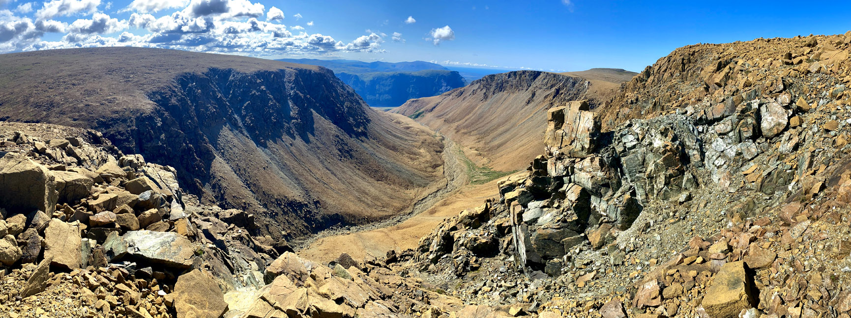
From the BMDB Falls viewpoint, the route turns south and follows along the east flank of South Branch, which provides spectacular views through a steep narrow canyon that’s impassable at its base.
Once at the back end of the gulch, the contours becomes more gentle and allow an easy crossing of south branch brook
and last look at Blow Me Down Brook Gulch
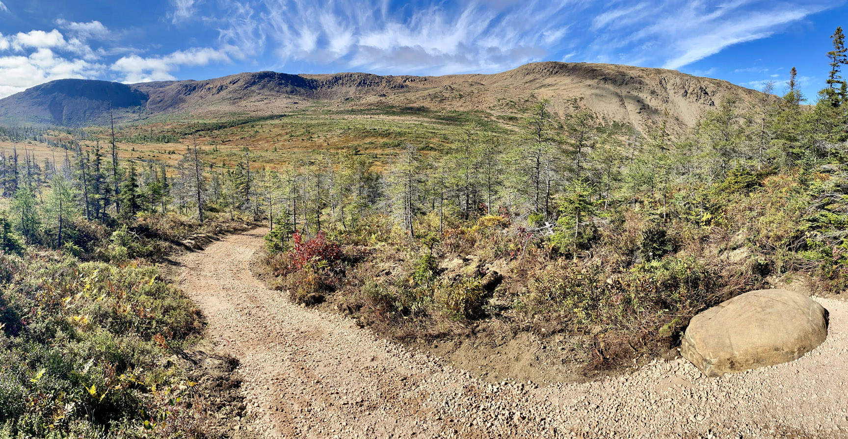
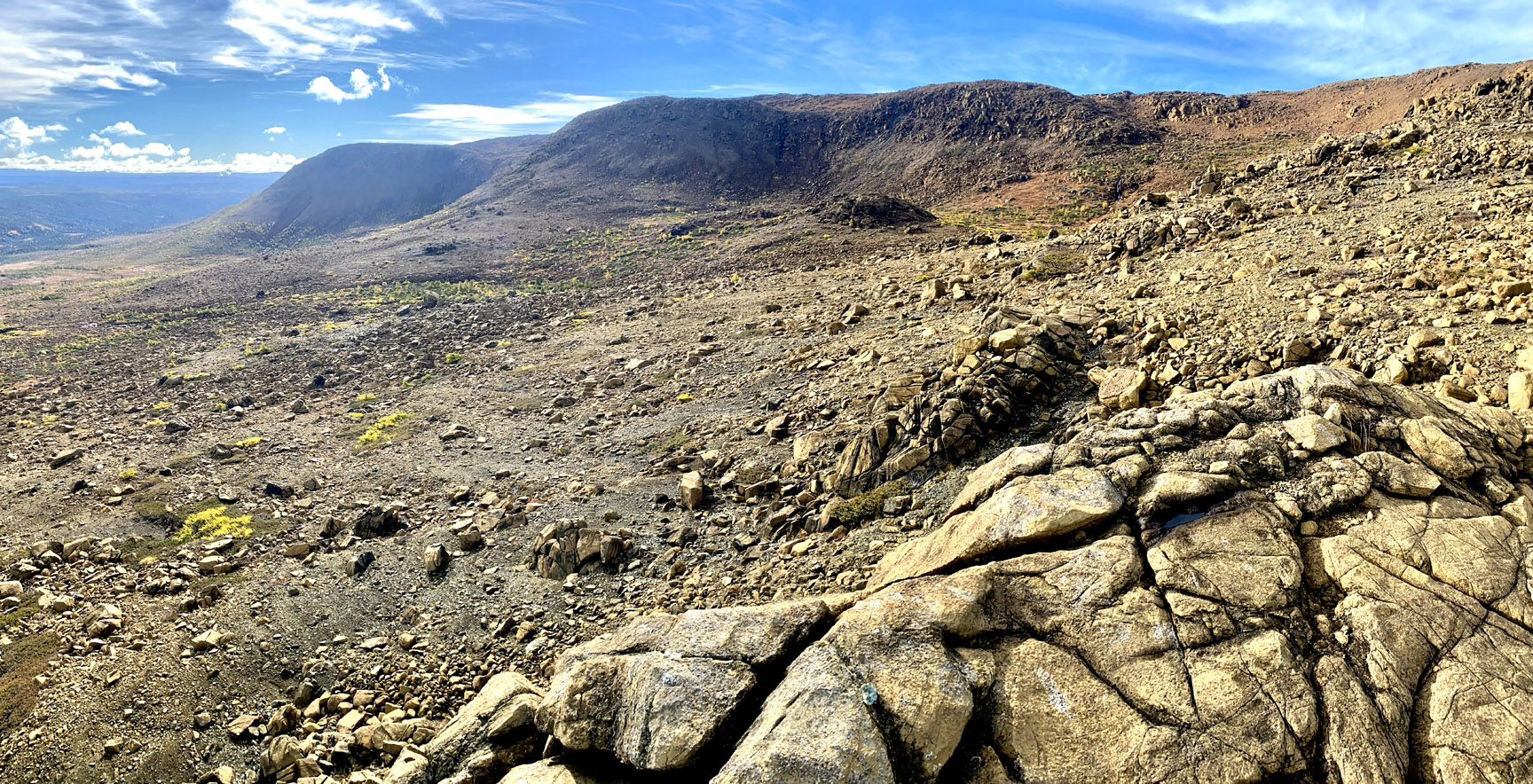
before the route turns southwest to cross the broad, rocky meadow at top center of the massif.
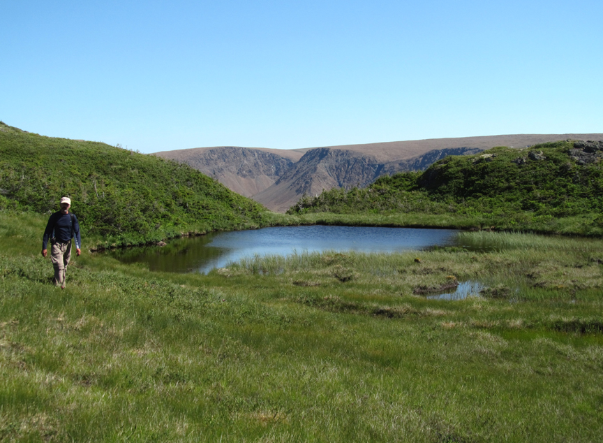
Before descending into the Simms Gulch watershed, the route passes a small, easily navigatable wetland
then follows the headwaters stream of Simms Gulch’s north branch
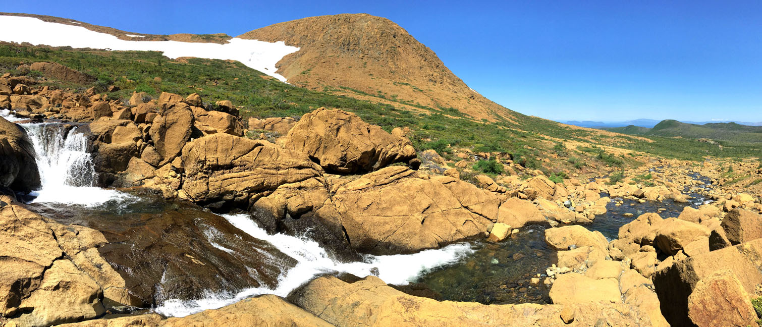
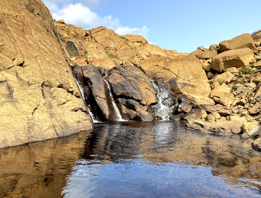
passing Three Sisters Waterfall
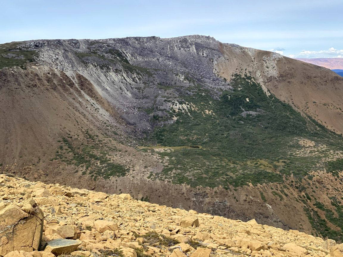
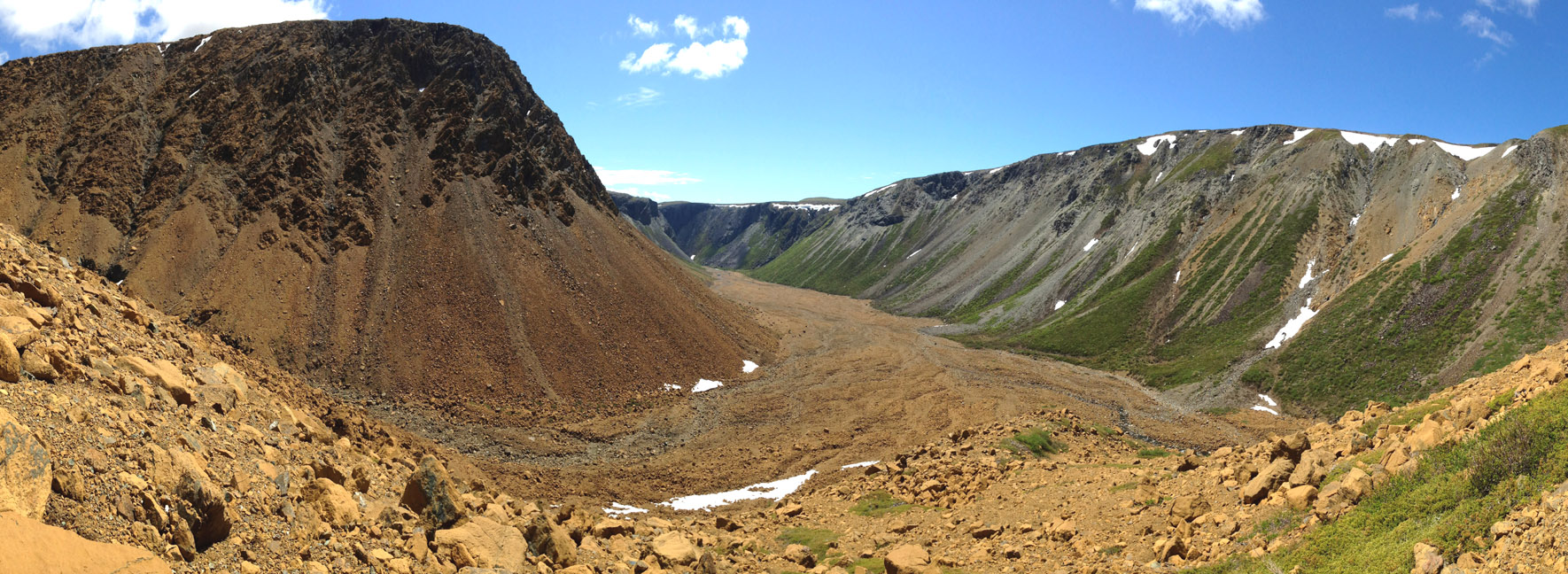
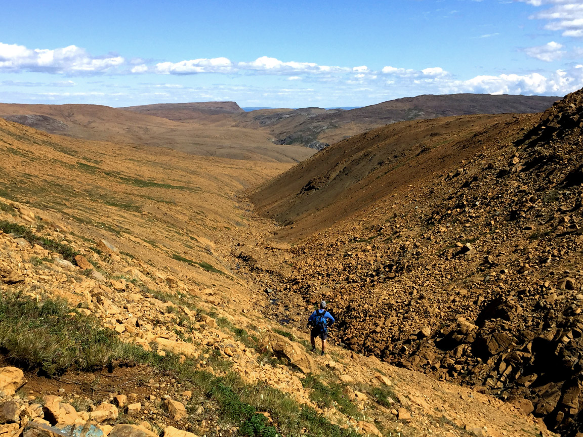
before descending into and out of Simms Gulch on a “stone glacier” of primarily ultramafic peridotite rocks that either tumbled down the steep eastern cliff wall or were washed down one of two upper tributaries that normally flow underground.
Like the northern slope of Blow Me Down Gulch, the western cliff wall of Simms Gulch is composed of a distinct light grey gabbro, part of the ocean floor of the ancient Iapetus Ocean.
It extends all the way to the entrance to the gulch where it crosses the streambed and spans both sides of the canyon, which is approximately 300 meters (984 feet) at its narrowest and 600 meters (1,970 feet) at its widest, and rises from a height of 200 meters (655 feet) on the canyon floor to 600 meters (1,970 feet) on both flanks.
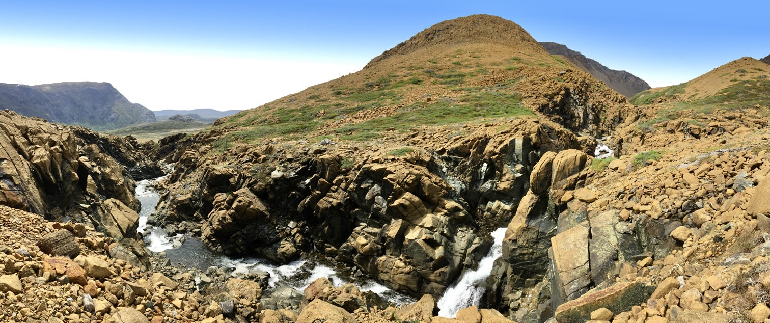
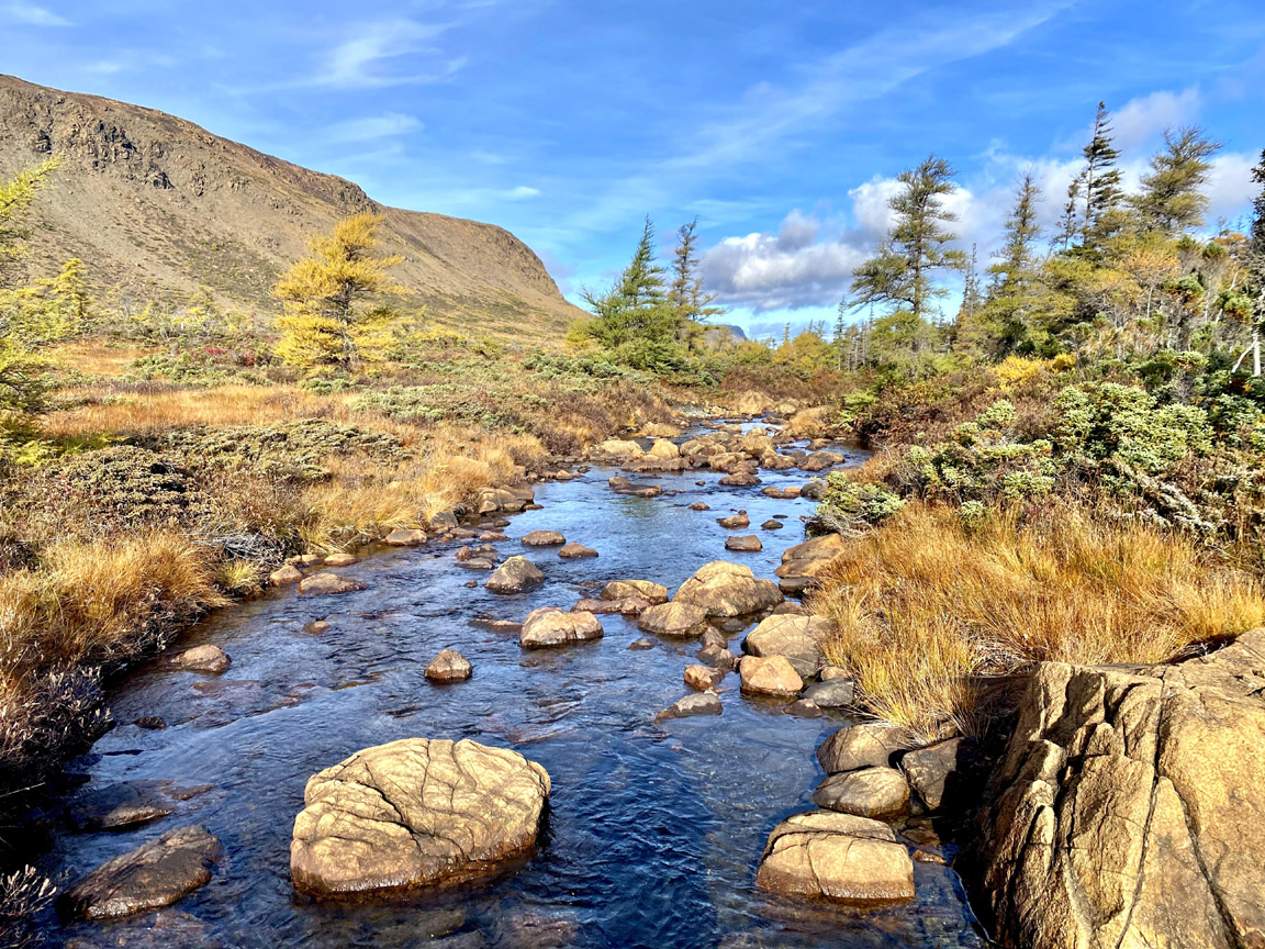
Leaving the gulch, hikers follow along the edge of Simms Brook before descending a trail through a coniferous forest to the shore of Serpentine Lake.
Along the way a short detour can be made back to Simms Brook for a series of waterfalls that are a great place to cool off.
Once at the lake, hikers are reminded to cross to the other side by walking on a sandbar on the western end of the lake, not by crossing the deeper river a short distance away. This crossing is not recommended on foot before July, as winter snowmelt may raise the lake level to waist deep or higher. (Summer levels are normally between knee and thigh.) Once on the other side, the beach near the logging road is a great place to camp for the night.
Stage Four – Lewis Hills
is 36.5 km (22 miles) in length and begins with a 2.5 kilometer (1.5 mile) walk on a gravel backcountry road to the trailhead of the IATNL Lewis Hills Trail. After a shallow stream crossing and 2 kilometer (1.25 mile) trek up a forested trail to the base of the mountains, hikers are afforded a terrific view of the route from Simms Gulch
before navigating around boulders and across stream to a small pond at the entrance to Wheelers Gulch.
From there it’s a 1 km walk to the entrance to Red Rocky Gulch and another Mars-like peridotite landscape from Earth’s upper mantle.
It’s a 5 kilometer (3 mile) trek up through the gulch, which begins by walking on small rocks along the side of the brook and ends by weaving around large boulders on the west bank of the upper gulch, which rises to an elevation of 620 meters (2,035 feet).
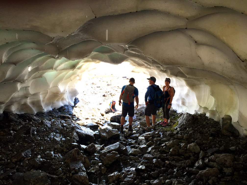
Once in the high country above 500 meters (1,640 ft), it is quite possible to cross snow fields in summer and discover an ice cave with cool shade on a hot day.
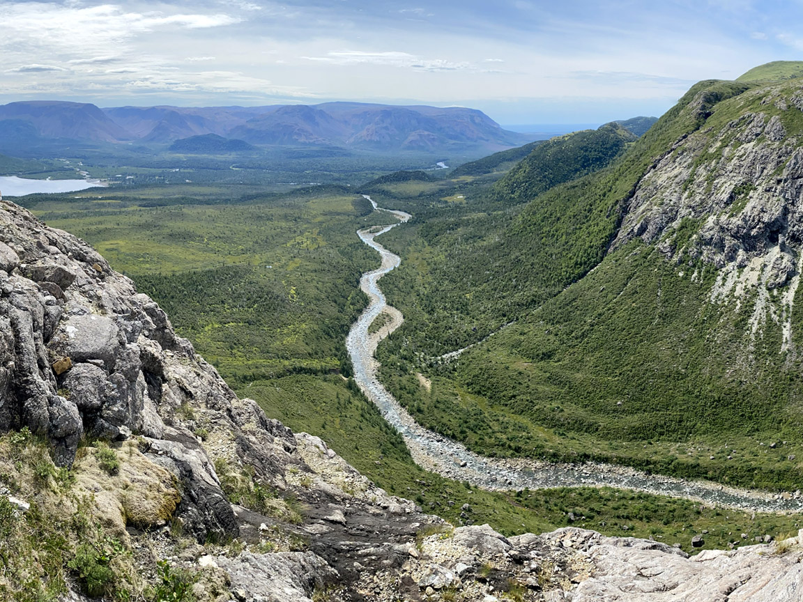
Just 3 kilometers (2 miles) from the top of Red Rocky Gulch is the back end of Rope Cove Canyon, which affords a magnificent view of a multi-colored valley composed of peridotite on the southern end and mafic gneiss and amphibolite of the Mount Barren Complex on the northern end, with the Gulf of St Lawrence in the background. This is a good place to camp for the night, with a small stream to cook and wash.
Day Two of this stage is a 19 kilometer (12 mile) trek that begins with sweeping vistas of the headwaters of Fox Island River and a perpendicular tributary flowing from Cabox
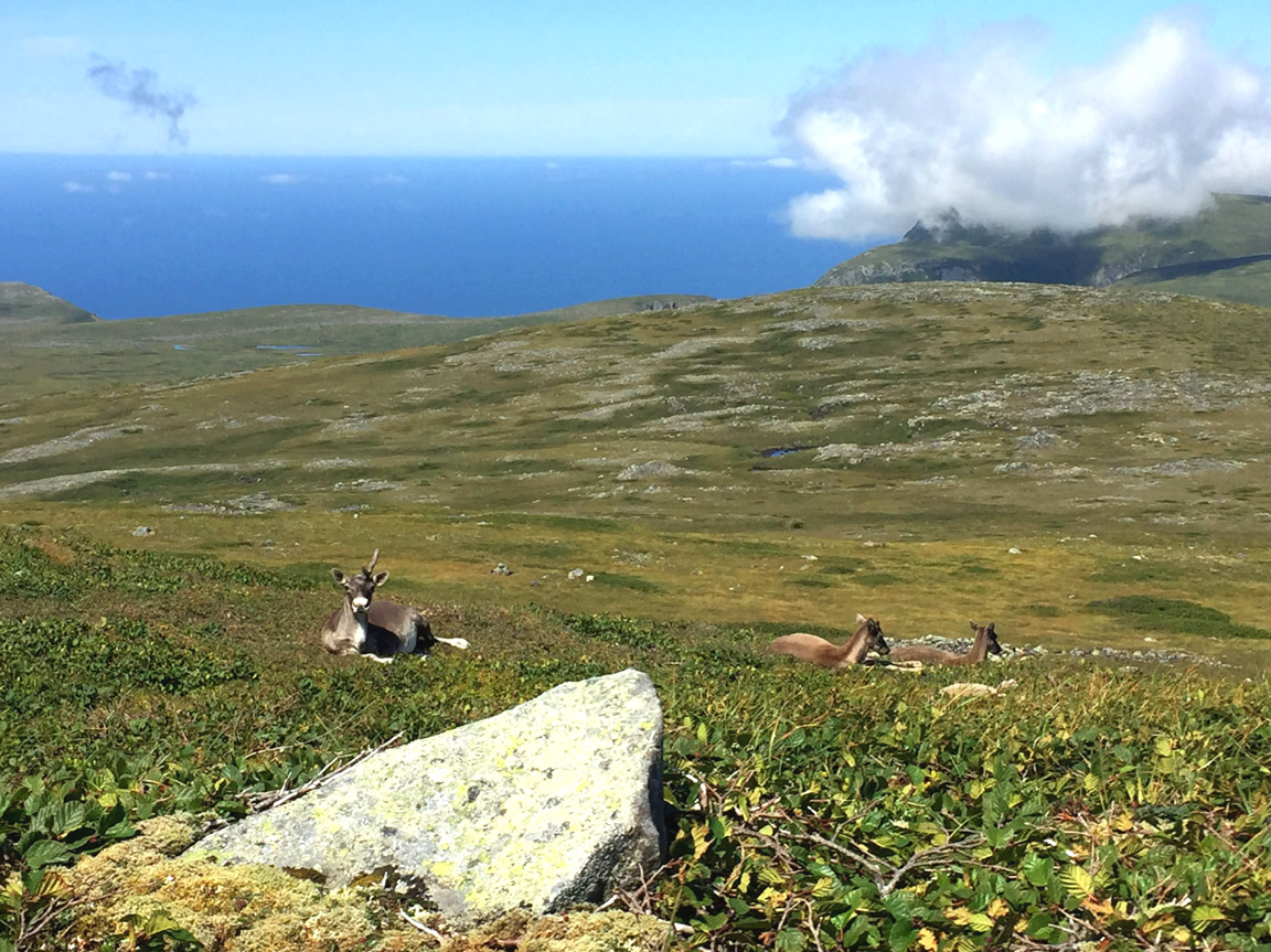
which at 814 meters (2,670 feet) is the highest point on the island of Newfoundland. Lucky hikers may encounter a family of caribou resting there in the midday sun.
An alternate route to the Cabox from Rope Cove Canyon is via Molly Ann Gulch along the IATNL Lewis Hills Trail, just a short distance away but in the substantially different Mount Barren geological formation
where like Rope Cove Canyon, campers may be fortunate enough to watch the sun set into the Gulf of St Lawrence.
No matter the route to the summit, it’s all downhill from there! … first across a broad gentle slope then down another peridotite gulch
that ends in a series of crystal-clear cascading pools that drain into Fox Island River.
An easy crossing of the shallow river is followed by a 160 meter (525 feet) climb up a moderate slope providing good views of the mountains and river
then a level 2 km trek through a relatively dry wetland and forest trail to the southern trailhead of the IATNL Lewis Hills Trail.
Be sure to pre-arrange transportation from this point, which is a 1 – 1.5 hour drive over gravel backcountry road (in ATV, SUV or pickup truck) from Stephenville.