
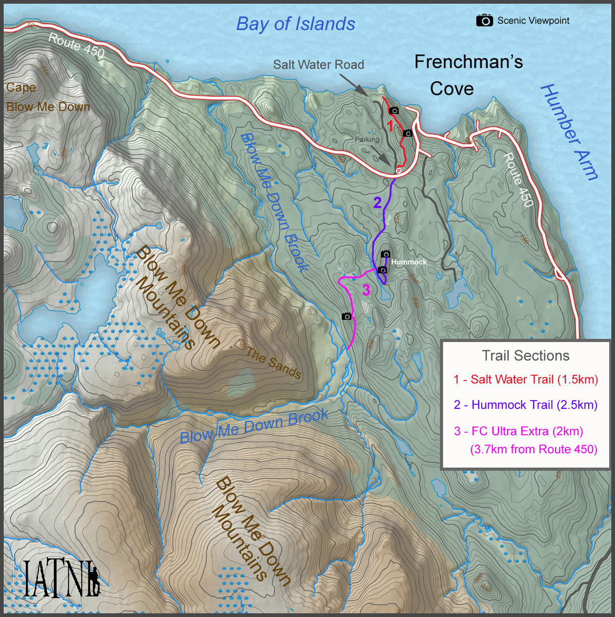
The IATNL Hummock Trail is the second of three connected trails above Frenchman’s Cove on the south side of Bay of Islands, with the other two being Salt Water Trail and FC Ultra Extra.
The trail extends 2.5km from Route 450 near Salt Water Road to the top of the Frenchman’s Cove Hummock. Hikers can park their vehicle to the right immediately after turning onto Salt Water Road.
From Route 450, the 6-8ft wide trail corridor winds approximately 1/2 kilometer through forest and across short stretches of generally dry wetland until it comes within view of the Hummock.
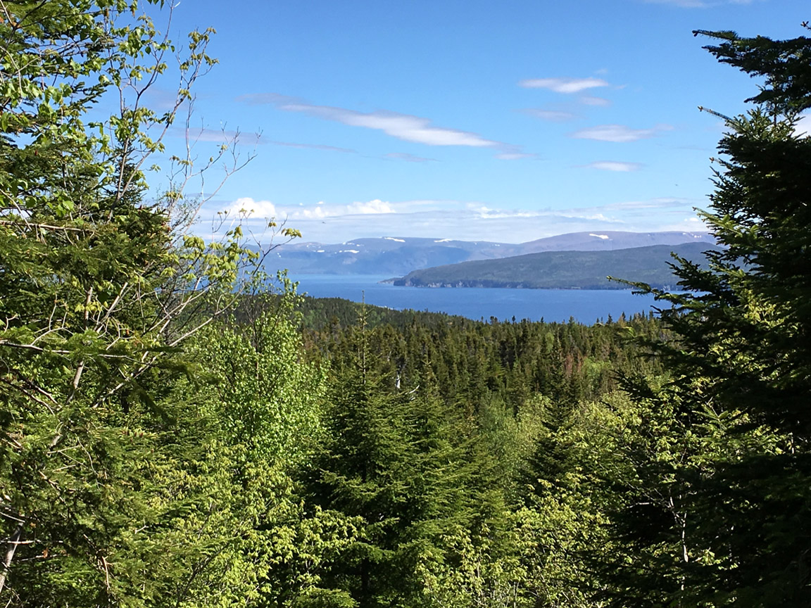
From there the trail rises 50 meters in 1km to the western side of the Hummock, where the FC Ultra Extra (an alternative UltramaTrex route to/from the Blow Me Down Mountains) turns off to the right. Looking back along this section provides an occasional glimpse of the Bay of Islands and the North Arm Hills, where the IATNL UltramaTrex long-distance route continues to/from Trout River just west of Gros Morne National Park.
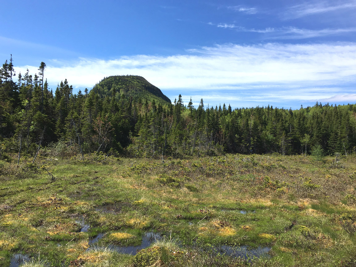
It is now only 200 meters until the trail makes a right angle turn to the left (east), followed by another 50 meters and left hand turn to the north. (Hikers that go too far will come to a cabin near the small pond and must turn back and search for the trail on the right.)
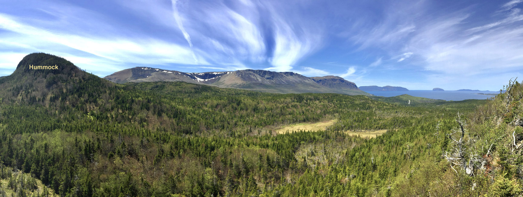
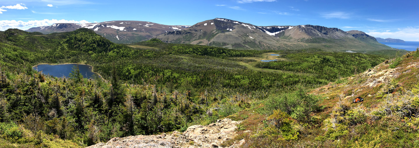
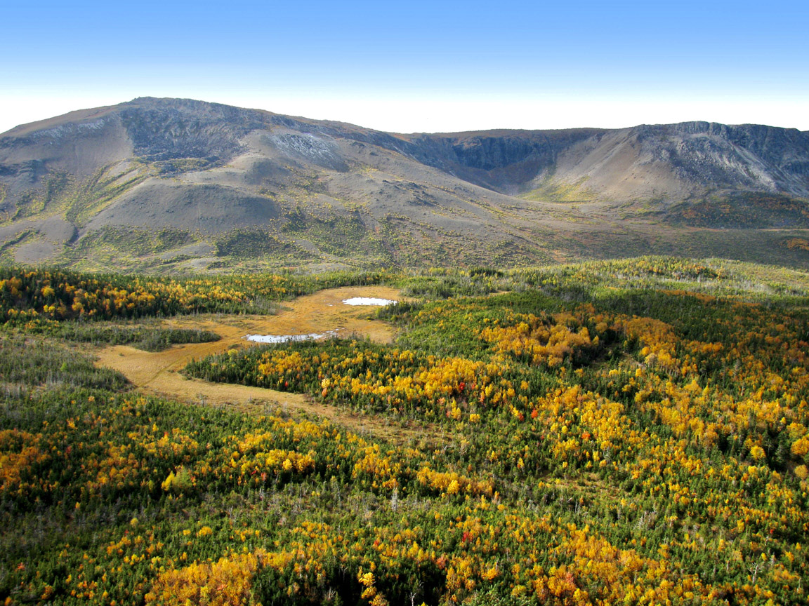
At this point the trail is at the base of the Hummock, where after a short steep scramble the route tapers off into a 200 meter long ascent up 70 meters elevation to the top. Along the way, dramatic views of the Blow Me Down Mountains reveal themselves to the west.
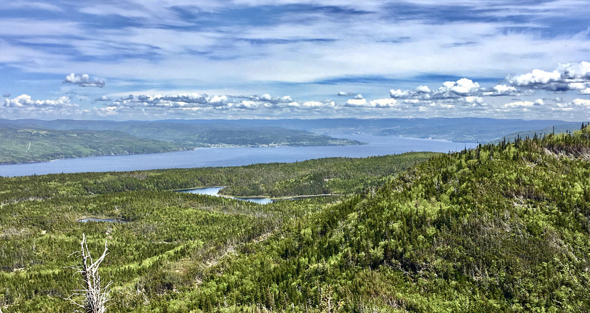
Turning to the east provides a view of Humber Arm to the city of Corner Brook, a distance of 20km.
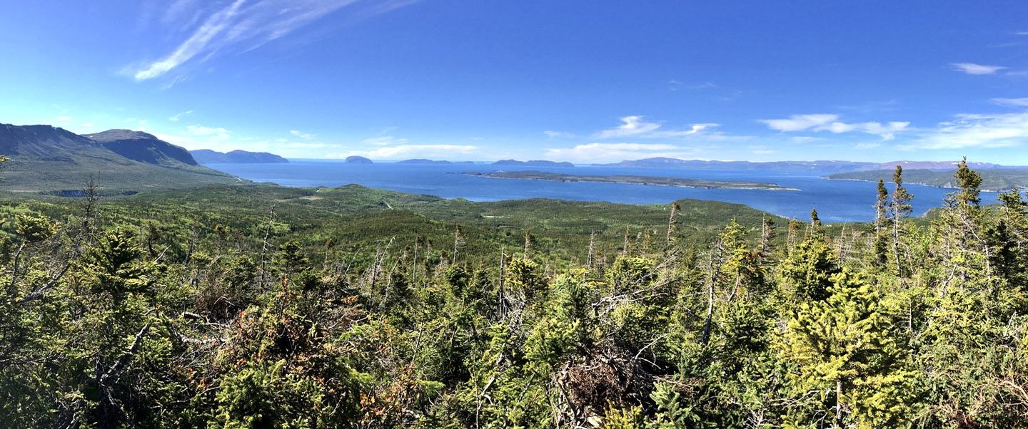
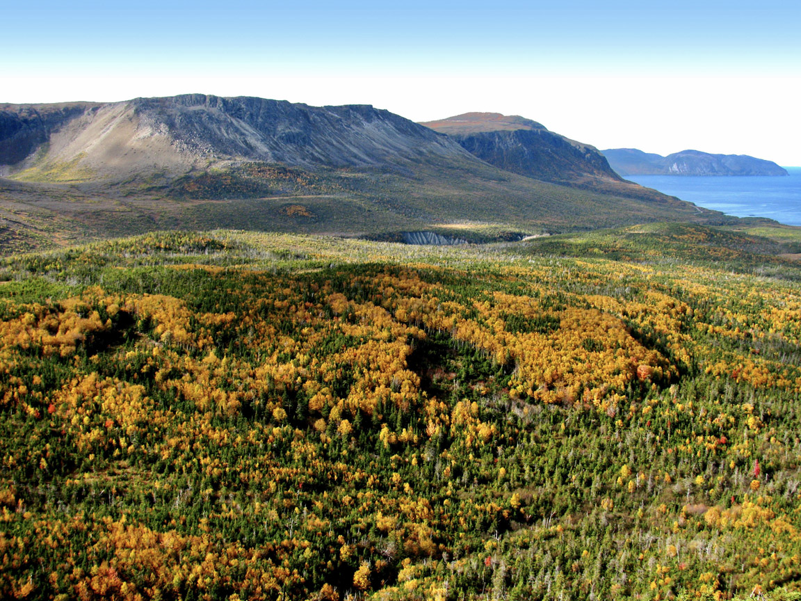
A 200 meter walk to the north side of the Hummock reveals a terrific panoramic view of the outer Bay of Islands, from Cape Blow Me Down to Middle Arm Point.
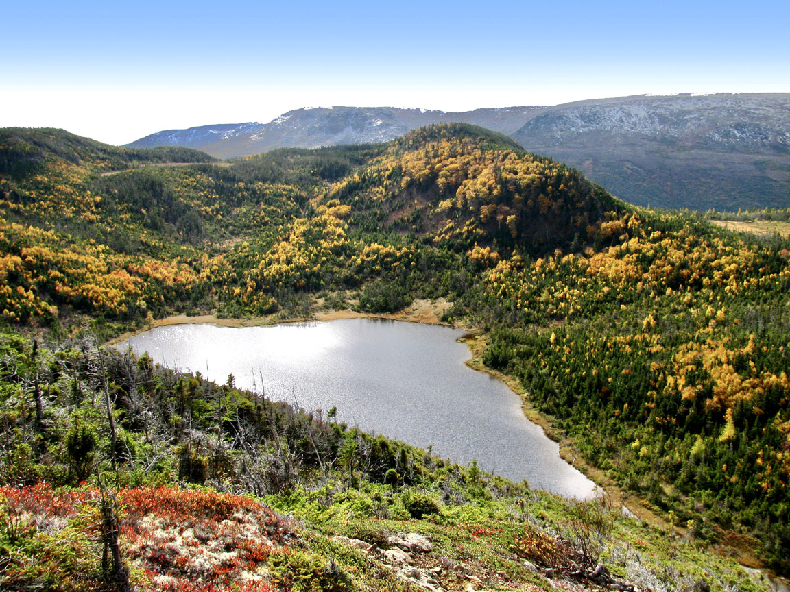
Like most of Western Newfoundland, the autumn views from the top of the Hummock are ablaze in orange and gold.