

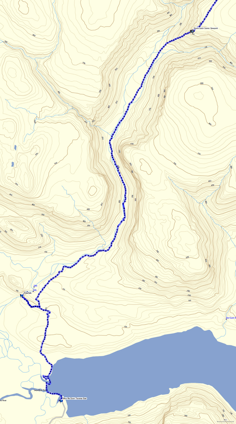


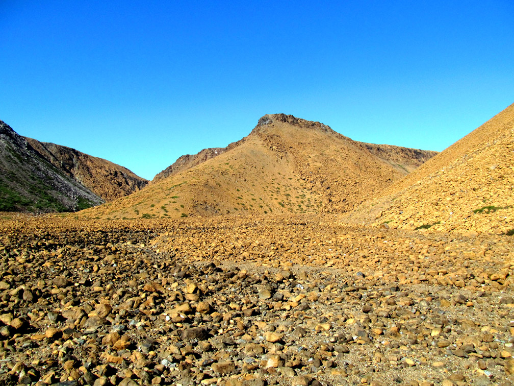


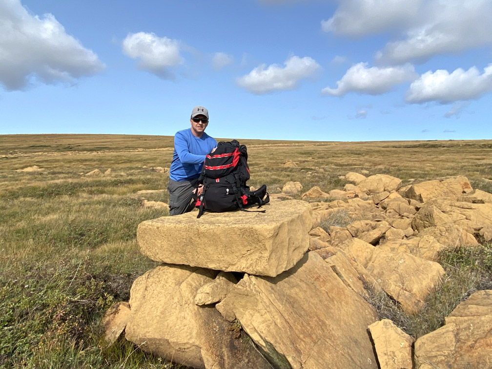


The Blow Me Down Traverse is a 29km (17.5mi) trek across the Blow Me Down Ophiolite Massif, from the western end of Serpentine Lake and Simms Gulch in the south (below photo) to Frenchman’s Cove on the south shore of the Bay of Islands in the north.
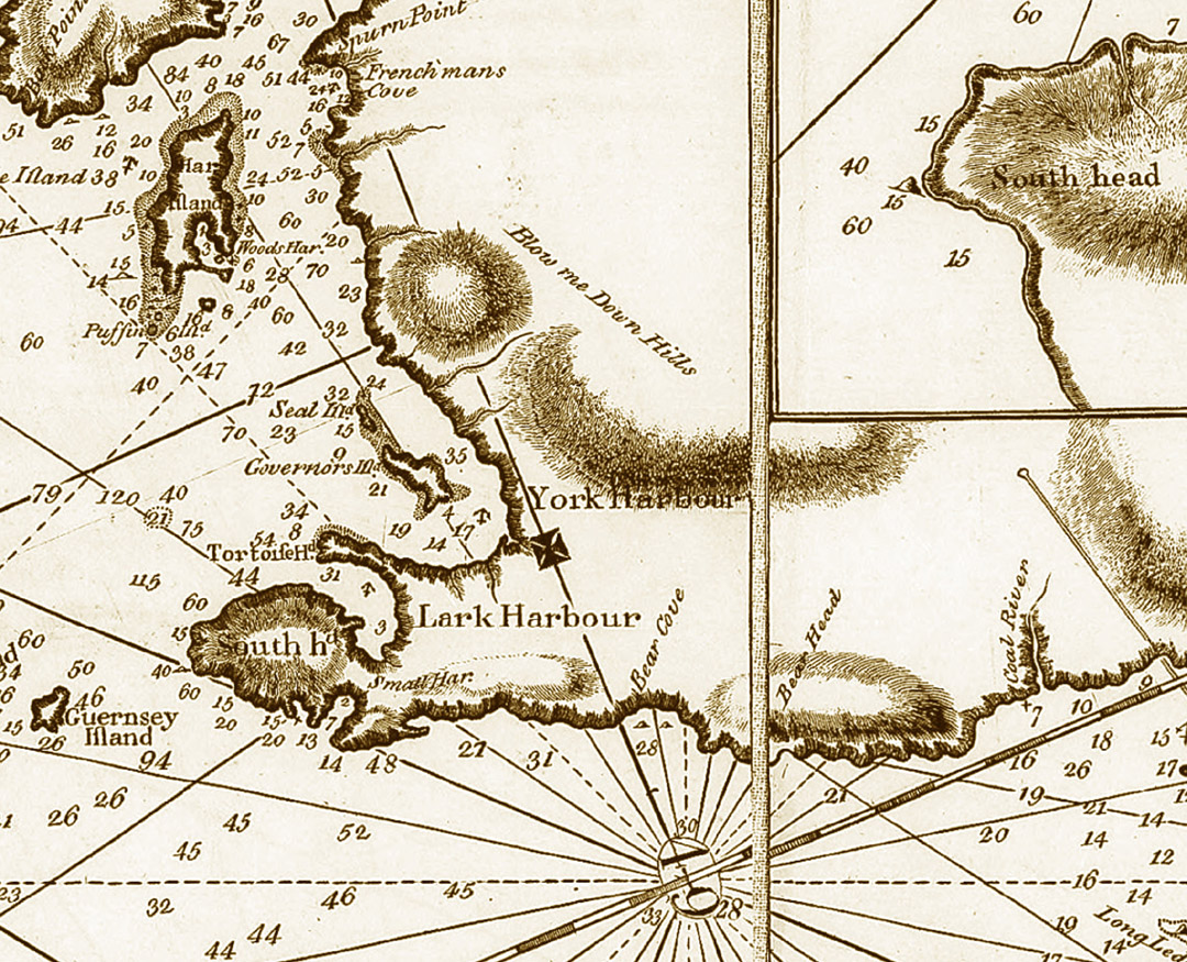
The “hills” were named “Blow Me Down” on renowned explorer, surveyor and cartographer James Cook’s Chart of the West Coast of Newfoundland published in 1768, the year Cook was selected by the British Admiralty and Royal Society to command a voyage to the South Pacific to witness the transit of Venus and search for the fabled southern continent. Cook charted the region the previous year and observed that “winds blow here sometimes with great Violence Occasioned by the nature of the land, there being a Valley of low land between this Harbour and Coal River [Serpentine River] which is bounded on each side with high hills, this causeth these winds to blow very strong over the low land.”
The route essentially crosses the center of the massif along the geological boundary between rust-colored (i.e. oxidized) peridotite from earth’s mantle to the east and gray gabbro from oceanic crust to the west. These were forced to the surface by plate tectonics during the closing of the Iapetus Ocean approximately 500 million years ago.
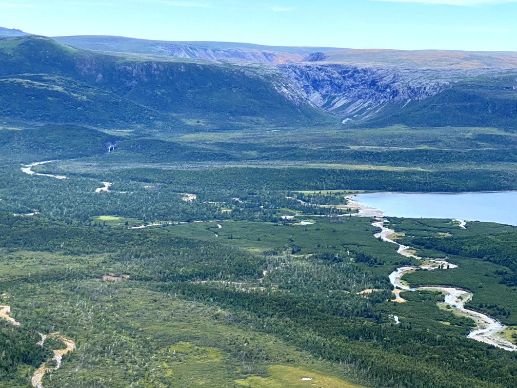
Both in the north and south, the trail route begins approximately 90m (295ft) above sea level and rises to a height of 640m (2100ft) near the summit between Blow Me Down, Simms and Knights gulches. Regardless of which end one starts, a Traverse of the massif requires ascending and descending the relatively steep back end of an ophiolite gulch composed both of peridotite and gabbro. In the north it is Blow Me Down Brook Gulch. In the south it is Simms (map below).
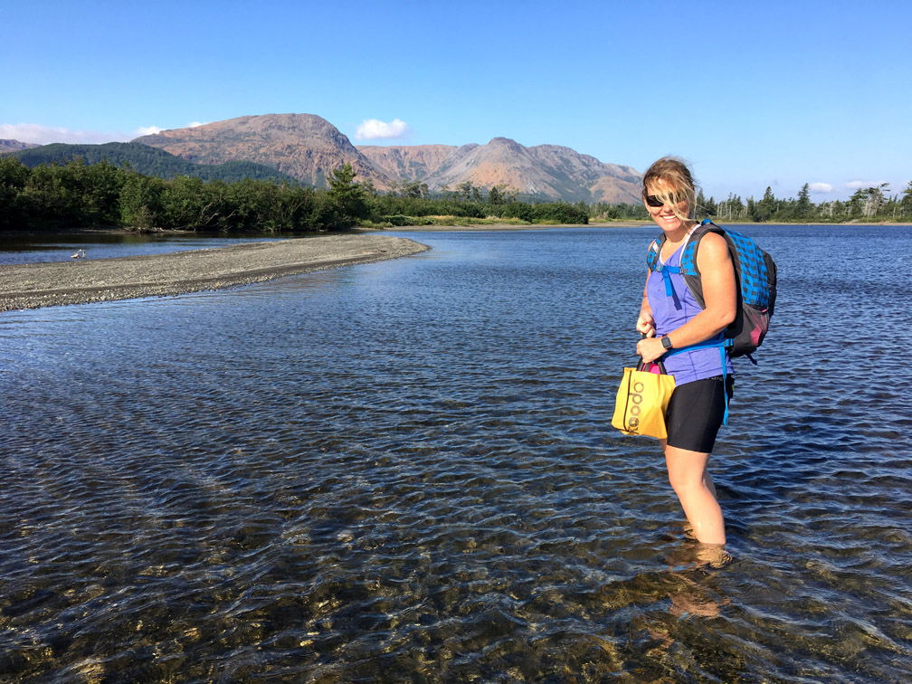
Starting in the south (e.g., after a trek of the Lewis Hills Trail or 1.5hr drive on the sometimes rough Logger School-Serpentine Logging Road), hikers must first cross the western end of Serpentine Lake, just above the running out of Serpentine River. After Spring run-off recedes, usually by mid-June, the water level above a sandbar near shore is generally no more than knee-deep. By late summer, it is often possible to walk the sandy beach around the shore and cross the 10-15m wide river with ease.
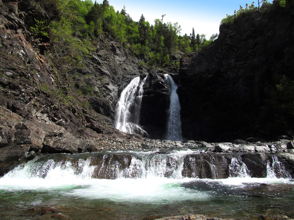
After crossing the river, the route meanders across a 100-200m grassy wetland before picking up a 1km cut trail up a forested hillside, across a dry shrubby barrens, then up another forested hillside until it reaches a fork in the trail, with the left branch leading to picturesque Simms Brook Waterfalls.
From the falls, there is another 2.5km trek through forest trail and along river bank before hikers descend to the rocky brook near the entrance to the gulch.
The rocks here are composed almost exclusively of light-gray gabbro, with a small percentage of rust-colored boulders washed down from the peridotite cliffs inside the canyon. But after another 2kms, the streambed becomes equal parts gabbro and peridotite, in spite of the fact that the canyon walls remain exclusively gabbro.
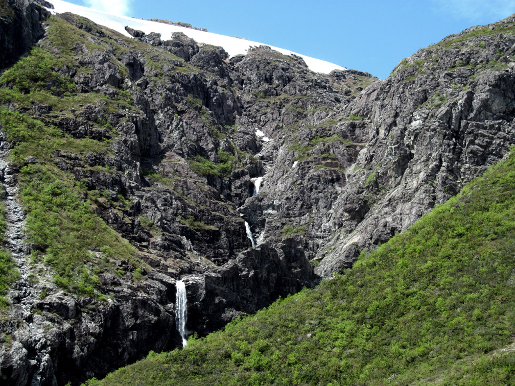
A short distance on the left, a cleavage in the canyon wall reveals a cascading series of waterfalls that drains much of the high country to the west, including the last of winter’s snow cover.
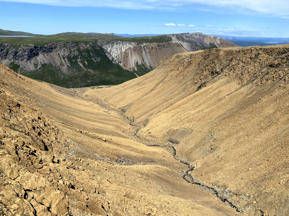
From here the source of the canyon’s peridotite also becomes evident, as the inner east flank and back end of the gulch are composed almost exclusively of peridotite.
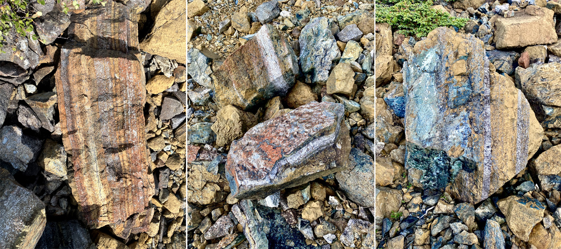
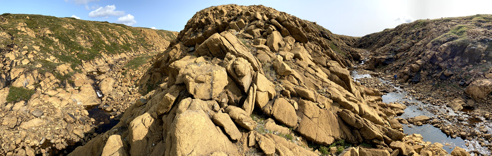
Here, as well as in Blow Me Down Brook Gulch to the north, one can find the boundary between oceanic crust (gabbro) and earth’s mantle (peridotite). Named the Mohorovičić Discontinuity, or Moho, after the Croatian seismologist who discovered it by identifying a change in the seismic waves velocity from the crust to the uppermost mantle within the lithospheric plate, it can usually be identified by a colorful layer-cake banding in the rocks, including gray, rusty orange, and a variety of other colors and shades derived from the various rock types and metamorphic changes found within the rocks.
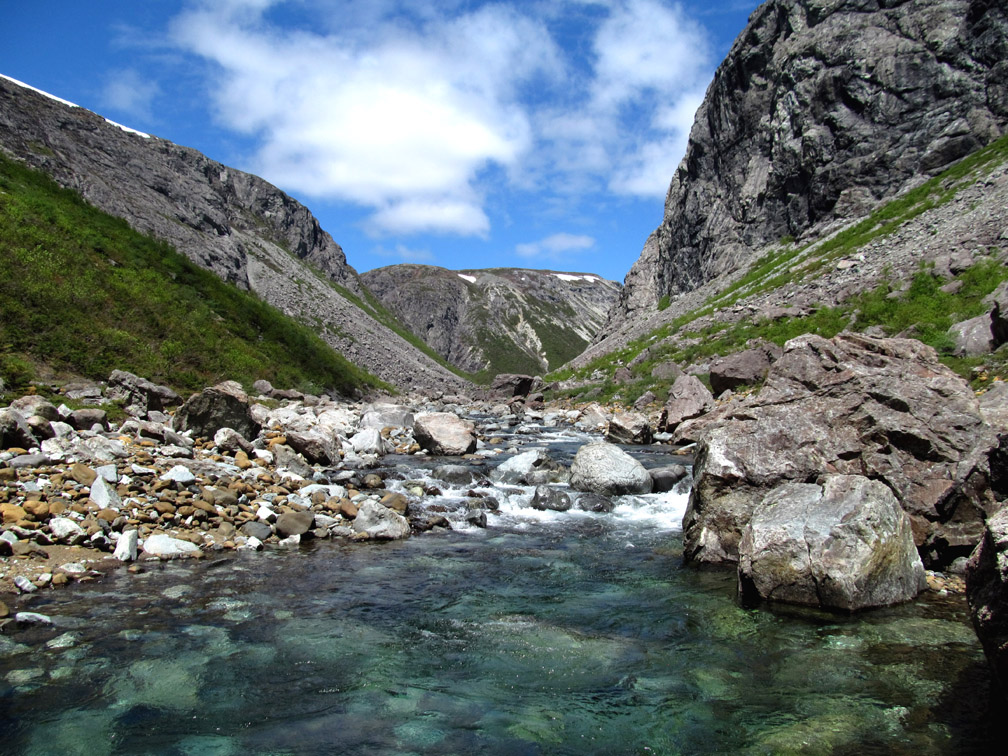
In addition to the Moho, Simms Gulch is characterized by what can be referred to as a stone glacier, whereby the flat central lowland of the canyon is covered by a broad boulder-strewn conveyor belt moving imperceptibly slow down the 5km (3mi) long canyon, with a crystal-clear stream appearing then disappearing below the rocky surface.
At the back end of the canyon, hikers must climb the long peridotite slope that divides the gulch into north and east branches, with only the latter passable by rock-hopping stream-crossing adventurers.
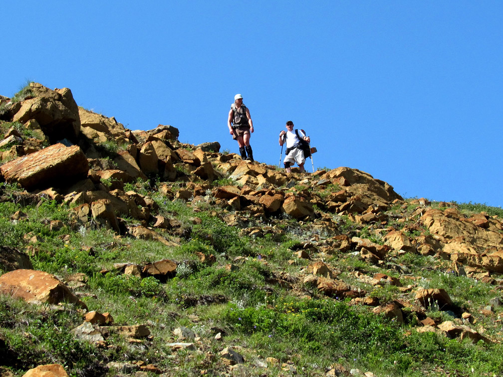
Though a little steep at the top, the ridge is not a dangerous or difficult climb, if hikers take care and follow the easiest route to the top.
The ridge, whether halfway up or near the top, provides a spectacular view of Simms Gulch
and its north and east branches.
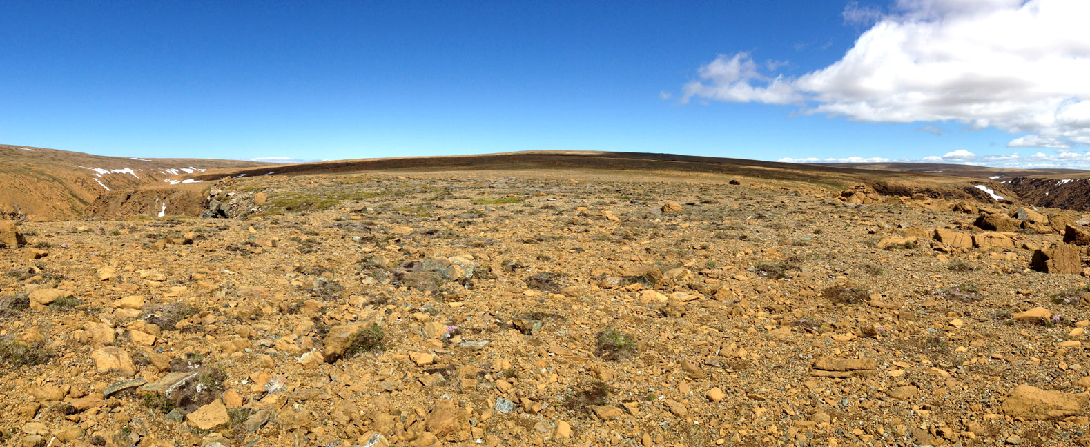
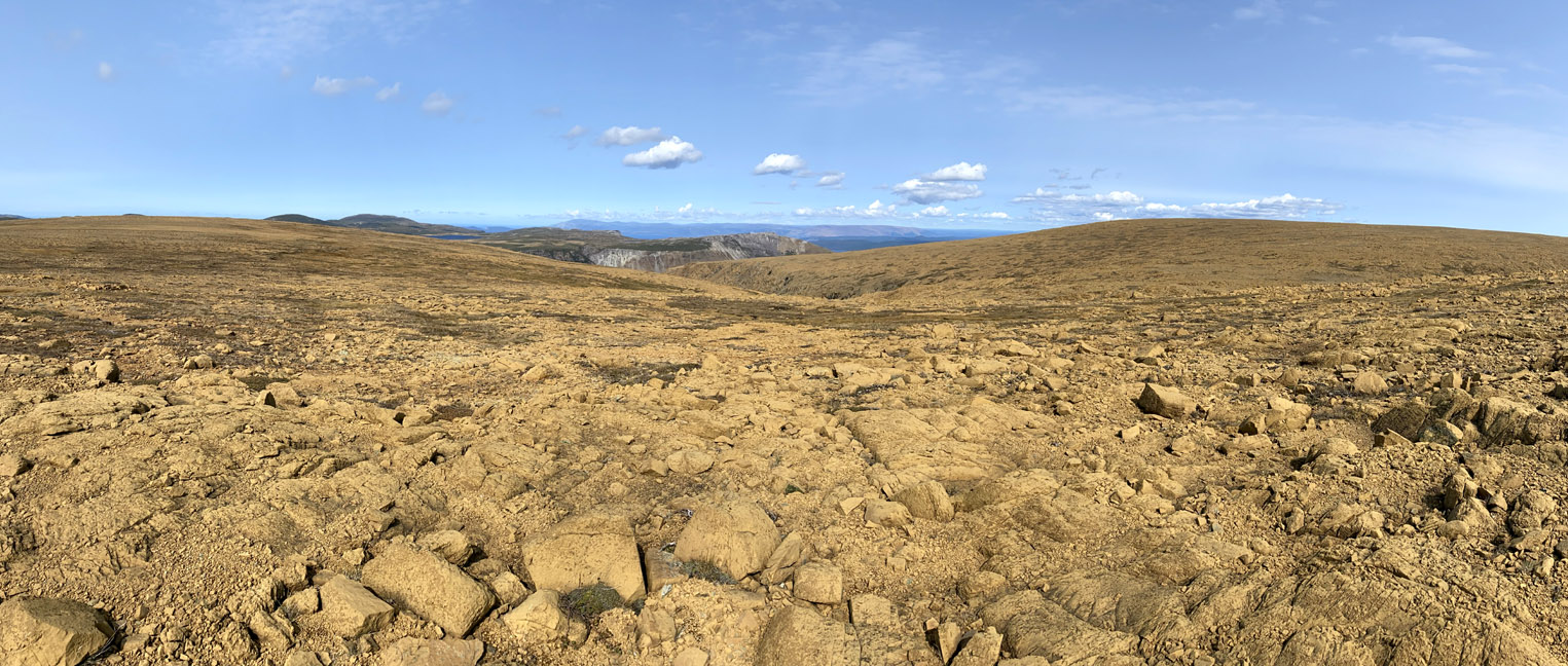
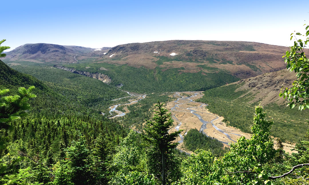
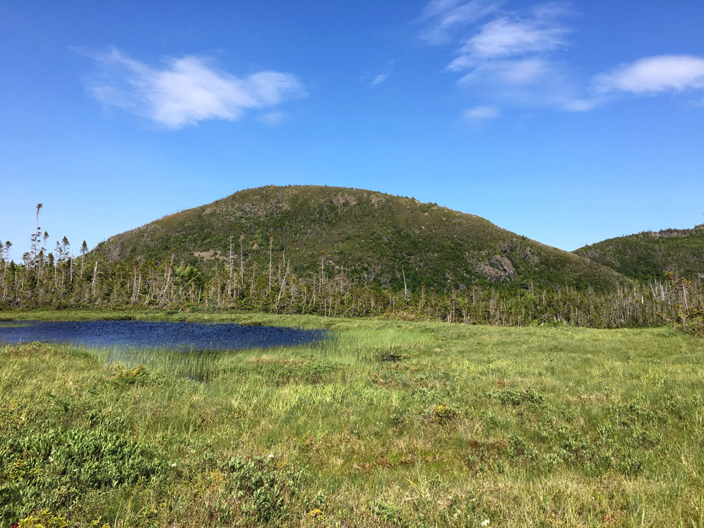
Once on top, the landscape changes dramatically, from rugged cliffs and steep canyons, to rolling hills and serpentine barrens.
The Blow Me Down Traverse heads northeast and after 2.5kms intersects the upper reaches of Simms Gulch’s North Branch, where it cuts much less deep into the massif and splits again into its own north and east branches.
Both branches provide an opportunity for hikers to take a refreshing dip in a small pool on a hot day.
Walking in this broad and barren big sky country is done with ease, particularly while following along the side of the brook.
An ideal spot to stop for lunch on a calm day is Table Rock, which is just 2kms south of Blow Me Down Brook’s South Branch.
Soon hikers must leave the brook behind and find their way across open country, at times weaving around small bog puddles
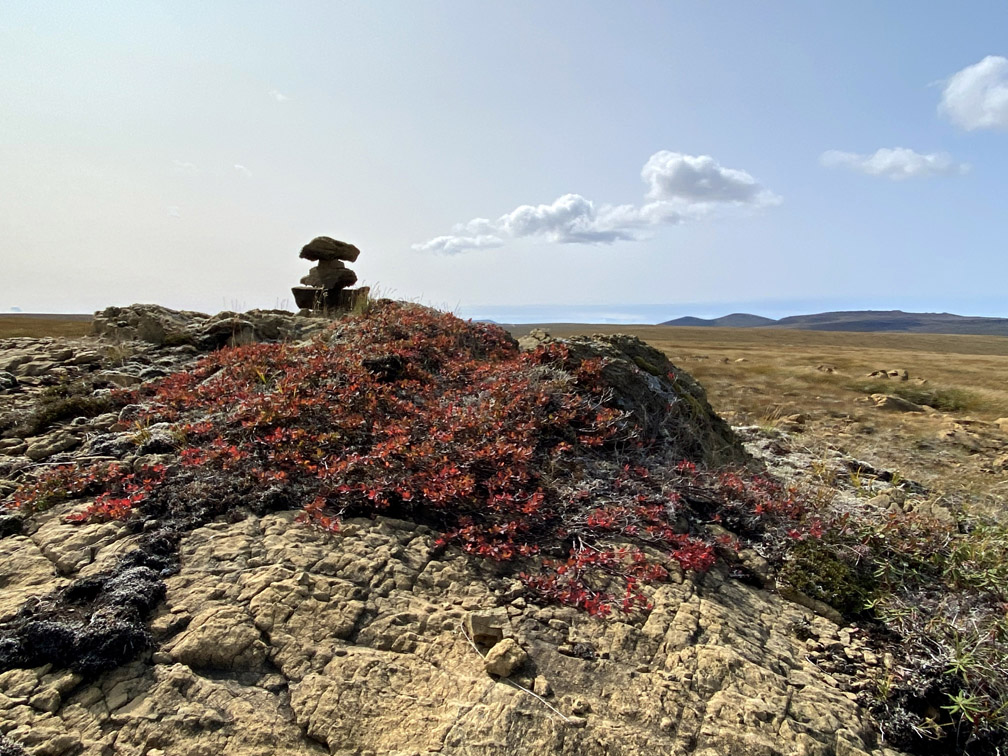
while aiming for a distant landmark, such as outcrop cairn.
These windswept central barrens with a good mix of vegetation and water sources is an ideal location to view caribou in their summer range
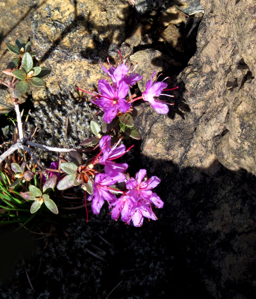
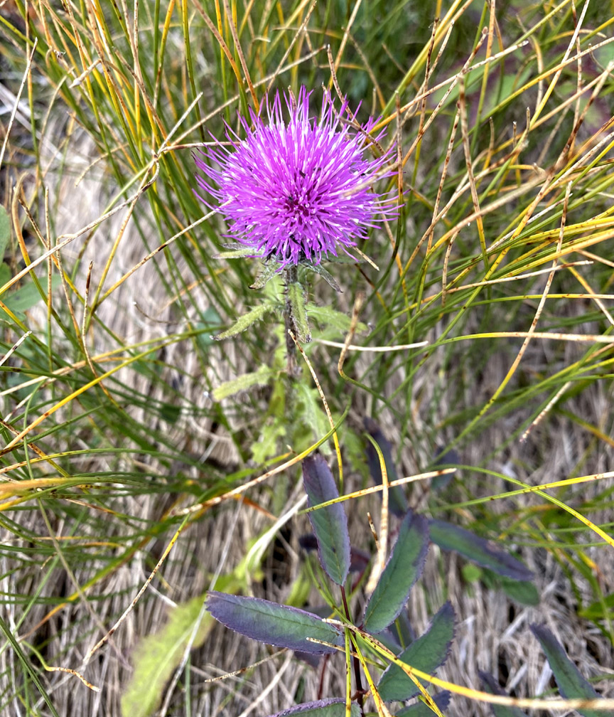
and a variety of wildflowers, some of which are rarely seen beyond this ultramafic landscape.
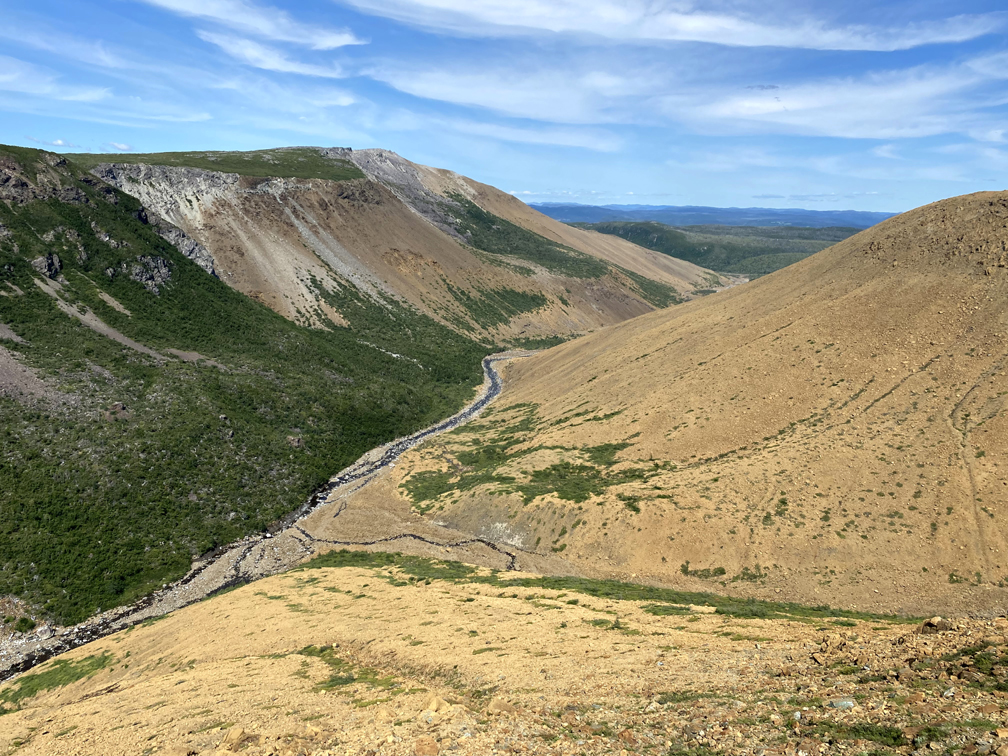
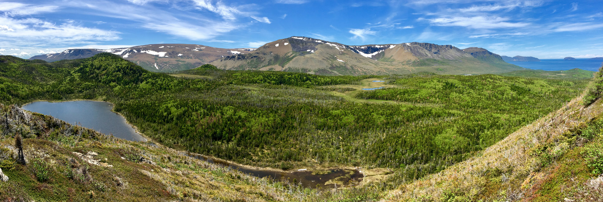
From a height of 640m (2100ft), near the intersecting point of Simms, Blow Me Down and Knights Brook watersheds, the Traverse descends towards the back end of Blow Me Down Brook Gulch’s South Branch
with its view of a south-facing gray gabbro cliff wall from a north-draining rusty peridotite valley.
From here, hikers follow along the western edge of the South Branch, staying high enough to avoid descending into the impassable canyon while remaining low enough to take advantage of its spectacular views.
At the point where South Branch meets Blow Me Down Brook Gulch, a sweeping panoramic vista extends from Blow Me Down Brook Falls to The Sands, a long sandy ridge that rises to the top of the gulch’s north flank and provides good access to the gabbroic half of the massif.
It is here where hikers must make a switchback descent to the canyon floor below, taking care not to send a loose rock tumbling down onto fellow hikers below.
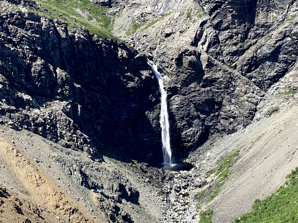
The descent also provides great vantage points to view Blow Me Down Brook Gulch
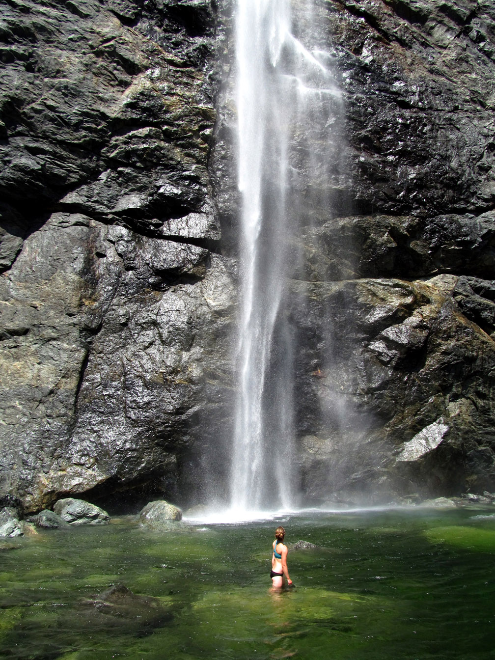
and 100m (328ft) high Blow Me Down Brook Falls
where a short detour provides a great opportunity to cool off in a large deep waterfalls pool!
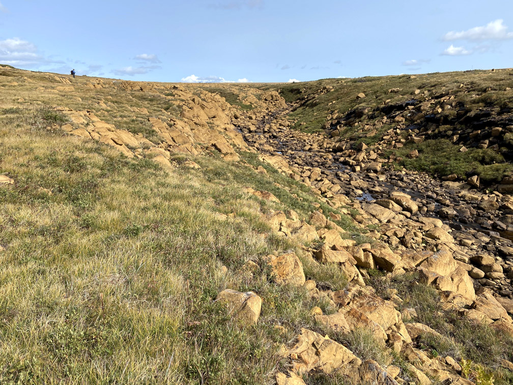
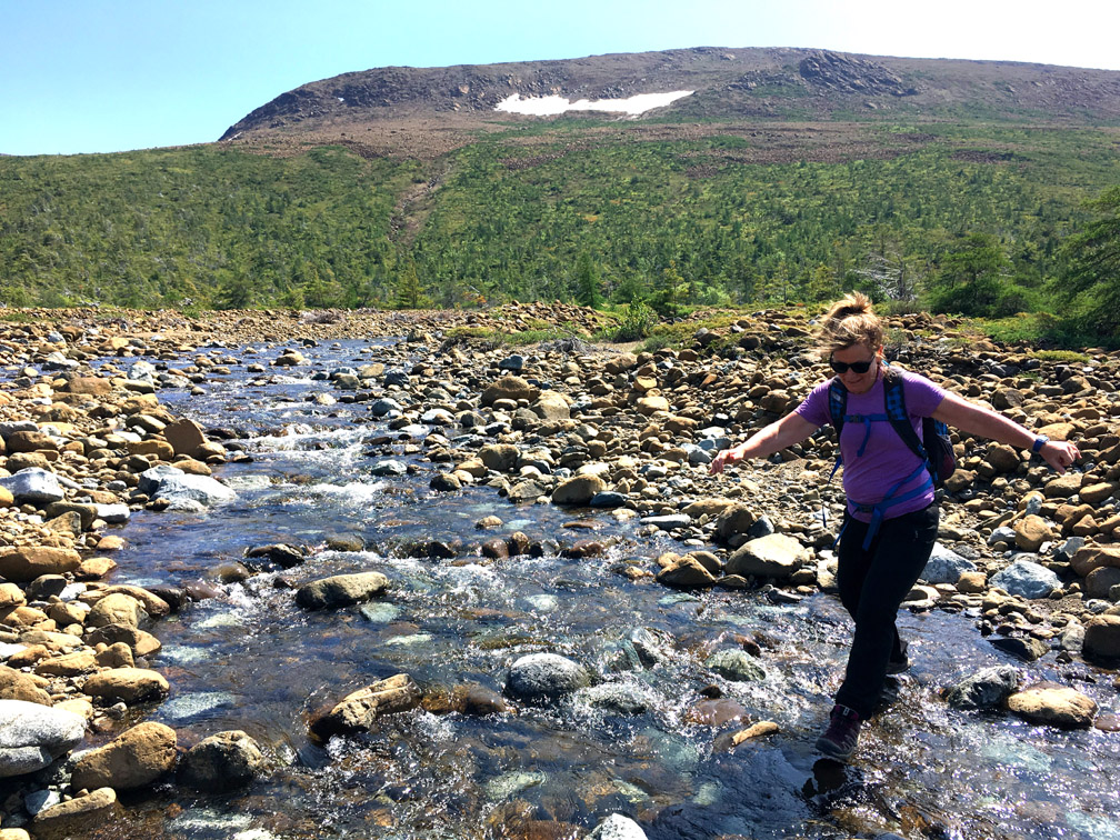
From the waterfalls, it is a rock hopping 3.5km (2mi) trek downstream to the entrance to Blow Me Down Brook Gulch
Soon it will be necessary to cross the rocky brook … with hikers still on if your balance is good!
then climb 130m (427ft) vertical up a hillside trail that provides nice views of Blow Me Down Brook and Mountains.
After another 1km of forest trail and half kilometer across a generally-not-too-wet bog, the Traverse connects to a little-used 2km atv trail at the base of the Hummock
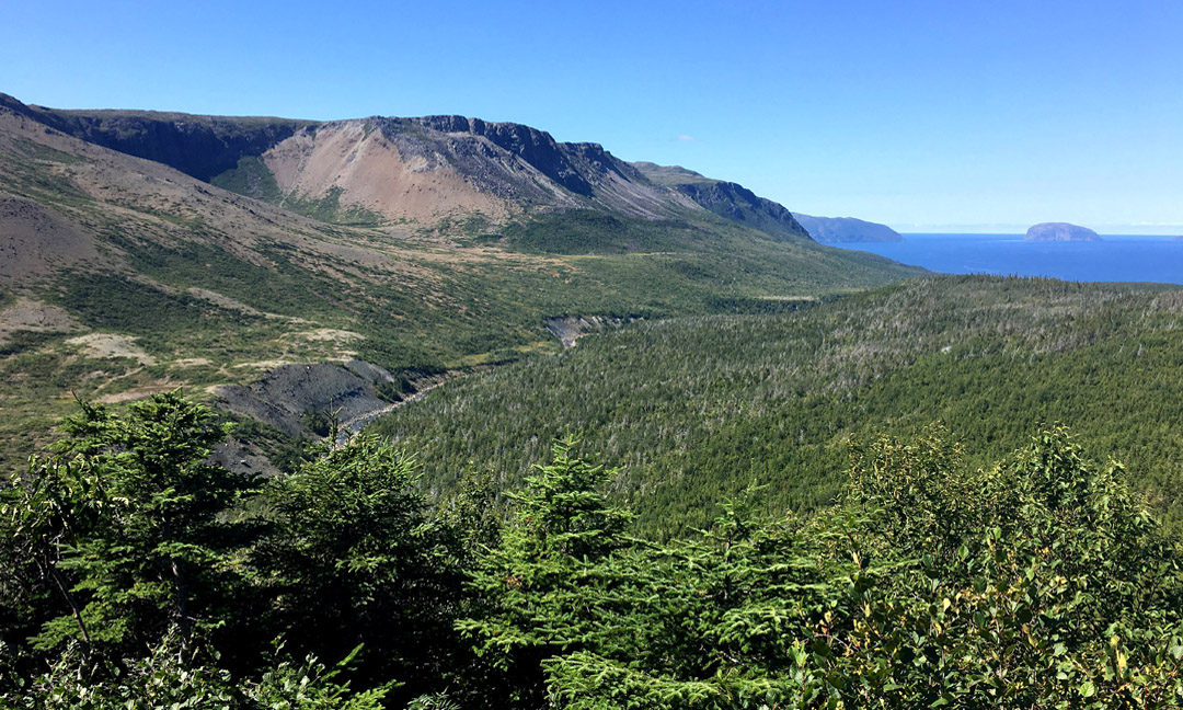
where a short 100m (328ft) vertical trail to the top provides a panoramic view of the Blow Me Down Mountains and outer Bay of Islands.
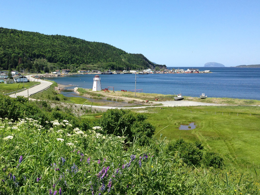
From the Hummock and adjacent atv trail, it’s all downhill to the finish at Frenchman’s Cove, with its picturesque little harbour and view of Guernsey Island (aka Weeball), named after one of Newfoundland Governor (and Admiral) Hugh Palliser’s frigates during his visit in 1764 after the Seven Years War.