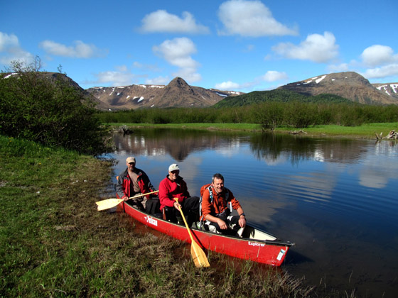
On June 12, IATNL executive members Paul Wylezol, Arne Helgeland and Kevin Noseworthy took Hugh Barron, Marketing Sector Manager with the British Geological Survey in Edinburgh, Scotland, on a day-hike into Simms Gulch on the north side of Serpentine Valley. The 24 km (15 mile) trek was under ideal conditions, including clear blue skies, good visibility, mid-teens temperatures, and few black flies and mosquitos!

The day began with a 1.5 hour drive on Logger School and Serpentine roads, gravel logging roads that get rougher and narrower the closer one gets to Serpentine River. Once at the river, the quartet paddled around the western end of the pond at the “running out” of the river.

(Left to right) Kevin Noseworthy, Arne Helgeland and Hugh Barron
(Click to make image larger)
From the north side of the river, the quartet followed the IATNL Blow Me Down Mountain Trail to Simms Falls, which also provided a scenic view of the Lewis Hills.
(Click to make image larger)
From there they hiked to the entrance of Simms Gulch, a nice place to stop for lunch before heading into the narrow 2,000 ft (650 m) ophiolite valley of earth’s mantle and oceanic crust.

Arne Helgeland taking a well-deserved break

Hugh Barron at the entrance to Simms Gulch
(Click to make image larger)
Soon the vista changes from various shades of green and grey to also peridotite orange, bisected by Simms Brook as it emerges from under the rubble of tumbling rocks.

To the left is a series of cascading waterfalls emerging from a hilltop gully, sending winter snowmelt on its sinuous journey to Serpentine River and the Gulf of St. Lawrence.
(Click to make image larger)

Simms Gulch itself was strewn with a variety of unusual ophiolite rocks, most having wash down the valley but many having broken lose and tumbled down the side of the steep valley.

Kevin Noseworthy and a green faced boulder

Paul Wylezol and Hugh Barron (in green shirt)
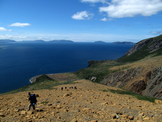
Before long the day-hike adventurers were at the base of a long gradual ridge that ascends between a fork in the valley. This is one of the few ways to the Blow Me Down Mountain plateau above.

On the climb out of this rocky gulch, it was surprising to see small patches of colorful wildflowers, unusual for this alkaline landscape generally devoid of plant life.

Looking up, the view of the valley and surrounding mountains was unrivalled, made even more so by the near perfect clarity and light of this late afternoon.
(Click to make image larger)
The view from above also provided terrific views of the two side valleys

one of which (Simms East Gulch) Paul circled around and descended to explore.

View of Simms East Gulch (formerly Chicken Gulch)
To his satisfaction, the side gulch was passable, made all the easier by the occasional snow bridge and tunnel

that helped replenish small waterfalls that spilled into crystal clear pools.

And it was a good thing, as the sun was beginning to set below the west wall of the gulch as the explorers made their way out of the canyon and back to the canoe paddle across the lake.
(Click to make image larger)


