On April 10, 2014, IAT Chairperson Paul Wylezol and IATNL Finance Director Kevin Noseworthy set off on a 16-hour snowmobile/hike duathlon across the North Arm Hills. The purpose of the adventure was to check out the condition of a remote fishing outpost at Stowbridges in North Arm of the Bay of Islands. It will be used as a base for hiking across the North Arm Hills to and from Gros Morne National Park.

The day began with a 50-mile snowmobile ride on Goose Arm Logging road to the eastern end of the North Arm Hills. After a short break, the duathlon duo headed into the hills on their way to Liverpool Ponds, site of a planned IATNL hiking camp, approximately halfway between North Arm, Bay of Islands and Trout River Pond.

The terrain on top of the 2,000ft mountains is characterized by rolling hills and broad valleys, which in winter is mostly snow-covered and barely recognizable.

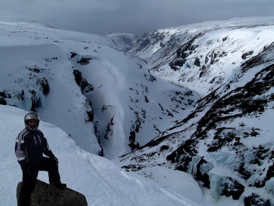
The two Liverpool Ponds are located at the headwaters of Liverpool Brook, which enters a steep and winding gorge with a series of waterfalls, shortly after it drains from the ponds.

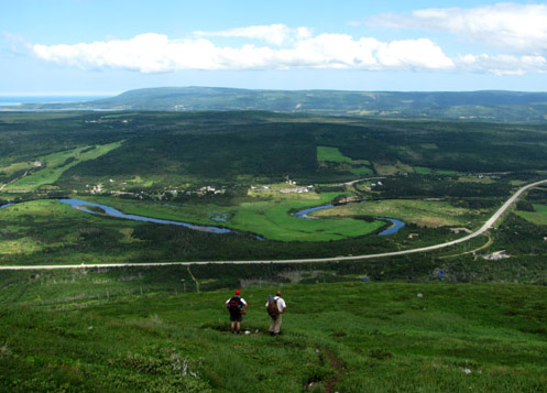
From there Paul and Kevin rode up a gentle snow-covered wind-swept stream valley and meadow, which in summer serves as the perfect trailway from the barren and rocky North Arm Hills down a grassy transition to subalpine tundra.

Once on top of the North Arm Hills, the landscape changes dramatically, from a predominantly white blanket of snow with occasional outcrops of dark gray rock and scrub to predominantly rust colored peridotite with occasional patches of disappearing snow.

This southwestern side of the mountains is windswept by the prevailing southwesterlies, which gathers and dumps the blowing snow across the eastern lee side of the hills. The abrasive rocks tend to snag bits of snow, taking on the appearance of giant frosted gingerbread.

The temperature here is generally 5 – 10 degrees Celsius colder than the coastline below, with this day reaching approximately -15C with the wind chill.

The top of North Arm Hill marks the end of the first stage of the snowmobile ride and the beginning of a 2.5 mile (4 kilometer) 2,000 foot descending hike to the fishing outpost of Stowbridges on the north side of North Arm, Bay of Islands.

The gentle slope to the bottom provides fantastic views of the bay, including the outer edge of sea ice catching the day’s lazy waves and occasional drifting ice.

The view west includes serrated coastline and coastal cliffs, and emerging islands from clouds and mist.

Once at sea level, Paul and Kevin walked the icy shoreline

to within sight of Stowbridges, where they scrambled up a gully and walked around a seaside cliff that barred access to the sheltered cove.

The small summer fishing outpost has been used by Cox’s Cove fisherman for approximately 100 years. Its position on a sand and gravel beach tucked behind a low headland is one of the few on the north side of the bay protected from the prevailing south westerlies.

After sizing up the condition of the house and storage sheds and determining what materials are required to bring them up to satisfactory condition, the two riding/hiking “duathletes” turned around and headed back up the shore and long gentle slope of North Arm Hill.

Over their shoulders the evening sun broke through the dark brooding cloud cover and lit up the bay and islands

before lighting the way forward off the glistening icy hills.

Stay tuned for more news and adventure from the North Arm Hills and “Safe Haven” at Stowbridges!


