
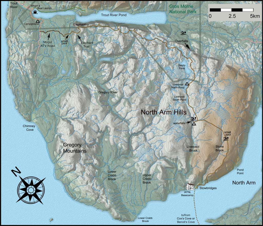


The IATNL North Arm Traverse is a 48km (29mi) north to south or south to north traverse of North Arm Ophiolite Massif that includes the 3.8km (2.3mi) IATNL Elephant Trail and 3.3km (2mi) Mogul ATV Road in the north.
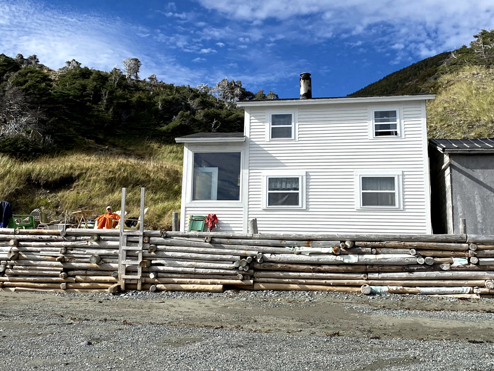
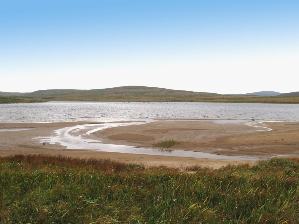
When beginning in the south, the traverse requires a 13km (8mi), 20-40 minute (weather dependent), dory ride from Cox’s Cove in Middle Arm, or 25km (15mi), 30 minute zodiac ride from Benoit’s Cove in Humber Arm, to the IATNL Basecamp in Stowbridges Cove in North Arm.
The basecamp (which can sleep 10-12 people in bunks) is available for rent by hikers arriving late in the day, or those wanting a day of rest and relaxation before or after a trek. Note, the best time to cross the bay is in the morning or evening, to avoid a rougher ride if the wind comes up in the afternoon.
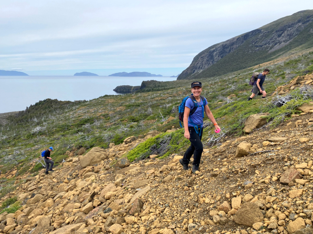
To start the Traverse, hikers must follow the trail behind the camp that leads to a small rust-colored peridotite barrens with a good view of the Bay of Islands and the route up North Arm Hill.
After crossing the little barrens, hikers must descend a little gully and follow the beach
where they have to cross a small brook before turning up another gully at the base of North Arm Hill.
Once up through the gully and over the side of North Arm Hill
hikers must turn right and head up the long, relatively gentle slope of the mountain, which provides nice views of the outer Bay of Islands
and rugged Stowbridges Gulch.
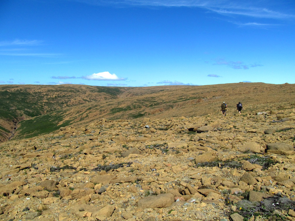
North Arm Hill is part of the ultramafic section of North Arm Ophiolite Massif, composed primarily of rust-colored peridotite from the earth’s mantle which was forced to the surface by plate tectonics during the closing of the Iapetus Ocean (pre-cursor of the Atlantic Ocean) approximately 450-500 million years ago when this multifarious landmass was located in the Tropics. In addition to the spectacular views, if hikers look down as they climb up, they will be surprised by the awe-inspiring scenery at their feet, from colorful and uniquely textured metamorphic rocks
to colorful and hardy plants able to find food and shelter in this Martian landscape.
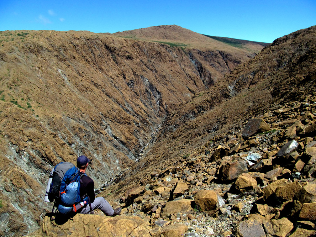
At 550m (1800ft) the hill begins to level off to plateau
as a series of headwater valleys drain into Stowbridges Gulch at left.
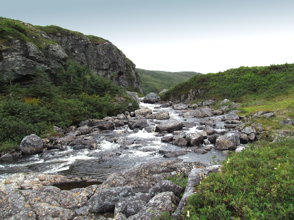
After 3.5km (2mi) strolling across a peridotite barrens, the trail route intersects a headwater stream with cascade and pool, an ideal spot for lunch and refreshing dip on a warm summer day.
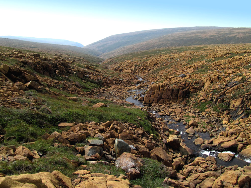
From here it’s just another kilometer to the primary headwaters of Stowbridges Gulch
which marks the dividing line to a dramatically different landscape of lush green grass and northwest draining streams.
The walking here is pleasant and much easier on the feet, knees and hips, and before long – another 3.8km (2.3mi) to be precise – hikers arrive at Liverpool Brook at an ideal location for stragglers and late departers to set up camp for the night.
In addition to being a somewhat sheltered location with good water source (in fact, all of the larger streams along the Traverse contain potable water), this pretty spot at the junction of a river and two feeder streams contains several picturesque waterfalls and pools ideal for splashing and photographing.
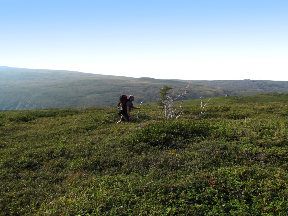
From this point, the trail route heads north above the east bank of Liverpool Brook, occasionally weaving its way through low scrub, bushwhacking a little here, and following a moose or caribou path there.
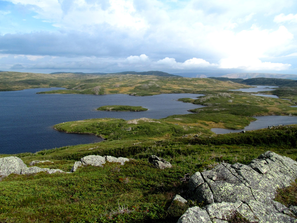
After 2 kilometers and 2 stream crossings
Liverpool Brook’s First Twin Pond comes into view.
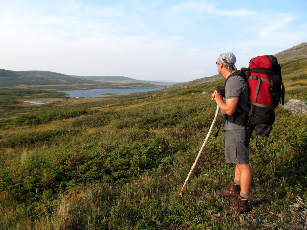
Soon hikers are walking around the east side of both twin ponds, and along the river that connects the two.
At the north end of the second twin pond is a sandy beach that makes a fine place to set up camp or go for a swim.
However for the next 25km (15mi), it is much more likely to find a moose or caribou swimming across a lake than a hiker splashing around the shore.
It’s not surprising when you consider that the North Arm Hills are a remote and inaccessible wilderness landscape, with ideal terrain for moose, caribou and black bear.
However with a little common sense and a healthy respect for wildlife, the wild animals along the North Arm Traverse will keep a safe distance and avoid hikers whenever they encounter them, which will be far more than you know.
After leaving the Liverpool Brook watershed, the Traverse crosses the boundary into Gros Morne National Park’s backcountry wilderness, where it can be divided into two sections: land of lakes and south rim.
The land of lakes begins with a trek around Sandy Pond, a 2km long, nearly 1km wide lake which empties into a long narrow pond that spills over a 300m (984ft) escarpment, and in the process forms the 150+m (500ft) Overfalls Waterfalls.
The Traverse crosses the stream between the two bodies of water
then follows the shoreline around the near end of the smaller pond, before weaving around the barren western flank of another small and large pond.
Once past this series of ponds, the route follows a moose or caribou trail here and a short bushwhack there, connecting the barren green dots
until it reaches and circles another pond, weaves and bobs a little further, then descends the low end of a ridge into Beaver Pond Valley, where a large high split-rock formation stands guard over both Beaver Pond and Trout River Pond.
In these coastal mountains the weather can change abruptly, from bright sun to rain, drizzle and fog, which at this elevation is likely to be low-lying clouds. For this reason it’s important for hikers to be prepared, and if it at all possibly carry a gps with a track of the route. Also, keep an eye out for strategically located rock cairns that, when present, can confirm you’re on track and help guide the way in foggy rain or shine.
Once past Beaver Pond, the Traverse climbs 140m (460ft) in elevation over 1.6km (1mi) in distance to the edge of Trout River Pond’s south rim, which it follows intermittently for 6km (3.5mi) as the crow flies, weaving around small ponds and stands of scrub
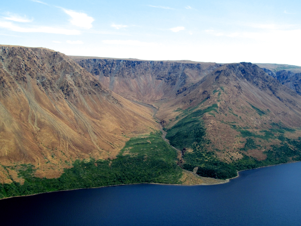
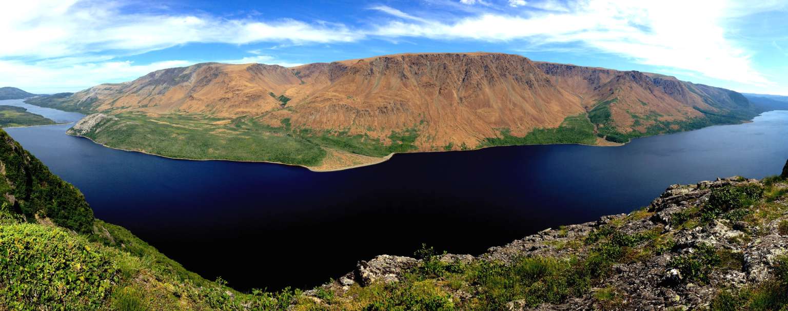
occasionally breaking out on top of a rocky outcrop with a spectacular view of Table Mountain (aka the Tablelands) and Trout River Pond.
Table Mountain is the most northerly of the four Bay of Islands Ophiolite Massifs, formed by plate tectonics during the closing of the Iapetus Ocean, with the other three being North Arm Hills/Gregory Mountains, Blow Me Down Mountains and Lewis Hills.
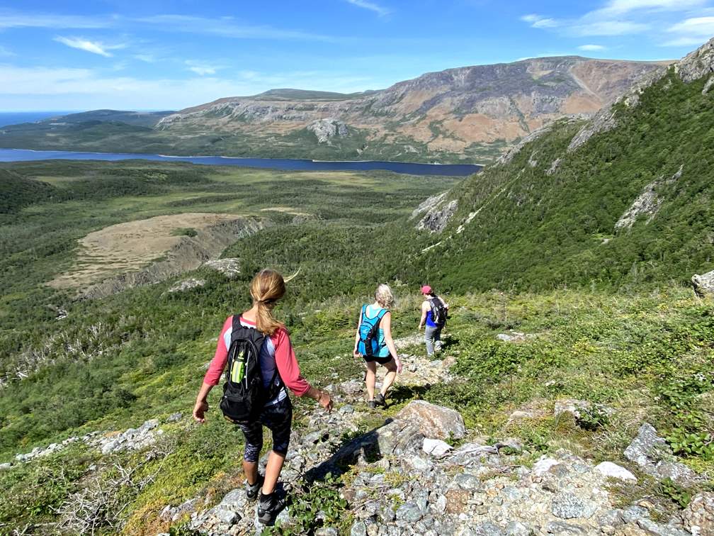
The trek across south rim, though unnoteworthy itself, provides some of the best views of Table Mountain, with its sunny southern exposure, diverse angles and bird’s eye view.
Once on the Elephant Head at the western end of the rim, with its view of Fox Point Gulch (part of the IATNL UltramaTrex route) and Narrows,
the Traverse follows the 3.8km (2.3mi) IATNL Elephant Trail off the Hills.
Once at the trailhead, hikers must walk 3.3km (2mi) on Mogul ATV Road to its intersection with Chimney Cove Road, which is 3.6km (2.2mi) from the town of Trout River and an ice cold drink!