
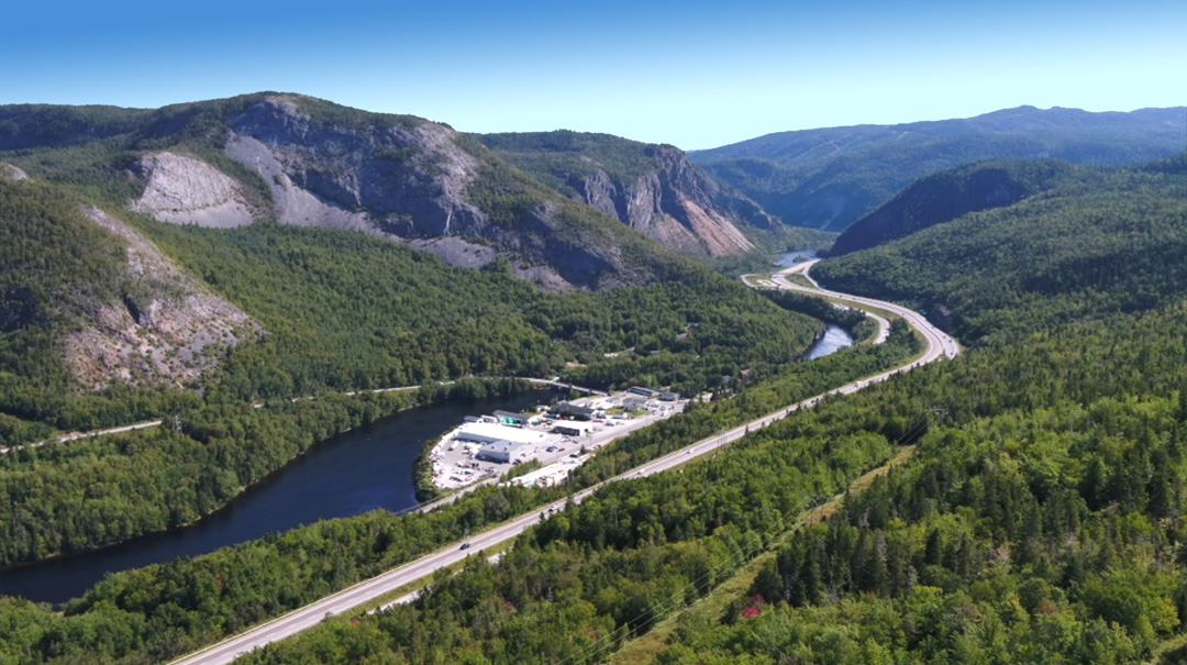


The Humber Valley Trail is a 14.5km (8.7mi) cut trail across the forested hillsides on the north side of the lower Humber River between Mount Patricia and Humber Village.
This section of Newfoundland’s Long Range Mountains – part of Northern America’s Appalachian Mountains – is composed primarily of limestone, dolostone, marble and shale from the ancient continental slope of Laurentia (i.e., proto North America) formed nearly 500 million years ago when the region was located in the Tropics.
The Humber River, which winds its way through the mountains and is one of Newfoundland’s largest rivers, was explored by renowned surveyor and cartographer James Cook in 1767, the year before he was selected by the British Admiralty and Royal Society to command a voyage to the South Pacific to witness the transit of Venus and search for the fabled southern continent.
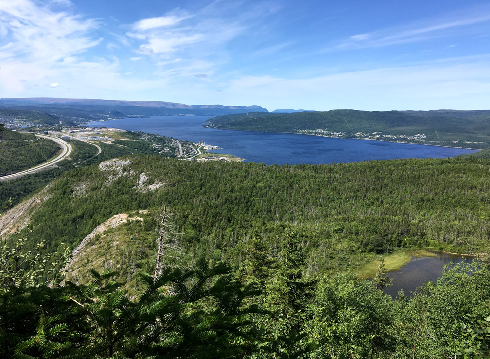
Today’s explorers can hike high above the river, where they can take in spectacular views of Humber Arm, Bay of Islands
and the glacier-carved Humber Valley.
However the trail itself starts near the mouth of the river at sea level and hikers must climb through a mix of birch, maple, fir and spruce to a height of 240m (787ft) before they reach the first viewpoint.
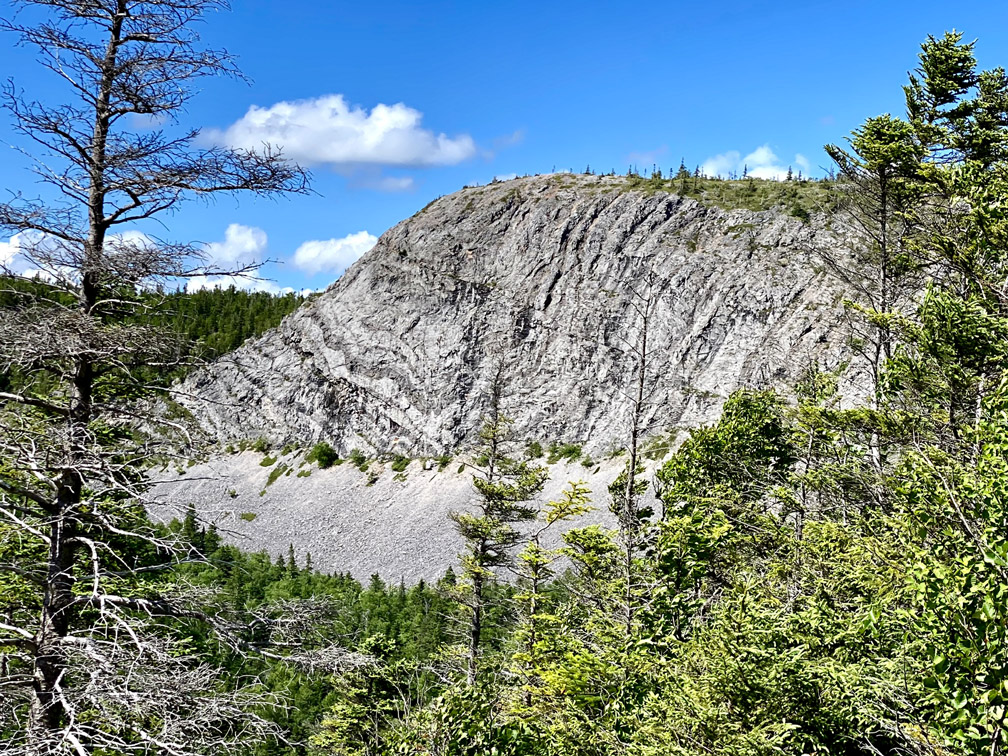
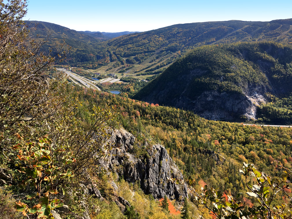
Along the way they get an occasional glimpse of Humber Syncline, a U-shaped sedimentary formation created by earth’s tectonic forces
whose bald head provides the first significant view, including a profile of Bear Head (below) which local climbers enjoy scaling.
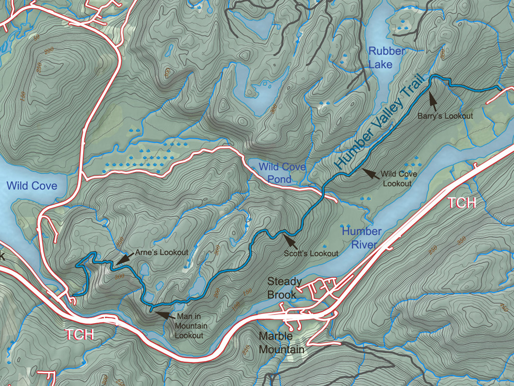
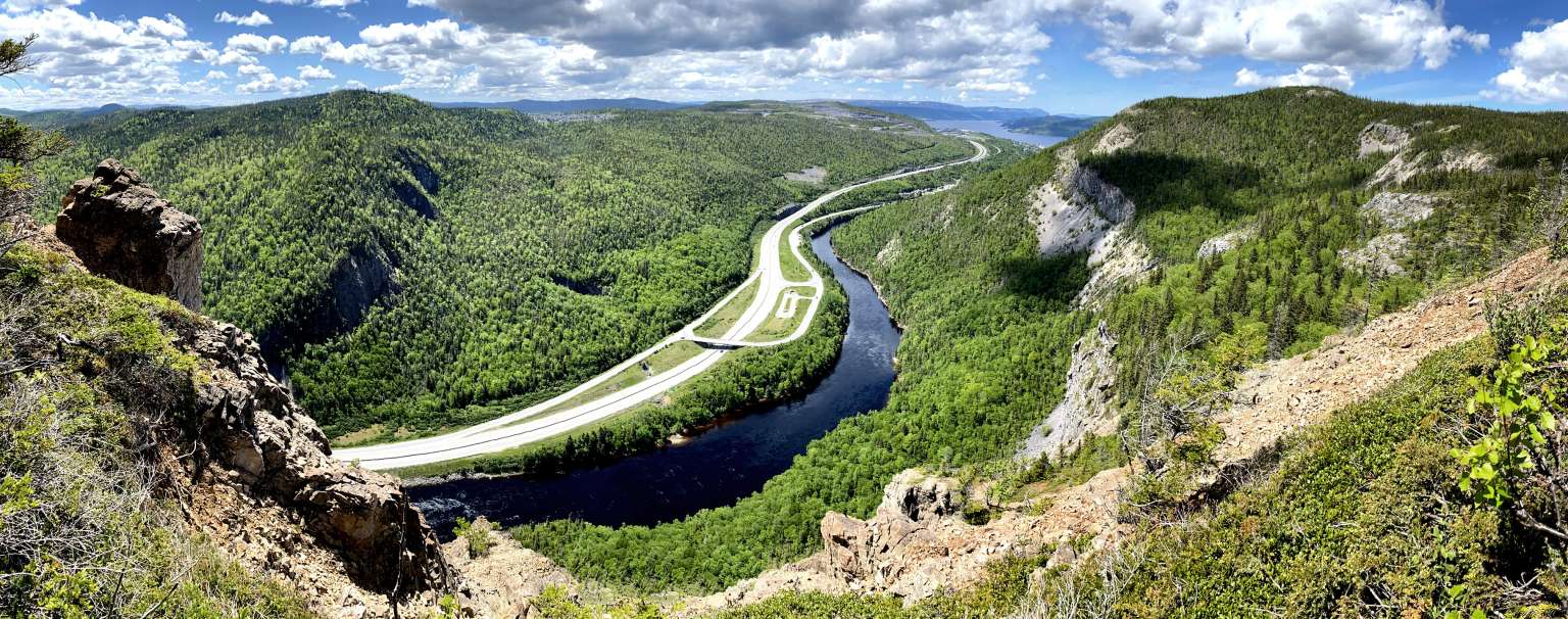
From the top of Humber Syncline, the Humber Valley Trail rises 100m (328ft) via a series of relatively steep switchbacks until it reaches Arne’s Lookout, which provides a dramatic view of the Humber Arm and Blow Me Down Mountains (below in May).
The lookout is also the intersecting point with IATNL Bear Head Trail, which provides an alternate route up or down the mountain, thus forming a hikeable Arne’s Loop.
From Arne’s Lookout the trail heads downhill for 1.4km, dropping 100m (328ft) vertical before continuing another 250 meters to Man In The Mountain Lookout at an elevation of 270m (886ft). Along the way it passes one small and two large ponds, and occasionally a few swimmers cooling off on a warm summer day.
The panoramic view from top of Man In The Mountain, which is 4kms from the trailhead,
is nearly as well-known to locals as the face of the man himself from below.
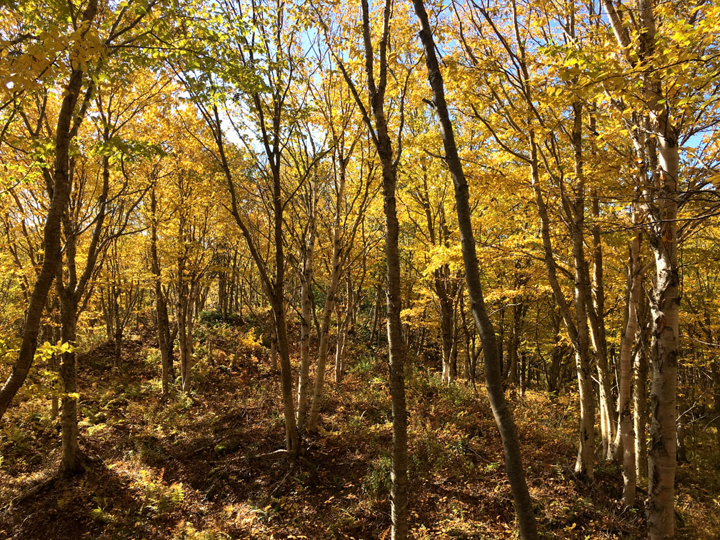
From Man In The Mountain, the Humber Valley Trail is much less trodden and more remote to easily maintain. As a consequence, the trail is a little harder to follow and may be partially obstructed by the occasional windfall tree. It is recommended to follow a gps track of the route from this point to Wild Cove Road (5.3kms) and Humber Village (10.6kms), which receives more hikers in autumn when the leafy trees turn a brilliant yellow, red, orange and gold.
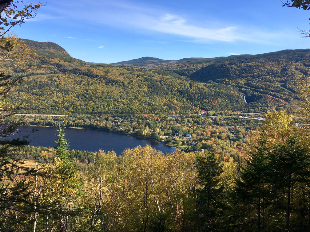
As the trail winds its way into Humber Valley the viewscape changes, with many views now oriented south or east rather than west, including views of Marble Mountain Ski Resort
and the idyllic town of Steady Brook below picturesque Steady Brook Falls.
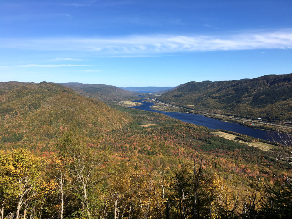
Before descending to Wild Cove Road, a short side trail leads to Scott’s Lookout
which provides an ideal vantage point to view the lower Humber Valley between Steady Brook and Humber Village.
The 1.3km walk to the little-used gravel road is primarily through a birch forest with a carpet of ferns and leaves.
The trail crosses the road (though about 15m out of line) approximately 4.9kms from its intersection with Route 440.
Just below the road, the trail crosses 10m wide Wild Cove Brook, just above a pretty 10m waterfalls.
Once again the trail passes through a birch forest
while rising 190m (623ft) to Wild Cove Lookout, which provides a terrific view of Humber River, Steady Brook and Marble Mountain to the left, and Wild Cove Pond, Humber Arm and Blow Me Down Mountains to the right.
The 2.2km walk between Wild Cove Lookout and Barry’s Lookout is along the crest of the mountain with little change in elevation or vegetation.
Like Scott’s Lookout 4.8kms to the west, Barry’s Lookout provides a terrific view of the lower Humber Valley, from Humber Village to the western end of Deer Lake.
The Lookout was named after local resident Barry May, who was both an outdoor adventurer and dedicated conservationist.
From Barry’s Lookout, it’s downhill through birch forest for another 2kms
until the trail reaches the Humber Village Trailhead on a gravel access road, approximately 125 meters west of a cell tower and shed.
For an alternate route to Ballam Bridge Trailhead from Arne’s Lookout, go to IATNL Bear Head Trail.