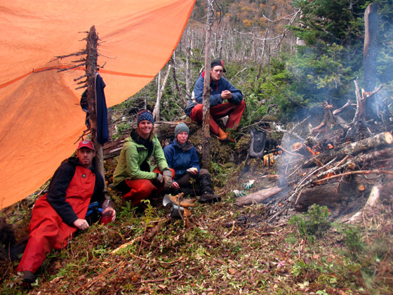

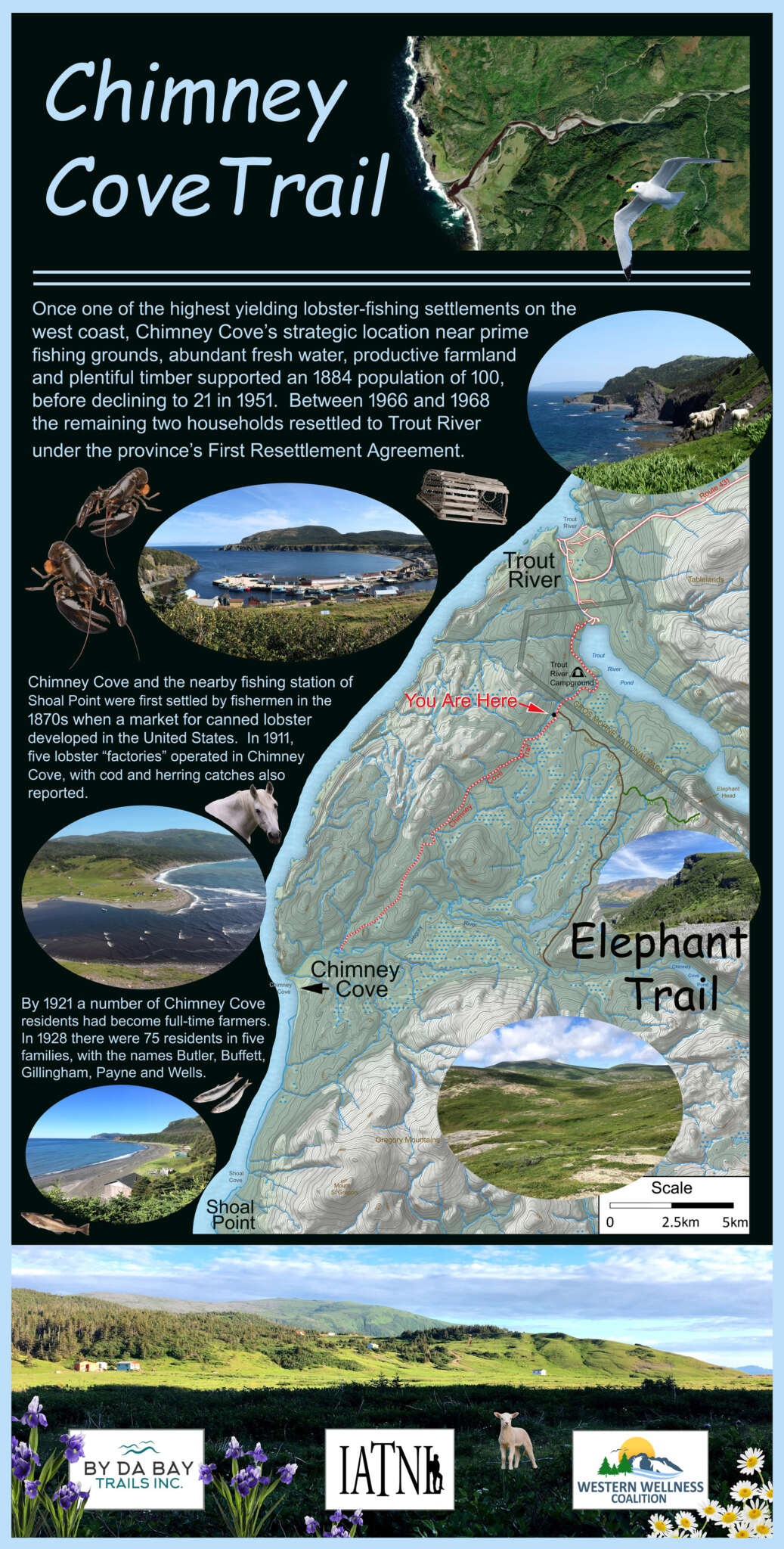


On August 9, 2024, IATNL Chairperson Paul Wylezol and Appalachian explorer Lew Coty made an 18.5km Gregory Mountains traverse from Gregory River to Shoal Point Cove.
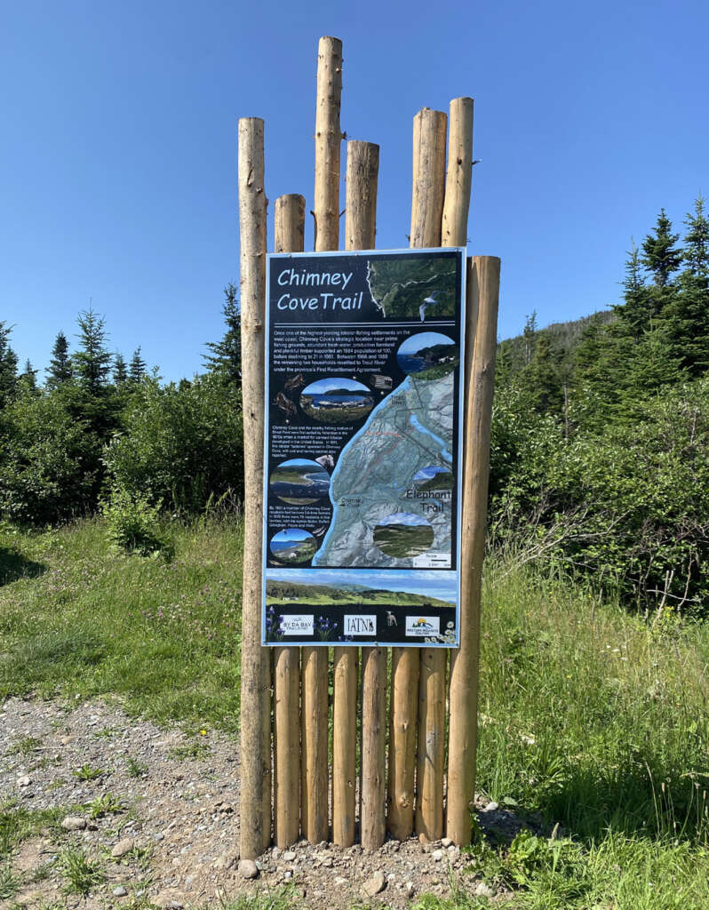
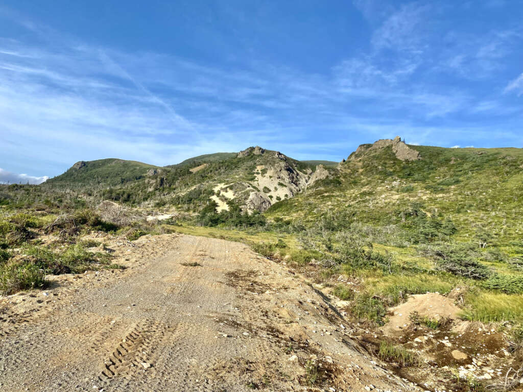
The adventure began early in the morning at the intersection of Mogul ATV Trail and Chimney Cove Road (near the new Chimney Cove Trail sign created by IATNL and installed by Keith Pevie) 2 km south of Trout River Campground in Gros Morne National Park
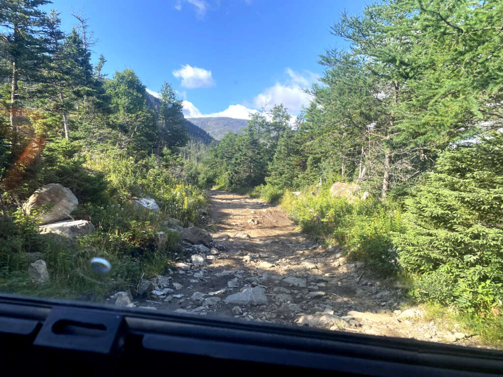
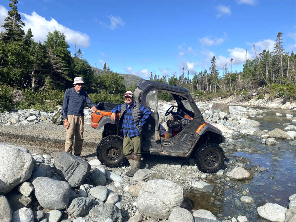
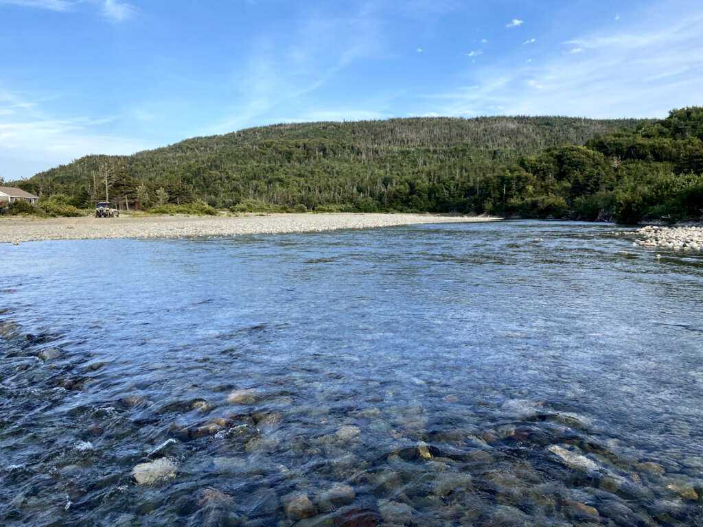
where George Crocker of Gros Morne Transportation and Tours picked them up in a side-by-side all terrain vehicle and drove them 10 km on a narrow and bumpy gravel road to Gregory River
just above where it makes a right angle turn south and nearly divides the twin Gregory Mountains/North Arm Hills into two unconnected mountain ranges.
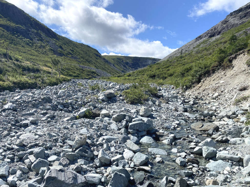
After saying their goodbyes, Paul and Lew headed off down Gregory River
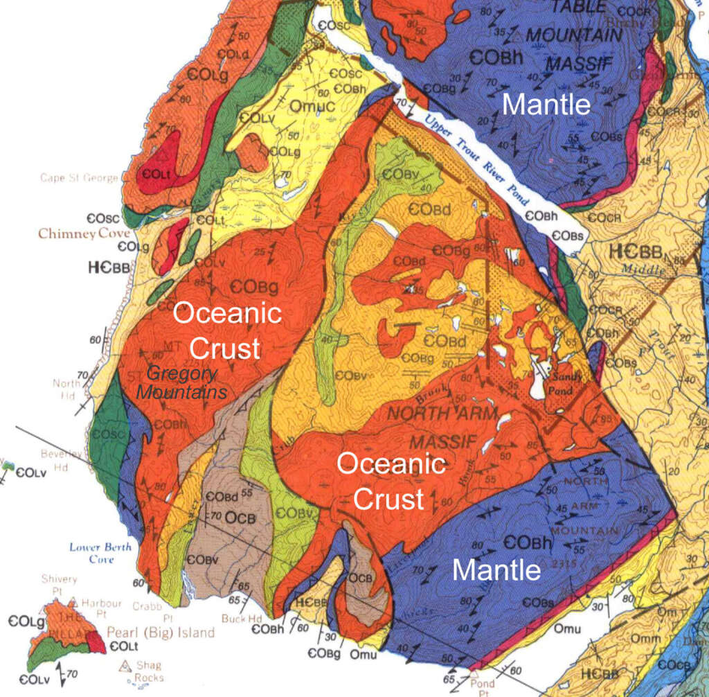
jumping from rock to rock and side to side while admiring the variety of rock types characteristic of the North Arm Hills/Gregory Mountains, one of four massifs of the Bay of Islands Ophiolite Complex.
The Bay of Islands Ophiolite Complex (including from north to south, Tablelands, North Arm Hills/Gregory Mountains, Blow Me Down Mountains and Lewis Hills) is composed of Earth’s mantle and oceanic crust that was forced to the surface by plate tectonics approximately 485 million years ago during the closing of the Iapetus Ocean, pre-cursor of the Atlantic Ocean.
With few exceptions, oceanic crust composed largely of light-gray gabbro is found in the west (e.g. Gregory Mountains) while mantle rock such as rust-colored peridotite is found primarily in the east (e.g. North Arm Hills).
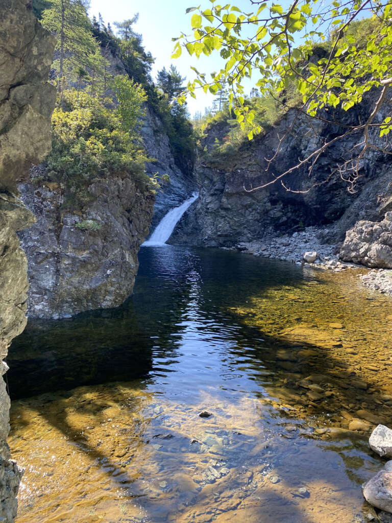
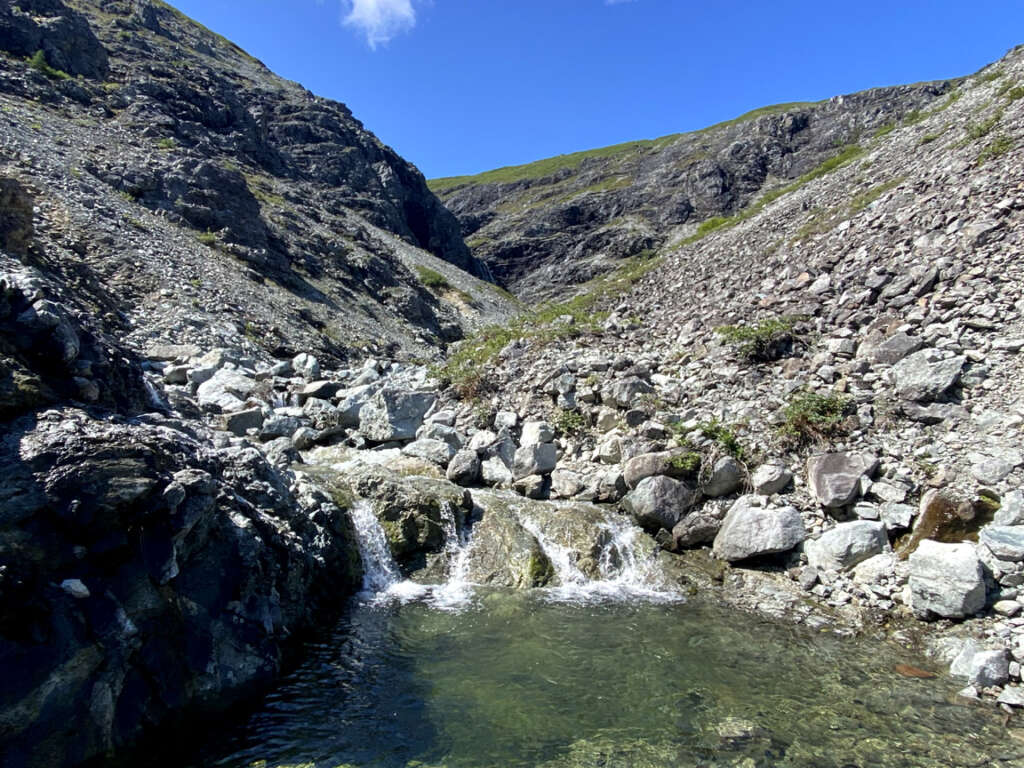
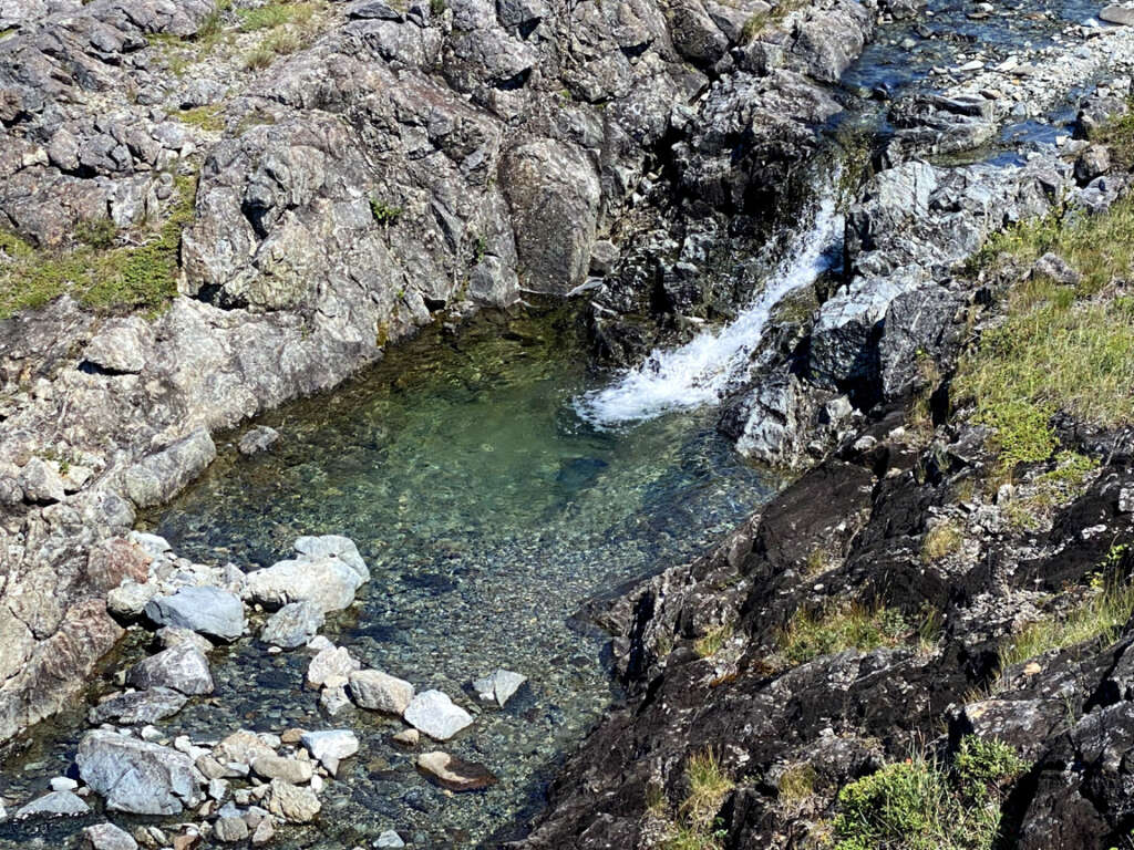
Before walking downstream, Paul and Lew made a short detour up Gregory River to view a picturesque little waterfalls with wading pool below, an ideal spot to spend an hour or two on a hot summer day.
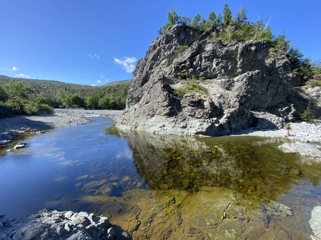
But this was early morning with a long way to go, so they headed off downstream until they encountered another inviting pool at a big bend in the river.
Here again they had to cross the river
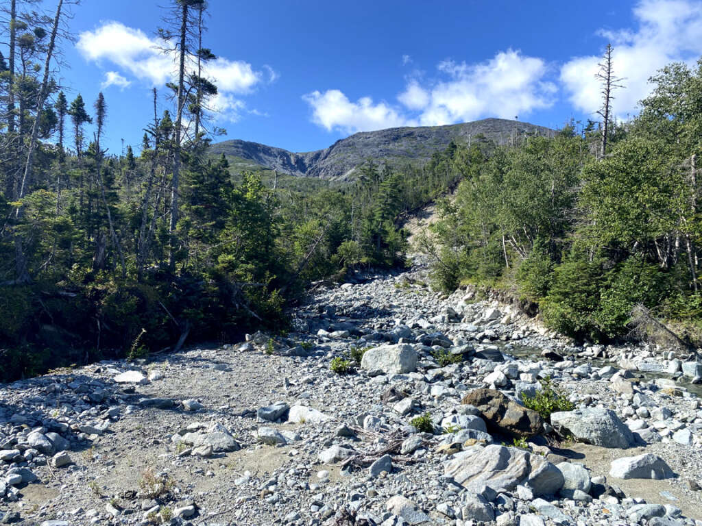
and after another half-kilometer, they came to a relatively dry tributary flowing from an unnamed canyon. This was their route to the high-country of the Gregory Mountains.
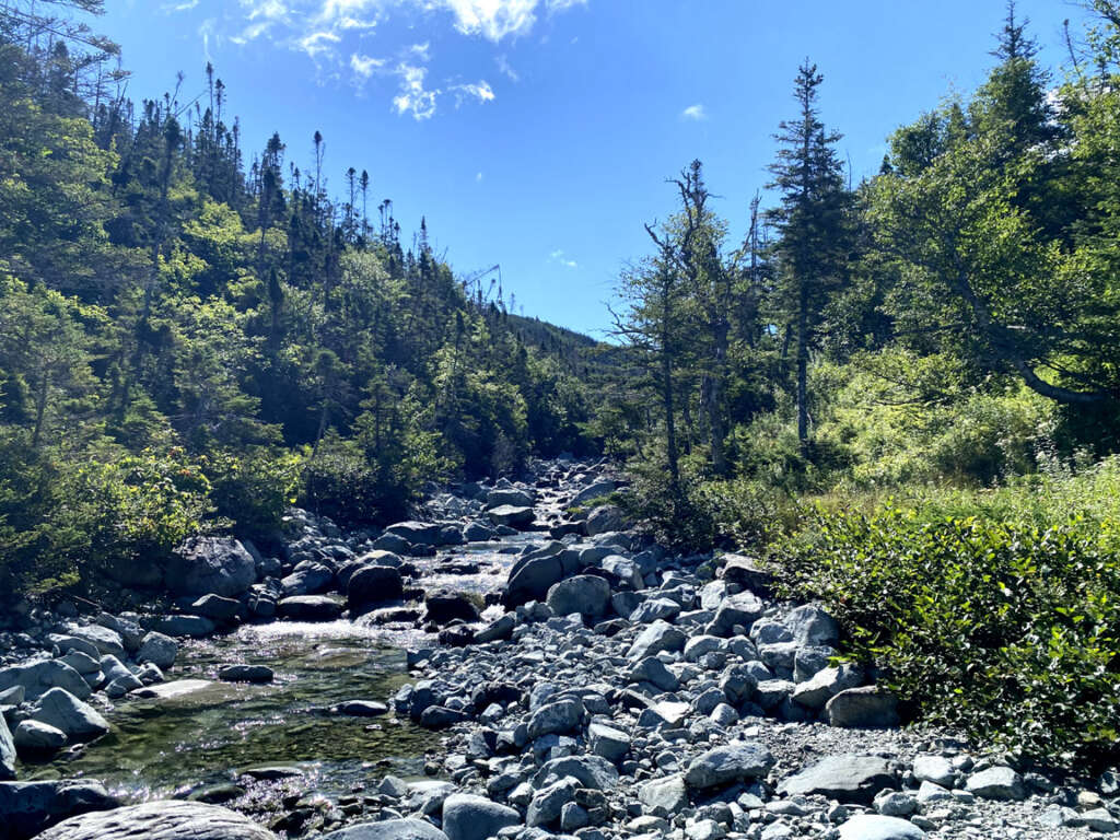
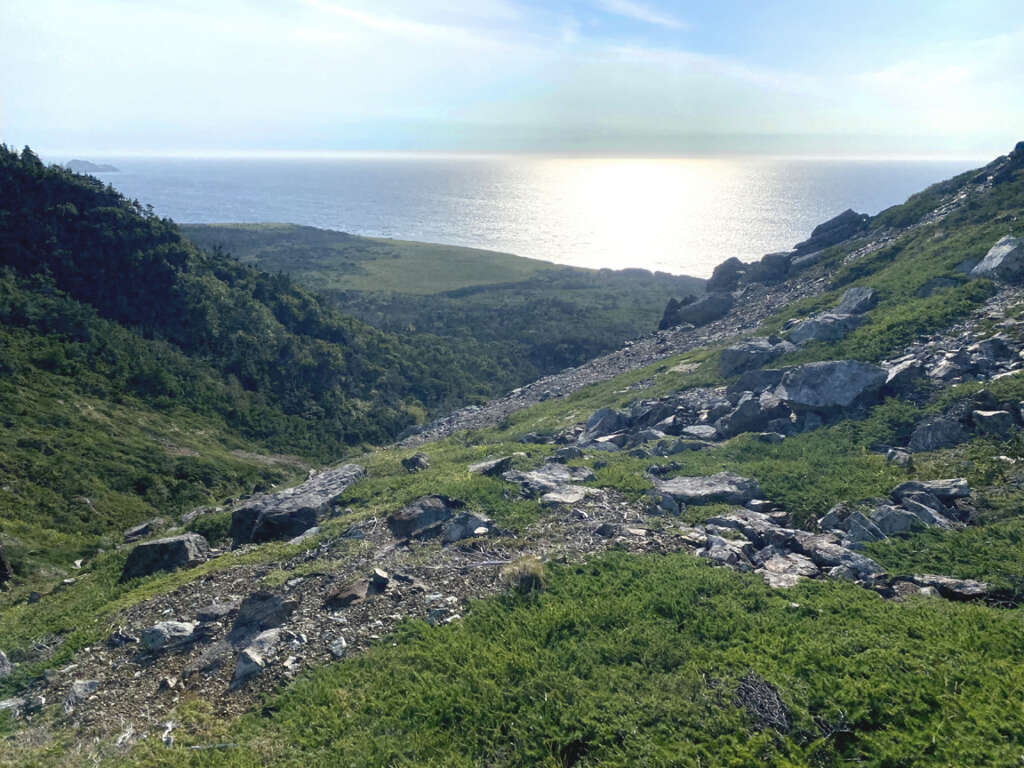
After walking one kilometer up a rocky riverbed
the forested hillsides gave way to scrub and scree
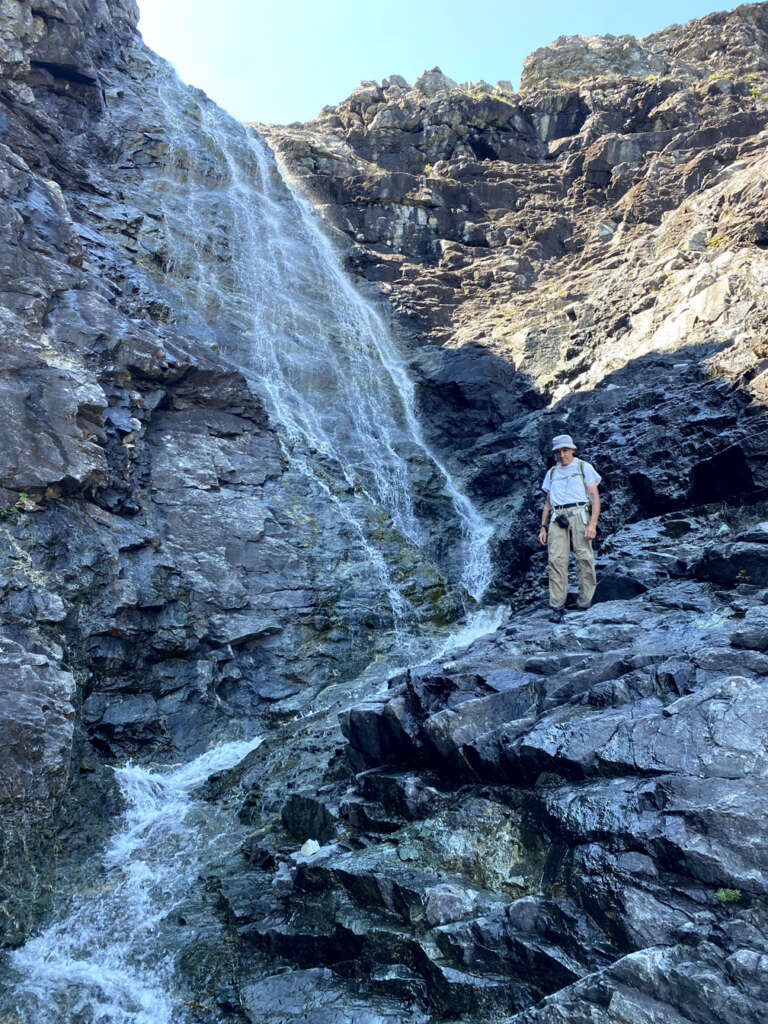
until the 3 km mark where the canyon converged
at an impassable waterfalls.
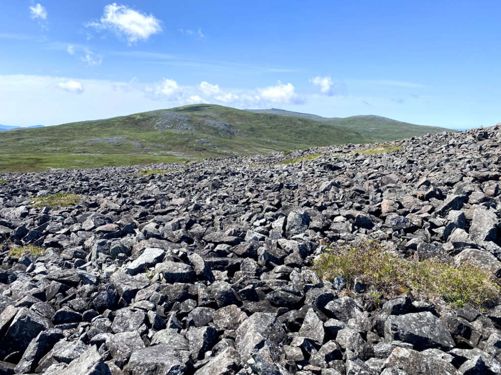
Fortunately there is a climbable screefield just before the falls which provides a not-too-difficult passage out of the canyon.
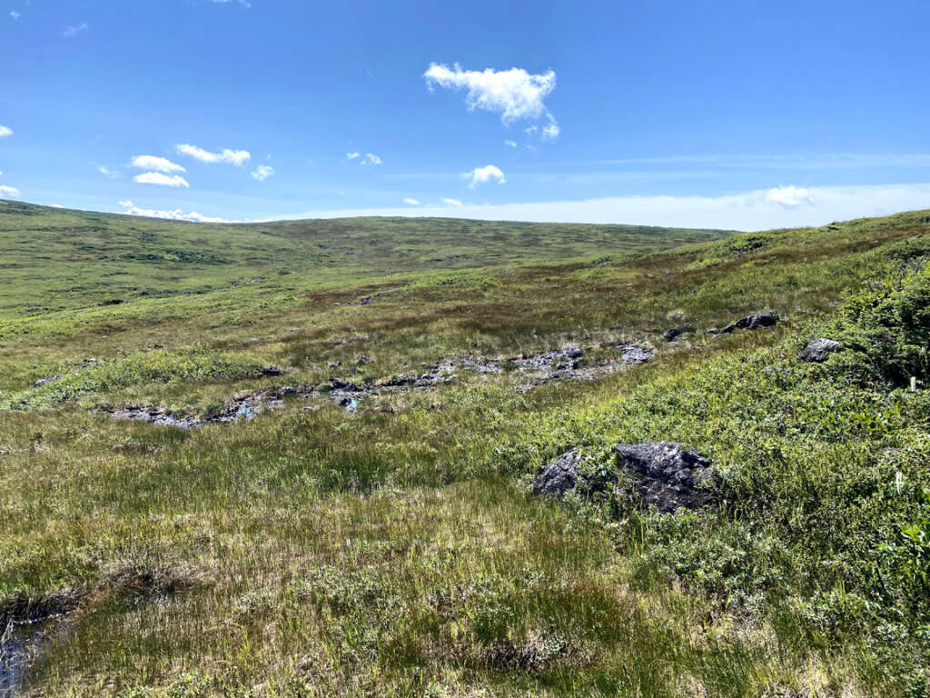
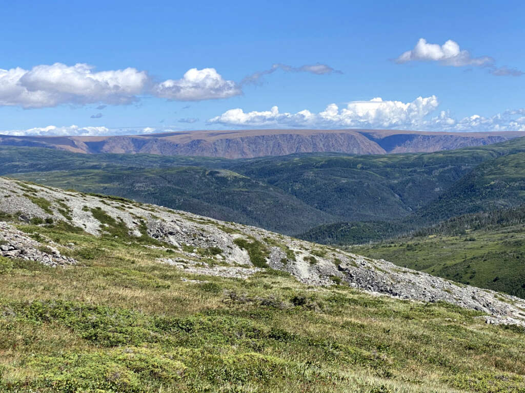
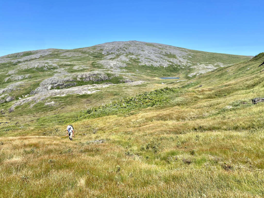
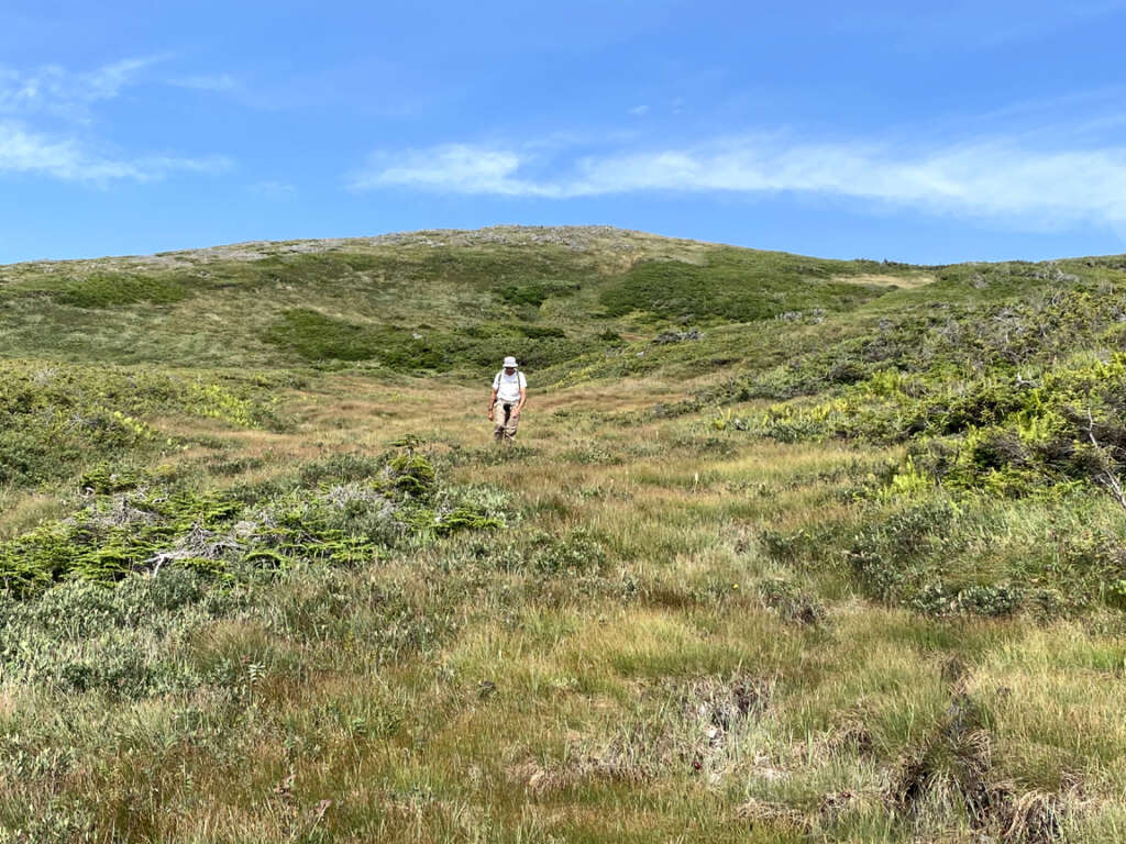
Once in the high-country the landscape changes dramatically, with wide-open spaces and wide-angle views of rolling lush grasslands with moss and shrubs too.
To the northeast can be seen the rust-colored mantle of the Tablelands
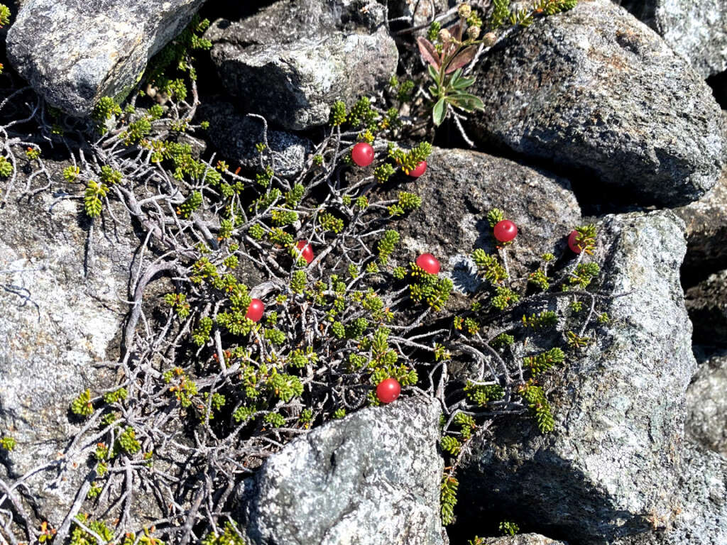
while to the southwest can be seen fields of gabbroic scree
containing ground-hugging patches of pink crowberries.
Before long, Paul and Lew were following a small stream that meandered south then west
before passing through a picturesque alpine meadow with small clear pond and dry level ground suitable for tenting.
Here hikers can also find a small cascading waterfalls and crystal-clear pool, ideal for a refreshing mid-afternoon or evening dip.
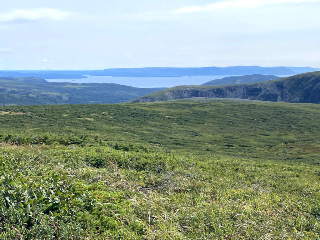
While the stream turned north and flowed downhill to Gregory River, our two hikers turned south and climbed through a notch in the mountains, but not before taking in the long view to Chimney Cove and the Gulf of St. Lawrence.
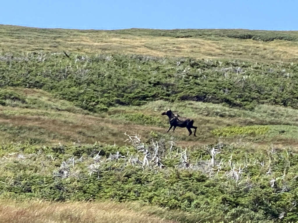
Once over the mountain, the landscape drains south into the Lower Crabbs river valley and the vegetation becomes more challenging
requiring hikers to follow leads through shoulder-high scrub, where at any moment a moose may jump up and retreat through a dense thicket or scramble over a hill.
From here both hikers and moose can see the Bay of Islands to the south
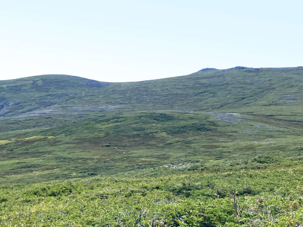
and Mount St. Gregory to the west
but Paul and Lew must turn north to find a route west that doesn’t require bushwhacking through scrub that’s generally too high to climb over, too low to crawl under and too thick to fight through.
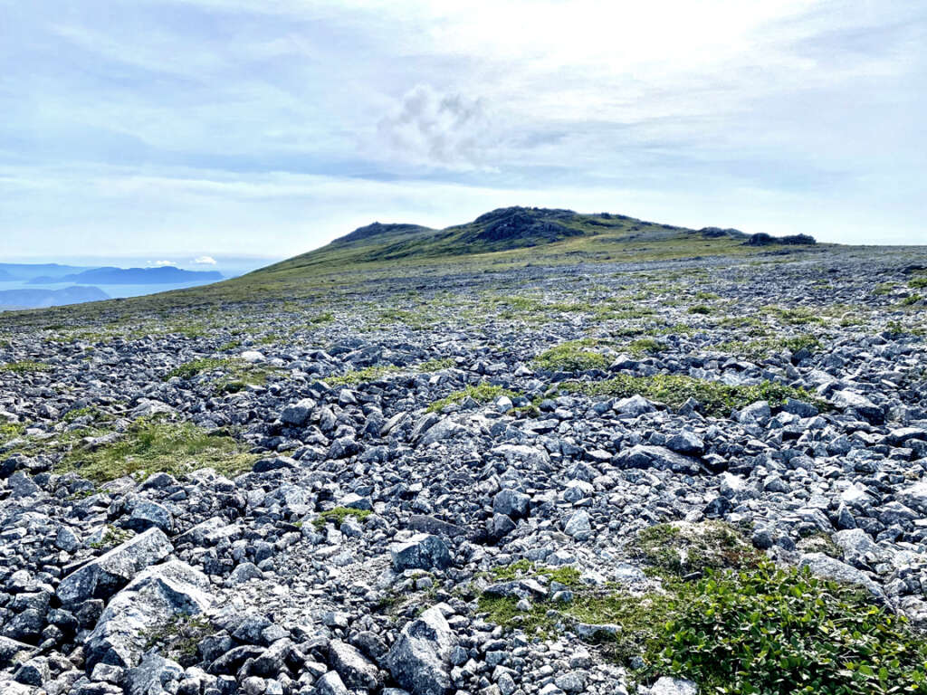
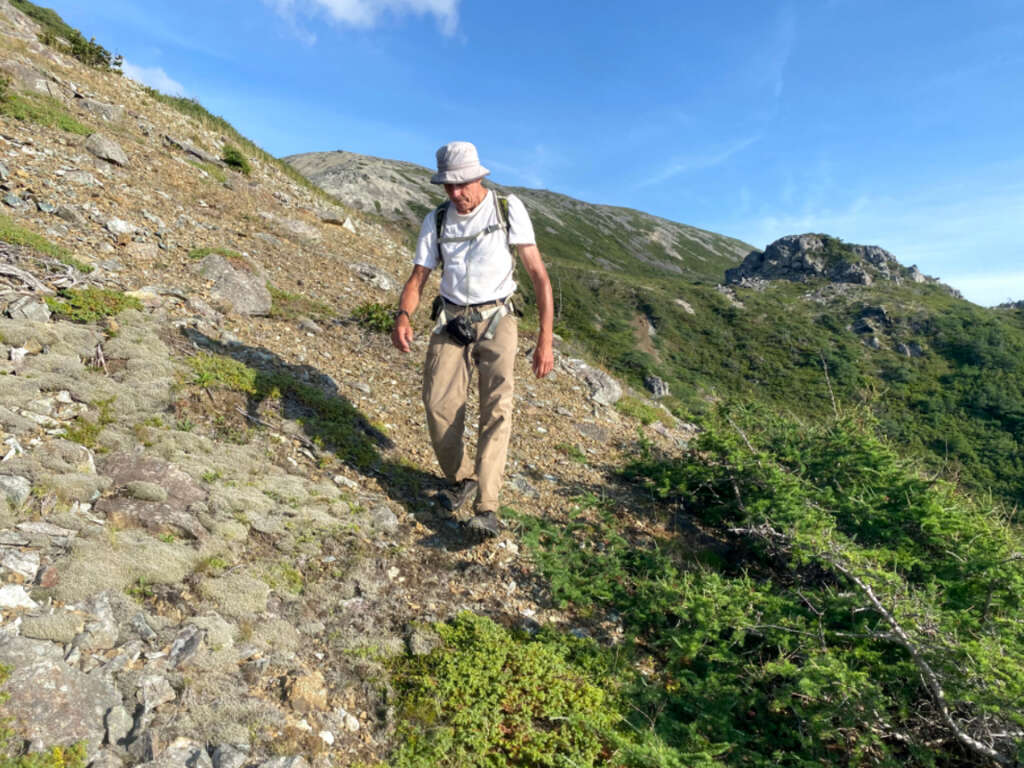
In spite of the 2.5 km walk across a broad valley and up a long slope to Mount St Gregory, the big views and small details shortened the trek and increased the anticipation.
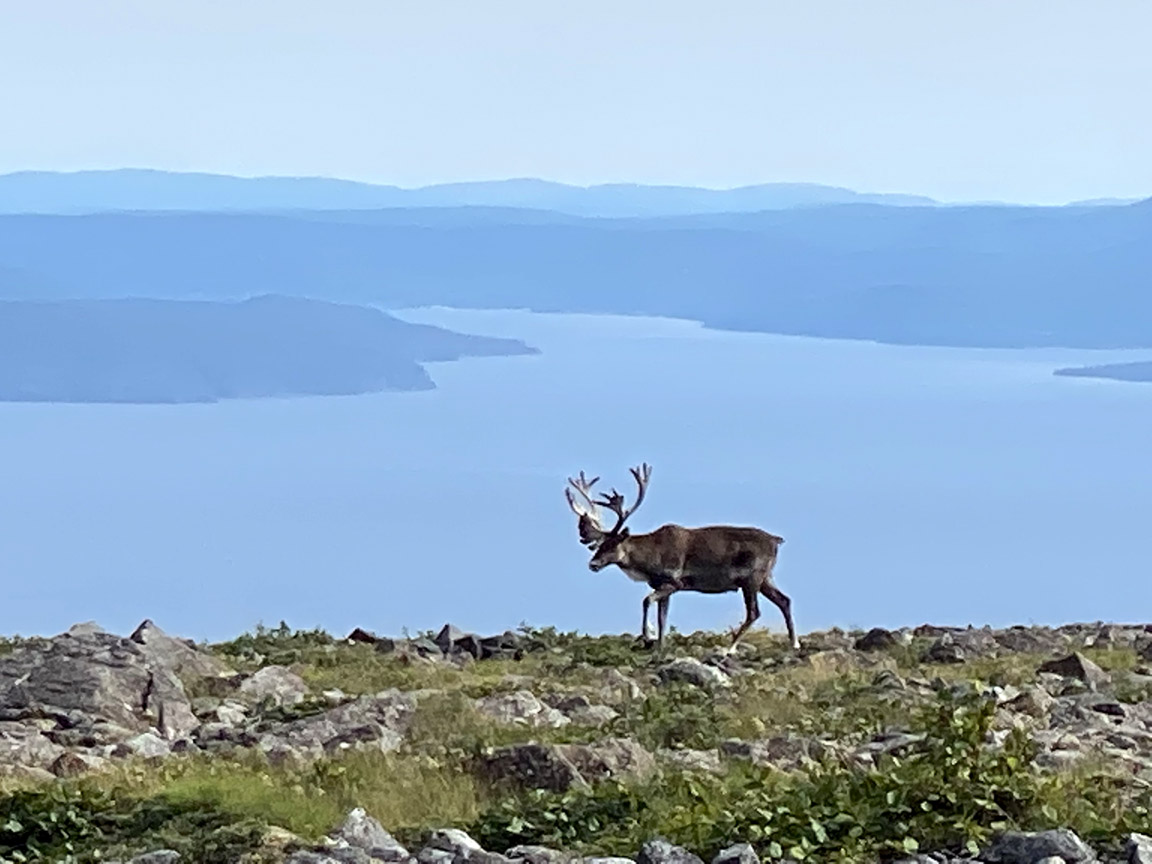
Once on top, the twin peaks and ocean backdrop didn’t disappoint
nor did the caribou stag which stood guard, as if protecting the mountaintop fortress of Gregory himself.
The terrain itself is composed primarily of sharp-edged gabbro rocks of varying sizes and ground-hugging vegetation and lichens
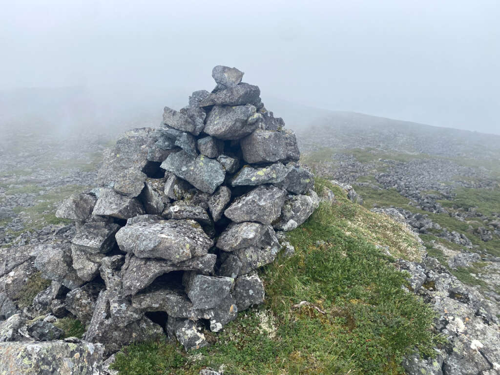
while the sky is often draped in low-hanging clouds that hug the land like coastal fog.
After well-deserved summit photos
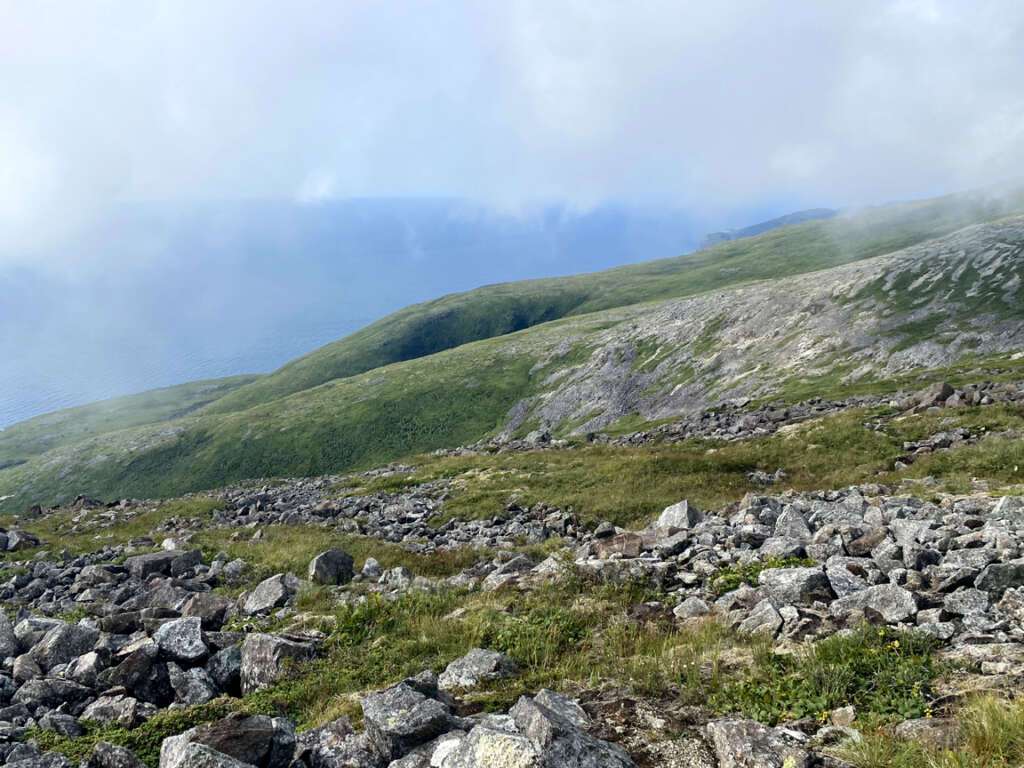
Paul and Lew begin their descent off the 677m / 2,221ft high mountain peak, enjoying the coastal views as they reappear under the clouds.
The remaining 3.5kms in 1.5hrs required fancy footwork, first over precarious and sometimes tippy scree, then through low brush and the occasional snag.
Between 150 and 170m elevation, a mountain-size shelf holds two small ponds
one of which had to be skirted before the final descent to the coastal plain that was uplifted 10m to 30m above sea-level by isostatic rebound after the last ice age glacier receded approximately 10,000 years ago.
Near the bottom, a small section of rust-colored peridotite from Earth’s mantle emerges from the mountainside, providing a glimpse of another geological formation characteristic of the Gregory Mountains/North Arm Hills Ophiolite Massif.
Here and there one can also see multi-colored gray and rust-colored rocks and outcrops characteristic of the Mohorovičić discontinuity (or Moho), which is the boundary between Earth’s mantle and crust.
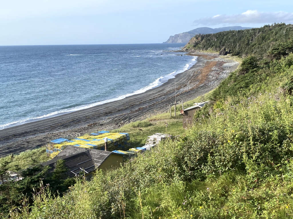
After another short walk, Paul and Lew reach another landmark
the fishing cove at Shoal Point, which marks the boundary between human occupation and wilderness domain.
As luck should have it, the pre-arranged pick-up by Gros Morne Transportation and Tours had just arrived via the new Shoal Point ATV Trail
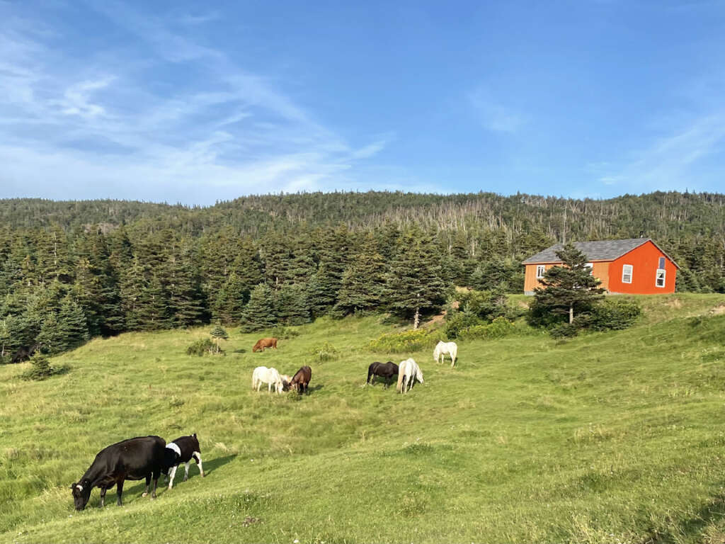
and our two intrepid adventurers ride off into the sunset! But not before passing through the picturesque resettled community of Chimney Cove, where residents of Trout River and Bonne Bay South maintain seasonal cottages and a few farm animals.
The distance from Shoal Point to Chimney Cove is 6.5km, which after another crossing of Gregory River, leaves an 11km drive back to Go!